Furniture on Sale
1
to
1
1
1
1
1
1
1
1,827
1,097
560
491
Sale Items
Creator: W. & A.K. Johnston
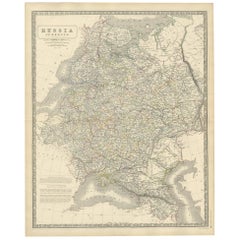
Antique Map of Russia 'in Europe' by W. & A.K. Johnston, circa 1850
By W. & A.K. Johnston
Located in Langweer, NL
Detailed map of the region with a decorative piano key border. This map shows towns, railroads, rivers, lakes, mountains, railroad lines, Sub-oceanic Telegraph lines, etc.
Category
Antique Mid-19th Century Maps
Materials
Paper
Related Items
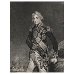
Original Antique Print, Portrait of Lord Nelson, circa 1850
Located in St Annes, Lancashire
Great image of Lord Nelson
Fine steel engraving by H.Robinson
After J.Hoppner
Published circa 1850
Unframed.
Category
Antique 1850s English Prints
Materials
Paper
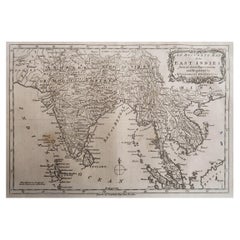
Original Antique Map of India. C.1780
Located in St Annes, Lancashire
Great map of India
Copper-plate engraving
Published C.1780
Three small worm holes to right side of map and one bottom left corner
Unframed.
Category
Antique Early 1800s English Georgian Maps
Materials
Paper
Original Antique Map of Spain and Portugal, circa 1790
Located in St Annes, Lancashire
Super map of Spain and Portugal
Copper plate engraving by A. Bell
Published, circa 1790.
Unframed.
Category
Antique 1790s English Other Maps
Materials
Paper
Original Antique Map of Italy. C.1780
Located in St Annes, Lancashire
Great map of Italy
Copper-plate engraving
Published C.1780
Unframed.
Category
Antique Early 1800s English Georgian Maps
Materials
Paper
Original Antique Map of Switzerland, Engraved By Barlow, Dated 1807
Located in St Annes, Lancashire
Great map of Switzerland
Copper-plate engraving by Barlow
Published by Brightly & Kinnersly, Bungay, Suffolk.
Dated 1807
Unframed.
Category
Antique Early 1800s English Maps
Materials
Paper
No Reserve
H 8 in W 10 in D 0.07 in
Original Antique Map of The World by Thomas Clerk, 1817
Located in St Annes, Lancashire
Great map of The Eastern and Western Hemispheres
On 2 sheets
Copper-plate engraving
Drawn and engraved by Thomas Clerk, Edinburgh.
Published by Mackenzie And Dent, 1817
...
Category
Antique 1810s English Maps
Materials
Paper
Original Antique Map of Spain and Portugal, Engraved By Barlow, 1806
Located in St Annes, Lancashire
Great map of Spain And Portugal
Copper-plate engraving by Barlow
Published by Brightly & Kinnersly, Bungay, Suffolk. 1806
Unframed.
Category
Antique Early 1800s English Maps
Materials
Paper
No Reserve
H 8 in W 10 in D 0.07 in
Original Antique Map of The Netherlands, Engraved by Barlow, Dated 1807
Located in St Annes, Lancashire
Great map of Netherlands
Copper-plate engraving by Barlow
Published by Brightly & Kinnersly, Bungay, Suffolk.
Dated 1807
Unframed.
Category
Antique Early 1800s English Maps
Materials
Paper
No Reserve
H 8 in W 10 in D 0.07 in
Original Antique Map of Sweden, Engraved by Barlow, 1806
Located in St Annes, Lancashire
Great map of Sweden
Copper-plate engraving by Barlow
Published by Brightly & Kinnersly, Bungay, Suffolk. 1806
Unframed.
Category
Antique Early 1800s English Maps
Materials
Paper
Original Antique Map of Asia. C.1780
Located in St Annes, Lancashire
Great map of Asia
Copper-plate engraving
Published C.1780
Two small worm holes to right side of map
Unframed.
Category
Antique Early 1800s English Georgian Maps
Materials
Paper
Original Antique Map of France, Arrowsmith, 1820
Located in St Annes, Lancashire
Great map of France
Drawn under the direction of Arrowsmith.
Copper-plate engraving.
Published by Longman, Hurst, Rees, Orme and Brown, 1820
Unframed.
Category
Antique 1820s English Maps
Materials
Paper
Original Antique Map of Italy. Arrowsmith. 1820
Located in St Annes, Lancashire
Great map of Italy
Drawn under the direction of Arrowsmith
Copper-plate engraving
Published by Longman, Hurst, Rees, Orme and Brown, 1820
Unframed.
Category
Antique 1820s English Maps
Materials
Paper
Recently Viewed
View AllMore Ways To Browse
Cabinet Door Hardware And Pulls
Dining End Chairs French
Bleached French Oak Cabinet
Bedside Tables Chest Of Drawers
Cabinets On Wheels
Travel Poster Denmark
Empire Display
Wall Cabinet With Glass Door
Vintage Yellow Cabinet
Midcentury Knoll Desk
Wooden Antique Chest Of Drawers
Wooden Chest Of Drawers Antique
Bamboo With Doors
Walnut French Corner Cabinet
Cabinet With Parchment
Cabinet Latch
White Corner Cabinet
Wooden Chest Of Drawers Antique Furniture


