Europe Maps
335
5,208
1
1
to
988
5,210
241
5,210
5,210
5,210
41
31
9
8
4
3
1
1
1
1
1
1
2,793
2,050
365
2
205
19
6
78
2
53
5
1
3
3
3
1
5,149
53
22
17
16
346
243
151
51
51
107
59
29
23
16
Item Ships From: Europe
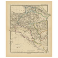
Ancient Crossroads: Albania to Assyria in Antiquity, Published in 1880
Located in Langweer, NL
The map titled "ALBANIA, IBERIA, COLCHIS, ARMENIA, MESOPOTAMIA, BABYLONIA, ASSYRIA" portrays the ancient regions that would encompass parts of modern-day Eastern Turkey, Armenia, Aze...
Category
1880s Antique Europe Maps
Materials
Paper
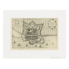
Antique Map of the City of Workum by Blaeu, 1649
Located in Langweer, NL
Antique map titled 'Worckum'. Old map of the city of Workum, Friesland. Originates from J. Blaeu's 'Town Book'.
Artists and Engravers: Joan Blaeu (23 September 1596 - 28 May 1673...
Category
17th Century Antique Europe Maps
Materials
Paper
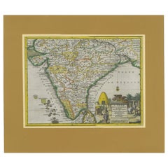
Antique Map of India during the height of the Mughal Imperial Expansion, 1713
Located in Langweer, NL
Antique map titled 'L'Inde de ca le Gange (..)'. Beautiful original antique map embracing most of India, made during the height of the Mughal imperial expansion. The map encompasses ...
Category
Early 18th Century Antique Europe Maps
Materials
Paper
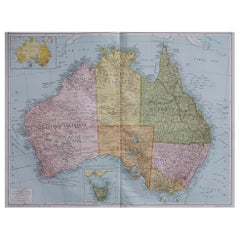
Large Original Vintage Map of Australia, circa 1920
Located in St Annes, Lancashire
Great map of Australia
Original color. Good condition
Published by Alexander Gross
Unframed.
Category
1920s English Vintage Europe Maps
Materials
Paper
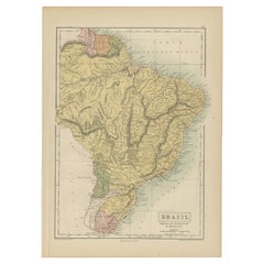
Antique Map of Brazil, Uruguay, Paraguay and Guyana by A & C. Black, 1870
Located in Langweer, NL
Antique map titled 'Brazil'. Original antique map of Brazil, Uruguay, Paraguay and Guyana. This map originates from ‘Black's General Atlas of The...
Category
Late 19th Century Antique Europe Maps
Materials
Paper
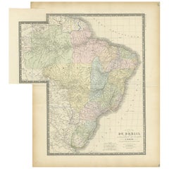
Antique Map of Brazil by Levasseur '1875'
Located in Langweer, NL
Antique map titled 'Carte du Brésil'. Large map of Brazil, with small fold out. This map originates from 'Atlas de Géographie Moderne Physique et Politiq...
Category
Late 19th Century Antique Europe Maps
Materials
Paper
Antique Map of North and West Africa by J.B. Elwe, 1792
Located in Langweer, NL
Beautiful richly engraved map of North and West Africa, based upon the earlier maps of De L'Isle. Richly annotated throughout and with excellent regional detail. Too much detail to d...
Category
Late 19th Century Antique Europe Maps
Materials
Paper
Renaissance Mapping of Sumatra: Featuring Singapore in Münster’s Woodcut, c.1590
Located in Langweer, NL
Description: Antique map titled 'Sumatra ein grosse Insel / so von den alten Geographen Taprobana genennt worden'. Beautiful map of Sumatra and the southern part of Malaysia, with Si...
Category
16th Century Antique Europe Maps
Materials
Paper
Ornate Cartography of Colonial Grandeur: The West India Islands around 1851
Located in Langweer, NL
This map is a part of John Tallis's series of maps, known for their detailed and ornamental style. John Tallis & Company, mentioned in the caption, was an English cartographic publis...
Category
1850s Antique Europe Maps
Materials
Paper
Antique County Map, Rutlandshire, English, Framed, Cartography, Victorian, 1860
Located in Hele, Devon, GB
This is an antique lithography map of Rutlandshire. An English, framed atlas engraving of cartographic interest, dating to the mid 19th century and later.
Superb lithography of Rutl...
Category
Mid-19th Century British Victorian Antique Europe Maps
Materials
Wood
Antique County Map, Norfolk, English, Framed Lithography, Cartography, Victorian
Located in Hele, Devon, GB
This is an antique lithography map of Norfolk. An English, framed atlas engraving of cartographic interest, dating to the mid 19th century and later.
Superb lithography of Norfolk a...
Category
Mid-19th Century British Victorian Antique Europe Maps
Materials
Glass, Wood
An Ornate and Historical Tallis Map of Jamaica with Decorative Vignettes, 1851
Located in Langweer, NL
This original antique map of Jamaica is part of the renowned series created by the Tallis Company, known for their detailed and decorative maps of the 19th century. The company was f...
Category
1850s Antique Europe Maps
Materials
Paper
An Old Illustrated Tallis Map of Central America with Volcanic Vignettes, 1851
Located in Langweer, NL
This map of Central America, part of John Tallis & Company's series from "The British Colonies" by Robert Montgomery Martin, is a fine example of mid-19th century cartography and wou...
Category
1850s Antique Europe Maps
Materials
Paper
Crossroads of Empires: A John Tallis Map of the Isthmus of Panama, 1851
Located in Langweer, NL
The Tallis map of the Isthmus of Panama is a beautifully detailed work, characteristic of the maps produced by John Tallis & Company, which was one of the last cartographic firms to ...
Category
1850s Antique Europe Maps
Materials
Paper
A Tallis Map of British Guiana with Colonial Vignettes and Other Landmarks, 1851
Located in Langweer, NL
This Tallis map of British Guiana (now known as Guyana) is a richly decorated document, much like other maps from the esteemed cartographic publisher John Tallis & Company. The firm,...
Category
1850s Antique Europe Maps
Materials
Paper
Empires of the East: An Ornate Tallis Map of Tibet, Mongolia, and Manchuri, 1851
Located in Langweer, NL
This original - with hand-colored borders- map of Tibet, Mongolia, and Manchuria is an example of the intricate work produced by John Tallis & Company, who were known for their detai...
Category
1850s Antique Europe Maps
Materials
Paper
Map of Independent Tartary with Vignettes of the Region's Culture, 1851
Located in Langweer, NL
The map of Independent Tartary is part of the collection by John Tallis & Company, which were unique for their elaborate decorative elements and detailed illustrations.
**The Maker ...
Category
1850s Antique Europe Maps
Materials
Paper
19th Century Illustrated Map of Ceylon (Sri Lanka) with Notable Landmarks
Located in Langweer, NL
John Tallis & Company is known for producing maps and atlases that were highly regarded for their accurate cartographic detail and their distinctive style. They often included ornate...
Category
1850s Antique Europe Maps
Materials
Paper
Antique Map of the Malay Archipelago with Images of Indigenous People, 1851
Located in Langweer, NL
John Tallis & Company, often simply known as Tallis, was renowned for the production of maps and illustrated geographical publications in the mid-19th century. Tallis maps, such as t...
Category
1850s Antique Europe Maps
Materials
Paper
Old Map of British Mediterranean Territories with Images of Historic Sites, 1851
Located in Langweer, NL
John Tallis & Company was a British map-making firm that gained widespread acclaim in the 19th century, particularly known for their detailed and artistically embellished maps. The f...
Category
1850s Antique Europe Maps
Materials
Paper
Map of Polynesia Highlighting Cultural Landscapes and Maritime Activities, 1851
Located in Langweer, NL
John Tallis & Company was a London-based map publisher that flourished during the 19th century. Their maps, characterized by elaborate borders and decorative vignettes, are some of t...
Category
1850s Antique Europe Maps
Materials
Paper
Map of New Zealand Showing Maori Culture and Early Colonial Settlements, 1851
Located in Langweer, NL
John Tallis & Company were renowned for their ornate and detailed maps in the mid-19th century. Their works often featured elaborate borders, decorative motifs, and insets of vignett...
Category
1850s Antique Europe Maps
Materials
Paper
Map of Tasmania with Illustrations of Local Fauna and Colonial Landmarks, 1851
Located in Langweer, NL
John Tallis & Company was renowned for their detailed and ornate maps during the 19th century. Their maps are distinguished by the intricate borders and vignettes that are as informa...
Category
1850s Antique Europe Maps
Materials
Paper
Mid-19th Century Decorative Map of Asia with Cultural and Natural Vignettes
Located in Langweer, NL
John Tallis & Company, known for their decorative mid-19th-century maps, created this map of Asia. These maps were distinctive for their elaborate borders and detailed vignettes. The...
Category
1850s Antique Europe Maps
Materials
Paper
Victorian Visions of the New World: A Detailed Tallis Map of North America, 1851
Located in Langweer, NL
The map presented here is an intricate example from the series of maps produced by John Tallis & Company. Tallis maps are known for their detailed and elaborate style, often includin...
Category
1850s Antique Europe Maps
Materials
Paper
Mid-19th Century Decorative Map of India with Cultural and Natural Vignettes
Located in Langweer, NL
The Tallis maps, including the one of India, are known for their detailed and ornamental style. They were produced during the mid-19th century, a time when cartographic publishing be...
Category
1850s Antique Europe Maps
Materials
Paper
An Illustrated Map of Kabul, Punjab, and Baluchistan by Tallis, 1851
Located in Langweer, NL
This map, attributed to John Tallis and featuring the work of Robert Montgomery Martin, is part of a series created for the publication "The British Colonies." John Tallis & Company ...
Category
1850s Antique Europe Maps
Materials
Paper
A Decorative Map of Nova Scotia and Newfoundland by John Tallis, 1851
Located in Langweer, NL
The map is part of the series created by John Tallis & Company, known for their mid-19th-century maps. This particular map illustrates the regions of Nova Scotia and Newfoundland and...
Category
1850s Antique Europe Maps
Materials
Paper
Antique Lithography Map, Buckinghamshire, English, Framed Cartography, Victorian
Located in Hele, Devon, GB
This is an antique lithography map of Buckinghamshire. An English, framed atlas engraving of cartographic interest, dating to the mid 19th century and later.
Superb lithography of B...
Category
Mid-19th Century British Victorian Antique Europe Maps
Materials
Wood, Paper
Antique Lithography Map, County Durham, English, Framed Cartography, Victorian
Located in Hele, Devon, GB
This is an antique lithography map of County Durham. An English, framed atlas engraving of cartographic interest, dating to the mid 19th century and later.
Superb lithography of Cou...
Category
Mid-19th Century British Mid-Century Modern Antique Europe Maps
Materials
Wood
Detailed Map of the Holy Land, Showing the Travels of Christ & Apostles, ca.1650
Located in Langweer, NL
Antique map titled 'Het Beloofde Landt Canaan door wandelt van onsen Salichmaeker Jesu Christo neffens syne Apostelen.'
Detailed map of the Holy Land, showing the travels of Christ and the Apostles, including Paul's travel's at sea and numerous sailing vessels. Below bible scenes such as the nativity and crucifiction of Christ. An excellent example of a Duch Bible map...
Category
1650s Antique Europe Maps
Materials
Paper
Ptolemaic Armillary Sphere Charles-François Delamarche Paris, 1805-1810 Circa
By Charles Francois Delamarche
Located in Milano, IT
Charles-François Delamarche
Ptolemaic armillary sphere
Paris, circa 1805-1810
Wood and papier-mâché
covered with printed and partly hand-coloured paper
It measures 15.74” in height, ...
Category
Early 1800s French Empire Antique Europe Maps
Materials
Paper, Wood
Antique Map of the City of Vienna by Balbi '1847'
Located in Langweer, NL
Antique map titled 'Vienne'. Original antique map of the city of Vienna, Austria. This map originates from 'Abrégé de Géographie (..)' by Adrien Balbi. Published 1847.
Category
Mid-19th Century Antique Europe Maps
Materials
Paper
Original Antique Map of Cyprus. Circa 1880
Located in St Annes, Lancashire
Great map of Cyprus
Drawn and Engraved by R.Walker
Published W.Mackenzie, London
Original colour
Unframed.
Category
1880s English Antique Europe Maps
Materials
Paper
Antique Map of the City of Leuven, Belgium, with Original Coloring, 1609
Located in Langweer, NL
An original antique map titled "Lovanium Brabantiarum," which depicts the city of Leuven in Belgium in old hand-colouring. The map is notable for its circular layout of the city, det...
Category
Early 17th Century Antique Europe Maps
Materials
Paper
Senex Map of Castile, Leon & La Mancha in The Spanish Heartland, 1714
Located in Langweer, NL
This antique map, titled "A Map of Old & New Castile from the Observations of Rodrigo Mendes Silva and others," depicts the regions of Old Castile and New Castile in Spain, along wit...
Category
Early 18th Century Antique Europe Maps
Materials
Paper
Large Map of Castile's Southern Realms - Granada, Andalusia, and Murcia, 1652
Located in Langweer, NL
This antique map, titled 'Les Etats de la Couronne de Castille', represents the southern regions of the Crown of Castile, specifically the territories of Andalusia, Granada, and Murc...
Category
Mid-17th Century Antique Europe Maps
Materials
Paper
Antique Map of Jura, a Famous Wine Area in France, 1854
Located in Langweer, NL
Antique map titled 'Dépt. du Jura'. Map of the French department Jura, France.
Jura is a department in the Bourgogne-Franche-Comté region in Eastern France. Named after the Jura Mo...
Category
19th Century Antique Europe Maps
Materials
Paper
Amsterdam city plan - Joost van Sassen
Located in UTRECHT, UT
“Afbeeldinge der Stad Amsterdam, gelyk deselve in den jaren 1536 door Cornelis Antonisz na ’t leven is geschildert, en Ao 1544 in druk uytgegeven.”, engraved by Joost van Sassen and ...
Category
1720s Dutch Other Antique Europe Maps
Materials
Paper
Early 20th Century Terrestrial Globe by G. Thomas Paris
By G. Thomas, Éditeur
Located in Pease pottage, West Sussex
Early 20th Terrestrial Globe by G. Thomas. 44 Rue ND des Champs, Paris. Found on original ebonised turned base and brass fittings. Paris, France Circa 1920.
Category
Early 20th Century French Europe Maps
Materials
Wood, Paper
Antique Map of Kentucky and Tennessee by Johnson, 1872
Located in Langweer, NL
Antique map titled 'Johnson's Kentucky (..)'. Original map of Kentucky and Tennessee. This map originates from 'Johnson's New Illustrated Family Atlas ...
Category
Late 19th Century Antique Europe Maps
Materials
Paper
Antique Map of The United States of North America, 1882
Located in Langweer, NL
This is a historical map titled "The United States of North America, Central Part" from the 1882 Blackie Atlas. It depicts the continental United States with a high level of detail, ...
Category
1880s Antique Europe Maps
Materials
Paper
Utrecht city plan
Located in UTRECHT, UT
“Platte grond der Stad Utrecht vertonende alle Gragten, Straaten, Stegen, Gangen, Markten, en plaatsen der openbare Gebouwen”, engraving published by Johannes van Schoonhoven in Amst...
Category
1770s Dutch Other Antique Europe Maps
Materials
Paper
Curaçao map - C. van Baarsel en zoon
Located in UTRECHT, UT
“Kaart van het eiland Curaçao.”, “Algemeene kaart der Caraïbische eilanden”, “Plan van het fort Amsterdam op Curaçao” from the atlas “Atlas der overzeesche bezittingen van Zijne Maje...
Category
1810s Dutch Other Antique Europe Maps
Materials
Paper
Antique Decorative Coloured Map of North America, 1882
Located in Langweer, NL
This original antique map of North America is from the Blackie & Son Atlas published in 1882. Here are several points of interest about this map:
1. **Political Borders**: The map l...
Category
1880s Antique Europe Maps
Materials
Paper
Antique Old Map of Africa with Insets of Mauritius, Reunion and Natal, 1882
Located in Langweer, NL
The uploaded image is a historical map of Africa from the 1882 atlas by Blackie & Son. The map includes the entire African continent, with various countries, regions, and topographic...
Category
1880s Antique Europe Maps
Materials
Paper
Old Map of the Chinese Empire and Japan, 1882
Located in Langweer, NL
An original antique map titled "The Chinese Empire and Japan," dating from an 1882 atlas by Blackie & Son. It is a color map with geographical features such as mountain ranges, river...
Category
1880s Antique Europe Maps
Materials
Paper
Original Antique Map of West Central France in Frame, 1748
Located in Langweer, NL
A nicely framed and hand-coloured decorative map titled "Gouvernemens Generaux De Poitou et De Saintonge" and engraved by M. Robert. This historical international map includes severa...
Category
1740s Antique Europe Maps
Materials
Paper
Antique Map of Canada, The Province of Ontario and Part of Quebec, 1882
Located in Langweer, NL
This is a historical map from the 1882 Blackie Atlas, this time detailing "The Province of Ontario, and Part of Quebec" in Canada. The map presents a detailed illustration of Ontario...
Category
1880s Antique Europe Maps
Materials
Paper
Antique Map of The United States of North America, Pacific States, 1882
Located in Langweer, NL
The map is from the same 1882 Blackie Atlas and focuses on the Pacific States of the United States of America during that period. Here are some details and historical context about t...
Category
1880s Antique Europe Maps
Materials
Paper
Antique Decorative Coloured Map Marocco, Algeria and Tunis, 1882
Located in Langweer, NL
The maps is from the 1882 atlas by Blackie & Son and offers a detailed view of the North African regions as understood in the late 19th century.
**Map of Morocco, Algeria, and Tun...
Category
1880s Antique Europe Maps
Materials
Paper
Antique Map of British North America, The Dominion of of Canada, 1882
Located in Langweer, NL
This map is titled "British North America, Dominion of Canada," from the 1882 Blackie Atlas. It features the geographical area that comprises modern-day Canada, with notable features...
Category
1880s Antique Europe Maps
Materials
Paper
Original Antique Coloured Map of Western Africa, Published in 1882
Located in Langweer, NL
This is a map of Western Africa from the 1882 Blackie & Son atlas. The map details the West African coast from the Sahara Desert in the north down to the Gulf of Guinea, including a ...
Category
1880s Antique Europe Maps
Materials
Paper
Antique Decorative Coloured Map of South Africa and Madagascar, 1882
Located in Langweer, NL
The map of South Africa is from the Blackie & Son Atlas, published in 1882. This historical map is quite interesting for several reasons:
1. **Historical Period**: This map was crea...
Category
1880s Antique Europe Maps
Materials
Paper
Antique Decorative Coloured Map Egypt, Nubia, Abyssinia and more, 1882
Located in Langweer, NL
This image contains two maps, with the left one being labeled "Egypt" and the right one "Nubia, Abyssinia and the Adjacent Lands." These maps highlight the Nile Valley and surroundin...
Category
1880s Antique Europe Maps
Materials
Paper
Antique Map Depicting Burma, Siam, Annam (Vietnam) and Japan, 1882
Located in Langweer, NL
The image shows two maps side by side from the 1882 atlas by Blackie & Son. On the left, the map is titled "BURMAH SIAM AND ANAM," while the one on the right is labeled "JAPAN."
**B...
Category
1880s Antique Europe Maps
Materials
Paper
Antique 19th Century Map of China by Blackie & Son, 1882
Located in Langweer, NL
This map is an 1882 Blackie & Son map of China. The title "CHINA." is prominently displayed at the bottom. The map is colored to differentiate various regions, possibly indicating di...
Category
1880s Antique Europe Maps
Materials
Paper
Antique Map of a Bay of Borneo, Indonesia, c.1760
Located in Langweer, NL
Antique map titled 'La Baye de l'isle et Ville de Borneo'. Small map depicting a Bay of Borneo.
Artists and Engravers: Anonymous.
Condition: Good, general age-related toning. ...
Category
18th Century Antique Europe Maps
Materials
Paper
Recently Viewed
View AllMore Ways To Browse
Iran Map
Map Nautical Chart
West Indies Antique Map
Antique Maps West Indies
18th Century Globe Of The World
Antique Texas Maps
Antique Texas Map
Antique Furniture North Bay
Antique Maps Of Texas
Old School Maps
Manila Antique
Antique Map Virginia
Antique Maps Virginia
Antique Virginia Map
Antique New Zealand Map
Antique Maps New Zealand
New Zealand Antique Map
Victorian Staircase
