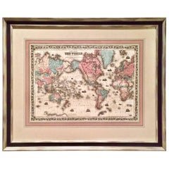
World Map by J.H. Colton 1860 Custom Framed with French Mat
View Similar Items


Want more images or videos?
Request additional images or videos from the seller
1 of 7
World Map by J.H. Colton 1860 Custom Framed with French Mat
About the Item
- Dimensions:Height: 31.5 in (80.01 cm)Width: 38.5 in (97.79 cm)Depth: 1.5 in (3.81 cm)
- Place of Origin:
- Period:
- Date of Manufacture:1860
- Condition:Bright clean image. Dimensions are of frame.
- Seller Location:San Francisco, CA
- Reference Number:1stDibs: LU855210156623
About the Seller
5.0
Recognized Seller
These prestigious sellers are industry leaders and represent the highest echelon for item quality and design.
Gold Seller
These expertly vetted sellers are highly rated and consistently exceed customer expectations.
Established in 1982
1stDibs seller since 2008
311 sales on 1stDibs
Typical response time: 1 hour
Associations
The Art and Antique Dealers League of AmericaAntiques Associations Members
More From This SellerView All
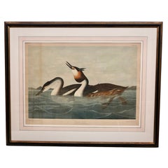
- John James Audubon Chromolithograph Crested Grebe Plate 389 by J.Bien N.Y. 1860By John James AudubonLocated in San Francisco, CAThe John James Audubon double elephant folio chromolithograph Plate 389 No. 6-4 Crested Grebe from Birds of America. Podiceps Cristatus. Adult ...Category
Antique 1860s American Prints
MaterialsPaper
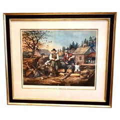
- Framed Folio Size Colored Lithograph by N.Currier Titled "Arguing the Point"Located in San Francisco, CAAn evocative hand colored lithograph by N. Currier (American 1813-1888), after a painting by A.F.Tait, titled "Arguing the Point", depicting a group of rural men engaged in an appare...Category
Antique Mid-19th Century American Victorian Prints
MaterialsPaper
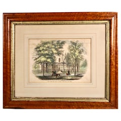
- Hand Colored Wood Engraving of Princeton University in Period Maple FrameLocated in San Francisco, CAAn mid-19th century colored wood engraving titled "View of the New Jersey College at Princeton New Jersey" depicting Nassau Hall in what is now Princeton University. This lovely hand colored rendition shows several walking women and a man aboard a horse, the background dominated by historic Nassau Hall, the largest academic building in the United States at the time, completed in 1756. It was here in 1783 that George Washington received formal thanks from the U.S. Congress for his efforts during the Revolutionary War...Category
Antique Mid-19th Century American Victorian Prints
MaterialsMaple, Paper
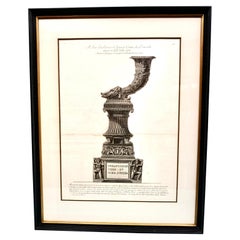
- Original Piranesi Framed Engraving of a Monument in the Form of a CornucopiaBy Giovanni Battista PiranesiLocated in San Francisco, CAGiovanni Battista Piranesi, Italian 1720-1778) Engraving on wove paper depicting an ancient Roman funeral monument in the form of a cornucopia from the Via...Category
Antique Early 19th Century French Neoclassical Prints
MaterialsPaper
- Scarce U.S. Coast Survey Map Depicting Entrance to San Francisco Bay Dated 1856Located in San Francisco, CAA fine example of the 1856 U.S. Coast lithographic survey nautical chart of the entrance to San Francisco bay and the city. Published in 1856 by the Office of the Coast Survey the of...Category
Antique Mid-19th Century American Maps
MaterialsPaper
 $1,036 Sale Price30% Off
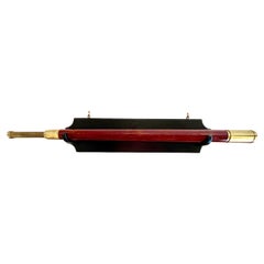
 - Signed 19th Century Mahogany and Brass Telescope on Custom Oak Wall MountLocated in San Francisco, CAAn English mahogany and brass single draw telescope made and signed by William Bruce, Kings Head Court Shoe Lane London, circa 1830. This handsom...Category
Antique 1830s English Georgian Scientific Instruments
MaterialsBrass
You May Also Like
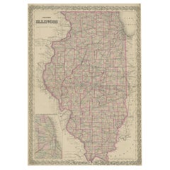
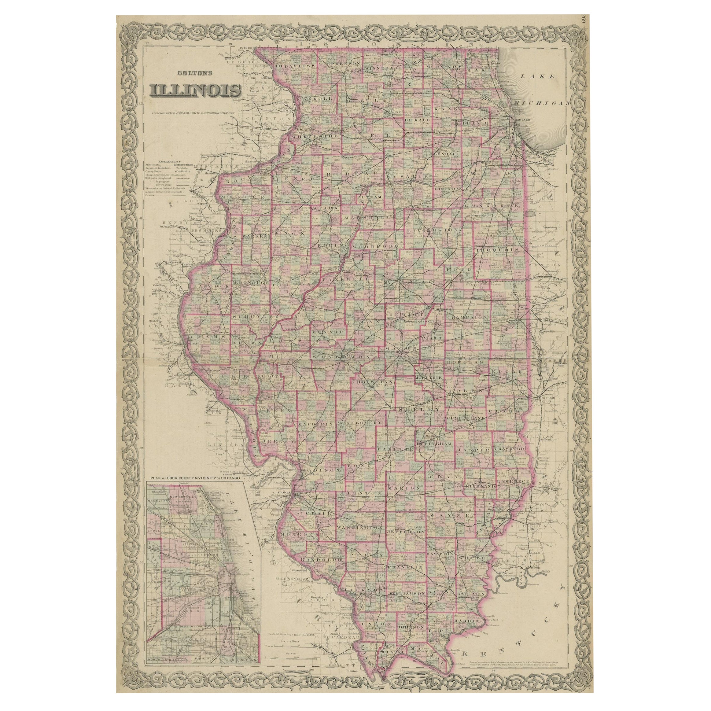
- Colton's Map of Illinois, with an Inset of ChicagoLocated in Langweer, NLAntique map titled 'Colton's Illinois'. Antique map of Illinois, a state in the Midwestern United States. With an inset map of of Cook County &...Category
Antique Mid-19th Century Maps
MaterialsPaper
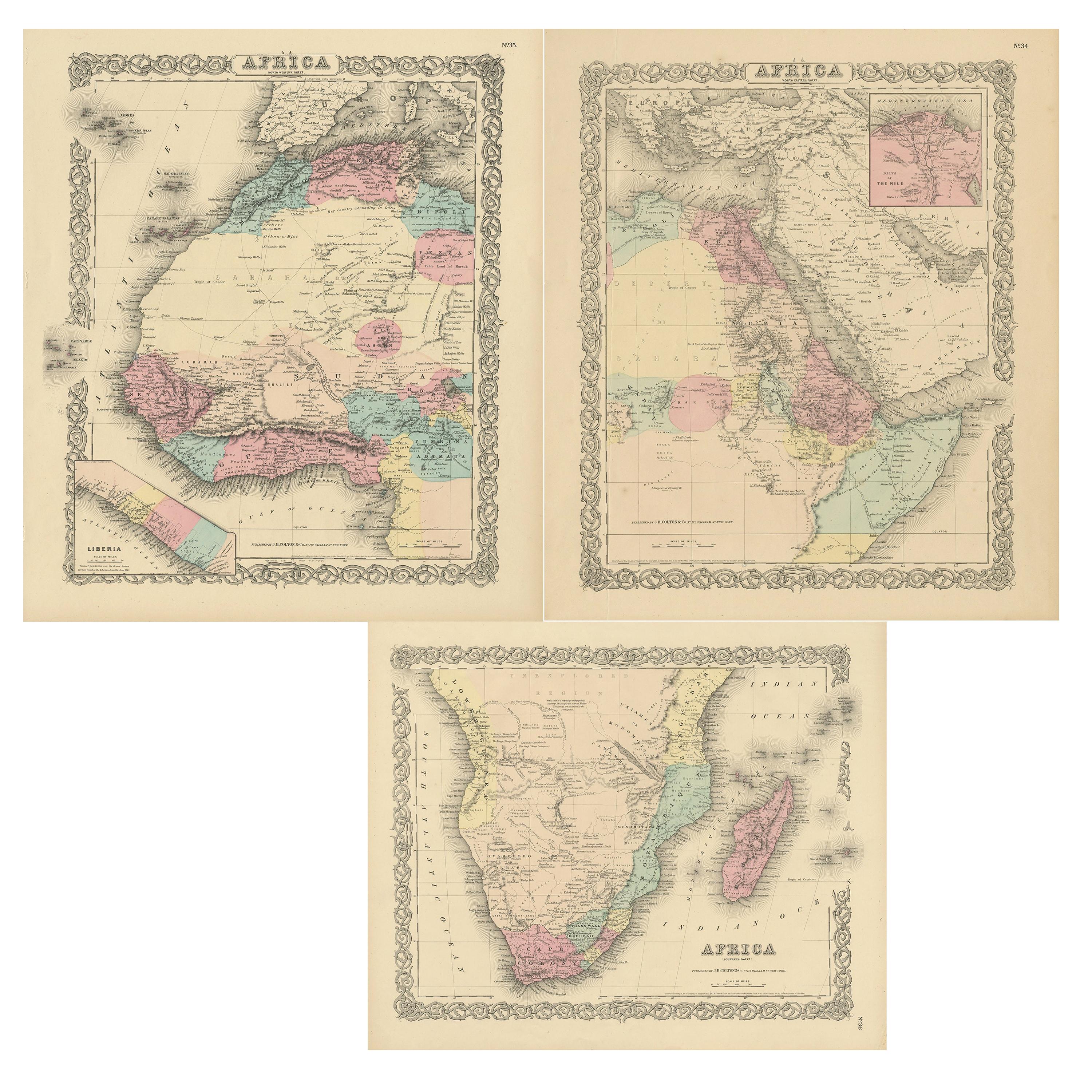
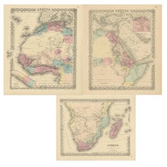
- Set of Three Antique Maps of Africa by Colton (circa 1855)Located in Langweer, NLSet of three individual maps of Africa including 'North West Africa', 'North Eastern Africa' and 'Southern Africa'. All three maps are surrounded by Colton's typical spiral motif border. Colton names numerous African tribes and nations throughout. An interesting set of maps...Category
Antique Mid-19th Century Maps
MaterialsPaper
 $303 Sale Price / set20% Off
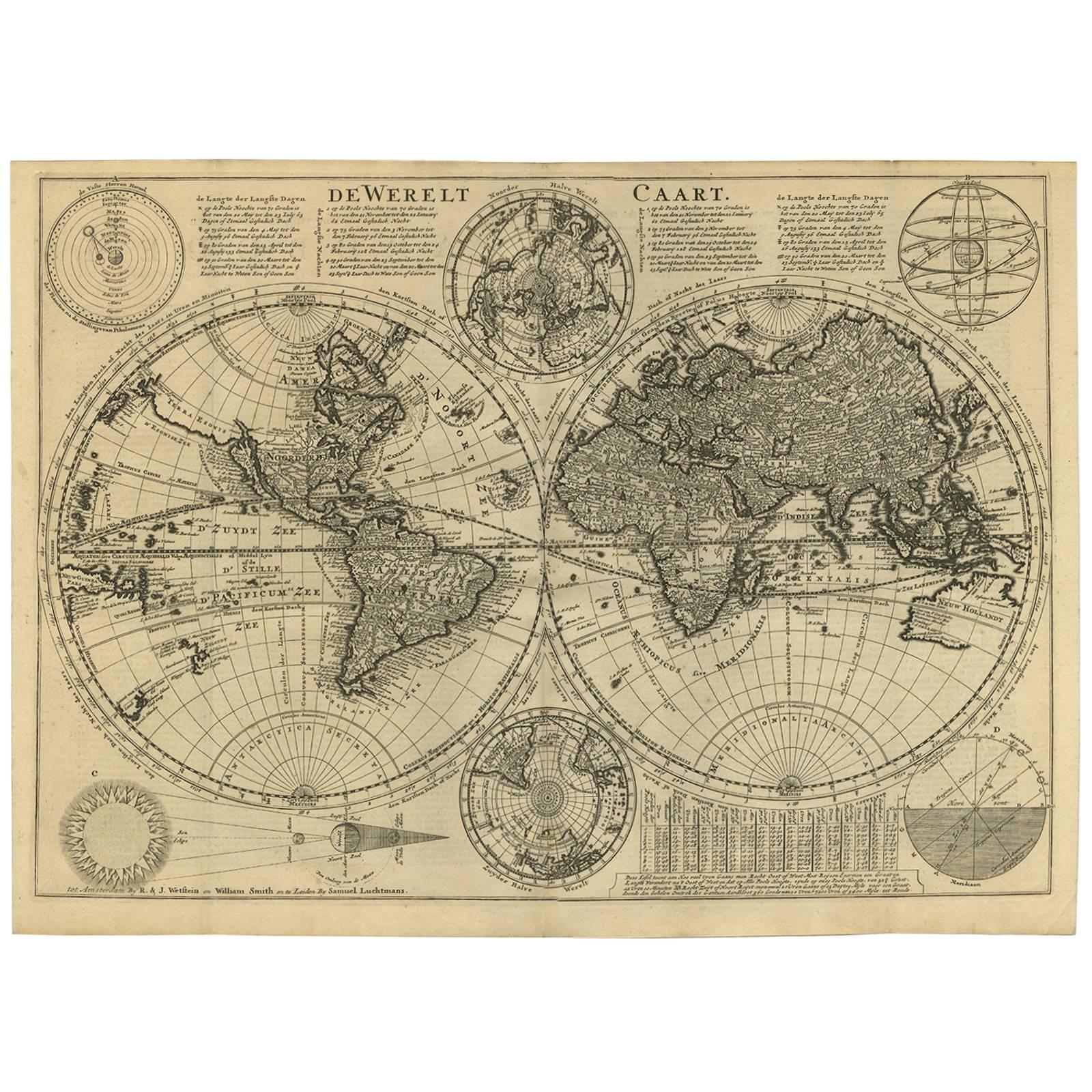
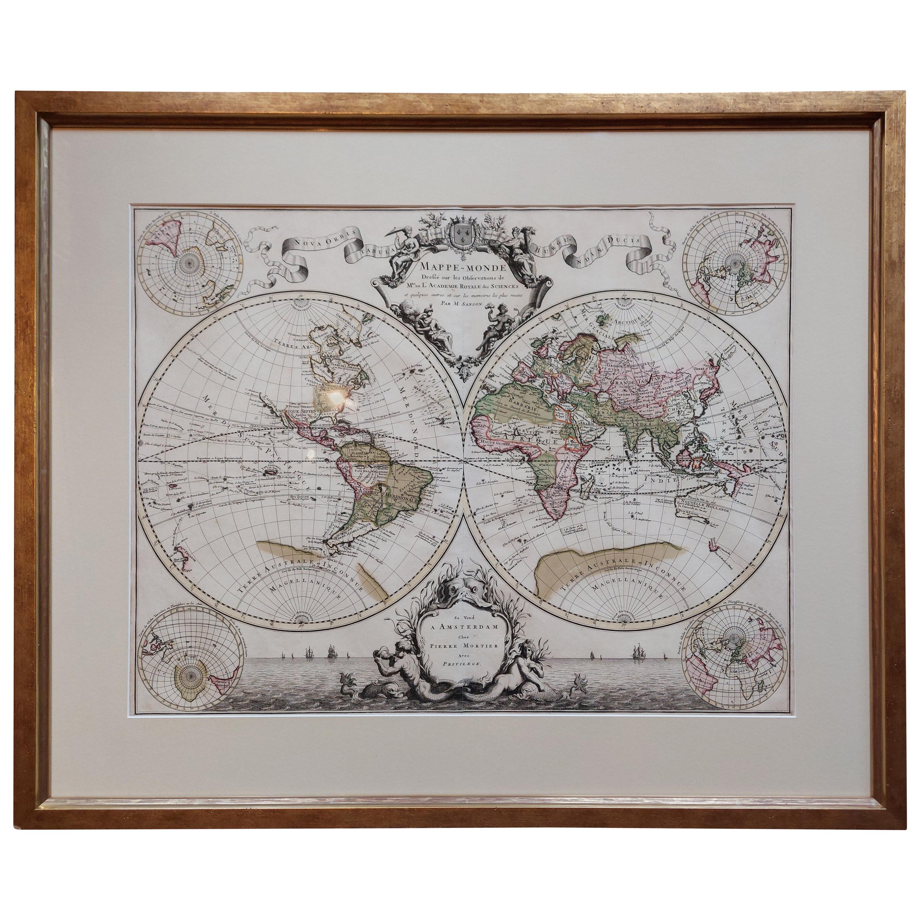
 - Original Antique Hand-colored World Map with or without Frame, '1696'Located in Langweer, NLAntique world map titled 'Mappe-Monde dressee sur les Observations de Mrs. de l'Academie Royale des Sciences (..)'. Beautiful original antique world map...Category
Antique Late 17th Century Maps
MaterialsPaper
- Antique World Map by Lesage, 1823Located in Langweer, NLAntique world map titled 'Mappe Monde Historique'. The map depicts both the Eastern and Western Hemispheres, with the hemispheres meeting in the midd...Category
Antique Early 19th Century Maps
MaterialsPaper
 $260 Sale Price20% Off
 - Antique World Map by P. Schenk '1706'By Peter SchenkLocated in Langweer, NLAntique map titled 'Diversa Orbis Terrae. Visu Incedente per Coluros Tropicorum, Ambos Ejus Polos, et Parciularis Sphaerae Zenith, in Planum Orthographica Projectio (..) Plat Ontwerp van verscheyde Aert-klooten (..)'. One of the earliest Dutch World Maps to focus on a more modern cartographic style, based on Carel Allard's map of 1696. This map represented a noteworthy shift from the traditional decorative Dutch 17th century maps where the margins would be full of classical mythological...Category
Antique Early 18th Century Maps
MaterialsPaper
 $4,101 Sale Price30% Off
 - Antique Map of Asia by Young, c.1860Located in Langweer, NLAntique map titled 'Asia'. Steel engraved map of Asia by Francis Young. Artists and Engravers: Engraved by Lewis Becker. Published by S.O. Beeton. We sell original antique maps to...Category
Antique 19th Century Maps
MaterialsPaper
 $117 Sale Price20% Off