Items Similar to Mid 19th Century Pair of Framed English Maps of Oxford and Cambridge
Want more images or videos?
Request additional images or videos from the seller
1 of 5
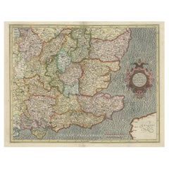
Mid 19th Century Pair of Framed English Maps of Oxford and Cambridge
About the Item
Pair of maps of Oxford and Cambridge in custom black wood frames. With beautiful hand-drawn lettering and a breathtaking commitment to detail, these mid 19th-century maps are a great example of mapmaking in the period.
England, circa 1860
Dimensions: 19W x 1.5D x 15.5H
- Dimensions:Height: 15.5 in (39.37 cm)Width: 19 in (48.26 cm)Depth: 1.5 in (3.81 cm)
- Sold As:Set of 2
- Style:Victorian (Of the Period)
- Materials and Techniques:
- Place of Origin:
- Period:
- Date of Manufacture:1860
- Condition:Wear consistent with age and use.
- Seller Location:Los Angeles, CA
- Reference Number:
About the Seller
4.7
Vetted Seller
These experienced sellers undergo a comprehensive evaluation by our team of in-house experts.
Established in 1989
1stDibs seller since 2004
Typical response time: <1 hour
- ShippingRetrieving quote...Ships From: West Hollywood, CA
- Return PolicyA return for this item may be initiated within 7 days of delivery.
More From This SellerView All
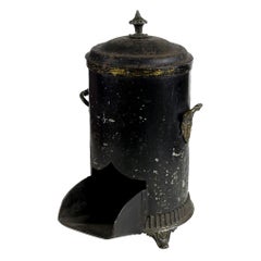
- Mid-19th Century English Black Coal ScuttleLocated in Los Angeles, CAMid 19th-century English coal scuttle. Originally used to store coal near the fireplace for immediate access, this could still be used in the same...Category
Antique 1860s English Victorian Fireplace Tools and Chimney Pots
MaterialsMetal
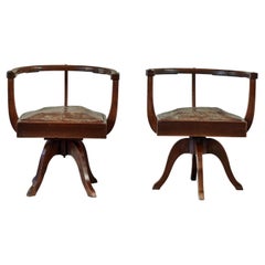
- Pair of 19th Century English Study ChairsLocated in Los Angeles, CASculptural study chairs from late 19th century England. With softly worn auburn leather drop-in seats and minimalist oak wood accents, these chairs have a ...Category
Antique 1880s English Chairs
MaterialsLeather, Oak
- Antique Framed Pen and Ink on Fabric Map of Cornwall from Early 19th CenturyLocated in Los Angeles, CAEarly 19th-century English pen-and-ink fabric map of Cornwall. With beautiful hand-drawn details and faded sepia tones, this framed piece turns history into art. England, circa 181...Category
Antique Early 19th Century English Drawings
MaterialsFabric, Walnut
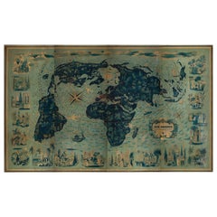
- Four Reproduction Vintage Panels of Air France World MapLocated in Los Angeles, CAReproduction of a beautiful green and blue mid-century Air France world map on four individual panels. The charming illustrations evoke an era of international jet-set style. May be ...Category
21st Century and Contemporary French Prints
MaterialsWood, Paper
- Four Reproduction Vintage Panels of Air France World MapLocated in Los Angeles, CAReproduction of beautiful blue and green mid-century Air France world map on four individual panels. The charming illustrations evoke an era of international jet-set style. May be pu...Category
21st Century and Contemporary French Prints
MaterialsPaper, Wood
- Late 19th Century English Tin and Wood Storage BoxLocated in Los Angeles, CALate 19th-century English imported storage box with hand-painted gilt Chinese character insignia and Greek key pattern. Features a jointed, hand-carved wooden top and tin siding in ...Category
Antique Late 19th Century Chinese Late Victorian Trunks and Luggage
MaterialsTin


You May Also Like
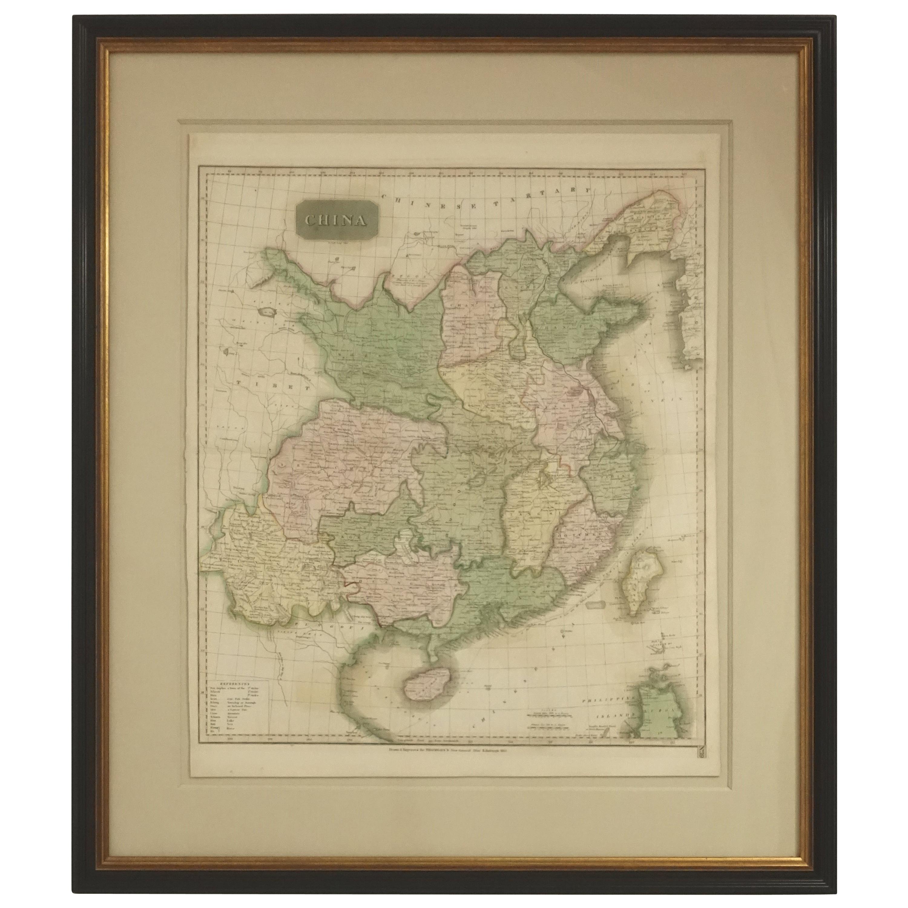
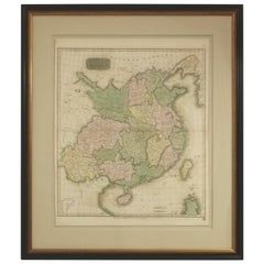
- Framed Early 19th Century Drawn and Engraved Map of ChinaBy John Knighton ThomsonLocated in San Francisco, CAHand drawn and tinted engraved map of China dated 1815 Created for Thomson's New General Atlas Edinburgh Beautifully framed with a linen covered mat.Category
Antique Early 19th Century European Prints
MaterialsPaper
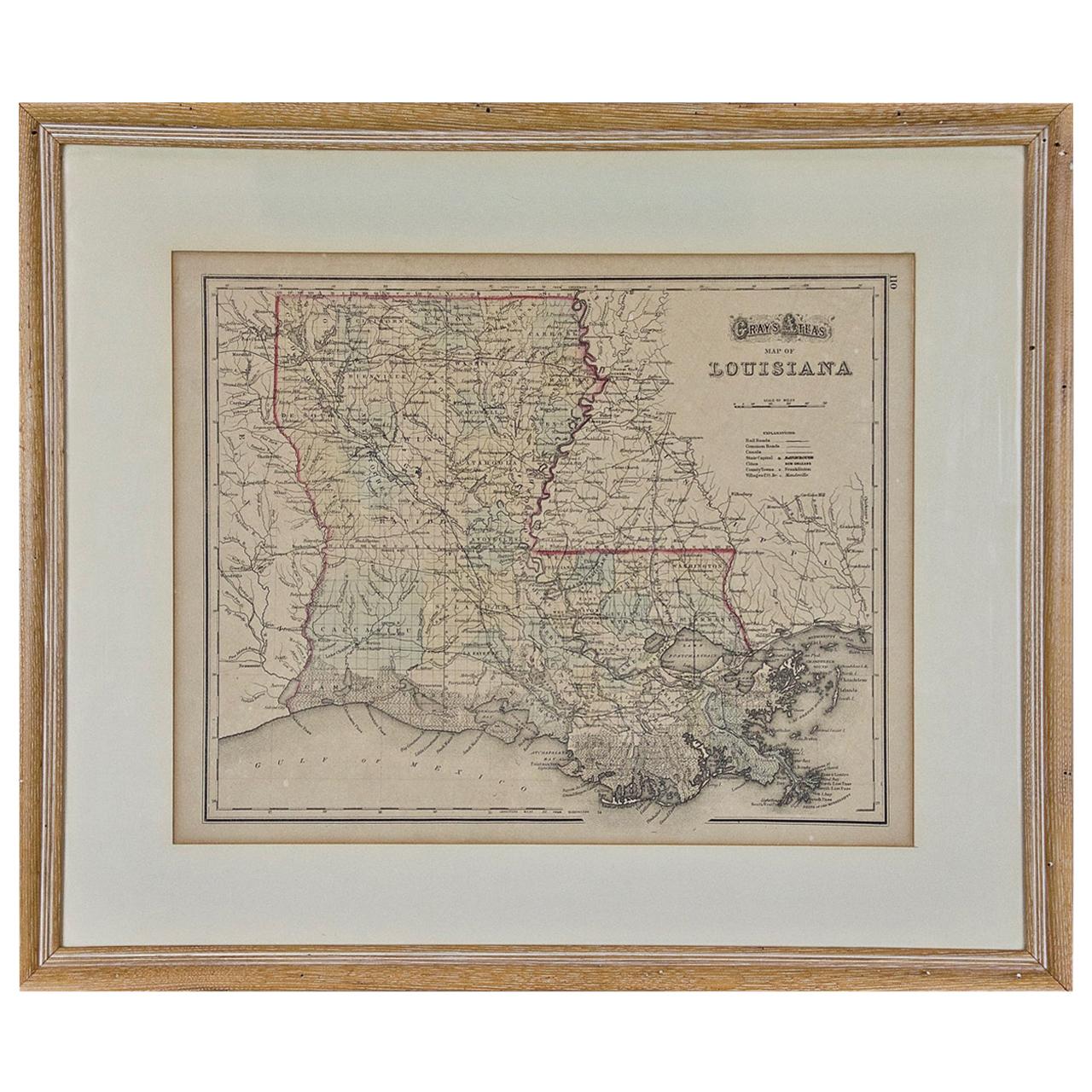
- Louisiana: A Framed 19th Century Map by O. W. GrayBy Gray and CoLocated in Alamo, CAThis framed 19th century map of the Louisiana territory was published in "Gray's Atlas of the United States with General Maps of the World, accompanied by Descriptions Geographical, Historical, Scientific and Statistica" published in 1873 in Philadelphia by O.W. Gray and Son and Stedman, Brown and Lyon. It is a highly detailed map of Louisiana...Category
Antique Mid-19th Century American Other Maps
MaterialsPaper
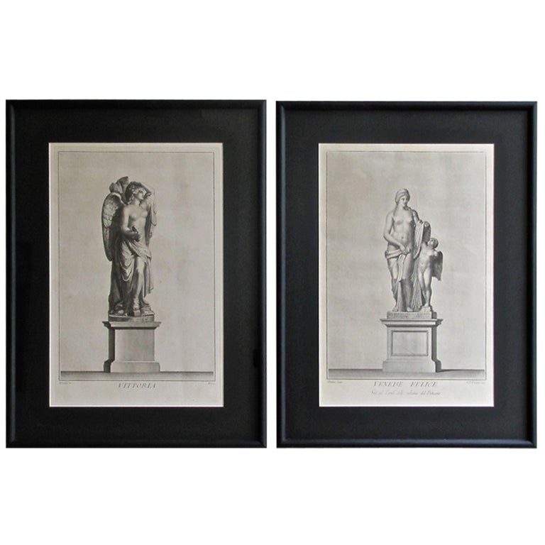
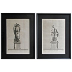
- Pair of 19th Century Neoclassic Framed PrintsLocated in Palm Springs, CAPair of 19th century neoclassic steel engraving prints. Professionally matted and framed.Category
Antique 19th Century Prints
MaterialsWood, Paper
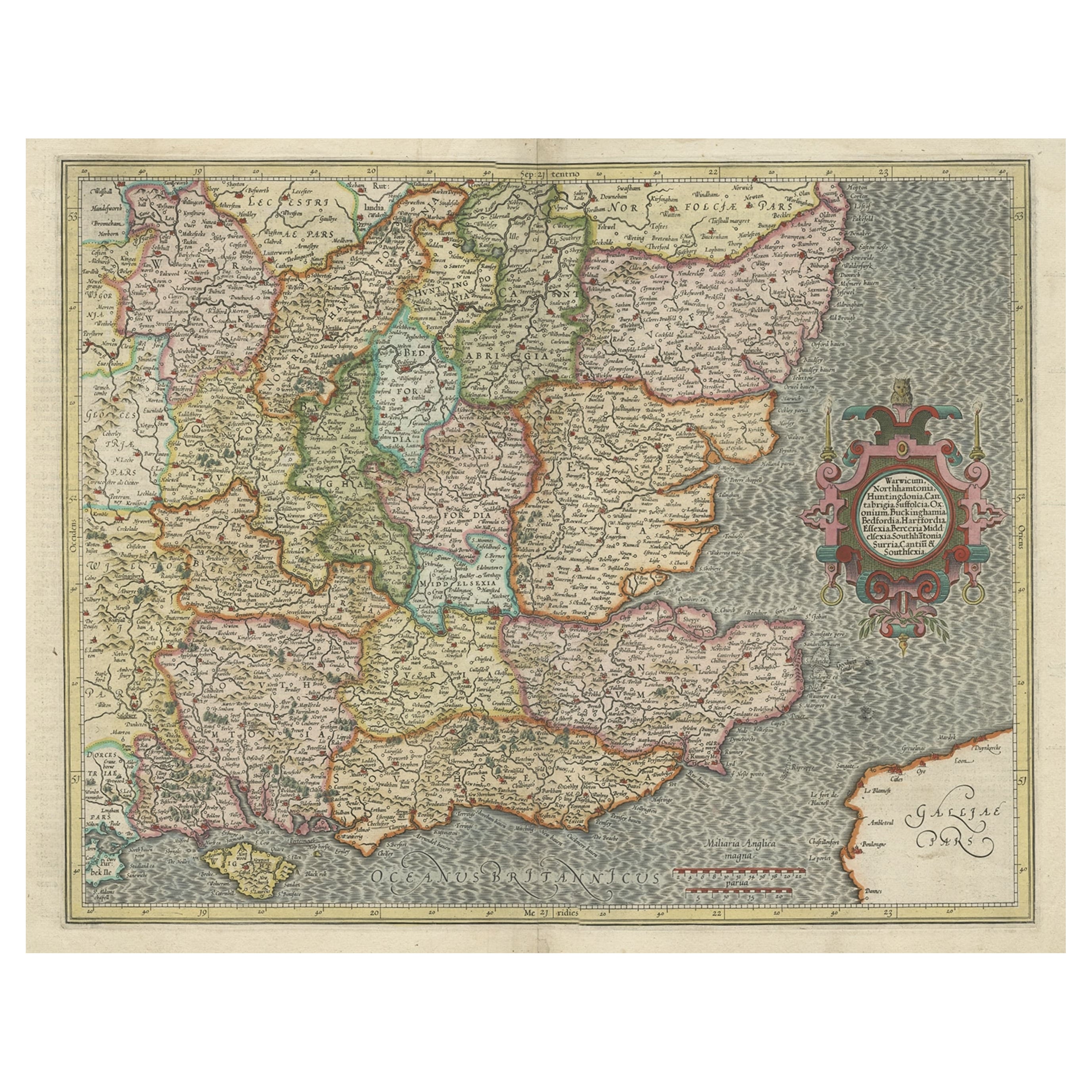
- Original Old Map of South East England Incl London, Oxford, Cambridge, Etc, 1633Located in Langweer, NLAntique map titled 'Warwicum, Northhamtonia, Huntingdonia, Cantabrigia, Suffolcia, Oxonium, Buckinghamia, Befordia, Harfordia, Essexia, Berceria, Middlesexia, Southhatonia, Surria, Catiu & Southsexia'. Old map of south east England. Includes London, Salisbury, Oxford, Cambridge, Leicester and Norwich and the Isle of Wight. Originates from the 1633 German edition of the Mercator-Hondius Atlas Major, published by Henricus Hondius and Jan Jansson under the title: 'Atlas: das ist Abbildung der gantzen Welt, mit allen darin begriffenen Laendern und Provintzen: sonderlich von Teutschland, Franckreich, Niderland, Ost und West Indien: mit Beschreibung der selben.' Artists and engravers: Gerard Mercator (1512 - 1594) originally a student of philosophy was one of the most renowned cosmographers and geographers of the 16th century, as well as an accomplished scientific instrument maker. He is most famous for introducing Mercators Projection, a system which allowed navigators to plot the same constant compass bearing on a flat map.Category
Antique 1630s Maps
MaterialsPaper
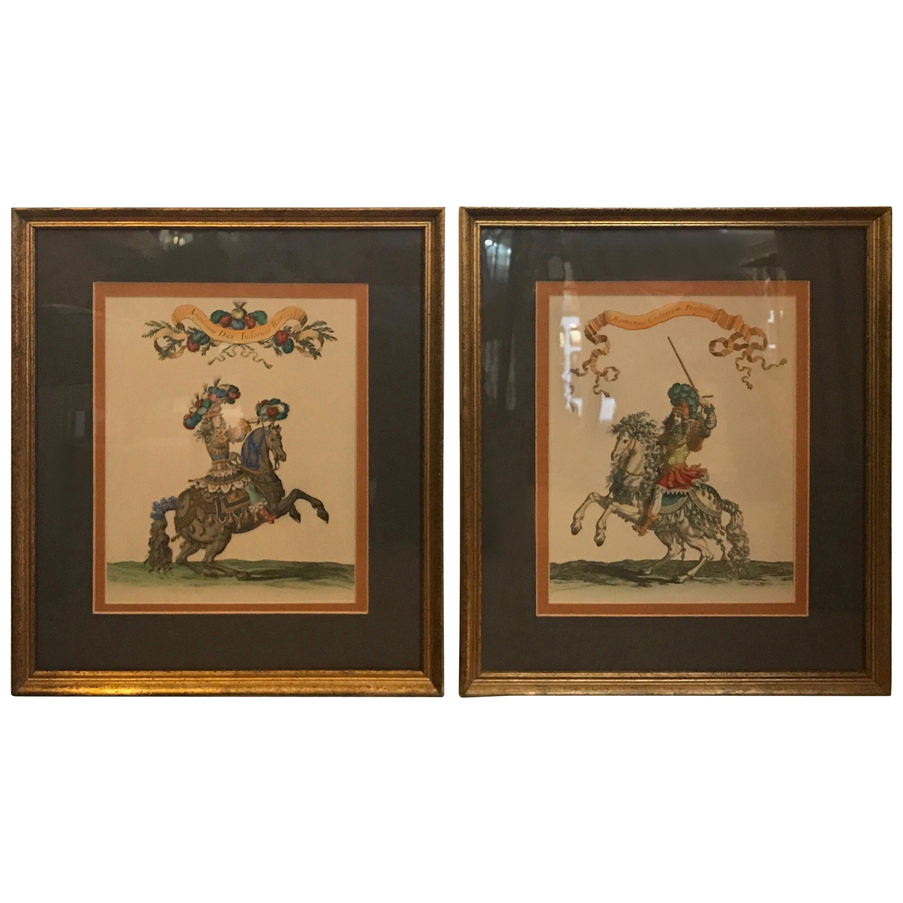
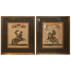
- Pair of 19th Century Hand Colored Engravings, FramedLocated in Lambertville, NJA pair of 19th century hand colored engravings titled Anguienus DUX, Indorum Rex. (Horseman on horse and the second Romanus Castrorum Praefectus (the commander of the camp). Framed i...Category
Antique Late 19th Century European Prints
MaterialsGiltwood
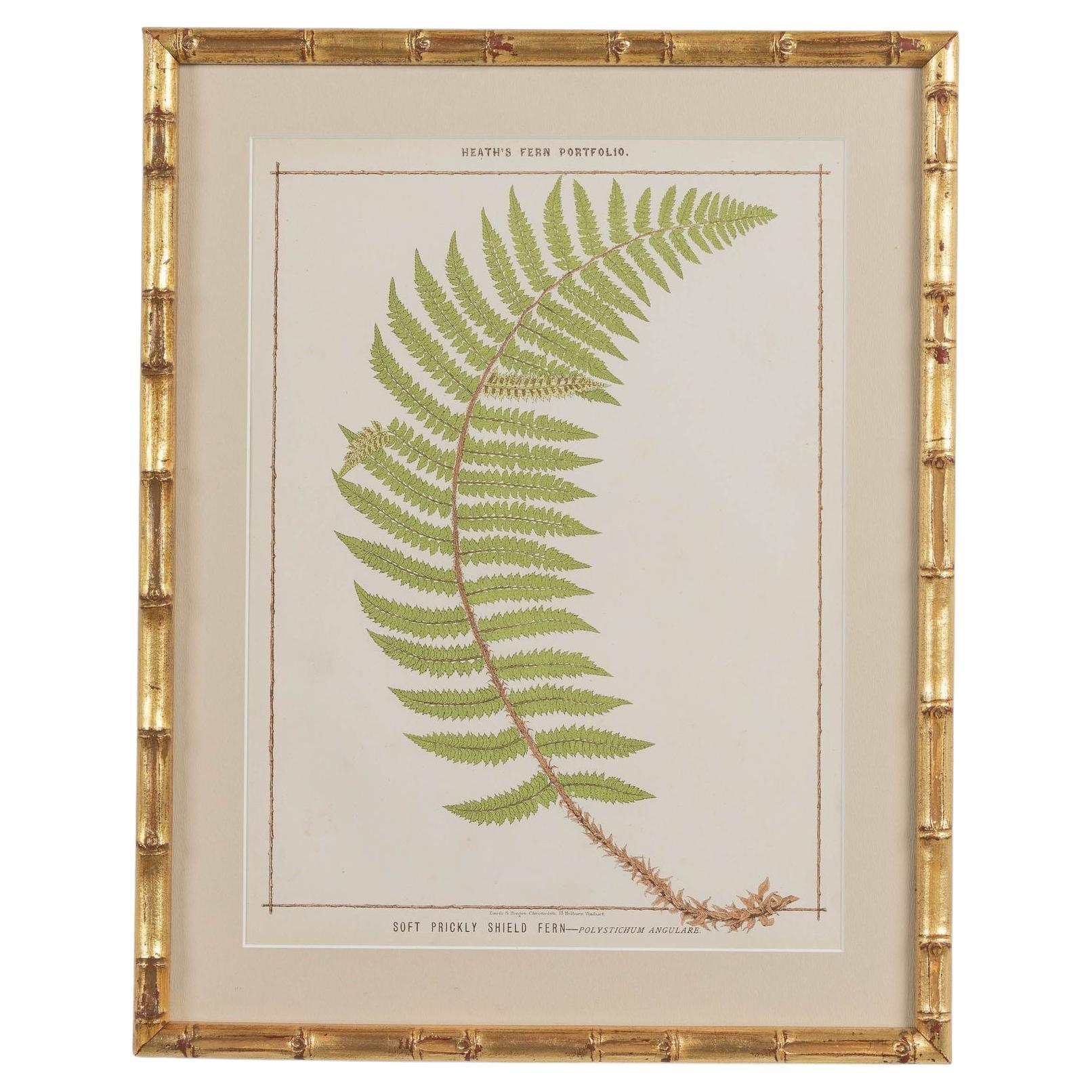
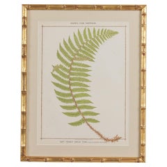
- 19th c. Framed English Chromolithograph FernLocated in Wichita, KSA beautiful collection of four chromolithographs from the 19th c. by Francis George Heath. Archival quality framing with archival matte front and back, protecting the original, antiq...Category
Antique 19th Century English Prints
MaterialsGlass, Wood, Paper

Recently Viewed
View AllMore Ways To Browse
Map Of Oxford
Cambridge Map
Antique Maps Oxford
Antique Maps Cambridge
Map Oxford England
Maps Cambridge England
Chest Of Drawers In Antique White
Large China Cabinet
Large Chinese Cabinet
Marble Top Chest Marquetry
19th Century French Marble Top Round
Chest Of Draweres Set
Regency Dining Table Set
Snake Red
Antique Mirrored Chests
Accent Chest Drawer
Escutcheon Plate
Swedish Boat