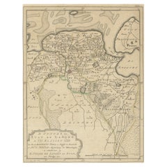
Map of the Netherlands
View Similar Items


Want more images or videos?
Request additional images or videos from the seller
1 of 6
Map of the Netherlands
About the Item
- Dimensions:Height: 27.5 in (69.85 cm)Width: 33 in (83.82 cm)Depth: 1.13 in (2.88 cm)
- Materials and Techniques:Paper,Engraved
- Place of Origin:
- Period:
- Date of Manufacture:1785
- Condition:Wear consistent with age and use.
- Seller Location:New York, NY
- Reference Number:1stDibs: LU108424781203
About the Seller
4.9
Platinum Seller
These expertly vetted sellers are 1stDibs' most experienced sellers and are rated highest by our customers.
1stDibs seller since 2014
511 sales on 1stDibs
Typical response time: 1 hour
More From This SellerView All
- Map of the Republic of GenoaLocated in New York, NYFramed antique hand-coloured map of the Republic of Genoa including the duchies of Mantua, Modena, and Parma. Europe, late 18th century. Dimension: 25...Category
Antique Late 18th Century European Maps
- Antique Map of Italy by Andriveau-Goujon, 1843By Andriveau-GoujonLocated in New York, NYAntique Map of Italy by Andriveau-Goujon, 1843. Map of Italy in two parts by Andriveau-Goujon for the Library of Prince Carini at Palazzo Carini i...Category
Antique 1840s French Maps
MaterialsLinen, Paper
 $3,350 / set
 - David Roberts, Tombs of the MamelukesBy David RobertsLocated in New York, NYDavid Roberts, Tombs of the Mamelukes. David Roberts (1796-1864) antique lithograph of the "Tombs of the Mamelukes, Cairo" from the 1st edition in gilt frame, England, 1849. Dimensi...Category
Antique Mid-19th Century English Prints
MaterialsPaper
- Set of Six Engravings of Italian Regional DressBy Alessandro d'AnnaLocated in New York, NYSet of six engravings of Italian regional dress. Set of six framed antique engravings from a series of Italian regional dress after Alessandro d'...Category
Antique Late 18th Century Italian Prints
MaterialsPaper
 $1,650 / set
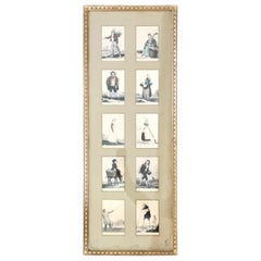
 - Framed Characters of BordeauxLocated in New York, NYFramed characters of Bordeaux. Ten elegant hand coloured French engravings of personages / vocations Bordelais stamped 1820 under celadon matting with rippled antique glass in a Rege...Category
Antique Early 19th Century French Prints
MaterialsGlass, Giltwood
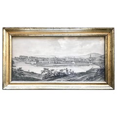
- Gilt-Framed View of BensançonLocated in New York, NYGilt-framed view of Besançon. Lemon gilt framed engracing of early 19th century view of Besançon France, 19th century Dimensions: 13.5” W x 7.5” H x...Category
Antique 19th Century French Prints
MaterialsGiltwood, Paper


You May Also Like
- Antique Map of the Province of Overijssel, the NetherlandsLocated in Langweer, NLOriginal antique map titled 'Ditio Trans-Isulana'. Original old map of the province of Overijssel, the Netherlands. With coat of arms and two decorative cartouches. Published by J. J...Category
Antique Mid-17th Century Maps
MaterialsPaper
- Antique Map of Groningen, the Netherlands, 1771Located in Langweer, NLAntique map titled 'De Synode van Stad en Landen in VII Klassen verdeeld (..)'. Map of the province of Groningen, the Netherlands. This map originates from 'Nieuwe kerkelyke geogra...Category
Antique 18th Century Maps
MaterialsPaper
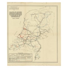
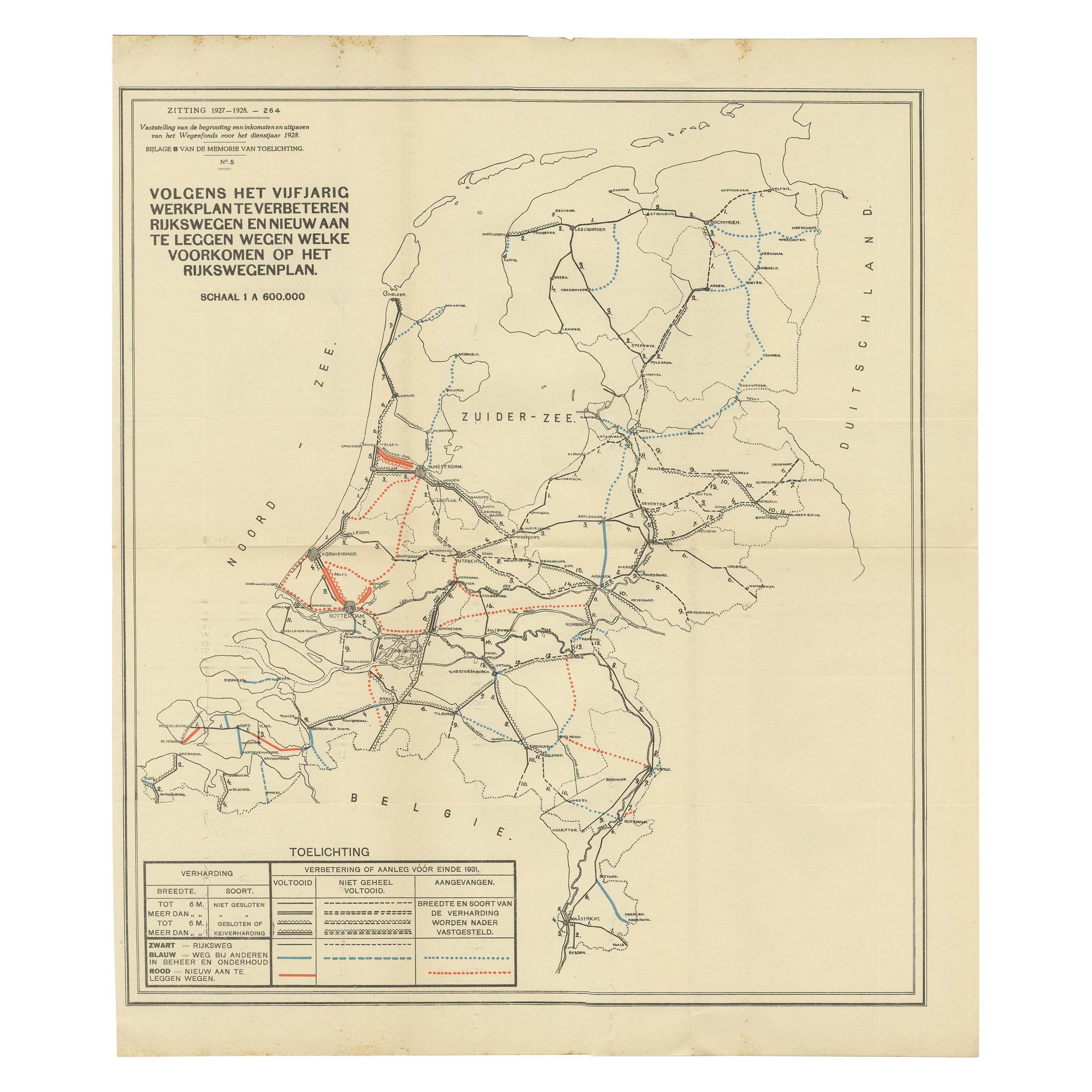
- Vintage Road Map of the Netherlands '1928'Located in Langweer, NLVintage map titled 'Volgens het vijfjarig Werkplan te verbeteren Rijkswegen en nieuw aan te leggen wegen welke voorkomen op het Rijkswegenplan'. Map of the Netherlands...Category
20th Century Maps
MaterialsPaper
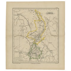
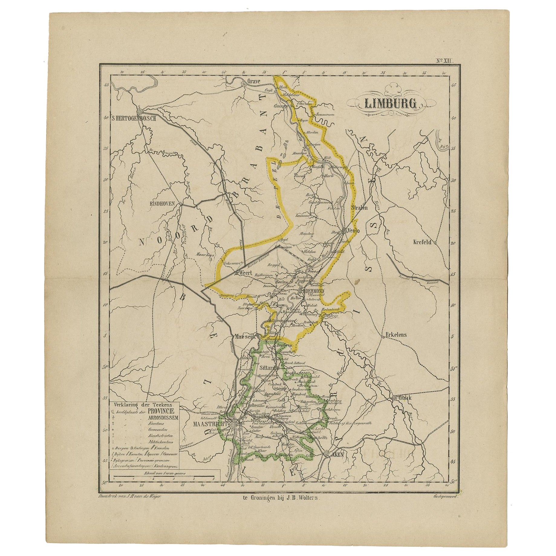
- Antique Map of the Province Limburg, The Netherlands, 1864Located in Langweer, NLAntique map titled 'De Provincie Limburg'. Map of the province of Limburg, the Netherlands. This map originates from 'F. C. Brugsma's Atlas van het Koninkrijk der Nederlanden (..)'. ...Category
Antique 19th Century Maps
MaterialsPaper
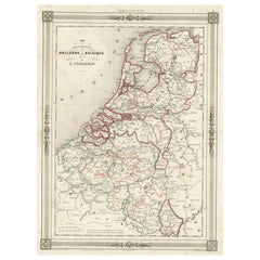
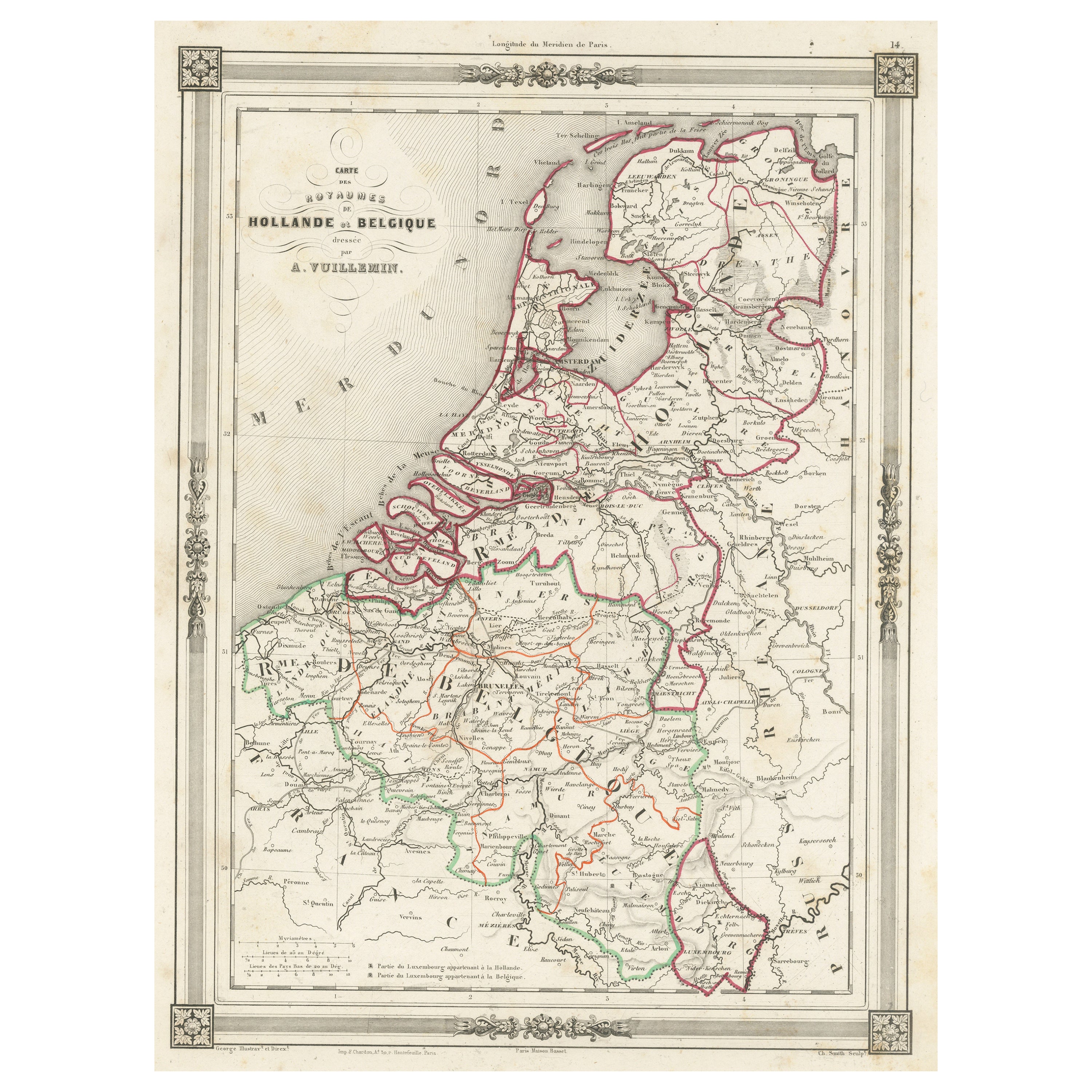
- Antique Map of the Netherlands, Belgium and LuxembourgLocated in Langweer, NLAntique map titled 'Carte des Royaumes Hollande et Belgique'. Attractive map of the Netherlands, Belgium and Luxembourg. This map originates fro...Category
Antique Mid-19th Century Maps
MaterialsPaper
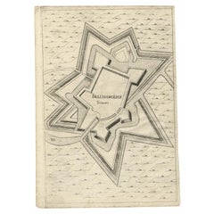
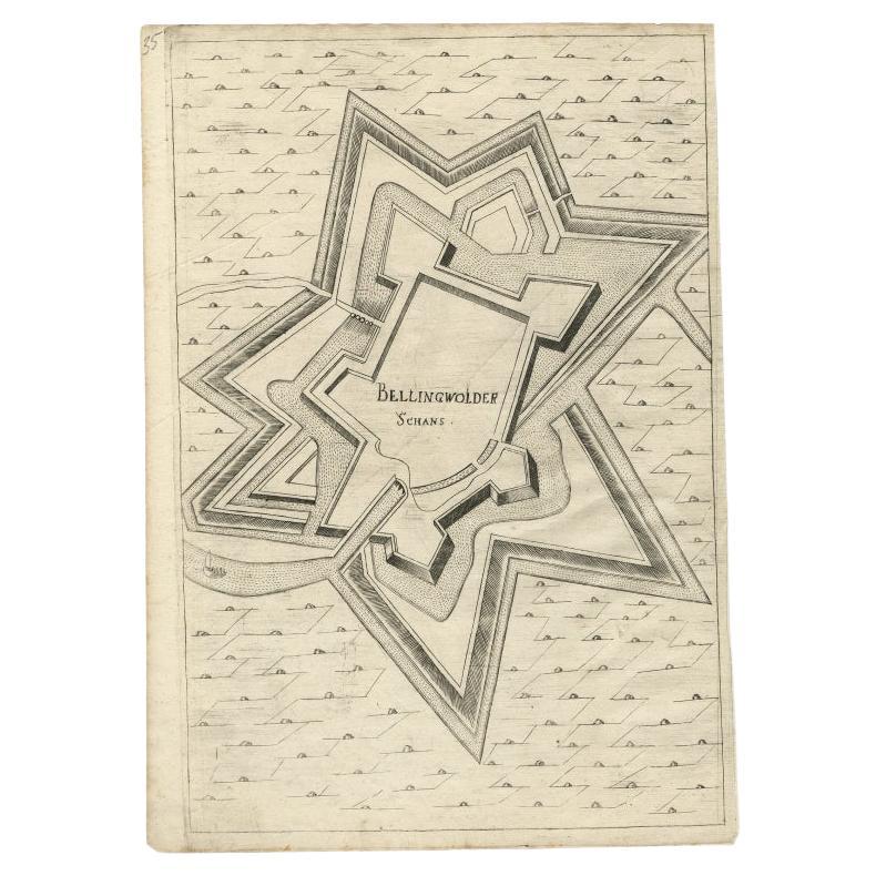
- Antique Map of Fortification of Bellingwolderschans, The Netherlands, 1673Located in Langweer, NLAntique map titled 'Bellingwolderschans'. Original map of the fortification of Bellingwolderschans, the Netherlands. This map originates from 'Teatro del Belgio', by G. Gualdo Priora...Category
Antique 17th Century Maps
MaterialsPaper