Items Similar to Countye of Monmouth, Dated 1610
Want more images or videos?
Request additional images or videos from the seller
1 of 11
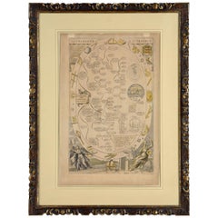
Countye of Monmouth, Dated 1610
About the Item
The countye of Monmouth with the situation of the townshire described Anno, 1610
The reverse with Monmouthshire, Chapter VI and an alphabetical list of towns.
In a beautiful Flemish oak polished and gilded frame
Cartographer: John Speed (1552-1629)
Signed/Inscribed: John Speed, John Sudbury & George Humble 1610.
- Creator:John Speed (Maker)
- Dimensions:Height: 20.48 in (52 cm)Width: 15.36 in (39 cm)Depth: 0.4 in (1 cm)
- Style:Baroque (Of the Period)
- Materials and Techniques:Paper,Glazed
- Place of Origin:
- Period:1610-1619
- Date of Manufacture:1610
- Condition:
- Seller Location:BUNGAY, GB
- Reference Number:1stDibs: LU3867315797982
About the Seller
5.0
Vetted Seller
These experienced sellers undergo a comprehensive evaluation by our team of in-house experts.
Established in 1985
1stDibs seller since 2018
Typical response time: 9 hours
- ShippingRetrieving quote...Ships From: BUNGAY, United Kingdom
- Return PolicyA return for this item may be initiated within 7 days of delivery.
More From This SellerView All
- Buckingham Both Shyre and Shire John Speed 1610 Gilded FrameLocated in BUNGAY, SUFFOLKJust purchased more information to follow. In unrestored condition, the sheet can be cleaned.Category
Antique 17th Century English Baroque Maps
MaterialsPaper
- Road Map John Ogilby London St David's Britannia No 15 Abingdon Monmouth FramedBy John OgilbyLocated in BUNGAY, SUFFOLKJohn Ogilby (British 1600-1676) Cosmographer and Geographick Printer to Charles II. A road map from Britannia, 1675/6. No 15. The continuation of the r...Category
Antique 1670s English Baroque Maps
MaterialsPaper
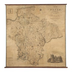
- Map Hanging Wall County of Devon C&J Greenwood 1827 Exeter Cathedral Lundy IsleLocated in BUNGAY, SUFFOLKC & J GREENWOOD MAP OF THE COUNTY OF DEVON, FROM AN ORIGINAL SURVEY, PUBLISHED 1827, WITH ENGRAVING OF EXETER CATHEDRAL AND MAP OF LUNDY INSET, 6ft 2 ...Category
Antique 1820s English Early Victorian Maps
MaterialsPaper
- Map Holy Land La Terre Sainte Engraved van Loon Published N de Fer 1703 FrenchLocated in BUNGAY, SUFFOLKLa Terre Sainte, The Holy Land, Tiree Des Memoires De M.De.La Rue. Par N. de Fer. Geographe de Sa Majeste Catoliq et de Monseigneur le Dauphin. Avec Privil du Roi 1703 Detailed map of the Holy Land from Nicholas de Fer's L'Atlas Curieux ou le Monde. East is oriented at the top. MAKER Nicolas de Fer 1646-1720 The French cartographer and engraver, Nicolas de Fer, was a master at creating maps that were works of art. The maps that he published were printed during the Baroque period when the decorative arts were characterized by ornate detail. De Fer’s detailed maps and atlases were valued more for their decorative content than their geographical accuracy. Nicolas de Fer was born in 1646. His father, Antoine de Fer, owned a mapmaking firm. At the age of twelve, Nicolas was apprenticed to a Parisian engraver named Louis Spirinx. The family business was starting to decline when his father died in 1673. Nicolas de Fer’s mother, Genevieve, took over the business after the death of her husband. In 1687 the business was passed on to Nicolas and the profits increased after he took over the firm. Nicolas de Fer was a prolific cartographer who produced atlases and hundreds of single maps. He eventually became the official geographer to King Louis XIV of France and King Philip V...Category
Antique Early 1700s French Louis XIV Maps
MaterialsPaper
- Cosmgraphy and Astrology, 1686 by Richard Blome from the First EditionBy Richard BlomeLocated in BUNGAY, SUFFOLKCosmography & Astrology Large oval engraved plate with inscriptions outlining the various parts of cosmography and astronomy; below, two emblematic figures with scientific instruments either side. Lettered with title, dedication, and various inscriptions. To his Excellency Roger Palmer, Earle of Castelmain and Baron of Limerick in Ireland, Embassador Extraordinary from his majesty King James II to his Holyness Pope Innocent 11th anno dom 1686. This plate is humbly DD by Richard Blome. On paper and retaining its original coloring. Sheet width 26 ½ cm., 10 ½ in., height 41 ½ cm., 16 ½ in., In a part-gilded Sansovino frame...Category
Antique 1680s English Charles II Decorative Art
MaterialsPaper
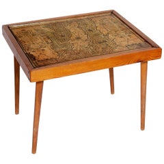
- Table Low Sofa Vintage 1950s Map Isle of Man John Speed 1610 Thomas Durham 1595Located in BUNGAY, SUFFOLK- The juxtaposition of modern design and this ancient map create a unique small table and conversation piece - This is the first map featuring the Isle of Man on its own. - It is also the first map of the Island based on an actual survey, undertaken by Thomas Durham 1595 and was first published by Speed in 1605-1611 and reprinted many times over the next century. This is the second state or print from 1610. The map is inset within a fruitwood box frame with a glass top. Supported by tapering stick legs. The map is based on a survey (and presumably a MS map) by Thomas Durham, of whom nothing is known other that he was paid by Sir Thomas Gerrard to make a survey of the Island. This survey, almost certainly for military purposes, arose from the disputed possession of the Island during which time Elizabeth had assumed control in order to prevent the Scots or the Spanish from using the Island as a base. Speed had used the Durham Map in his slightly earlier 4-sheet wall map showing invasions and battles of c1603/4 [ref: Shirley #261] - there are some differences from this 1605/10 map - Port Eran (rather than Earn on 1605);Knockalo point (= Contrary Hd) not on 1605;Spalbrecke shown west of Calf rather than E as on 1605/10. Thus it is possible that the Durham Map had even more detail than Speed used in his derived version. In sea are four mythical beasts with riders: to NW of Island Unicorn with Scottish flag...Category
Antique 1610s English Mid-Century Modern Sofa Tables
MaterialsPaper

You May Also Like
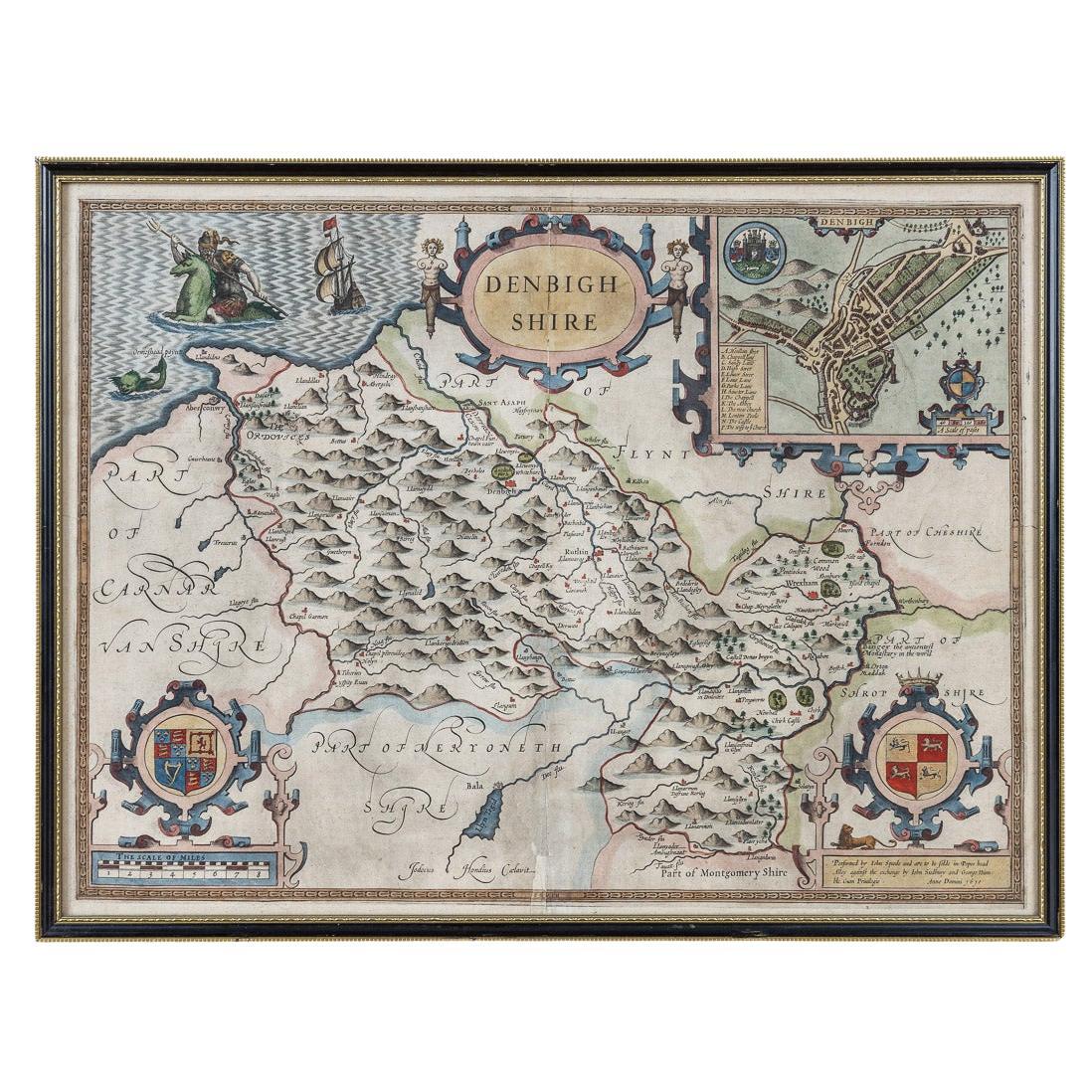
- 17th Century John Speed Map of Denbighshire, c.1610By John SpeedLocated in Royal Tunbridge Wells, KentAntique early 17th century British very rare and original John Speed, hand coloured map of Denbighshire, dated 1610, by John Sunbury and George Humble. John...Category
Antique 17th Century British Maps
MaterialsWood, Paper
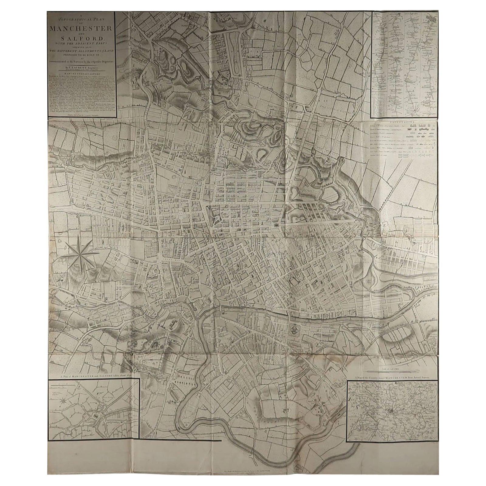
- Large Original Antique Folding Map of Manchester, England, Dated 1793Located in St Annes, LancashireSuperb map of Manchester and Salford Folding map. Printed on paper laid on to the original canvas Unframed. Published by C. Laurent, 1793. ...Category
Antique 1790s English Georgian Maps
MaterialsCanvas, Paper
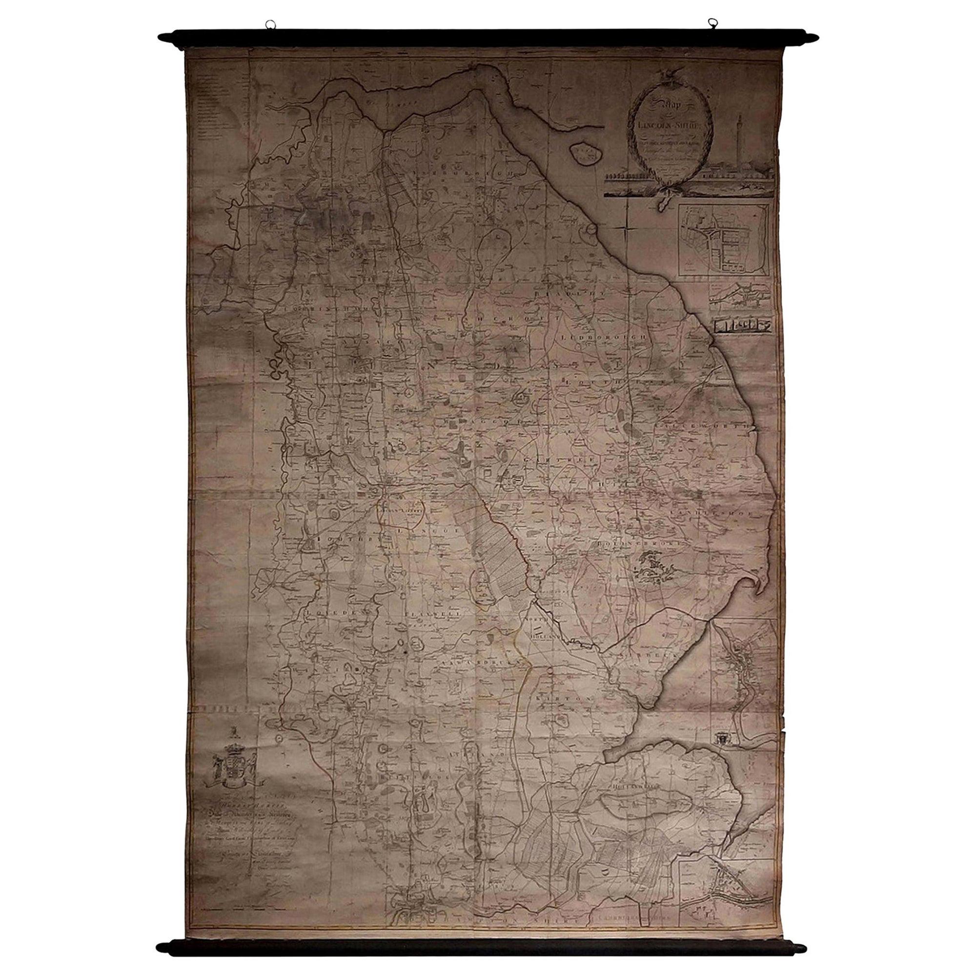
- Large Scale Antique Scroll Map of Lincolnshire, England, Dated 1778Located in St Annes, LancashireWonderful scroll map of Lincolnshire By Captain Armstrong, 1778 Copper plate engraving on paper laid on canvas Original ebonized wood frame with lo...Category
Antique 1770s English Georgian Maps
MaterialsWood, Paper
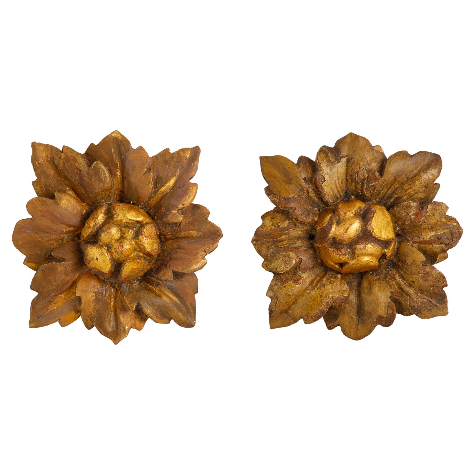
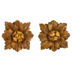
- Pair of Antique Friezes in the Shape of a FlowerLocated in Alessandria, PiemontePair of antique friezes in wood in the shape of a flower. They bear traces of lacquering, now erased by time. I just had the centrale part redone, to gi...Category
Antique Late 17th Century Italian Baroque Models and Miniatures
MaterialsFruitwood
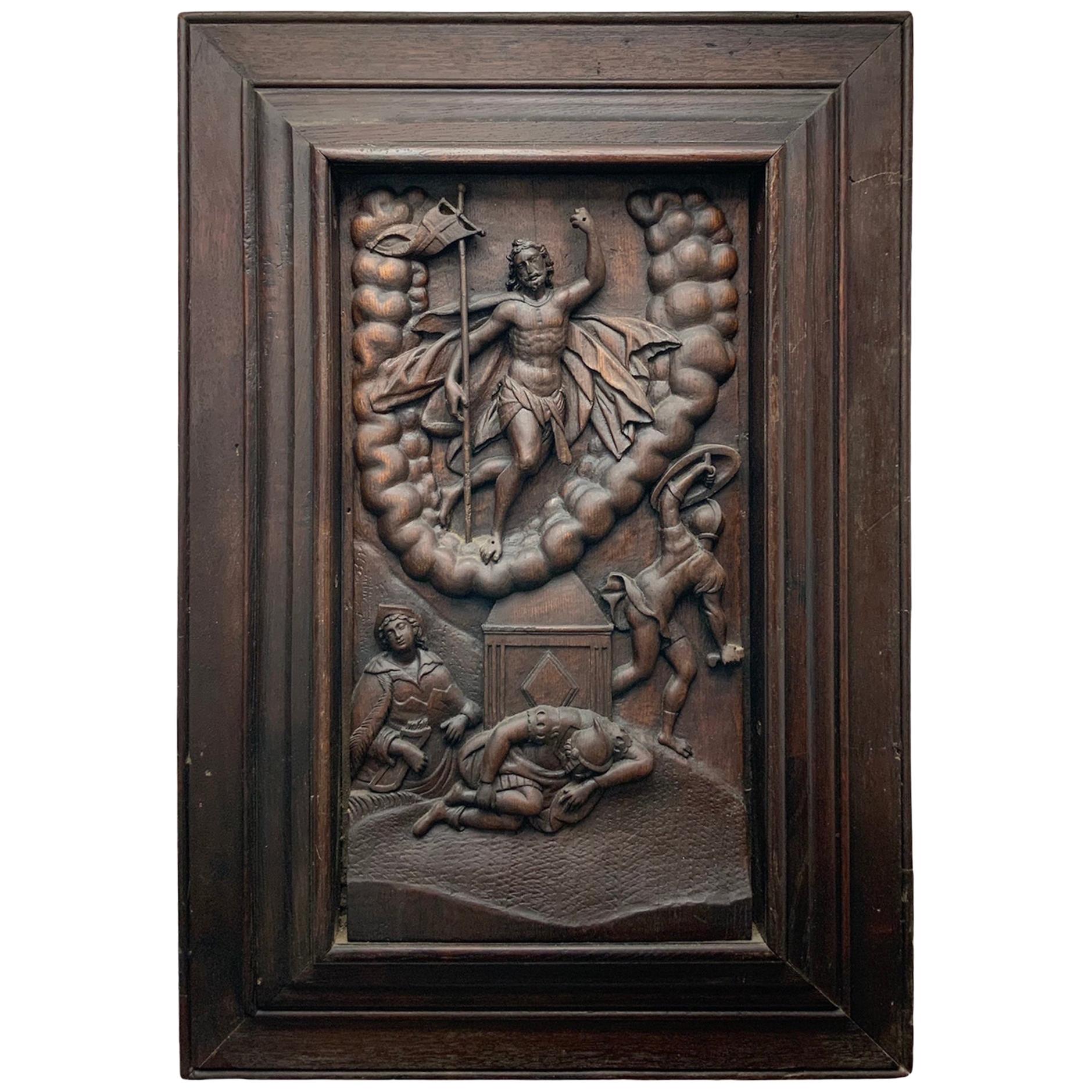
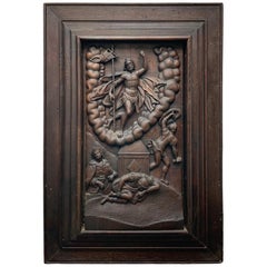
- Flemish Embossed Wood Plaque of the Resurrection of Jesus ChristLocated in Guaynabo, PRThis is a heavy large carved wood plaque depicting an embossed scene of the Resurrection of Jesus Christ. He is standing victorious and elevated over a U shaped cluster of clouds wit...Category
Antique 17th Century Belgian Baroque Decorative Art
MaterialsWood
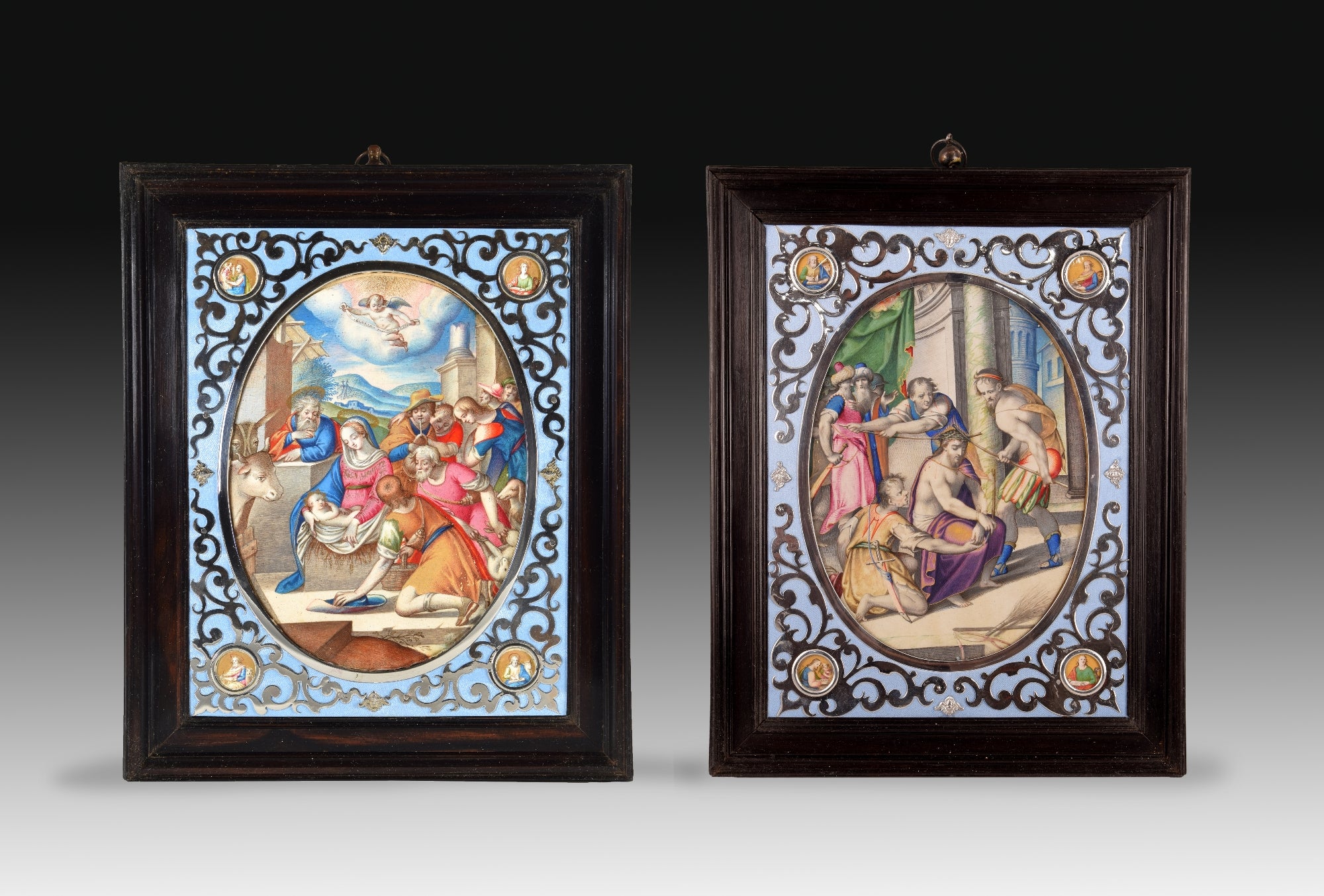
- Pair of Miniatures, Frans van de Casteele 'Kasteels' aka Francesco da CastelloBy Francesco da CastelloLocated in Madrid, ESFrans van de Casteele (Kasteels) called Francesco da Castello (Brussels, ca. 1541 - Rome, 1621) Adoration of the shepherds Crowning with thorns First decade of the 17th century...Category
Antique Early 17th Century European Baroque Decorative Art
MaterialsOther


Recently Viewed
View AllMore Ways To Browse
Flemish Oak
George Baroque
John Speed
John Vi
French Carved Wall Panel
Bed Wall Art
Elephant Wall
Antique Wall Ornament
Decorative Painted Tiles
Vintage Ceramic Wall Tiles
Retro Bird Wall Art
Screen Wall Hanging
Vintage Hand Painted Tiles
Vintage Hand Painted Tiles Tiles
Italian Ceramic Wall Art
Vintage Art Wooden Frame
Wall Art Coverings
Wood Wall Art Decor