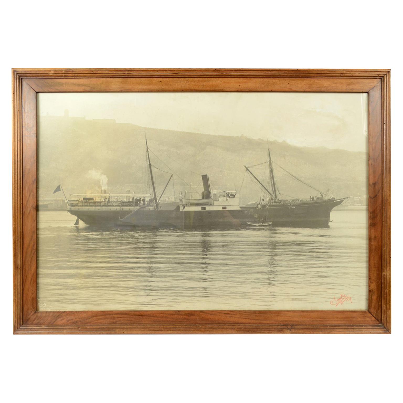
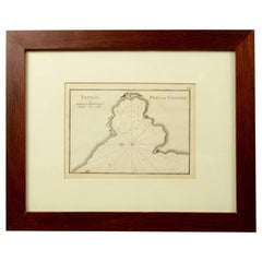
Antique Nautical Portolano of Natolie Golfe De Mandaya by A. Roux, France, 1844
View Similar Items

Want more images or videos?
Request additional images or videos from the seller
1 of 10
Antique Nautical Portolano of Natolie Golfe De Mandaya by A. Roux, France, 1844
About the Item
- Creator:Antoine Roux (Maker)
- Dimensions:Height: 12.21 in (31 cm)Width: 14.97 in (38 cm)Depth: 0.79 in (2 cm)
- Materials and Techniques:
- Place of Origin:
- Period:
- Date of Manufacture:1844
- Condition:
- Seller Location:Milan, IT
- Reference Number:1stDibs: LU1020220708572
About the Seller
4.9
Platinum Seller
These expertly vetted sellers are 1stDibs' most experienced sellers and are rated highest by our customers.
Established in 1999
1stDibs seller since 2014
More From This SellerView All
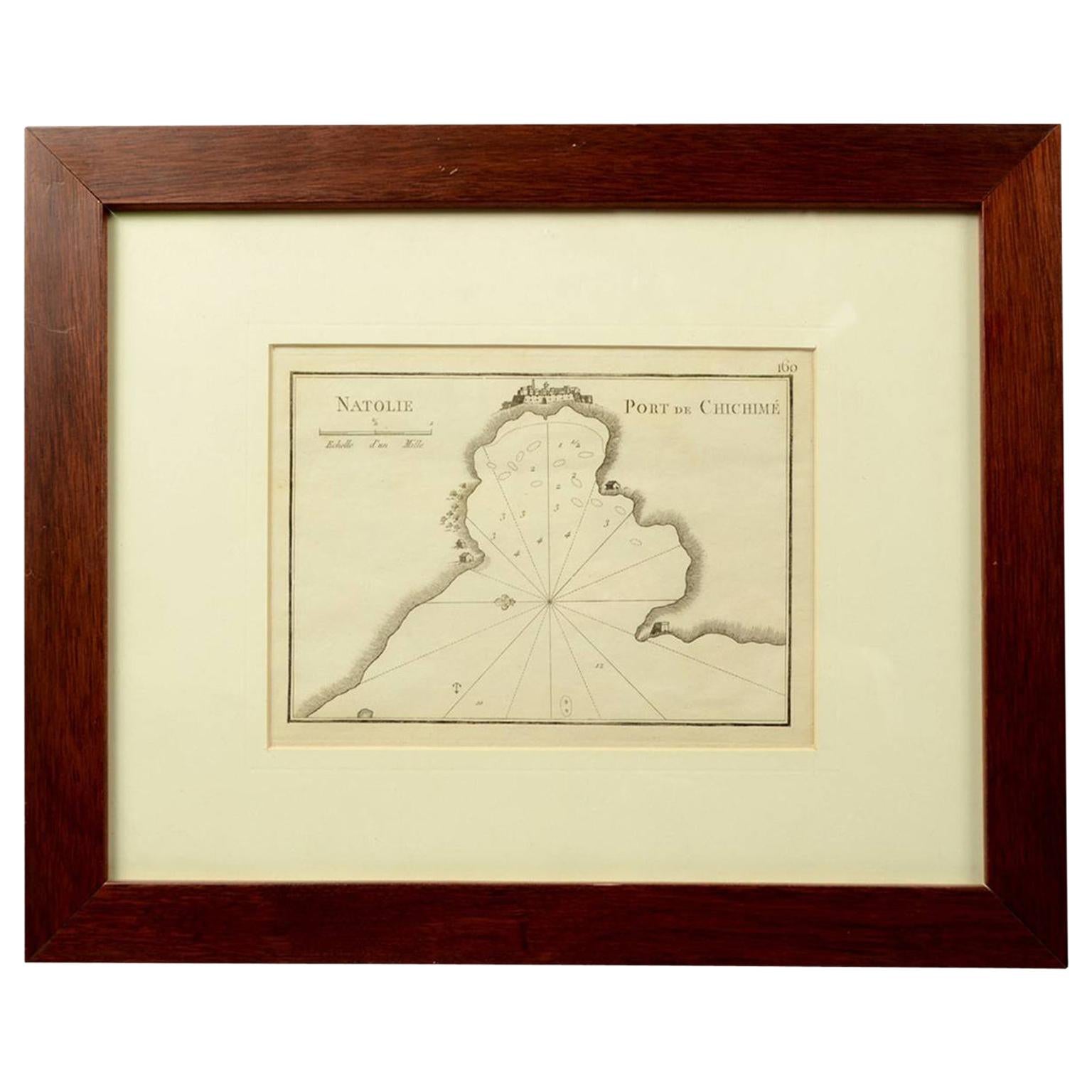
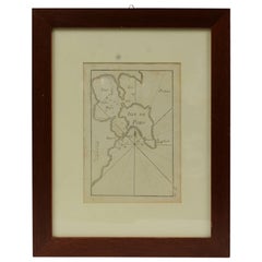
- 1844 French Nautical Portolano of Port De Chichimé Natolie by Antoine RouxBy Antoine RouxLocated in Milan, ITAntique portolano, nautical map of Port De Chichimé Natolie engraved on a copper plate by Antoine Roux, Marseille France 1844, from his work Recueil des principaux plans des ports et...Category
Antique 1840s French Nautical Objects
MaterialsPaper
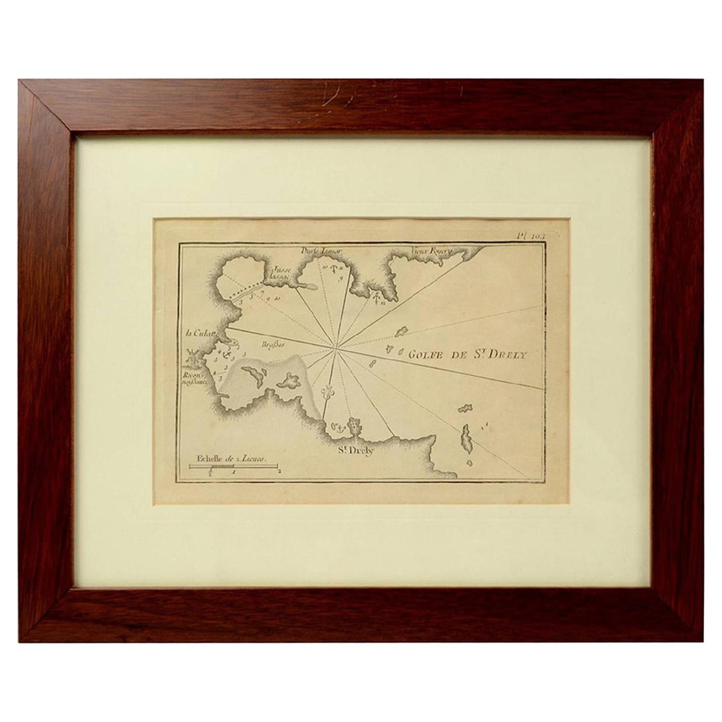
- 1844 French Antique Nautical Portolano of Golfe De St. Drely by Antoine RouxBy Antoine RouxLocated in Milan, ITAntique portolano, nautical map of Golfe De St. Drely engraved on a copper plate by Antoine Roux, Marseille France 1844, from his work Recueil des principaux plans des ports et de Ra...Category
Antique 1840s French Nautical Objects
MaterialsPaper
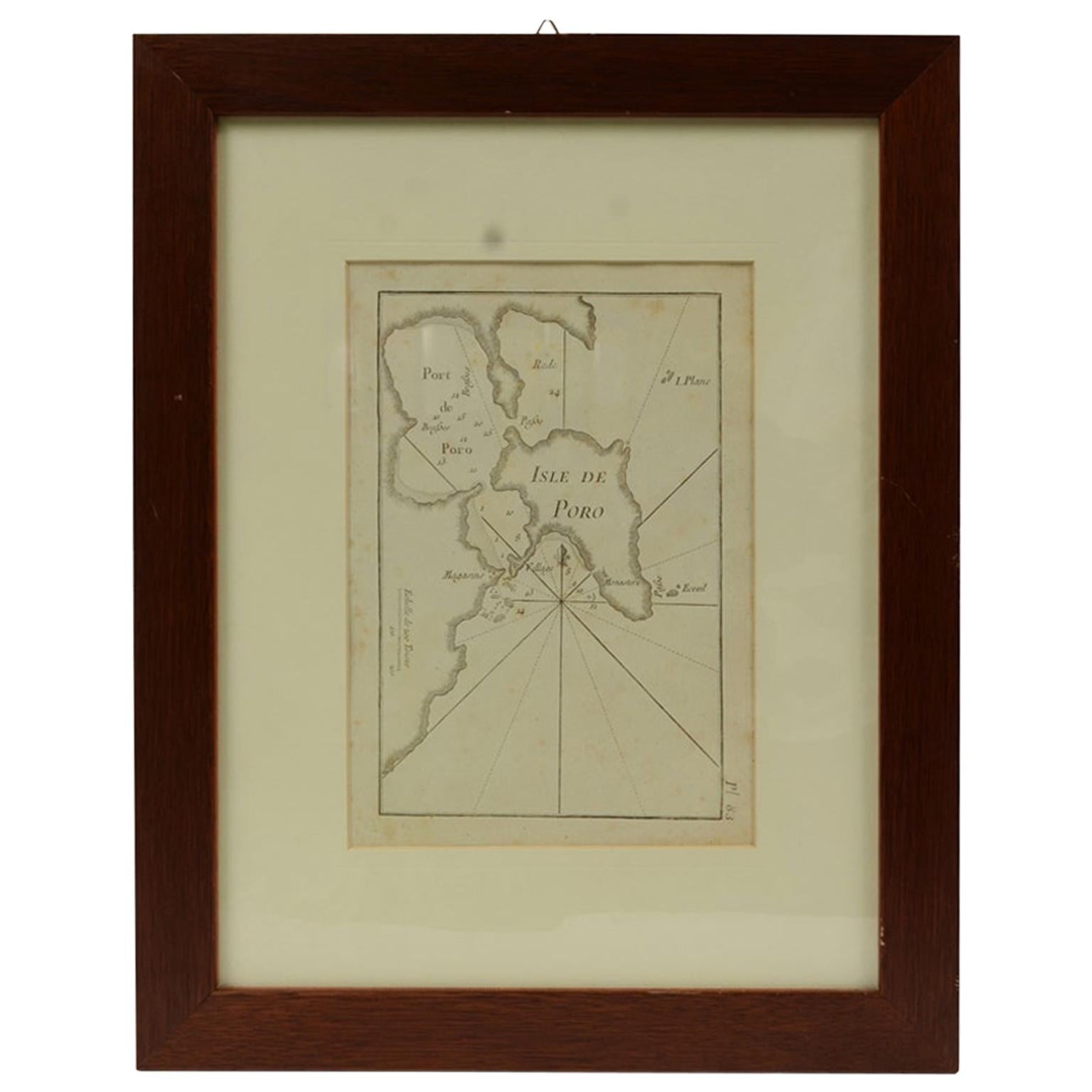
- Antique Nautical Portolano of Isle De Poro by Antoine Roux, France, 1844By Antoine RouxLocated in Milan, ITAntique portolano, nautical map of Isle De Poro engraved on a copper plate by Antoine Roux, Marseille France 1844, from his work Recueil des principaux plans des ports et de Rades de...Category
Antique 1840s French Nautical Objects
MaterialsPaper
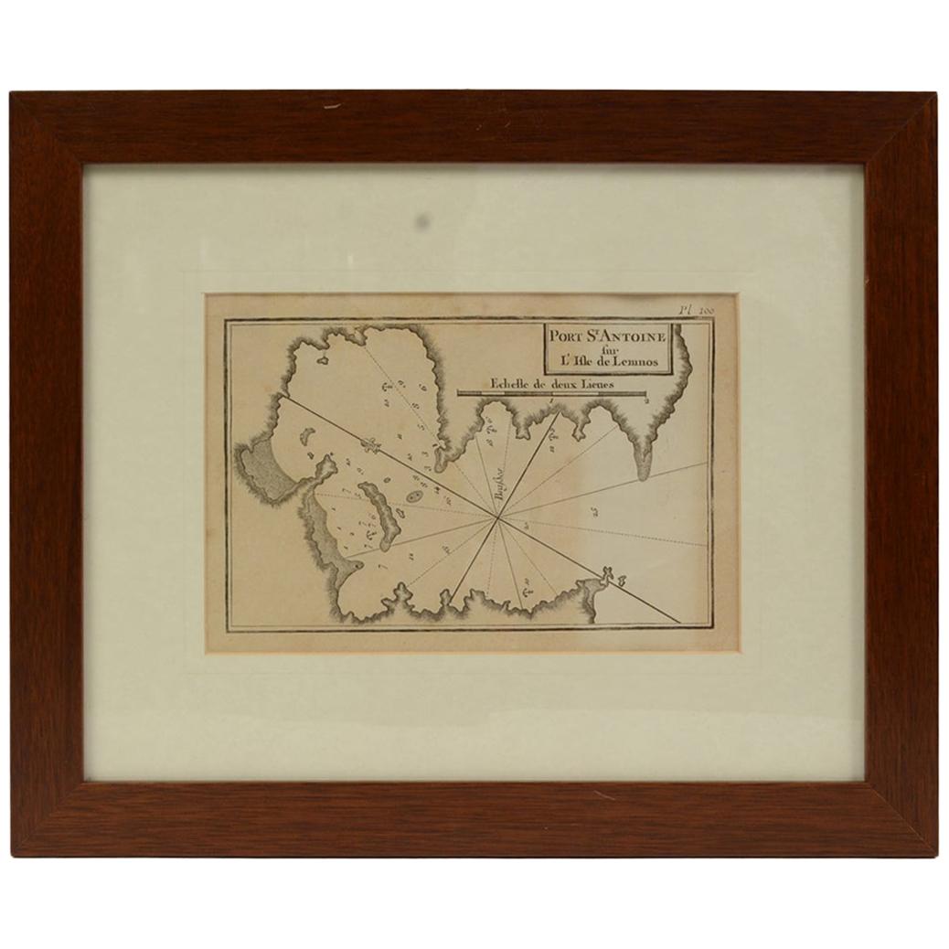
- Antique Nautical Portolano of Port St. Antoine by Antoine Roux, France, 1844By Antoine RouxLocated in Milan, ITAntique portolano, nautical map of Port St. Antoine engraved on a copper plate by Antoine Roux, Marseille, France, 1844, from his work Recueil des principaux plans des ports et de Ra...Category
Antique 1840s French Nautical Objects
MaterialsPaper
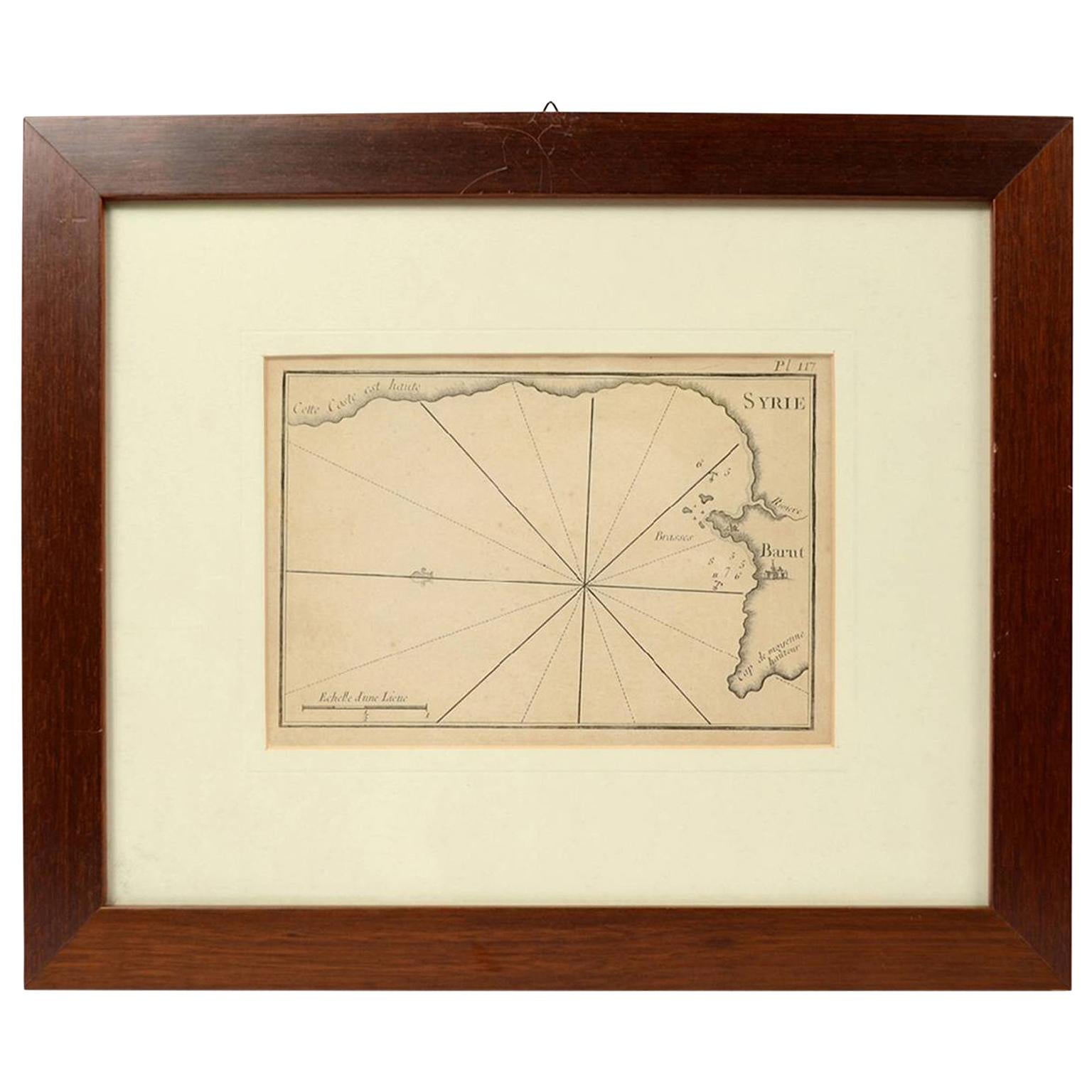
- 1844 French Antique Nautical print Engraved Portolano of Syrie by Antoine RouxBy Antoine RouxLocated in Milan, ITAntique portolano, nautical map of Syrie engraved on a copper plate by Antoine Roux, Marseille France 1844, from his work Recueil des principaux plans des ports et de Rades de la Mer...Category
Antique 1840s French Nautical Objects
MaterialsPaper
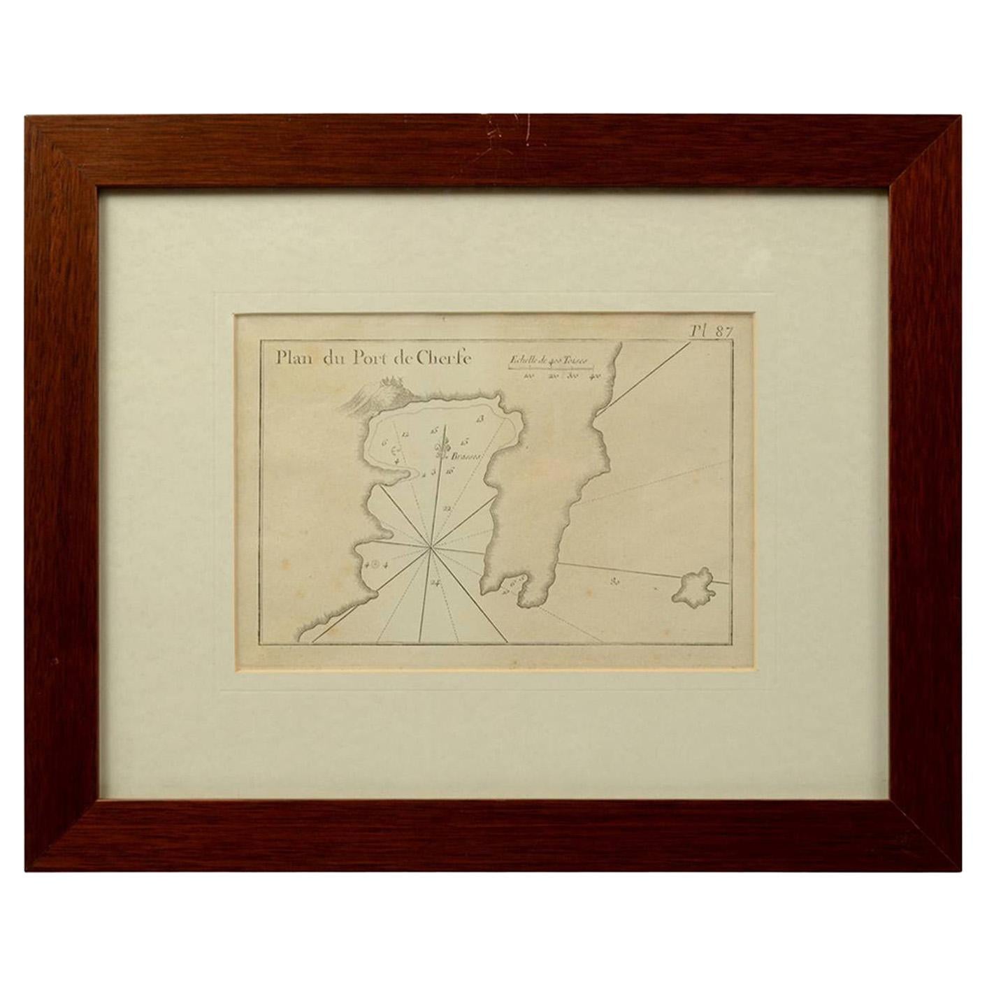
- 1844 French Antique Nautical Portolan of Plan du Port de Cherfe by Antoine RouxBy Antoine RouxLocated in Milan, ITAntique portolano, nautical map of Plan du Port de Cherfe engraved on a copper plate by Antoine Roux, Marseille France 1844, from his work Recueil des principaux plans des ports et d...Category
Antique 1840s French Nautical Objects
MaterialsPaper


You May Also Like
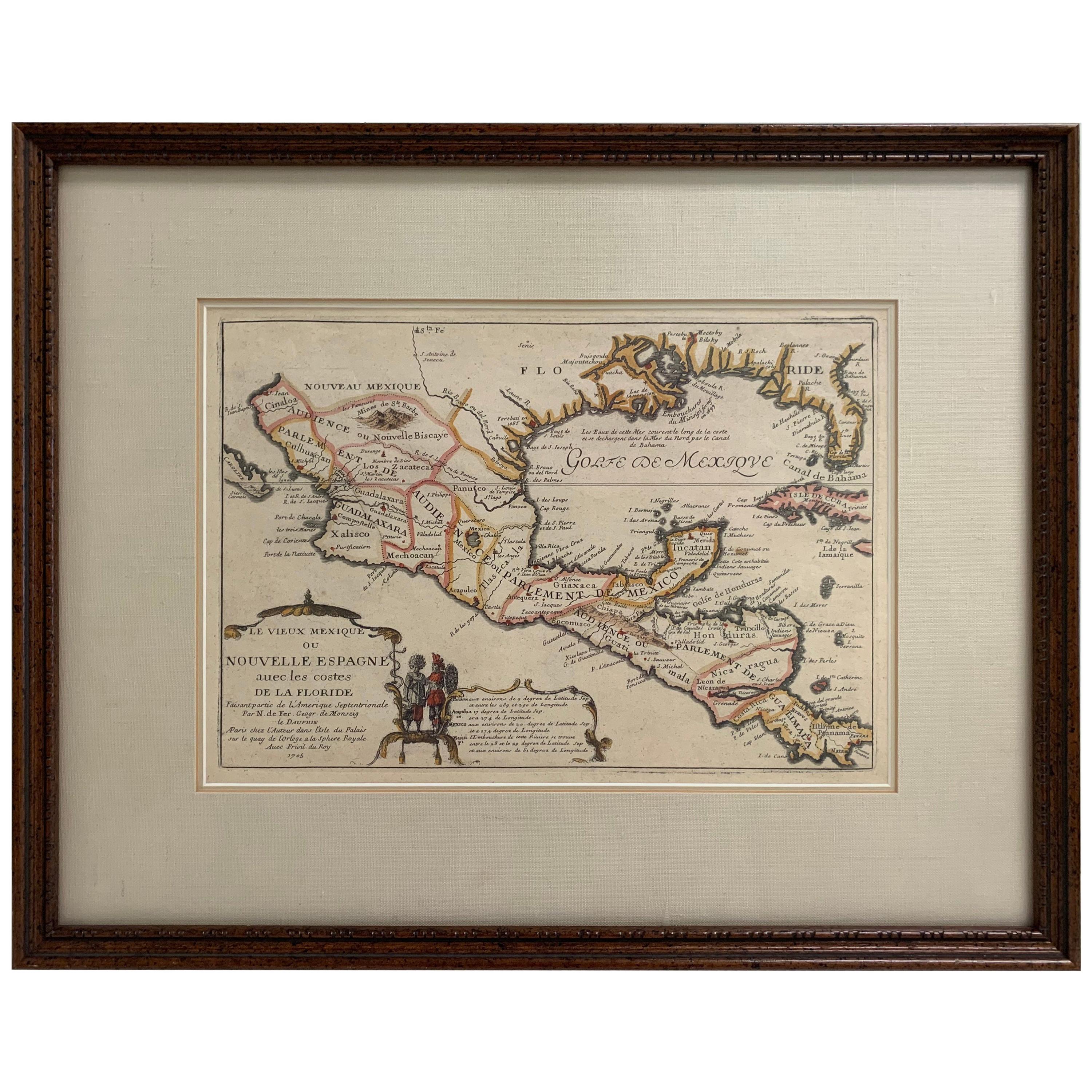
- 1705 Golfe de Mexico and Florida Framed MapLocated in Stamford, CTFramed map of Mexico & Florida circa 1705, Paris. Small map with Mexico and the Gulf Coast. Inset text indicating Panama, Acapulco, Mexico City and the Mississippi. Extends North to ...Category
Antique Early 1700s French Spanish Colonial Maps
MaterialsGlass, Wood, Paper
- Antique Map of New Zealand by Arrowsmith '1844'Located in Langweer, NLAntique map titled 'Map of the colony of New Zealand from official documents'. A scarce map of New Zealand. First issued in the 1830s, this state sh...Category
Antique Mid-19th Century Maps
MaterialsPaper
 $1,423 Sale Price24% Off
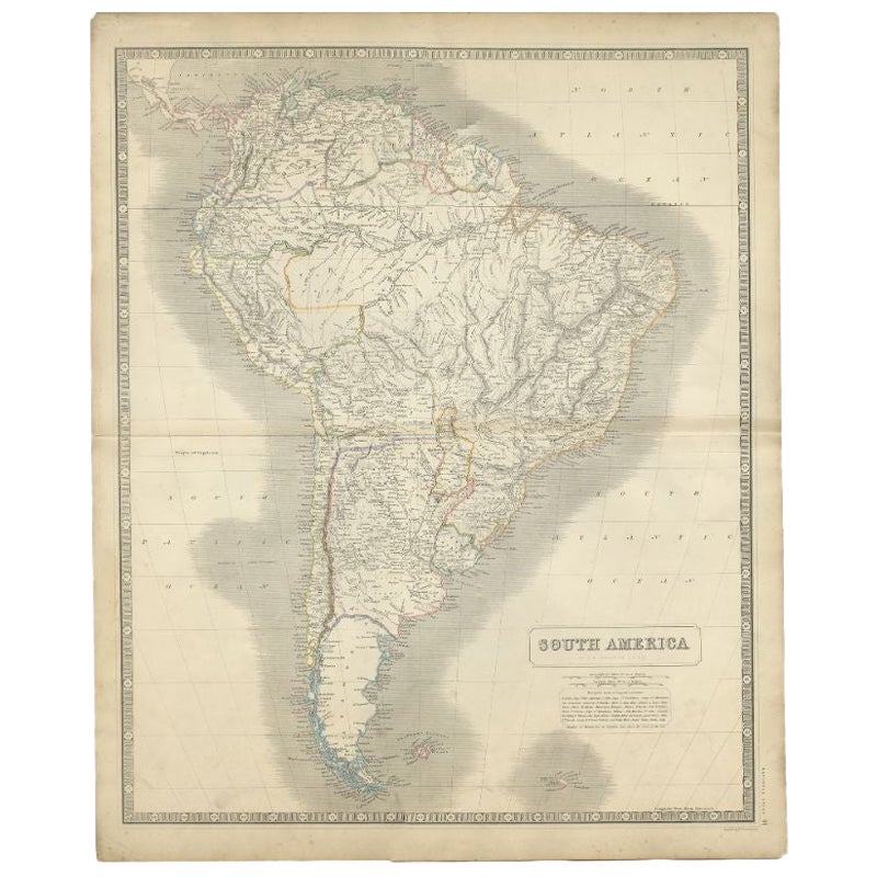
 - Antique Map of South America by Johnston, 1844Located in Langweer, NLAntitique map titled 'South America'. Beautiful original antique map of South America. This map originates from 'The National Atlas of His...Category
Antique 19th Century Maps
MaterialsPaper
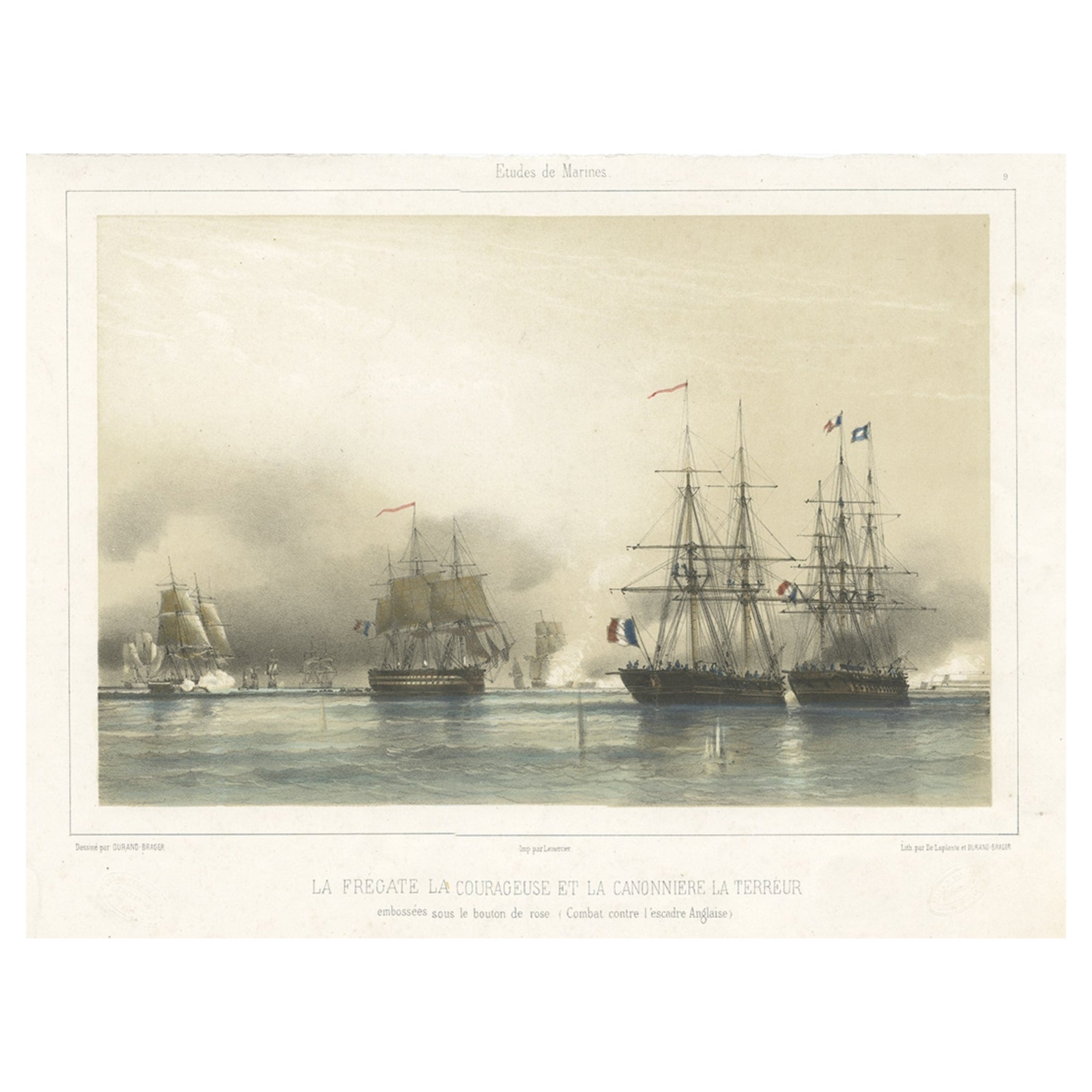
- Antique Litograph of a Combat Between French and British Ships, 1844Located in Langweer, NLAntique print titled 'La Fregate la Courageuse et la Canonnière la Terréur'. This print illustrates the combat between French ships and the British ships...Category
Antique 1840s Prints
MaterialsPaper
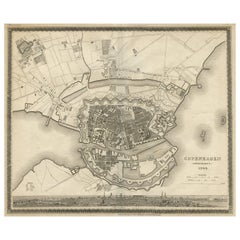
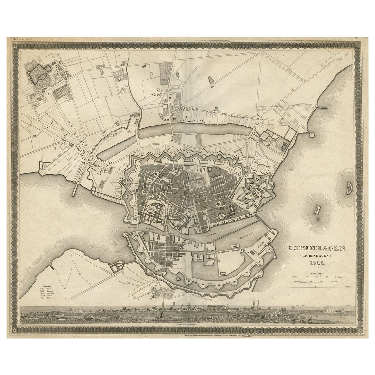
- Antique Map of the City of Copenhagen ‘Denmark’ by J. Meyer, 1844Located in Langweer, NLAntique map titled 'Copenhagen (Kiöbenhaven)'. With city view and German explanation. Originates from Meyer's Handatlas.Category
Antique Mid-19th Century Maps
MaterialsPaper
- Large Antique Map of France by De Wit, c.1680By Frederick de WitLocated in Langweer, NLAntique map titled 'Accuratissima Galliae Tabula vulgo Royaume de France'. Detailed map of France. Shows provinces, cities, rivers etc. Artists and Engravers: Frederick de Wit (1...Category
Antique 17th Century Maps
MaterialsPaper