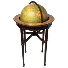
Regency Maps

REGENCY STYLE

Like France’s Empire style, Regency-style furniture was rooted in neoclassicism; the characteristics of its bedroom furniture, armchairs, dining room tables and other items include clean lines, angular shapes and elegant details.

Dating roughly from the 1790s to 1830s, antique Regency-style furniture gets its name from Prince George of Wales — formally King George IV — who became Prince Regent in 1811 after his father, George III, was declared unfit to rule. England’s Regency style is one of the styles represented in Georgian furniture.

George IV’s arts patronage significantly influenced the development of the Regency style, such as the architectural projects under John Nash, which included the renovation of Buckingham House into the formidable Buckingham Palace with a grand neoclassical facade. Celebrated designers of the period include Thomas Sheraton, Henry Holland and Thomas Hope. Like Nash, Hope instilled his work with classical influences, such as saber-legged chairs based on the ancient Greek klismos. He is credited with introducing the term “interior decoration” to English with the 1807 publishing of Household Furniture and Interior Decoration.

Although more subdued than previous styles like Rococo and Baroque, Regency interiors incorporated copious use of chintz fabrics and wallpaper adorned in chinoiserie-style art. Its furniture featured fine materials and luxurious embellishments. Furniture maker George Bullock, for instance, regularly used detailed wood marquetry and metal ornaments on his pieces.

Archaeological discoveries in Egypt and Greece informed Regency-era details, such as carved scrollwork, sphinxes and palmettes, as well as the shape of furniture. A Roman marble cinerary chest, for example, would be reinterpreted into a wooden cabinet. The Napoleonic Wars also inspired furniture, with martial designs like tented beds and camp-style chairs becoming popular. While the reddish-brown mahogany was prominent in this range of pieces, imported woods like zebrawood and ebony were increasingly in demand.

Find a collection of antique Regency tables, seating, decorative objects and other furniture on 1stDibs.

6
to
1
4
1
6
6
6
48
34
15
9
7
6
4
4
2
1
1
1
6
6
1
1
1
1
6
6
3
1
Style: Regency
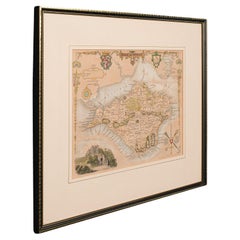
Antique Lithography Map, Isle of Wight, English, Framed, Engraving, Cartography
Located in Hele, Devon, GB
This is an antique lithography map of the Isle of Wight. An English, framed atlas engraving of cartographic interest, dating to the early 19th century and later. Superb lithography ...
Category

Early 19th Century British Antique Regency Maps

Materials

Wood

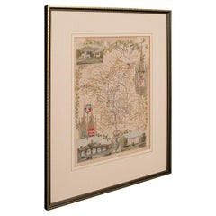
Antique Lithography Map, Worcestershire, English, Framed Engraving, Cartography
Located in Hele, Devon, GB
This is an antique lithography map of Worcestershire. An English, framed atlas engraving of cartographic interest, dating to the early 19th centur...
Category

Early 19th Century British Antique Regency Maps

Materials

Wood

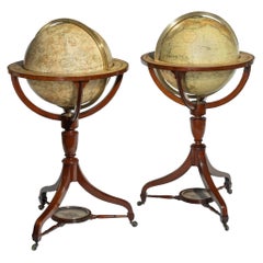
Fine Pair of Floor Globes by J & G Cary, Dated 1820 and 1833
Located in Lymington, Hampshire
A fine pair of 15 inch floor globes by J & G Cary, dated 1820 and 1833, each set into a mahogany stand with a vase shaped support and three legs centred on a compass, one with a labe...
Category

Early 19th Century English Antique Regency Maps

Materials

Mahogany

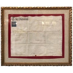
Early 19th Century Original Framed Land Indenture, England, 1810
Located in Lambertville, NJ
A large hand written land indenture document England, 1810, framed. The beautifully hand written document mounted on board with a red velvet border and ...
Category

1810s English Antique Regency Maps

Materials

Giltwood, Parchment Paper, Glass

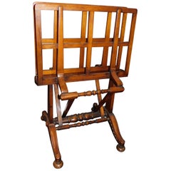
English Mahogany Wooden Folio Stand, Map and Document Holder, circa 1820
Located in Hamilton, Ontario
Regency era mahogany wood folio stand rack, map, poster, document holder used in a library, office or den, circa 1820. Folds out to six positions ...
Category

Early 19th Century English Antique Regency Maps

Materials

Wood

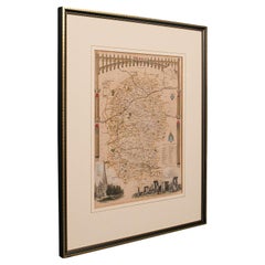
Antique Lithography Map, Wiltshire, English, Framed Engraving, Cartography
Located in Hele, Devon, GB
This is an antique lithography map of Wiltshire. An English, framed atlas engraving of cartographic interest, dating to the early 19th century and ...
Category

Early 19th Century British Antique Regency Maps

Materials

Wood

Related Items
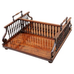
19th Century 'Regency Period, 1820s' English Fine Quality Mahogany Desktop Book
Located in North Miami, FL
19th century (Regency Period, 1820s) English fine quality mahogany desktop book stand with elegant spindles turned upright. Supports and scrolling ends to...
Category

19th Century English Antique Regency Maps

Materials

Wood, Mahogany

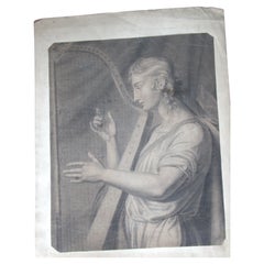
Harpist, 18th Century Drawing
Located in Perth, GB
18th.entury unframed pencil drawing of an Harpist.
Category

Mid-18th Century Antique Regency Maps

Materials

Paper

Harpist, 18th Century Drawing
H 19 in W 15 in D 0.01 in
Vanity Fair Framed Signed Print from Gaekwar Baroda, circa 1901
Located in London, GB
Vanity fair framed signedpPrint from Gaekwar Baroda circa 1901 We share what we love, and we love this pine framed original Vanity fair signed print from...
Category

Early 20th Century British Regency Maps

Materials

Paper

19th Century German Miniature Pocket Terrestrial Globe
Located in Essex, MA
A miniature 19th century 3.5 inch diameter pocket terrestrial globe by C. Abel-Klinger, Nuremberg, Germany, in English for the English speaking markets. Signed with cartouche reading...
Category

1880s German Antique Regency Maps

Materials

Brass

'7'19th Century British Real Estate Land Indentures Lease Documents 1867 Framed
Located in Dayton, OH
(7) 19th century British real estate land indentures lease documents 1867 framed 1860s European land indentures. Each is neatly framed with mat allowin...
Category

1860s Antique Regency Maps

Materials

Paper

Antique Hand Colored Framed Map of Europe
Located in West Palm Beach, FL
Antique reproduction copied from an edition dated 1595 by Ortelius.
Category

Late 19th Century Antique Regency Maps

Early 19th Century French Mahogany Miniature Escritoire
Located in Bedfordshire, GB
A very attractive and most unusual early 19th century French mahogany miniature escritoire having hinged top over one frieze drawer raised on original brass ball feet (This most unusual piece was almost certainly made originally as a travelling salesman...
Category

Early 19th Century French Antique Regency Maps

Materials

Mahogany

Pocket Globe by Nathaniel Hill, London 1754
Located in Milano, IT
Nathaniel Hill Pocket globe London, 1754 The globe is contained in its original case, which itself is covered in shark skin. There are slight gaps in the original paint on the sphere. The case no longer closes. The sphere measures 2.6 in (6.8 cm) in diameter whereas the case measures 2.9 in (7.4 cm) in diameter. lb 0.24 (kg 0.11) The globe is made up of twelve printed paper gores aligned and glued to the sphere. In the North Pacific Ocean there is a scroll with the inscription: A New terrestrial Globe by Nath. Hill, 1754. The celestial globe is depicted on the inside of the box. On the terrestrial globe much of central and southern Africa is empty. North America bears only the name of some British colonies. It shows California as a peninsula and the northwest coast of America as "unknown parts" (Alaska is not described and is only partially delineated; it would become part of the United States in 1867). The route of Admiral Anson is traced (1740) and the trade winds are indicated by arrows. Australia, still named New Holland (the new name would be introduced in 1829), is part of the west coast. (See Van der Krogt, P., Old Globes in the Netherlands, Utrecht 1984, p. 146 and Van der Krogt, P. - Dekker, E., Globes from the Western World, London 1993, p. 115.) Nathaniel Hill (London, news from 1746 to 1768) had impeccable professional credentials: he had done his apprenticeship with Richard Cushee, who at the time was carrying out surveying work for John Senex's Surrey map...
Category

1750s English Antique Regency Maps

Materials

Shagreen, Paper

Antique Terrestrial Globe Published in 1940s by Girard Barrère et Thomas, Paris
Located in Milan, IT
Terrestrial globe published in the 1940s by Girard Barrère et Thomas 17, Rue de Buci Paris. Turned wooden base, papier mâché sphere covered with paper printed by engraving on copper ...
Category

1940s French Vintage Regency Maps

Materials

Wood, Paper

Early 19th Century Marionette Puppets
Located in London, GB
Early 19th Century Marionette Puppets A rare untouched example of two hand crafted early 19th century marionette puppets, likely to be French in...
Category

1820s French Antique Regency Maps

Materials

Fabric, Pine, Paper

Mid-Century Modern Record Player LP Vinyl Album Metal Holder Rack Stand Table
Located in New York, NY
A Mid-Century Modern black record player and LP vinyl album metal holder rack stand table, circa mid-20th century, USA. Piece can support player and albu...
Category

Mid-20th Century American Regency Maps

Materials

Metal

Original Drawing by Leonce Pelletier Dated 1932
Located in Miami, FL
Very well drawn piece of art signed Leonce Pelletier, dated 1932. This subtle work depicts the very well known fish market in Nice, France most likely located in or near the Cours S...
Category

20th Century French Regency Maps

Materials

Paper

Previously Available Items
Antique Lithography Map, Wiltshire, English, Framed Engraving, Cartography
Located in Hele, Devon, GB
This is an antique lithography map of Wiltshire. An English, framed atlas engraving of cartographic interest, dating to the early 19th century and ...
Category

Early 19th Century British Antique Regency Maps

Materials

Wood

Vintage World Globe on Mahogany Stand
Located in Lambertville, NJ
Handsome Scholarly world globe with a Regency style mahogany base. The globe is 16 inches in diameter, circa 1940, Chicago. Perfect addition to a library or study.
Category

1940s American Vintage Regency Maps

Materials

Mahogany

English Regency Mahogany 1820s Era Map Cabinet with Antique Maps of the World
Located in Swedesboro, NJ
This is a highly unique item. This antique 1820s mahogany map cabinet comes complete with sleeves containing mounted antique maps of North America, Africa,...
Category

1820s English Antique Regency Maps

Materials

Mahogany

Regency maps for sale on 1stDibs.

Find a broad range of unique Regency maps for sale on 1stDibs. Many of these items were first offered in the 19th Century, but contemporary artisans have continued to produce works inspired by this style. If you’re looking to add vintage maps created in this style to your space, the works available on 1stDibs include more furniture and collectibles, wall decorations and other home furnishings, frequently crafted with wood, giltwood and other materials. If you’re shopping for used Regency maps made in a specific country, there are England, Europe, and United Kingdom pieces for sale on 1stDibs. While there are many designers and brands associated with original maps, popular names associated with this style include and George & John Cary. It’s true that these talented designers have at times inspired knockoffs, but our experienced specialists have partnered with only top vetted sellers to offer authentic pieces that come with a buyer protection guarantee. Prices for maps differ depending upon multiple factors, including designer, materials, construction methods, condition and provenance. On 1stDibs, the price for these items starts at $1,950 and tops out at $92,651 while the average work can sell for $5,200.

Recently Viewed

View All