Paper Maps
335
5,368
3
to
995
5,149
217
5,371
5,371
5,371
32
28
9
9
7
4
1
1
1
1
1
2,889
2,094
385
3
222
23
7
85
6
57
6
3
1
4
3
1
5,371
87
32
32
26
417
226
157
111
105
107
63
29
26
16
Material: Paper
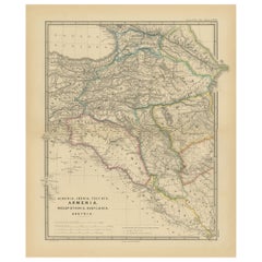
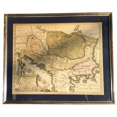
Ancient Crossroads: Albania to Assyria in Antiquity, Published in 1880
Located in Langweer, NL
The map titled "ALBANIA, IBERIA, COLCHIS, ARMENIA, MESOPOTAMIA, BABYLONIA, ASSYRIA" portrays the ancient regions that would encompass parts of modern-day Eastern Turkey, Armenia, Aze...
Category
1880s Antique Paper Maps
Materials
Paper
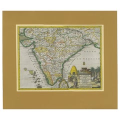
Antique Map of India during the height of the Mughal Imperial Expansion, 1713
Located in Langweer, NL
Antique map titled 'L'Inde de ca le Gange (..)'. Beautiful original antique map embracing most of India, made during the height of the Mughal imperial expansion. The map encompasses ...
Category
Early 18th Century Antique Paper Maps
Materials
Paper
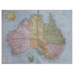
Large Original Vintage Map of Australia, circa 1920
Located in St Annes, Lancashire
Great map of Australia
Original color. Good condition
Published by Alexander Gross
Unframed.
Category
1920s English Vintage Paper Maps
Materials
Paper
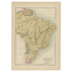
Antique Map of Brazil, Uruguay, Paraguay and Guyana by A & C. Black, 1870
Located in Langweer, NL
Antique map titled 'Brazil'. Original antique map of Brazil, Uruguay, Paraguay and Guyana. This map originates from ‘Black's General Atlas of The...
Category
Late 19th Century Antique Paper Maps
Materials
Paper
Four 18th Century Engraved and Hand-Colored Maps by Weigel
Located in Copenhagen, K
Small collection of four engraved maps of Italy, Balkan and of Central Asia.
Two are of Italy, one Corsica and Northern Italy and the other of the Southern Italian boot...
Category
18th Century German Antique Paper Maps
Materials
Paper
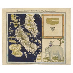
Renaissance Mapping of Sumatra: Featuring Singapore in Münster’s Woodcut, c.1590
Located in Langweer, NL
Description: Antique map titled 'Sumatra ein grosse Insel / so von den alten Geographen Taprobana genennt worden'. Beautiful map of Sumatra and the southern part of Malaysia, with Si...
Category
16th Century Antique Paper Maps
Materials
Paper
Antique Map of Brazil by Levasseur '1875'
Located in Langweer, NL
Antique map titled 'Carte du Brésil'. Large map of Brazil, with small fold out. This map originates from 'Atlas de Géographie Moderne Physique et Politiq...
Category
Late 19th Century Antique Paper Maps
Materials
Paper
Vintage 1939 Map of the Philippines and 1939 Cenus
Located in Van Nuys, CA
This vintage piece is a 1939 map of the Philippines accompanied by a census, sourced from Volume V of a book containing historical statistical information. Encased in a stylish black...
Category
1930s British Colonial Vintage Paper Maps
Materials
Paper
Ornate Cartography of Colonial Grandeur: The West India Islands around 1851
Located in Langweer, NL
This map is a part of John Tallis's series of maps, known for their detailed and ornamental style. John Tallis & Company, mentioned in the caption, was an English cartographic publis...
Category
1850s Antique Paper Maps
Materials
Paper
An Ornate and Historical Tallis Map of Jamaica with Decorative Vignettes, 1851
Located in Langweer, NL
This original antique map of Jamaica is part of the renowned series created by the Tallis Company, known for their detailed and decorative maps of the 19th century. The company was f...
Category
1850s Antique Paper Maps
Materials
Paper
An Old Illustrated Tallis Map of Central America with Volcanic Vignettes, 1851
Located in Langweer, NL
This map of Central America, part of John Tallis & Company's series from "The British Colonies" by Robert Montgomery Martin, is a fine example of mid-19th century cartography and wou...
Category
1850s Antique Paper Maps
Materials
Paper
Crossroads of Empires: A John Tallis Map of the Isthmus of Panama, 1851
Located in Langweer, NL
The Tallis map of the Isthmus of Panama is a beautifully detailed work, characteristic of the maps produced by John Tallis & Company, which was one of the last cartographic firms to ...
Category
1850s Antique Paper Maps
Materials
Paper
A Tallis Map of British Guiana with Colonial Vignettes and Other Landmarks, 1851
Located in Langweer, NL
This Tallis map of British Guiana (now known as Guyana) is a richly decorated document, much like other maps from the esteemed cartographic publisher John Tallis & Company. The firm,...
Category
1850s Antique Paper Maps
Materials
Paper
Empires of the East: An Ornate Tallis Map of Tibet, Mongolia, and Manchuri, 1851
Located in Langweer, NL
This original - with hand-colored borders- map of Tibet, Mongolia, and Manchuria is an example of the intricate work produced by John Tallis & Company, who were known for their detai...
Category
1850s Antique Paper Maps
Materials
Paper
Map of Independent Tartary with Vignettes of the Region's Culture, 1851
Located in Langweer, NL
The map of Independent Tartary is part of the collection by John Tallis & Company, which were unique for their elaborate decorative elements and detailed illustrations.
**The Maker ...
Category
1850s Antique Paper Maps
Materials
Paper
19th Century Illustrated Map of Ceylon (Sri Lanka) with Notable Landmarks
Located in Langweer, NL
John Tallis & Company is known for producing maps and atlases that were highly regarded for their accurate cartographic detail and their distinctive style. They often included ornate...
Category
1850s Antique Paper Maps
Materials
Paper
Antique Map of the Malay Archipelago with Images of Indigenous People, 1851
Located in Langweer, NL
John Tallis & Company, often simply known as Tallis, was renowned for the production of maps and illustrated geographical publications in the mid-19th century. Tallis maps, such as t...
Category
1850s Antique Paper Maps
Materials
Paper
Old Map of British Mediterranean Territories with Images of Historic Sites, 1851
Located in Langweer, NL
John Tallis & Company was a British map-making firm that gained widespread acclaim in the 19th century, particularly known for their detailed and artistically embellished maps. The f...
Category
1850s Antique Paper Maps
Materials
Paper
Map of Polynesia Highlighting Cultural Landscapes and Maritime Activities, 1851
Located in Langweer, NL
John Tallis & Company was a London-based map publisher that flourished during the 19th century. Their maps, characterized by elaborate borders and decorative vignettes, are some of t...
Category
1850s Antique Paper Maps
Materials
Paper
Map of New Zealand Showing Maori Culture and Early Colonial Settlements, 1851
Located in Langweer, NL
John Tallis & Company were renowned for their ornate and detailed maps in the mid-19th century. Their works often featured elaborate borders, decorative motifs, and insets of vignett...
Category
1850s Antique Paper Maps
Materials
Paper
Map of Tasmania with Illustrations of Local Fauna and Colonial Landmarks, 1851
Located in Langweer, NL
John Tallis & Company was renowned for their detailed and ornate maps during the 19th century. Their maps are distinguished by the intricate borders and vignettes that are as informa...
Category
1850s Antique Paper Maps
Materials
Paper
Mid-19th Century Decorative Map of Asia with Cultural and Natural Vignettes
Located in Langweer, NL
John Tallis & Company, known for their decorative mid-19th-century maps, created this map of Asia. These maps were distinctive for their elaborate borders and detailed vignettes. The...
Category
1850s Antique Paper Maps
Materials
Paper
Victorian Visions of the New World: A Detailed Tallis Map of North America, 1851
Located in Langweer, NL
The map presented here is an intricate example from the series of maps produced by John Tallis & Company. Tallis maps are known for their detailed and elaborate style, often includin...
Category
1850s Antique Paper Maps
Materials
Paper
Mid-19th Century Decorative Map of India with Cultural and Natural Vignettes
Located in Langweer, NL
The Tallis maps, including the one of India, are known for their detailed and ornamental style. They were produced during the mid-19th century, a time when cartographic publishing be...
Category
1850s Antique Paper Maps
Materials
Paper
An Illustrated Map of Kabul, Punjab, and Baluchistan by Tallis, 1851
Located in Langweer, NL
This map, attributed to John Tallis and featuring the work of Robert Montgomery Martin, is part of a series created for the publication "The British Colonies." John Tallis & Company ...
Category
1850s Antique Paper Maps
Materials
Paper
A Decorative Map of Nova Scotia and Newfoundland by John Tallis, 1851
Located in Langweer, NL
The map is part of the series created by John Tallis & Company, known for their mid-19th-century maps. This particular map illustrates the regions of Nova Scotia and Newfoundland and...
Category
1850s Antique Paper Maps
Materials
Paper
Antique Map of Kentucky and Tennessee by Johnson, 1872
Located in Langweer, NL
Antique map titled 'Johnson's Kentucky (..)'. Original map of Kentucky and Tennessee. This map originates from 'Johnson's New Illustrated Family Atlas ...
Category
Late 19th Century Antique Paper Maps
Materials
Paper
Antique Map of a Bay of Borneo, Indonesia, c.1760
Located in Langweer, NL
Antique map titled 'La Baye de l'isle et Ville de Borneo'. Small map depicting a Bay of Borneo.
Artists and Engravers: Anonymous.
Condition: Good, general age-related toning. ...
Category
18th Century Antique Paper Maps
Materials
Paper
Antique Lithography Map, Buckinghamshire, English, Framed Cartography, Victorian
Located in Hele, Devon, GB
This is an antique lithography map of Buckinghamshire. An English, framed atlas engraving of cartographic interest, dating to the mid 19th century and later.
Superb lithography of B...
Category
Mid-19th Century British Victorian Antique Paper Maps
Materials
Wood, Paper
Framed Mid-19th Century Wall Map of Long Island, the Hamptons
Located in Sag Harbor, NY
A Framed museum quality find. This large wall map dates to the mid-1800s. Detailed inset maps of, Sag Harbor, East Hampton, Amagansett, Shelter Island and most villages in Long Islan...
Category
Mid-19th Century American Antique Paper Maps
Materials
Linen, Paper
Ptolemaic Armillary Sphere Charles-François Delamarche Paris, 1805-1810 Circa
Located in Milano, IT
Charles-François Delamarche
Ptolemaic armillary sphere
Paris, circa 1805-1810
Wood and papier-mâché
covered with printed and partly hand-coloured paper
It measures 15.74” in height, ...
Category
Early 1800s French Empire Antique Paper Maps
Materials
Paper, Wood
Detailed Map of the Holy Land, Showing the Travels of Christ & Apostles, ca.1650
Located in Langweer, NL
Antique map titled 'Het Beloofde Landt Canaan door wandelt van onsen Salichmaeker Jesu Christo neffens syne Apostelen.'
Detailed map of the Holy Land, showing the travels of Christ and the Apostles, including Paul's travel's at sea and numerous sailing vessels. Below bible scenes such as the nativity and crucifiction of Christ. An excellent example of a Duch Bible map...
Category
1650s Antique Paper Maps
Materials
Paper
Antique Map of the City of Vienna by Balbi '1847'
Located in Langweer, NL
Antique map titled 'Vienne'. Original antique map of the city of Vienna, Austria. This map originates from 'Abrégé de Géographie (..)' by Adrien Balbi. Published 1847.
Category
Mid-19th Century Antique Paper Maps
Materials
Paper
Original Antique Map of Cyprus. Circa 1880
Located in St Annes, Lancashire
Great map of Cyprus
Drawn and Engraved by R.Walker
Published W.Mackenzie, London
Original colour
Unframed.
Category
1880s English Antique Paper Maps
Materials
Paper
Antique Map of the City of Leuven, Belgium, with Original Coloring, 1609
Located in Langweer, NL
An original antique map titled "Lovanium Brabantiarum," which depicts the city of Leuven in Belgium in old hand-colouring. The map is notable for its circular layout of the city, det...
Category
Early 17th Century Antique Paper Maps
Materials
Paper
Senex Map of Castile, Leon & La Mancha in The Spanish Heartland, 1714
Located in Langweer, NL
This antique map, titled "A Map of Old & New Castile from the Observations of Rodrigo Mendes Silva and others," depicts the regions of Old Castile and New Castile in Spain, along wit...
Category
Early 18th Century Antique Paper Maps
Materials
Paper
1856 U.S. Coast Survey Map of Chesapeake Bay and Delaware Bay
Located in Colorado Springs, CO
Presented is U.S. Coast Survey nautical chart or maritime map of Chesapeake Bay and Delaware Bay from 1856. The map depicts the region from Susquehanna, Maryland to the northern Oute...
Category
1850s American Antique Paper Maps
Materials
Paper
Large Map of Castile's Southern Realms - Granada, Andalusia, and Murcia, 1652
Located in Langweer, NL
This antique map, titled 'Les Etats de la Couronne de Castille', represents the southern regions of the Crown of Castile, specifically the territories of Andalusia, Granada, and Murc...
Category
Mid-17th Century Antique Paper Maps
Materials
Paper
"Clason's Guide Map of Montana" by The Clason Map Company, Circa 1920s
Located in Colorado Springs, CO
Presented is “Clason's Guide Map of Montana,” published in the early 1920s by the Clason Map Company. Issued as a folding map, this map identifies county boundaries, county seats, Na...
Category
1920s American Art Deco Vintage Paper Maps
Materials
Paper
1840 Map of the City of Washington Published by William M. Morrison
Located in Colorado Springs, CO
This map, printed in 1840, is a detailed representation of Washington, D.C. in the mid-19th century. The map shows block numbers, wards, and government buildings as well as details o...
Category
1840s American Federal Antique Paper Maps
Materials
Paper
1840 "New Map of the City of New York With Part of Brooklyn & Williamsburg"
Located in Colorado Springs, CO
Presented is a hand-colored, engraved folding map titled "New Map of the City of New York With Part of Brooklyn & Williamsburg" by J. Calvin Smith. The map was issued bound in the bo...
Category
1840s American Antique Paper Maps
Materials
Paper
Antique Map of the Region of Tokyo and Nagasaki in Japan, 1922
Located in Langweer, NL
Antique map of Japan titled 'Japan - Environs of Tokio & Nagasaki'. Old map of Japan, includes inset maps of Tokyo, Nagasaki and surroundings. This map or...
Category
20th Century Paper Maps
Materials
Paper
1915 "San Francisco City and County" Hanging Map by W. Bashford Smith
Located in Colorado Springs, CO
Presented is a rare wall map of San Francisco by W. Bashford Smith. Published in San Francisco in 1915, this map indicates streets and city districts, and, most notably, shows the si...
Category
1910s American Art Deco Vintage Paper Maps
Materials
Wood, Paper
Antique Kittinger 8-inch Terrestrial World Globe on a Mahogany Wooden Stand
Located in Philadelphia, PA
A fine, antique 8 inch terrestrial globe.
Manufactured by Kittinger Company, Inc. (in collaboration with the publishers W. & A.K. Johnston, Ltd. of Edinburgh, Scotland).
On a turne...
Category
Early 20th Century Paper Maps
Materials
Mahogany, Gesso, Wood, Paper
1837 Mitchell's "Tourist's Pocket Map of the State of Virginia" by J.H. Young
Located in Colorado Springs, CO
This is J. H. Young's pocket map of the Virginia, which shows county development current to 1835. The map was engraved by E. Yeager and F. Dankworth and published by S. A. Mitchell. ...
Category
1830s American Antique Paper Maps
Materials
Paper
Antique Print of Persian Decorative Art by Racinet, 1869
Located in Langweer, NL
Old print of Persian decorative art. This print originates from 'L'Ornement polychrome'. A beautiful work containing about 2000 patterns of all the styles of Art old and Asian, middl...
Category
19th Century Antique Paper Maps
Materials
Paper
Amsterdam city plan - Joost van Sassen
Located in UTRECHT, UT
“Afbeeldinge der Stad Amsterdam, gelyk deselve in den jaren 1536 door Cornelis Antonisz na ’t leven is geschildert, en Ao 1544 in druk uytgegeven.”, engraved by Joost van Sassen and ...
Category
1720s Dutch Other Antique Paper Maps
Materials
Paper
Original Antique Map of The United States of America, circa 1890
Located in St Annes, Lancashire
Great map of the USA
By The Stanford's Geographical Establishment
Original colour
Unframed.
Category
1890s English Victorian Antique Paper Maps
Materials
Paper
Antique Map of The United States of North America, 1882
Located in Langweer, NL
This is a historical map titled "The United States of North America, Central Part" from the 1882 Blackie Atlas. It depicts the continental United States with a high level of detail, ...
Category
1880s Antique Paper Maps
Materials
Paper
Early 20th Century Terrestrial Globe by G. Thomas Paris
Located in Pease pottage, West Sussex
Early 20th Terrestrial Globe by G. Thomas. 44 Rue ND des Champs, Paris. Found on original ebonised turned base and brass fittings. Paris, France Circa 1920.
Category
Early 20th Century French Paper Maps
Materials
Wood, Paper
Antique Map of Brabant 'The Netherlands' by N. Visscher, circa 1690
Located in Langweer, NL
Antique map titled 'Brabantiae Batavae pars orientalis, comprehendens Tetrarchiam sive majoratum sylvaeducensem in ejusdem subjacentes ditiones (..)'. Map of the Dutch province 'Brab...
Category
Mid-18th Century Antique Paper Maps
Materials
Paper
1865 "Johnson's California, Utah, Nevada, Colorado, New Mexico, Arizona" Map
Located in Colorado Springs, CO
Presented is an original 1865 "Johnson's California, with Territories of Utah, Nevada, Colorado, New Mexico, and Arizona” map. First published in 1864, thi...
Category
Mid-19th Century Antique Paper Maps
Materials
Paper
Antique Decorative Coloured Map of North America, 1882
Located in Langweer, NL
This original antique map of North America is from the Blackie & Son Atlas published in 1882. Here are several points of interest about this map:
1. **Political Borders**: The map l...
Category
1880s Antique Paper Maps
Materials
Paper
1865 "Johnson's Missouri and Kansas" Map by Johnson and Ward
Located in Colorado Springs, CO
Presented is an original 1865 "Johnson's Missouri and Kansas” map. This map was issued as pages 59 and 60 in the 1865 edition of “Johnson's New Illustrated ...
Category
Mid-19th Century Antique Paper Maps
Materials
Paper
Utrecht city plan
Located in UTRECHT, UT
“Platte grond der Stad Utrecht vertonende alle Gragten, Straaten, Stegen, Gangen, Markten, en plaatsen der openbare Gebouwen”, engraving published by Johannes van Schoonhoven in Amst...
Category
1770s Dutch Other Antique Paper Maps
Materials
Paper
Curaçao map - C. van Baarsel en zoon
Located in UTRECHT, UT
“Kaart van het eiland Curaçao.”, “Algemeene kaart der Caraïbische eilanden”, “Plan van het fort Amsterdam op Curaçao” from the atlas “Atlas der overzeesche bezittingen van Zijne Maje...
Category
1810s Dutch Other Antique Paper Maps
Materials
Paper
Antique Old Map of Africa with Insets of Mauritius, Reunion and Natal, 1882
Located in Langweer, NL
The uploaded image is a historical map of Africa from the 1882 atlas by Blackie & Son. The map includes the entire African continent, with various countries, regions, and topographic...
Category
1880s Antique Paper Maps
Materials
Paper
Antique Decorative Coloured Map of South Africa and Madagascar, 1882
Located in Langweer, NL
The map of South Africa is from the Blackie & Son Atlas, published in 1882. This historical map is quite interesting for several reasons:
1. **Historical Period**: This map was crea...
Category
1880s Antique Paper Maps
Materials
Paper
Recently Viewed
View AllMore Ways To Browse
Greek Asia Minor
Antique Maps Canada
Antique Map Canada
Canada Antique Map
West Indies Map
Antique Maps Of Canada
Bali Map
Map Huge
Antique Portuguese Plates
Sweden Antique Map
Belgian Army
Antique Map South Africa
Antique Map Of South Africa
Map Of West Indies
South Africa Antique Map
Belgium Army
Cornelius Company
Sea Chart Map
