Canvas Maps
6
to
1
4
2
6
6
6
1
1
1
2
3
1
2
80,426
5,371
87
32
32
3
2
2
1
1
1
Material: Canvas
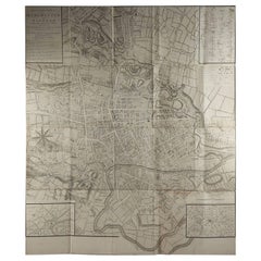
Large Original Antique Folding Map of Manchester, England, Dated 1793
Located in St Annes, Lancashire
Superb map of Manchester and Salford
Folding map. Printed on paper laid on to the original canvas
Unframed.
Published by C. Laurent, 1793.
...
Category
1790s English Georgian Antique Canvas Maps
Materials
Canvas, Paper
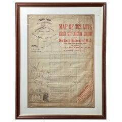
Framed Original Land Map Survey of Tyler Park, Jersey City Railroad
Located in Lambertville, NJ
A framed and matted historical map of Tyler park jersey city New Jersey Railroad. The paper on canvas in later appropriate frame. Good condition with some creasing and age discolorat...
Category
1870s American Antique Canvas Maps
Materials
Canvas, Glass, Wood
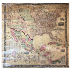
Large Antique 1859 Map of North America
Located in Sag Harbor, NY
This Map was made by Augustus Mitchell in 1859 It is in amazing condition for being 163 years old. This price is for the rolled up easy to ship version of this piece. I will be Frami...
Category
Mid-19th Century American Antique Canvas Maps
Materials
Canvas, Paper
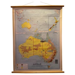
Decorative Vintage Print, Dutch Chart of Australia, 1st Edition, 1952
Located in Langweer, NL
The vintage school chart of Australia titled "Australië," created by W. Bakker & H. Rush and published in 1952:
**Title**: Australië
**Creators**: W. Bakker & H. Rush
**Publication ...
Category
Mid-20th Century European Canvas Maps
Materials
Canvas
Antique Map of the East Indies by Brouwer, 1917
Located in Langweer, NL
Antique map titled 'Geotektonische Schetskaart van het Oostelijk Gedeelte van den Oost-Indischen Archipel':
**Title**: Geotektonische Schetskaart van het Oostelijk Gedeelte van den ...
Category
Early 20th Century Canvas Maps
Materials
Canvas, Paper
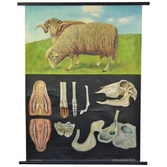
1960s Canvas Wall School Chart with Sheep by Jung-Koch-Quentell
Located in Antwerp, BE
Vintage school wall chart, pull down chart with beautiful illustrated lithograph of Sheep. It shows the animal in it's natural environment as well as some anatomical details.
This P...
Category
Mid-20th Century German Mid-Century Modern Canvas Maps
Materials
Wood, Canvas, Paper
Related Items
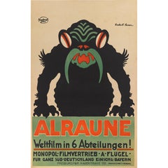
"Alraune", Original German Movie Poster
Located in London, GB
Original German movie poster for the silent 1919 horror film. The film tells the story of a woman who is forced to mate with a mandrake root, prod...
Category
1910s German Vintage Canvas Maps
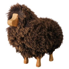
Mid-Century, Waldorf Wooden Sheep with Brown Sheep Fur
By Peter Kraft
Located in Los Angeles, CA
Cute, Mid-Century, decorative sheep by Waldorf with genuine brown sheep wool and a carved wood face and legs. Vintage accent piece with leather ears and light patina. In original co...
Category
1960s German Mid-Century Modern Vintage Canvas Maps
Materials
Sheepskin, Wood
Antique Map of Persia, Afghanistan and Balochistan, 1859
Located in Langweer, NL
The antique map titled "Persia, Afghanistan and Beloochistan" is a remarkable historical document originating from 'The Imperial Atlas of Modern Geography', published by W. G. Blacki...
Category
Mid-19th Century Antique Canvas Maps
Materials
Paper
Original Antique Map of The World by Thomas Clerk, 1817
Located in St Annes, Lancashire
Great map of The Eastern and Western Hemispheres
On 2 sheets
Copper-plate engraving
Drawn and engraved by Thomas Clerk, Edinburgh.
Published by Mackenzie And Dent, 1817
...
Category
1810s English Antique Canvas Maps
Materials
Paper
Antique Map of Italy, North Part, by W. G. Blackie, 1859
Located in Langweer, NL
The "Antique Map of Italy, North Part" by W. G. Blackie, dated 1859, is a historically significant cartographic piece, showcasing the northern region of Italy in the mid-19th century...
Category
Mid-19th Century Antique Canvas Maps
Materials
Paper
Decorative Wedgwood by Alison Kelly, 1st Edition
Located in valatie, NY
Decorative Wedgwood by Alison Kelly. Country Life Limited, 1965. 1st Edition hardcover with dust jacket. The book covers: Josiah Wedgwood and the Taste of His Time, Ideas for Interior Decoration, Chimney-Piece Designs, Jasper Chimney-Pieces, Wyatt, Holland & Cameron (architects), Fonts, Furnishing Details, Tiles and Dairies, Furniture Inset with Wedgwood Ware, the Victorian Revival. A study of Wedgwood's decorative production as it relates to the taste of the times in the applied arts. The author describes the whole range of Wedgwood's output in the field of interior decoration, from the basalt figures and wall plaques to the more esoteric fonts and funeral urns...
Category
1960s American Vintage Canvas Maps
Materials
Paper
Original Antique Map of Switzerland, Engraved By Barlow, Dated 1807
Located in St Annes, Lancashire
Great map of Switzerland
Copper-plate engraving by Barlow
Published by Brightly & Kinnersly, Bungay, Suffolk.
Dated 1807
Unframed.
Category
Early 1800s English Antique Canvas Maps
Materials
Paper
No Reserve
H 8 in W 10 in D 0.07 in
Art Deco Prints Giuliano Ercoli 1st Edition 1989
Located in London, GB
First English edition. Translated from the Italian by Linda Fairburn. Table of contents, endnotes, biographical sketches of significant artists. 232 color plates. Color frontispiece and illustrations in text. Focuses on the French pochoir...
Category
1980s Vintage Canvas Maps
Materials
Paper
Original Antique Map of Spain and Portugal, Engraved By Barlow, 1806
Located in St Annes, Lancashire
Great map of Spain And Portugal
Copper-plate engraving by Barlow
Published by Brightly & Kinnersly, Bungay, Suffolk. 1806
Unframed.
Category
Early 1800s English Antique Canvas Maps
Materials
Paper
No Reserve
H 8 in W 10 in D 0.07 in
Blue Evil Eye Wall Hanging Home Protection
Located in North Hollywood, CA
Large blue glass evil eye wall hanging for home protection.
Silver metal coins and lucky carps fishes amulet with blue glass home protection wal...
Category
1980s Turkish Bohemian Vintage Canvas Maps
Materials
Art Glass
Original Vintage Poster Pictorial Map British Railways Cambridge University City
By Kerry Lee
Located in London, GB
Original vintage pictorial travel map poster for Cambridge published by British Railways Eastern Region featuring a fantastic colorful illustration by the British artist, illustrator and poster designer who specialized in pictorial maps...
Category
1960s British Vintage Canvas Maps
Materials
Paper
H 39.97 in W 50.01 in D 0.04 in
Large Original Antique Map of New Jersey, USA, circa 1900
Located in St Annes, Lancashire
Fabulous map of New Jersey
Original color
Engraved and printed by the George F. Cram Company, Indianapolis.
Published, circa 1900
Unframed
Repairs to minor edge tears
Category
1890s American Antique Canvas Maps
Materials
Paper
Previously Available Items
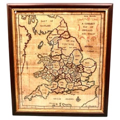
Silk Needlework Map of England and Wales Signed Anna Brewster Dated 1783
Located in San Francisco, CA
A charming silk needlework depiction of England and Wales executed in 1783 by Anna Brewster. This Georgian map sampler is signed and dated in the upper lef...
Category
Late 18th Century English Georgian Antique Canvas Maps
Materials
Canvas, Silk
H 24.5 in W 21.5 in D 1.5 in
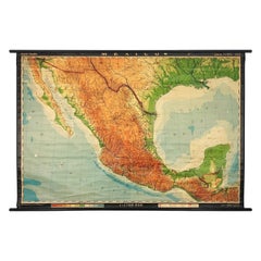
Extra Large Midcentury School Map of Mexico by Haack Painke Kooyman
Located in Mexico City, CDMX
We offer this extra large midcentury school map of Mexico by Haack Painke Kooyman, circa 1960. This vintage item remains fully functional, but it shows si...
Category
1960s German Mid-Century Modern Vintage Canvas Maps
Materials
Canvas
W&A K Johnston’s Charts of Physical Maps by G W Bacon
Located in Chillerton, Isle of Wight
Large university chart “Physical Map of Scotland” by Bacon
W&A K Johnston’s charts of physical maps by G W Bacon,
This is colorful Physical map of Scotland, it is large lithogr...
Category
Early 20th Century Beaux Arts Canvas Maps
Materials
Canvas
Vintage Botanical West German Biology Print Chart by Hagemann, Germany, 1960s
Located in Antwerp, BE
1960s canvas wall school chart, Pull down chart with beautiful illustration of a flower. It shows the details of the flower Taraxacum on a bla...
Category
Mid-20th Century German Hollywood Regency Canvas Maps
Materials
Canvas, Paper
H 45.28 in W 33.47 in D 0.4 in
1960s Canvas Wall School Chart of Cow and Bull by Jung Koch Quentell
Located in Antwerp, BE
1960s canvas wall school chart, pull down chart
with a beautiful illustration of the cow and bull.
It shows the anatomical details of the an...
Category
Mid-20th Century German Mid-Century Modern Canvas Maps
Materials
Canvas, Wood, Paper
1920s Double Sided Cartocraft Slated School Map, U.S.A. & World Denoyer Geppert
Located in Buffalo, NY
1920s Double Sided Cartocraft Slated School Map, One side depecting the United States, other side depecting the World, Made by Denoyer Geppert ,Pull down retractable, Slated material...
Category
1920s American Industrial Vintage Canvas Maps
Materials
Canvas, Wood
H 62 in W 68 in D 1 in
1950s Canvas Wall - School Chart Raptorial Birds by Jung - Koch - Quentell
Located in Antwerp, BE
Vintage Wall School Chart theme Raptorial Birds.
By Jung-Koch-Quentell - the trio who designed these Wall School Charts / Maps. Published by Hagemann Düsseldorf.
This pull down char...
Category
Mid-20th Century German Country Canvas Maps
Materials
Canvas
H 45.67 in W 37.01 in D 0.79 in
Wall-School Chart "Sonnenblume" from Jung-Koch-Quentell, 1965
Located in Almelo, NL
Wall chart of the Sonneblume by Jung Koch Quentell
- Canvas backed
- On it's original wooden hangers
- German, circa 1965.
- Measures: 37 x 45 inch.
Jung Koch Quentell
Th...
Category
1960s German Other Vintage Canvas Maps
Materials
Canvas
Wall-School Chart "Ohrenqualie" from Jung-Koch-Quentell, 1960s
Located in Almelo, NL
Wall chart of the Ohrenqualie by Jung Koch Quentell
- Canvas backed
- On it's original hangers
- German, 1960s.
- Measures: 37 x 45 inch.
Jung Koch Quentell
The name Jung...
Category
1960s German Other Vintage Canvas Maps
Materials
Canvas
Wall-School Chart "Lobster" from Jung-Koch-Quentell, 1968
Located in Almelo, NL
Wall chart of the Lobster by Jung Koch Quentell
- Canvas backed
- On it's original hangers
- German, 1968
- Measures: 37 x 45 inch
Jung Koch Quentell
The name Jung Koch ...
Category
1960s German Other Vintage Canvas Maps
Materials
Canvas
German Butterfly School Chart or Science Poster "Tagschmetterling" By M. Richter
Located in Almelo, NL
This German school chart contains beautiful pictures from flowers and butterflies. The school chart is made by the famous illustrator M. Richter.
Category
Mid-20th Century German Canvas Maps
Materials
Canvas
H 29 in W 39 in D 2 in
18th Century Map of the Bourgogne Region
Located in Vosselaar, BE
This large map of the French Bourgogne region was printed and mounted in the late 18th century. Since the governemental centralisation by the Sun King (Louis XIV) the succesing monar...
Category
Late 18th Century French Neoclassical Antique Canvas Maps
Materials
Canvas
