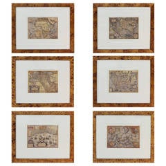
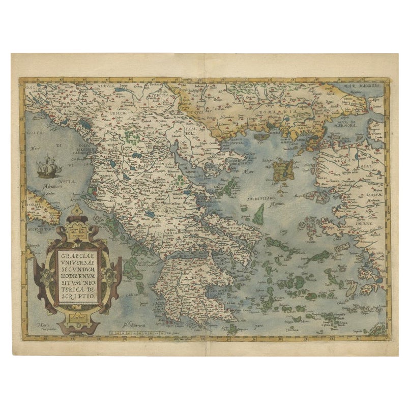
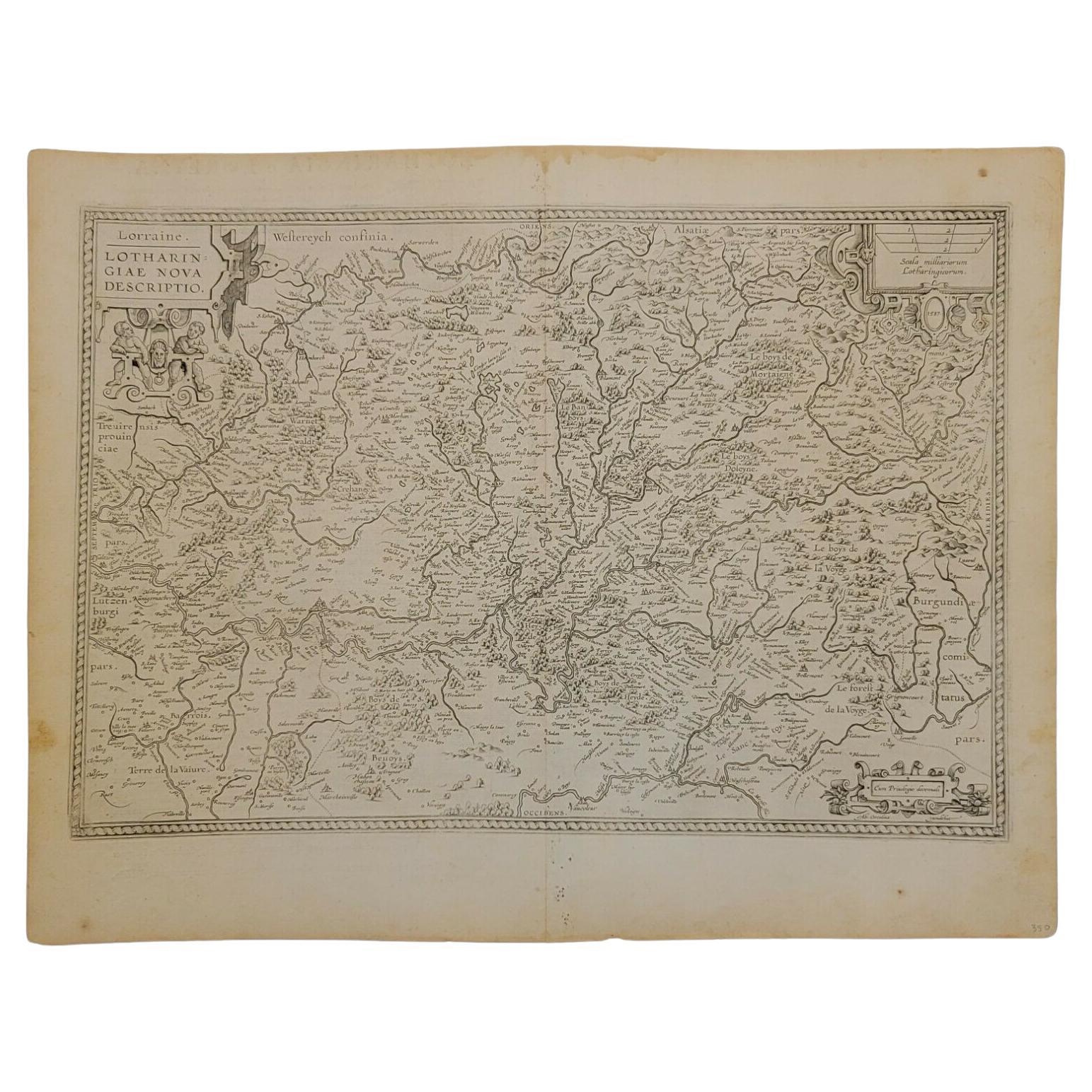
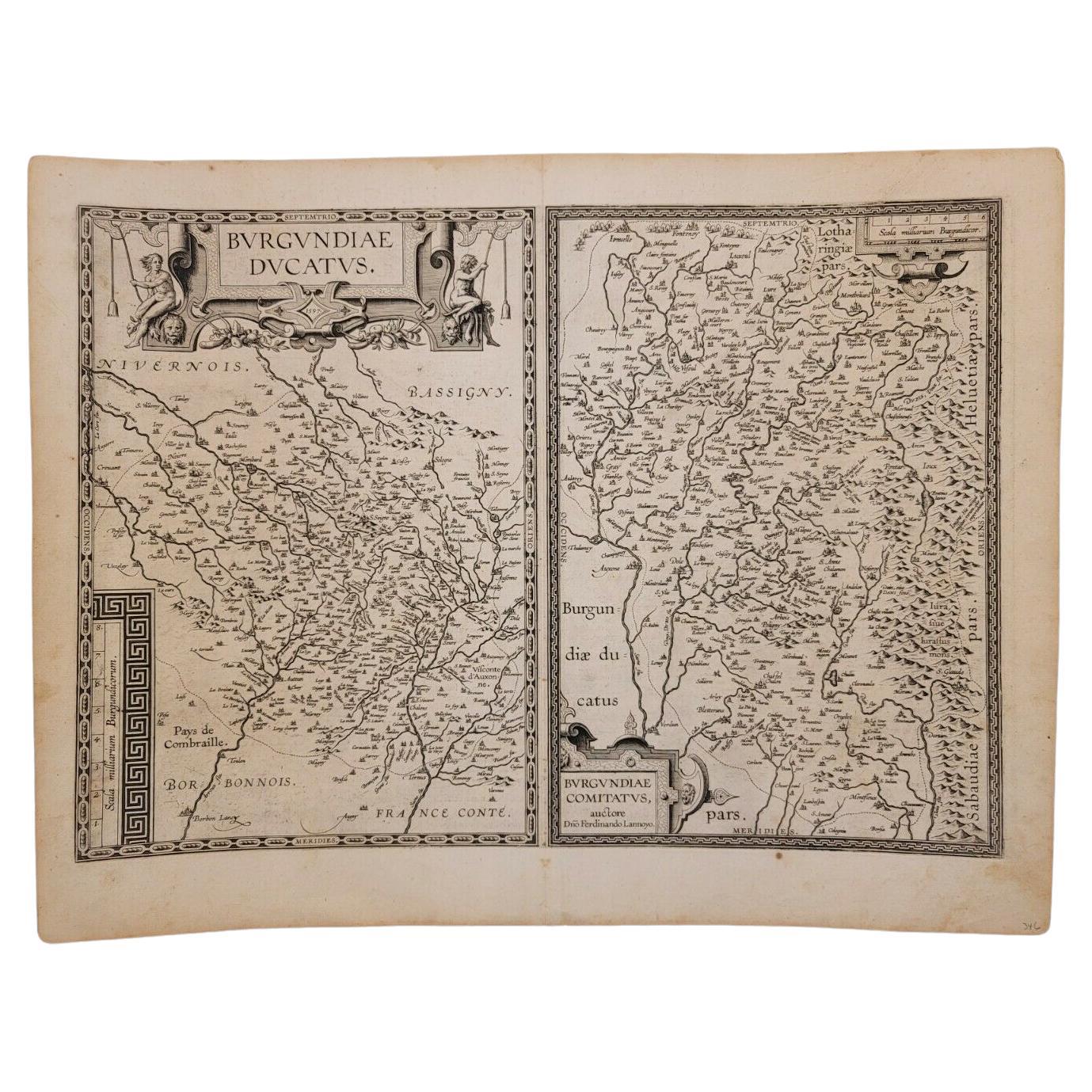
Grouping of Six Prints Featuring Antique Maps by Abraham Ortelius
View Similar Items


1 of 10
Grouping of Six Prints Featuring Antique Maps by Abraham Ortelius
About the Item
- Creator:Abraham Ortelius (Designer)
- Dimensions:Height: 22.5 in (57.15 cm)Width: 26.25 in (66.68 cm)Depth: 0.38 in (9.66 mm)
- Sold As:Set of 6
- Style:American Classical (In the Style Of)
- Place of Origin:
- Period:
- Date of Manufacture:20th Century
- Condition:Wear consistent with age and use. Overall very good vintage condition. Minor areas of wear to a few frames enhances the old world look.
- Seller Location:Bridport, CT
- Reference Number:Seller: Revelisa1stDibs: LU90112421332
You May Also Like
- Antique Map of Southeast Asia by Ortelius '1587'By Abraham OrteliusLocated in Langweer, NLAntique map titled 'Indiae Orientalis Insularumque Adiacientium Typus'. Ortelius includes early European depictions of both Japan and China and is the first to name Formosa (Taiwan). The Philippines and East Indies or Spice Islands are shown based upon Portuguese and Spanish sources, and before their penetration by the Dutch. Japan is shown in kite form, as a large oval island...Category
Antique 16th Century Maps
MaterialsPaper

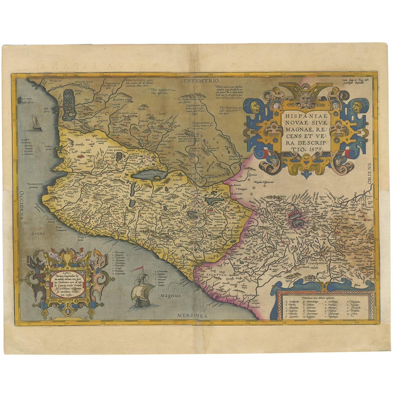
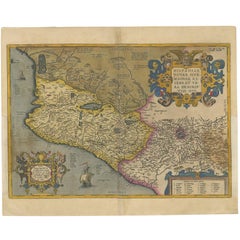
- Antique Map of Mexico by Ortelius, circa 1602By Abraham OrteliusLocated in Langweer, NLAntique map titled 'Hispaniae Novae Sivae Magnae Recens Et Vera Descriptio 1579'. Map of western New Spain, showing the recently-created Spanish settlements, many rivers, and large l...Category
Antique Early 17th Century Belgian Maps
MaterialsPaper
 $953 Sale Price20% Off
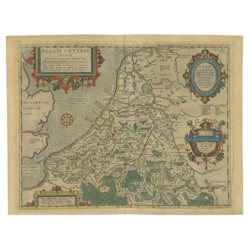
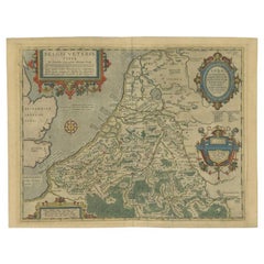
 - Antique Map of the Low Countries by Ortelius, 1584By Abraham OrteliusLocated in Langweer, NLAntique map titled 'Belgii Veteris Typus'. Beautiful map of the Low Countries, extending to the English Channel and part of Britain. This map originates from Ortelius' 'Theatrum Orbi...Category
Antique 16th Century Maps
MaterialsPaper
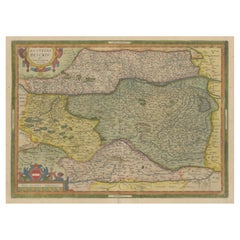
- Antique Map of Austria by Ortelius, c.1612Located in Langweer, NLAntique map titled 'Austriae Descrip. per Wolfgangum Lazium' Original antique map of Austria. Published by A. Ortelius, circa 1612. Artists a...Category
Antique 17th Century Maps
MaterialsPaper
- Antique Map of East Frisia by Ortelius, c.1595Located in Langweer, NLAntique print, titled: 'Frisia Orientalis.' Map of East Frisia originating from 'Theatrum Orbis Terrarum'. It is based on the manuscript map by Jon Bloe...Category
Antique 16th Century Maps
MaterialsPaper
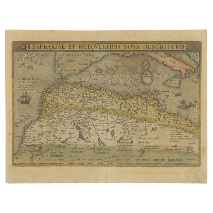
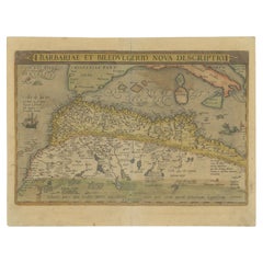
- Antique Map of North Africa by Ortelius, c.1580Located in Langweer, NLAntique map titled 'Barbariae et Biledulgerid Nova Descriptio'. Original antique map of North Africa. The map covers the regions of Barbaria and Biledulgerid, essentially the territo...Category
Antique 16th Century Maps
MaterialsPaper

Recently Viewed
View AllMore Ways To Browse
Mercator Framed
Antique Map Argentina
Antique Map Of Argentina
John Acton
William Acton
Antique Map Norfolk
Antique Map Of Colombia
Antique Maps Hampshire
Antique Maps Norfolk
Colombia Map Antique
Durham Antique Map
Mozambique Antique Map
Nottinghamshire Antique Map
Patagonia Map
Antique Furniture Queensland
Gabon Antique Map
Minnesota Map
Moravia Map