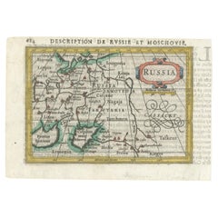
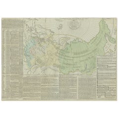
Early 17th Century Dutch Miniature Antique Map of The Russian Empire, 1616
View Similar Items


Want more images or videos?
Request additional images or videos from the seller
1 of 5
Early 17th Century Dutch Miniature Antique Map of The Russian Empire, 1616
About the Item
- Dimensions:Height: 4.53 in (11.5 cm)Width: 6.5 in (16.5 cm)Depth: 0 in (0.02 mm)
- Materials and Techniques:
- Period:1610-1619
- Date of Manufacture:1616
- Condition:
- Seller Location:Langweer, NL
- Reference Number:Seller: BG-131061stDibs: LU3054326059742
About the Seller
5.0
Platinum Seller
These expertly vetted sellers are 1stDibs' most experienced sellers and are rated highest by our customers.
Established in 2009
1stDibs seller since 2017
1,909 sales on 1stDibs
More From This SellerView All
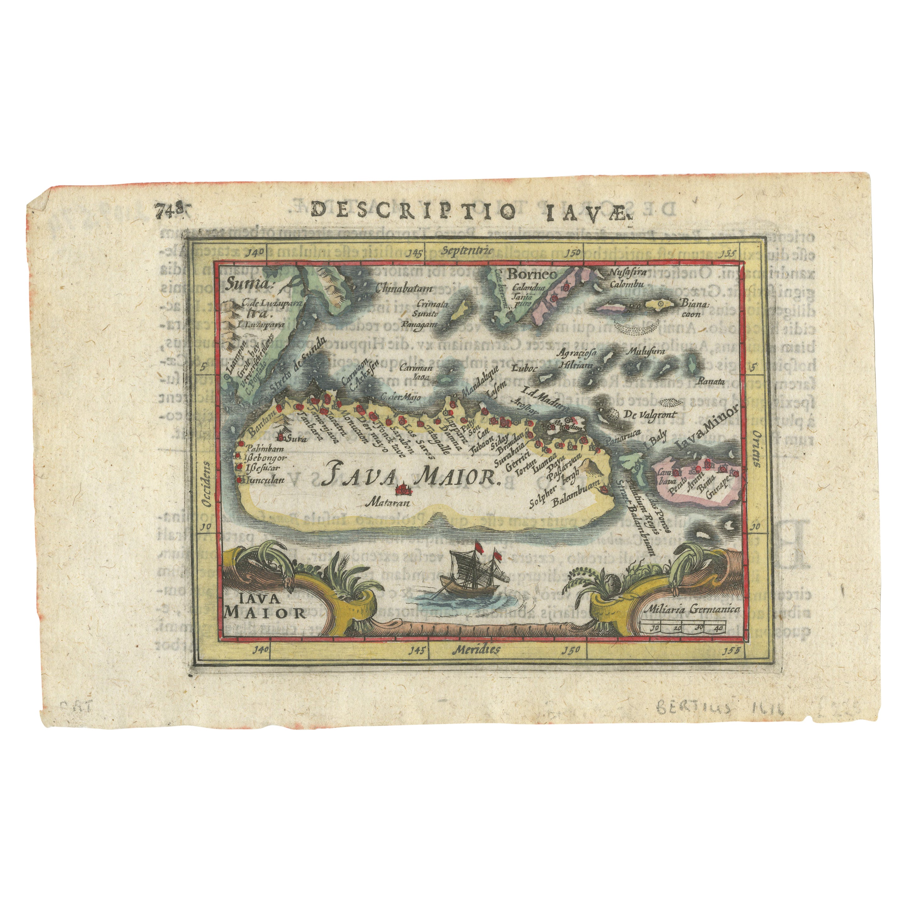
- Rare 16th Century Original Handcolored Miniature Map of Java, Indonesia, 1616Located in Langweer, NLVery handsome original old coloured copper engraving by Bertius of the island of Java in the early days of the Dutch colonisation - at that time named The Dutch East Indies or nowada...Category
Antique 1610s Maps
MaterialsPaper
 $425 Sale Price20% Off
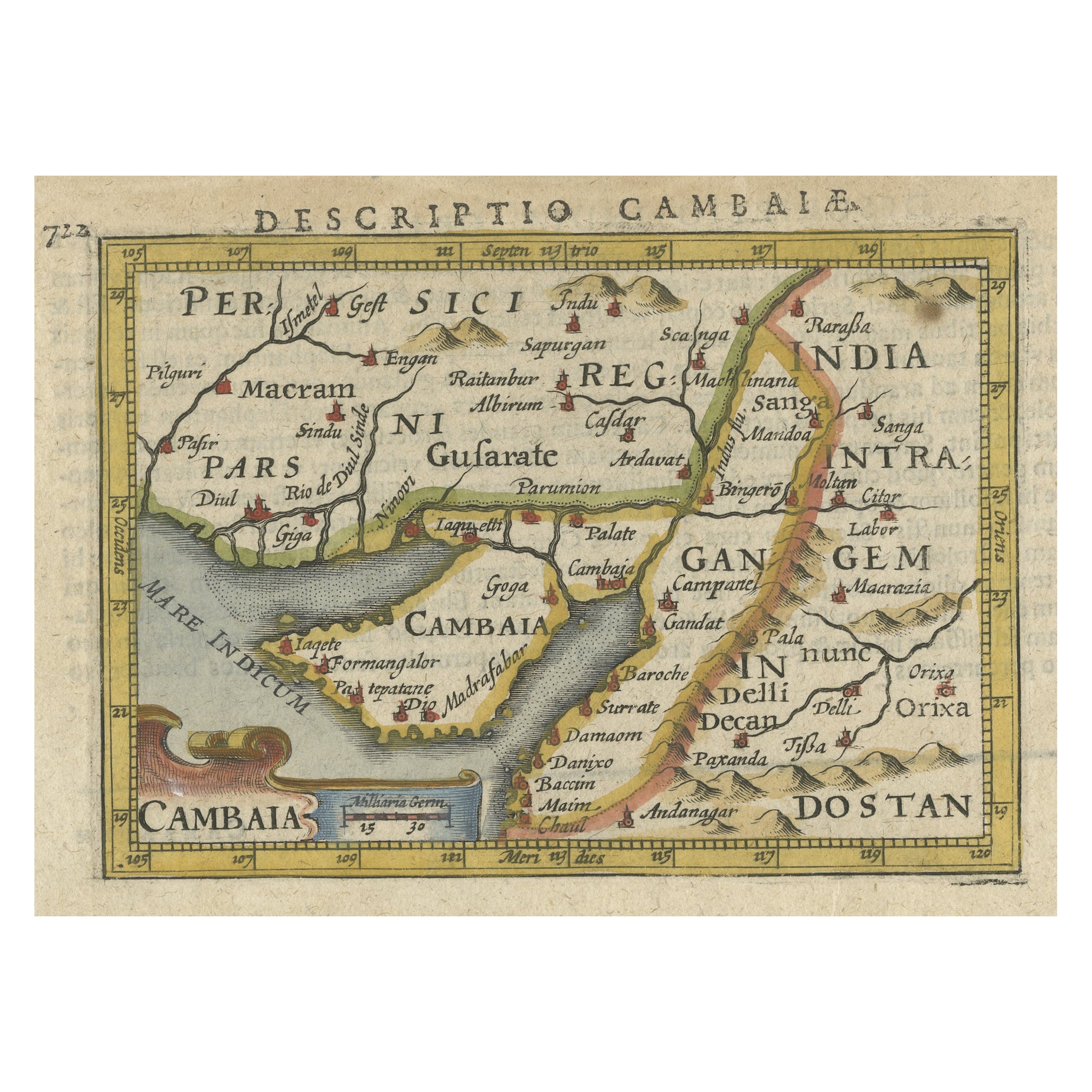
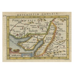
 - Rare Antique Miniature Map of Pakistan, India and Cambaia, ca.1616Located in Langweer, NLOld 17th century miniature antique map of 'Cambaia' , from the 1616 edition of Jadocus Hondius Atlas by Petrus Bertius. Original copperplate engraving with hand coloring. Carto...Category
Antique 17th Century Maps
MaterialsPaper
- Original Antique Engraved Map of the Russian Empire, 1778Located in Langweer, NLDescription: Antique map titled 'A New and Correct Map of the Russian Empire'. Original antique map of the Russian Empire. This map originates from Moore's 'New and Complete Coll...Category
Antique 1770s Maps
MaterialsPaper
 $477 Sale Price20% Off
 - Antique Map of the Russian Empire by R. Bonne, 1780Located in Langweer, NLAntique map titled 'Carte de l'Empire de Russie.' Drawn by R. Bonne for G. Raynal’s Atlas de Toutes les Parties Connues du Globe Terrestre, Dressé pour l'Histoire Philosophique et Po...Category
Antique Late 18th Century Maps
MaterialsPaper
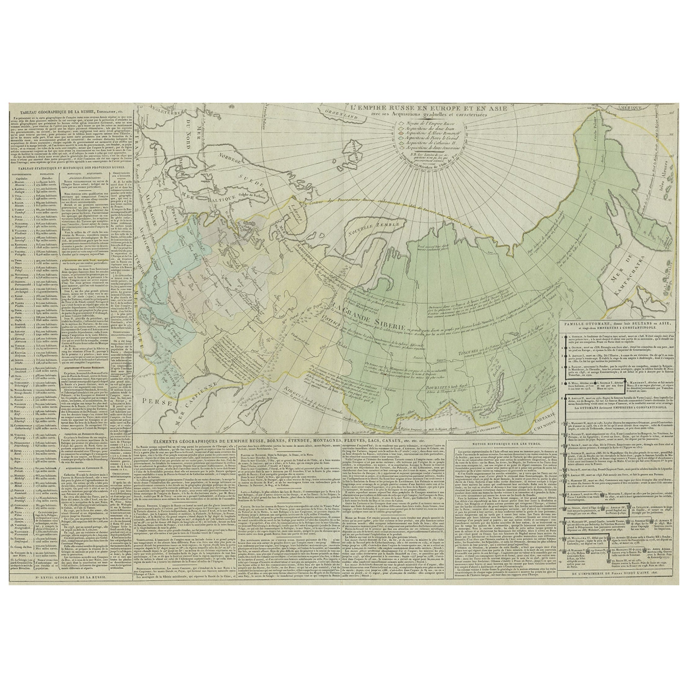
- Antique Map of the Extension of the Russian Empire in the XIXth Century, 1806Located in Langweer, NLAntique map titled 'L'Empire Russe en Europe et en Asie'. Map showing the extension of the Russian Empire at the beginning of the XIXth century. Several letterpress notations are...Category
Antique Early 1800s Maps
MaterialsPaper
 $486 Sale Price20% Off
 - Antique Miniature Map of the Turkish Empire by Bertius '1618'Located in Langweer, NLAntique miniature map titled 'Turcicum Imperium'. Rare miniature map of the Turkish Empire. This map originates from 'Tabularum Geographicarum Contractarum Libri septem (..)' by P. B...Category
Antique Early 17th Century Maps
MaterialsPaper


You May Also Like
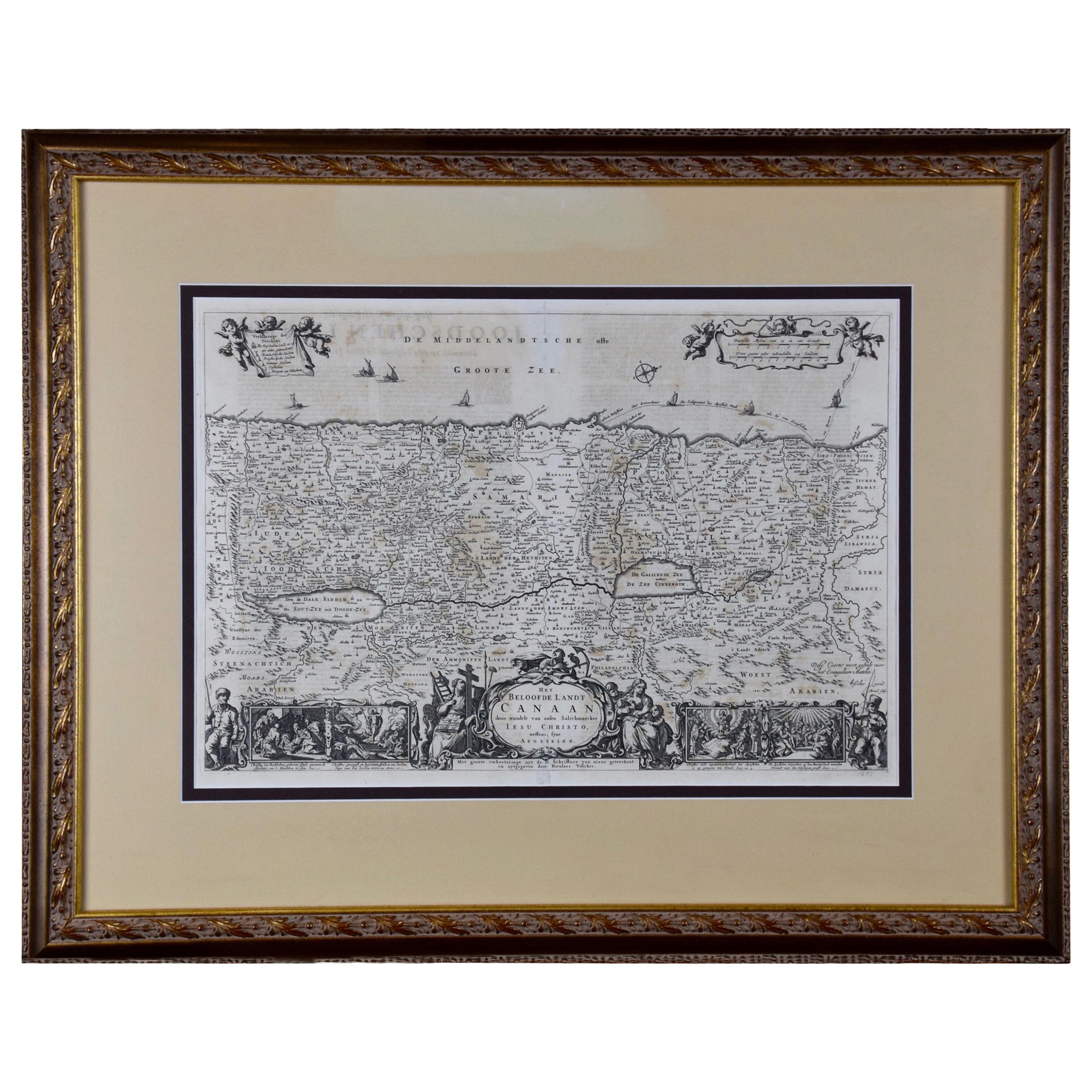
- The Holy Land at the Time of Jesus: A 17th Century Dutch Map by VisscherBy Nicolaes Visscher IILocated in Alamo, CAThis detailed Dutch map entitled "Het Beloofe de Landt Canaan door wandelt van onsen Salichmaecker Iesu Christo, nessens syne Apostelen" by Nicolaes Visscher was published in Amsterd...Category
Antique Mid-17th Century Dutch Maps
MaterialsPaper
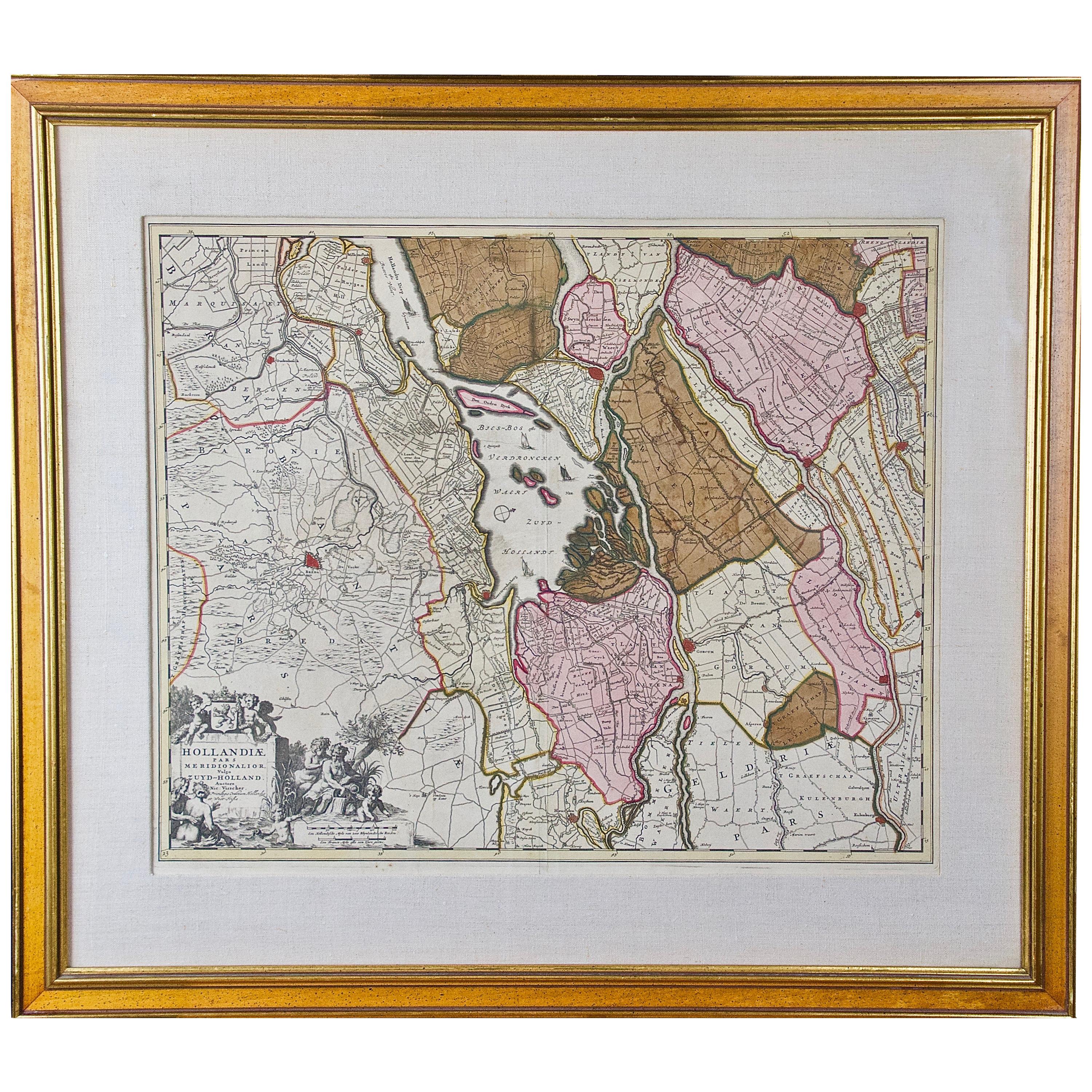
- Hand Colored 17th Century Visscher Map "Hollandiae" Southern HollandBy Nicolaes Visscher IILocated in Alamo, CAA hand colored 17th century map of the southern portions of Holland by Nicolaus (Nicolas) Visscher II entitled "Hollandiae pars Meridionalis, vulgo Zuyd-Holland", published in Amsterdam in 1678. The map shows the region between Breda, Heusden, Gornichem, Gouda, Dordrecht, and Willemstad. It includes a decorative cartouche in the lower left corner. The map is presented in an attractive maple colored wood frame with gold trim and a fabric mat. The Visscher family were one of the great cartographic families of the 17th century. Begun by Claes Jansz Visscher...Category
Antique Early 18th Century Dutch Maps
MaterialsPaper
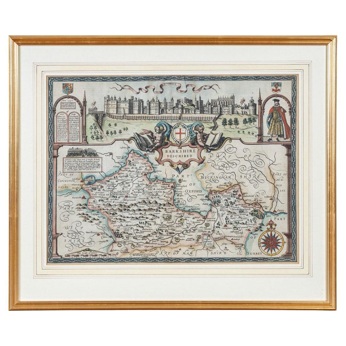
- 17th Century John Speed Map of the Barkshire Described, c.1616By John SpeedLocated in Royal Tunbridge Wells, KentAntique 17th century British very rare and original John Speed (1551-1629) map of the Barkshire Described, J. Sud and Georg Humble, publication (1616 or lat...Category
Antique 17th Century British Maps
MaterialsPaper

- Italy, Sicily, Sardinia, Corsica and Dalmatian Coast: A 17th Century Dutch MapBy Theodorus DanckertsLocated in Alamo, CAThis hand colored 17th century Dutch map entitled "Novissima et Accuratissima totius Italiae Corsicae et Sardiniae Descriptio" by Theodore Danckerts depicts the Italian Peninsula in ...Category
Antique Late 17th Century Dutch Maps
MaterialsPaper
- Dutch Map and City Plan of La Roche-sur-Foron, France, 17th Century Hand ColoredBy Coenraet DeckerLocated in Alamo, CA"Rupes Allobrogum vulgo La Roche" by Dutch engraver Coenraet Decker (1650-1685) is from the atlas Theatrum Statuum Regiae Celestudinis Sabaudiae Ducis, published in 1682. This richly...Category
Antique Late 17th Century Dutch Maps
MaterialsPaper
- 17th Century Hand Colored Map of the Liege Region in Belgium by VisscherBy Nicolaes Visscher IILocated in Alamo, CAAn original 17th century map entitled "Leodiensis Episcopatus in omnes Subjacentes Provincias distincté divisusVisscher, Leodiensis Episcopatus" by Nicolaes Visscher II, published in Amsterdam in 1688. The map is centered on Liege, Belgium, includes the area between Antwerp, Turnhout, Roermond, Cologne, Trier and Dinant. This attractive map is presented in a cream-colored mat measuring 30" wide x 27.5" high. There is a central fold, as issued. There is minimal spotting in the upper margin and a tiny spot in the right lower margin, which are under the mat. The map is otherwise in excellent condition. The Visscher family were one of the great cartographic families of the 17th century. Begun by Claes Jansz Visscher...Category
Antique Late 17th Century Dutch Maps
MaterialsPaper


