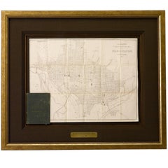
Antique Map of Washington DC, Roose's Companion and Guide Map, 1885
View Similar Items


Want more images or videos?
Request additional images or videos from the seller
1 of 5
Antique Map of Washington DC, Roose's Companion and Guide Map, 1885
About the Item
- Dimensions:Height: 26.25 in (66.68 cm)Width: 31 in (78.74 cm)Depth: 2 in (5.08 cm)
- Materials and Techniques:Paper,Engraved
- Place of Origin:
- Period:
- Date of Manufacture:1885
- Condition:Wear consistent with age and use. Overall very good condition. Original fold lines present with some minimal toning from age.
- Seller Location:Colorado Springs, CO
- Reference Number:Seller: M1281stDibs: LU90974634093
About the Seller
4.9
Platinum Seller
These expertly vetted sellers are 1stDibs' most experienced sellers and are rated highest by our customers.
Established in 2010
1stDibs seller since 2011
398 sales on 1stDibs
More From This SellerView All
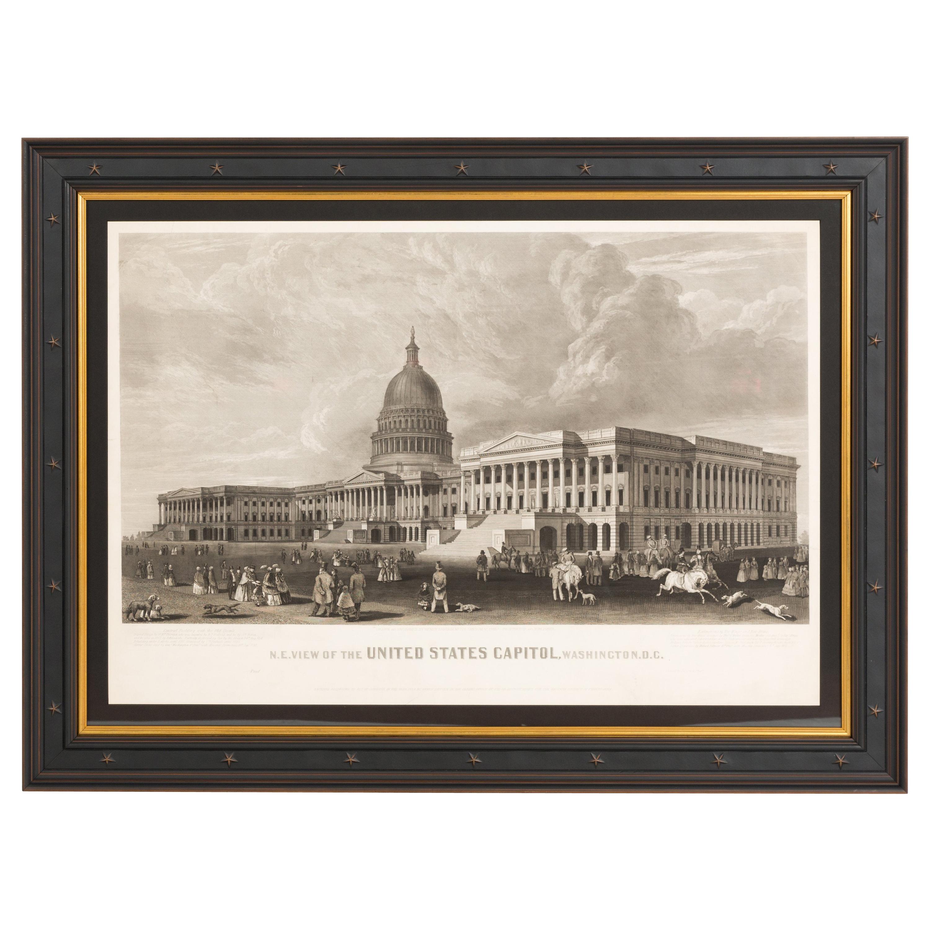
- N.E. View of the United States Capitol, Washington, DC Antique Proof Print 1858Located in Colorado Springs, COThis engraved print shows a view of the United States Capitol Building, in Washington, D.C. The print depicts the neoclassical building from the northeast orientation, with a bustling street scene in front. The steel engraving is a proof printing, drawn and engraved by Henry Sartain and published in 1858. Plans began in May 1854 to build a new cast-iron dome for the United States Capitol. The then-architect of the Capitol Thomas Walter and his team were sold on the aesthetics of a new dome, as well as the utility of a fire-proof one. A year later, on March 3, 1855, President Franklin Pierce...Category
Antique 1850s American Prints
MaterialsPaper
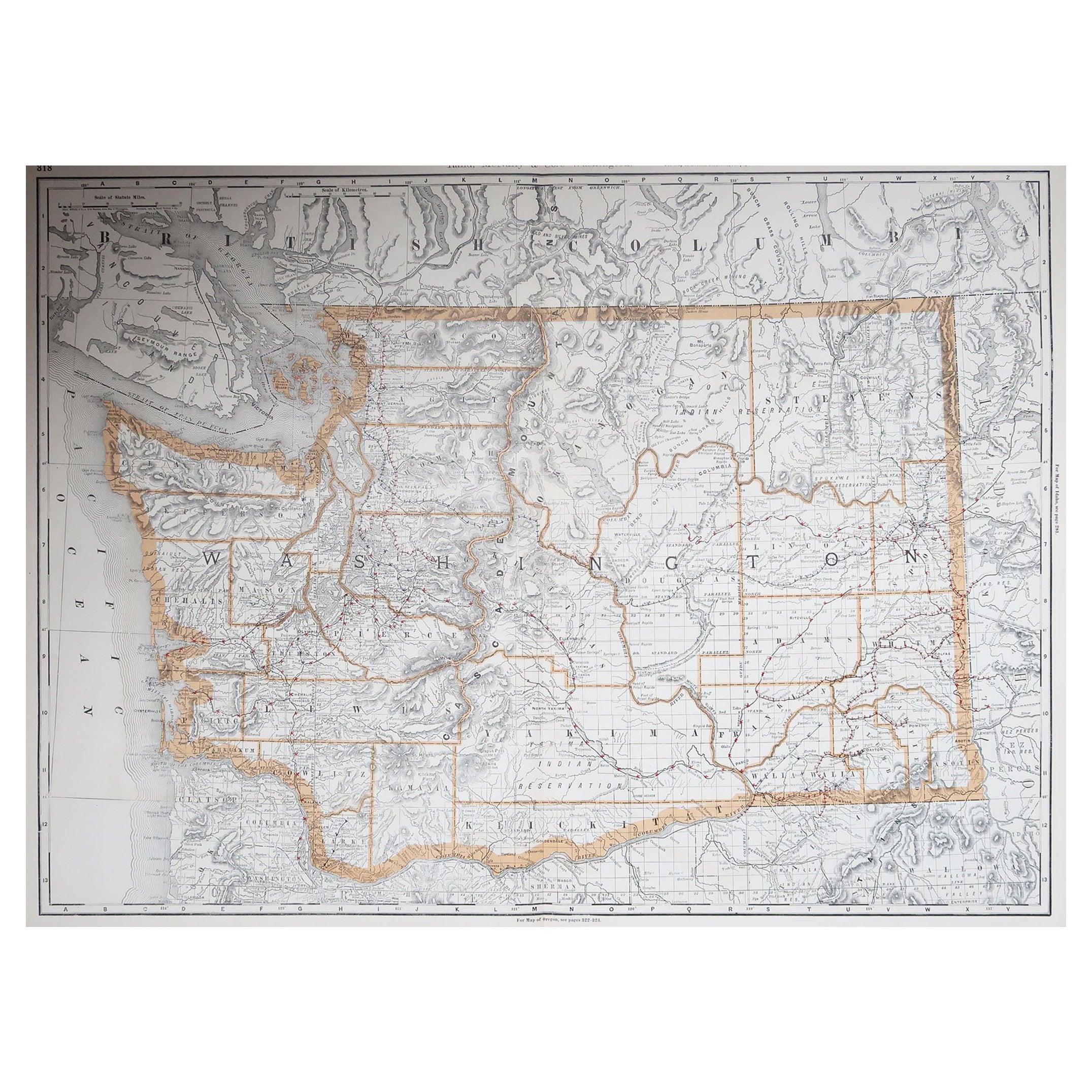
- "Clason's Guide Map of Montana" by The Clason Map Company, Circa 1920sLocated in Colorado Springs, COPresented is “Clason's Guide Map of Montana,” published in the early 1920s by the Clason Map Company. Issued as a folding map, this map identifies county boundaries, county seats, Na...Category
Vintage 1920s American Art Deco Maps
MaterialsPaper
- 1854 Map of Massachusetts, Connecticut and Rhode Island, Antique Wall MapLocated in Colorado Springs, COThis striking wall map was published in 1854 by Ensign, Bridgman & Fanning and has both full original hand-coloring and original hardware. This impression is both informative and highly decorative. The states are divided into counties, outlined in red, green, and black, and subdivided into towns. Roads, canals, and railroad lines are prominently depicted, although they are not all labeled. The mapmakers also marked lighthouses, banks, churches, and prominent buildings, with a key at right. The map is an informative and comprehensive overview of the infrastructural development of New England prior to the Civil War. Physical geographies depicted include elevation, conveyed with hachure marks, rivers and lakes. The impression features an inset map of Boston...Category
Antique 19th Century American Maps
MaterialsPaper
- 1907 Map of Colorado, Antique Topographical Map, by Louis NellLocated in Colorado Springs, COThis highly detailed pocket map is a topographical map of the state of Colorado by Louis Nell from 1907. The map "has been complied from all availabl...Category
Antique Early 1900s American Maps
MaterialsPaper
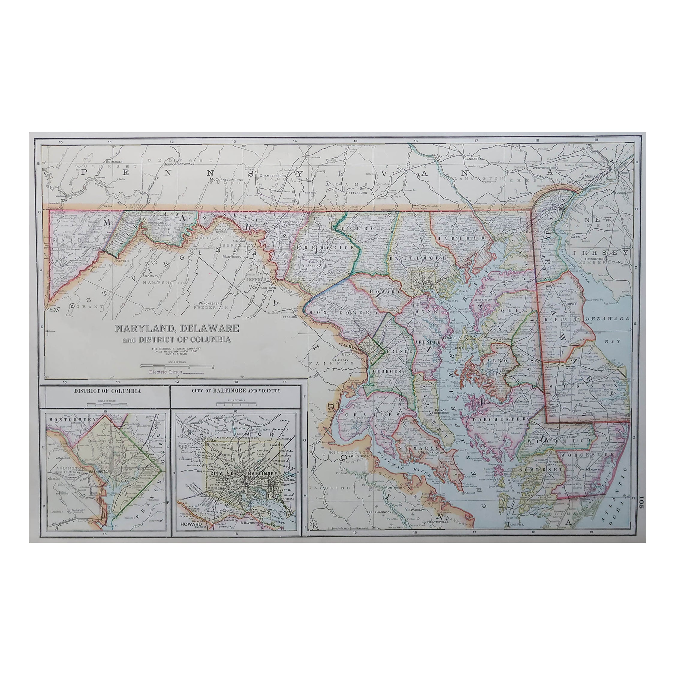
- 1861 Topographical Map of the District of Columbia, by Boschke, Antique MapLocated in Colorado Springs, COPresented is an original map of Albert Boschke's extremely sought-after "Topographical Map of the District of Columbia Surveyed in the Years 1856 ...Category
Antique 1860s American Historical Memorabilia
MaterialsPaper
- 1864 Map of North America, Antique Hand-Colored Map, by Adolphe Hippolyte DufourLocated in Colorado Springs, COOffered is a map of North America entitled Amerique du Nord from 1864. This rare, separately published wall map was produced by Adolphe Hippolyte Dufour. This map includes vibrant an...Category
Antique 1860s French Maps
MaterialsPaper


You May Also Like
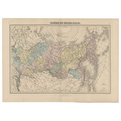
- Antique Map of Siberia and Russia, c.1885Located in Langweer, NLAntique map titled 'Siberie ou Russie d?Asie'. This is a fine example of J. Migeon's map of Russia in Asia. Migeon's map covers the Russian empire in Asia from european Russia and th...Category
Antique 19th Century Maps
MaterialsPaper
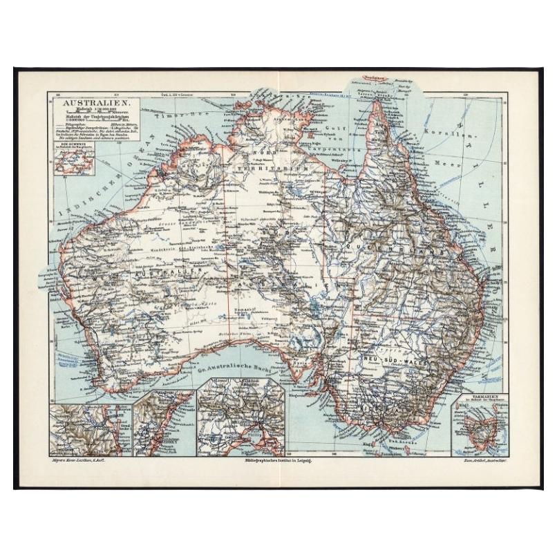
- German Antique Map of Australia, Meyers, 1885Located in Langweer, NLAustralien.' (Map of Australia. With inset maps of the large cities and Tasmania.) This attractive original old antique print / plate / map originate...Category
Antique 19th Century Maps
MaterialsPaper
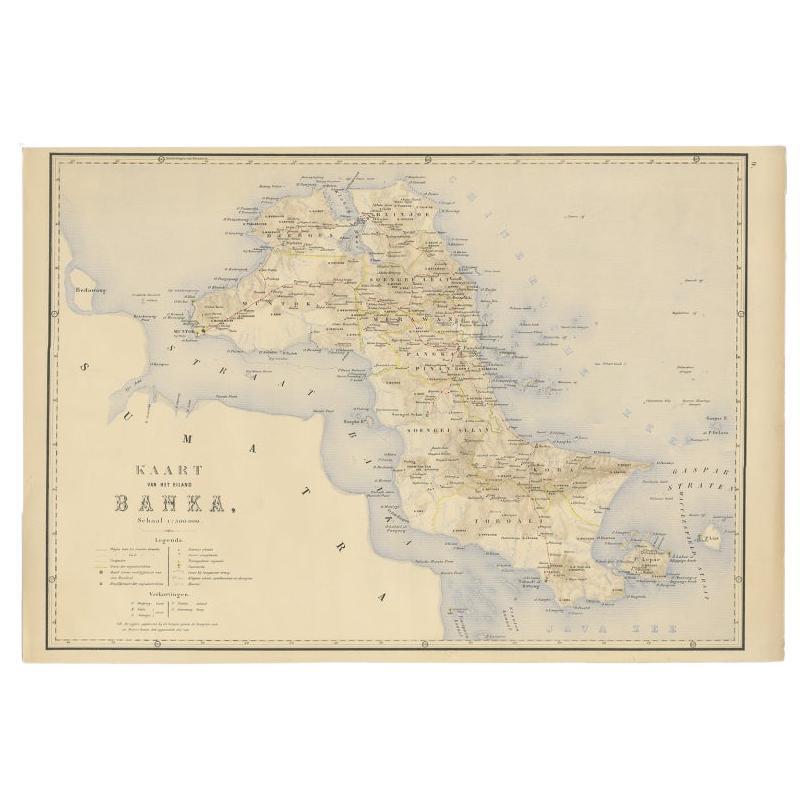
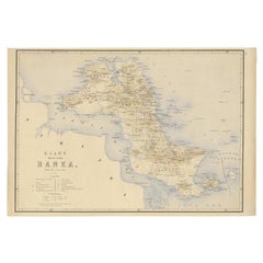
- Antique Map of Bangka Island, Indonesia, 1885Located in Langweer, NLAntique map titled 'Kaart van het Eiland Banka. Old map of Bangka Island, or Banka. This map originates from 'Atlas der Nederlandsche bezittingen in Oost-Indië naar de nieuwste bronn...Category
Antique 19th Century Maps
MaterialsPaper
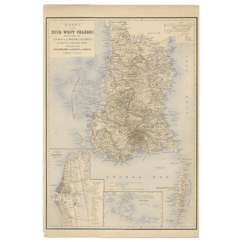
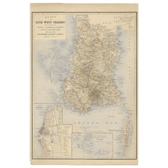
- Antique Map of Southern Sulawesi by Stemfoort, 1885Located in Langweer, NL"Antique map titled 'Kaart van Zuid West Celebes'. Old map of the southern tip of the southwestern part of Sulawesi. Includes a large inset map of the Makassar area, centered on Fort...Category
Antique 19th Century Maps
MaterialsPaper
- Antique Map of the Moluccas by Stemfoort, 1885Located in Langweer, NLAntique map titled 'Kaart der Molukken'. Old map of the southern tip of the Moluccas, or Maluku Islands. With an inset map of part of Ambon Island and an inset map of New Guinea. Thi...Category
Antique 19th Century Maps
MaterialsPaper
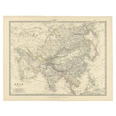
- Antique Map of the Asian Continent by Johnston, 1885Located in Langweer, NLAntique map titled 'Asia'. Beautiful map of the Asian continent by Keith Johnston F.R.S.E. Artists and Engravers: Engraved, printed and published by A.K. Johnston. Condition: ...Category
Antique 19th Century Maps
MaterialsPaper


Recently Viewed
View AllMore Ways To Browse
Antique Furniture Dc
Antique Furniture Washington Dc
Maryland Map
Map Of Maryland
Map Of Washington D C
Antique Furniture Va
Ben Bridge
City Plan Of Washington D C
Georgetown Used Furniture
Antique Map Of Maryland
Alexandria Antiques
Maryland Engraved
Washington Antique Map
Antique Maryland Map
Antique Map Maryland
Antique Maps Of Maryland
Alexandria Map
Dc Map