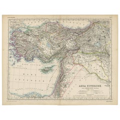
Antique Map of the Middle East by H. Kiepert, circa 1870
View Similar Items


Want more images or videos?
Request additional images or videos from the seller
1 of 5
Auction endedBrowse Current Auctions
Antique Map of the Middle East by H. Kiepert, circa 1870
About the Item
- Creator:Heinrich Kiepert (Author)
- Dimensions:Height: 14.38 in (36.5 cm)Width: 18.31 in (46.5 cm)Depth: 0.02 in (0.5 mm)
- Materials and Techniques:
- Period:
- Date of Manufacture:circa 1870
- Condition:General age-related toning. Please study image carefully.
- Seller Location:Langweer, NL
- Reference Number:Seller: BG-05315-111stDibs: LU3054311018731
About the Seller
5.0
Platinum Seller
These expertly vetted sellers are 1stDibs' most experienced sellers and are rated highest by our customers.
Established in 2009
1stDibs seller since 2017
1,909 sales on 1stDibs
More From This SellerView All
- Antique Map of Western Europe by H. Kiepert, circa 1870By Heinrich KiepertLocated in Langweer, NLAntique map titled 'Gallia, Britannia, Germania'. This map depicts a large part of Western Europe including countries like Germany, France, Great Britain, The Netherlands and more. T...Category
Antique Late 19th Century Maps
MaterialsPaper
 $138 Sale Price20% Off
 - Antique Map of Part of the Roman Empire by H. Kiepert, circa 1870By Heinrich KiepertLocated in Langweer, NLAntique map titled 'Imperia Persarum et Macedonum'. Depicts part of the Roman Empire, from Greece to Eastern India. This map originates from 'Atlas Antiqus. Zwölf Karten zur Alten Ge...Category
Antique Late 19th Century Maps
MaterialsPaper
 $130 Sale Price20% Off
 - Antique Map of Italy and Greece by H. Kiepert, circa 1870By Heinrich KiepertLocated in Langweer, NLAntique map titled 'Italiae pars media'. This map originates from 'Atlas Antiquus. Zwölf Karten zur Alten Geschichte' by H. Kiepert. Published in Berlin, circa 187.Category
Antique Late 19th Century Maps
MaterialsPaper
 $130 Sale Price20% Off
 - Antique Map of Egypt and Palestina by H. Kiepert 'circa 1870'By Heinrich KiepertLocated in Langweer, NLAntique map titled 'Aegyptus, Phoenice et Palestina'. With inset maps of Tyrus, Alexandria and Hierosolyma. This map originates from 'Atlas Antiquus. Zwölf Karten zur Alten Geschicht...Category
Antique Late 19th Century Maps
MaterialsPaper
 $138 Sale Price20% Off
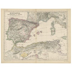
 - Antique Map of Spain, Mauritia and Africa by H. Kiepert, circa 1870By Heinrich KiepertLocated in Langweer, NLAntique map titled 'Hispania, Mauretania et Africa'. This map originates from 'Atlas Antiquus. Zwölf Karten zur Alten Geschichte' by H. Kiepert. Published in Berlin, circa 1870.Category
Antique Late 19th Century Maps
MaterialsPaper
 $130 Sale Price20% Off
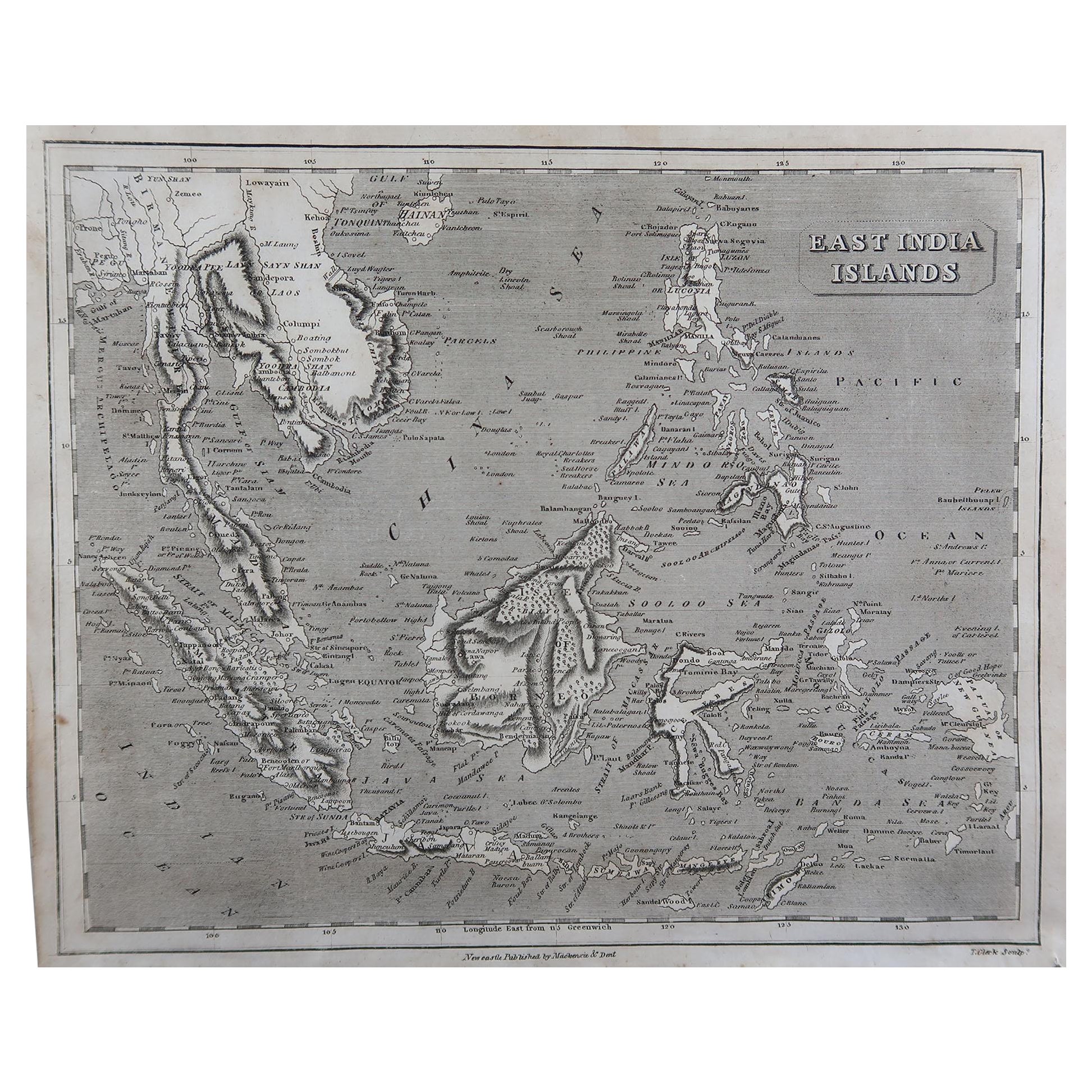
 - Antique Map of the East Indies by A & C. Black, 1870Located in Langweer, NLAntique map titled 'Indian Archipelago and Further India including Burmah, Siam, Anam &c'. Original antique map of Indian Archipelago and Further India. This map originates from ‘Bla...Category
Antique Late 19th Century Maps
MaterialsPaper

You May Also Like
- Map of the Republic of GenoaLocated in New York, NYFramed antique hand-coloured map of the Republic of Genoa including the duchies of Mantua, Modena, and Parma. Europe, late 18th century. Dimension: 25...Category
Antique Late 18th Century European Maps
- Antique Map of Italy by Andriveau-Goujon, 1843By Andriveau-GoujonLocated in New York, NYAntique Map of Italy by Andriveau-Goujon, 1843. Map of Italy in two parts by Andriveau-Goujon for the Library of Prince Carini at Palazzo Carini i...Category
Antique 1840s French Maps
MaterialsLinen, Paper
 $3,350 / set
 - Antique Map of Principality of MonacoBy Antonio Vallardi EditoreLocated in Alessandria, PiemonteST/619 - "Old Geographical Atlas of Italy - Topographic map of ex-Principality of Monaco" - ediz Vallardi - Milano - A somewhat special edition ---Category
Antique Late 19th Century Italian Other Prints
MaterialsPaper
 $225 Sale Price74% Off
 - Antique 18th Century Map of the Province of Pensilvania 'Pennsylvania State'Located in Philadelphia, PAA fine antique of the colony of Pennsylvania. Noted at the top of the sheet as a 'Map of the province of Pensilvania'. This undated and anonymous map is thought to be from the Gentleman's Magazine, London, circa 1775, although the general appearance could date it to the 1760's. The southern boundary reflects the Mason-Dixon survey (1768), the western boundary is placed just west of Pittsburgh, and the northern boundary is not marked. The map has a number of reference points that likely refer to companion text and appear to be connected to boundaries. The western and southern boundaries are marked Q, R, S, for example. A diagonal line runs from the Susquehanna R to the Lake Erie P. A broken line marked by many letters A, B, N, O, etc., appears in the east. There are no latitude or longitude markings, blank verso. Framed in a shaped contemporary gilt wooden frame and matted under a cream colored matte. Bearing an old Graham Arader Gallery...Category
Antique 18th Century British American Colonial Maps
MaterialsPaper
- Map "Estuary- Mouth of the Thames"Located in Alessandria, PiemonteST/426 - Antique French Map of the estuary of the Thames, map dated 1769 - "Mape of the entrance of the Thames. Designed by filing of Navy cards fo...Category
Antique Mid-18th Century French Other Prints
MaterialsPaper
 $954 Sale Price20% Off
 - Large Antique 1859 Map of North AmericaLocated in Sag Harbor, NYThis Map was made by Augustus Mitchell in 1859 It is in amazing condition for being 163 years old. This price is for the rolled up easy to ship version of this piece. I will be Frami...Category
Antique Mid-19th Century American Maps
MaterialsCanvas, Paper


Recently Viewed
View AllMore Ways To Browse
Middle East Furniture
Middle East Antiques
Middle East Map
Map Berlin
Berlin Maps
Antique Map Middle East
Middle East Antique Map
Middle East Maps
Map Of Middle East
Heinrich Kiepert On Sale
Antique Prints Maps
Antique Map Prints
Antique Maps And Prints
Antique Prints And Maps
Map 19th Century
Antique Atlas Furniture
Map Of France
Large Map