Items Similar to Antique Map of the Country Inhabited by the Samoyedic and Khanty People '1768'

Want more images or videos?
Request additional images or videos from the seller
1 of 5
Antique Map of the Country Inhabited by the Samoyedic and Khanty People '1768'
About the Item
Antique map titled 'Carte des Païs Habités par les Samojedes et Ostiacs'. Original antique map of the country inhabited by the Samoyedic and Khanty (Ostyak) peoples. Engraved by J.N. Bellin for 'Histoire Générale des Voyages'. Published 1768.
- Dimensions:Height: 9.85 in (25 cm)Width: 13.19 in (33.5 cm)Depth: 0.02 in (0.5 mm)
- Materials and Techniques:
- Period:
- Date of Manufacture:1768
- Condition:General age-related toning. Original folding lines. Minor wear/creasing, blank verso. Please study image carefully.
- Seller Location:Langweer, NL
- Reference Number:
About the Seller
5.0
Platinum Seller
These expertly vetted sellers are 1stDibs' most experienced sellers and are rated highest by our customers.
Established in 2009
1stDibs seller since 2017
1,909 sales on 1stDibs
Typical response time: <1 hour
- ShippingRetrieving quote...Ships From: Langweer, Netherlands
- Return PolicyA return for this item may be initiated within 14 days of delivery.
More From This SellerView All
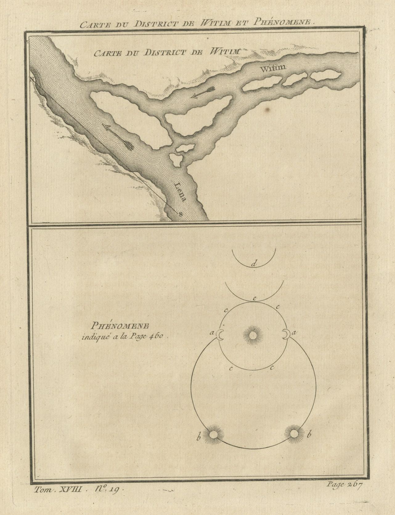
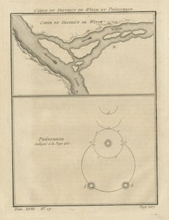
- Antique Map of the Vitim and Lena Rivers, Russia, 1768By PrevostLocated in Langweer, NLAntique map titled 'Carte du District de Witim et Phénomene (..)'. Map of the confluence of the Vitim and Lena rivers, and an illustration of atmospheric phenomena. This print origin...Category
Antique 18th Century Maps
MaterialsPaper
- Antique Map of Eastern Siberia by Bellin '1768'Located in Langweer, NLAntique map titled 'Suite de la Carte de la Siberie et le Pays de Kamtchatka'. Original antique map of the eastern portion of Siberia, centered on eastern Russia and the Mer d'Ochozk (Sea of Okhotsk) showing the Kamchatka Peninsula and I. de Beringe and I. Sagalin. The map shows the tracks of Russian ships...Category
Antique Mid-18th Century Maps
MaterialsPaper
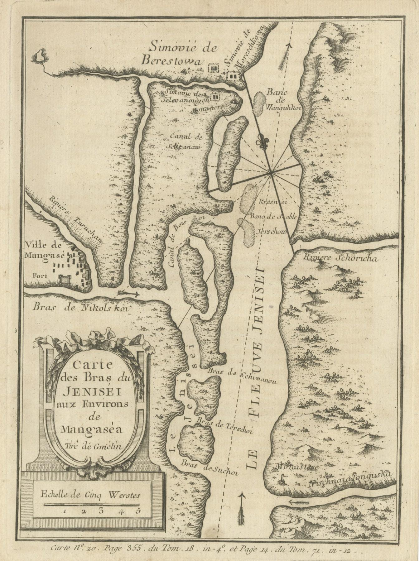
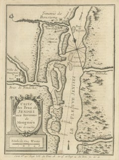
- Antique Map of the Yenisei River in Siberia, Russia, 1768By PrevostLocated in Langweer, NLAntique map titled 'Carte des Bras du Jenisei (..)'. Map of the Yenisei River and surroundings, Siberia. This print originates from volume 18 of 'Histoire generale des voyages (..)' ...Category
Antique 18th Century Maps
MaterialsPaper
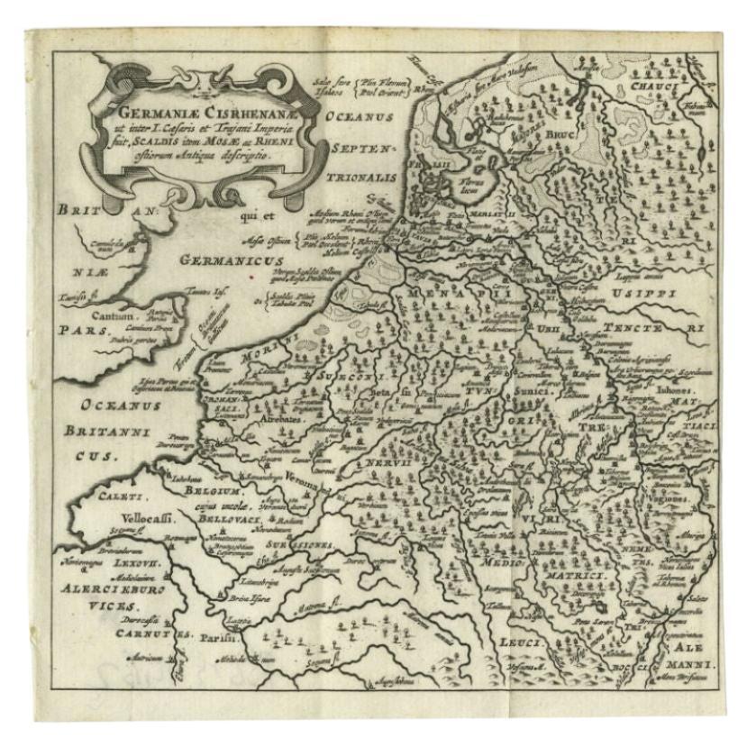
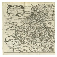
- Antique Map of the Low Countries and Surroundings in Europe, 1685By Philipp ClüverLocated in Langweer, NLAntique map titled 'Germaniae Cisrhenanae ut ineter I Caesaris et Traiani Suit imperia Scaldis Item Mose ac Rheni.' Miniature map of the Low Countries and part of Germany and France....Category
Antique 17th Century Maps
MaterialsPaper
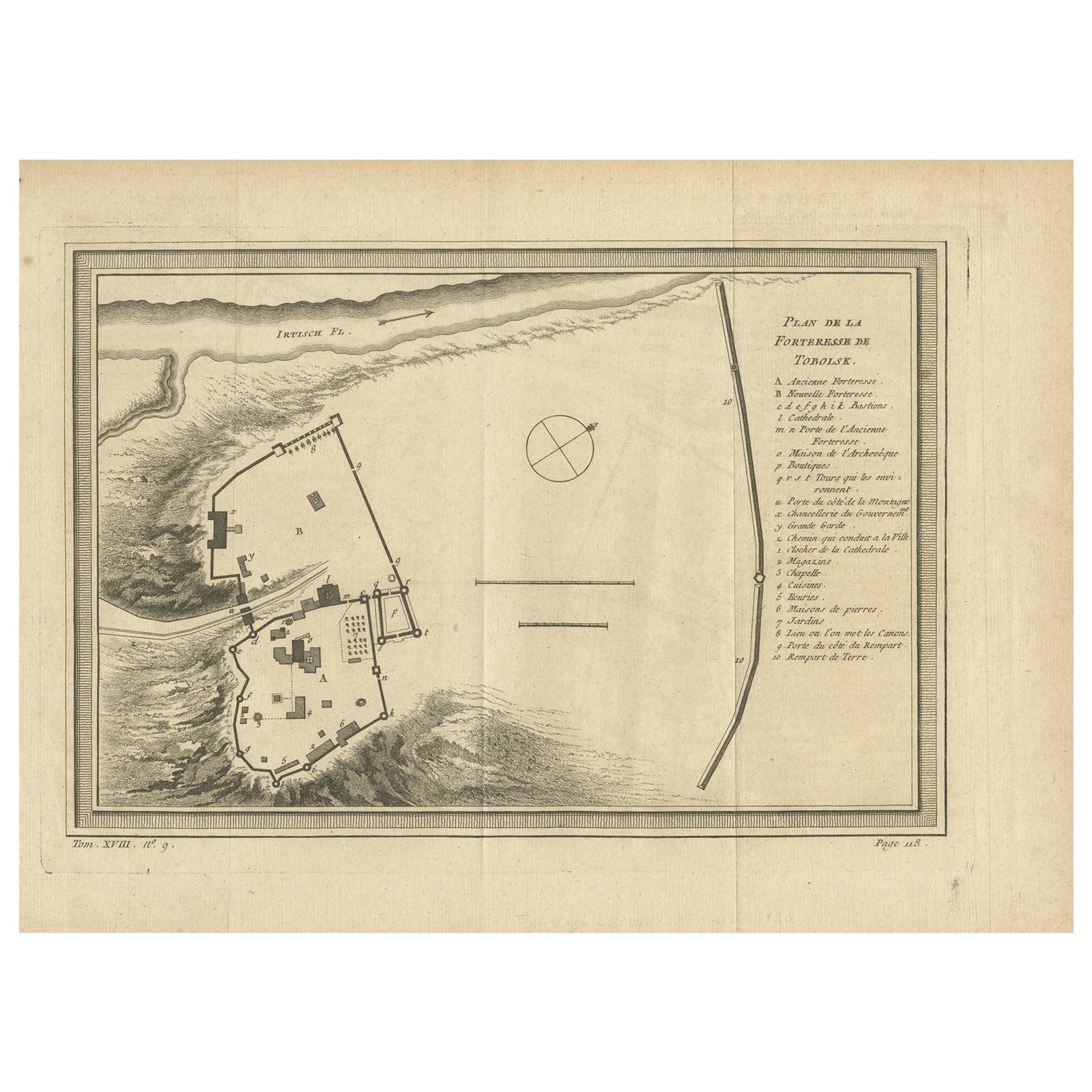
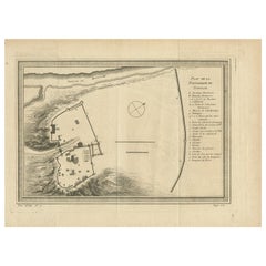
- Antique Plan of the Fortress of Tobolsk by Bellin '1768'Located in Langweer, NLAntique map titled 'Plan de la Forteresse de Tobolsk'. Original plan of the Fortress of Tobolsk, a town in Tyumen Oblast, Russia. Engraved by J.N. Bellin ...Category
Antique Mid-18th Century Maps
MaterialsPaper
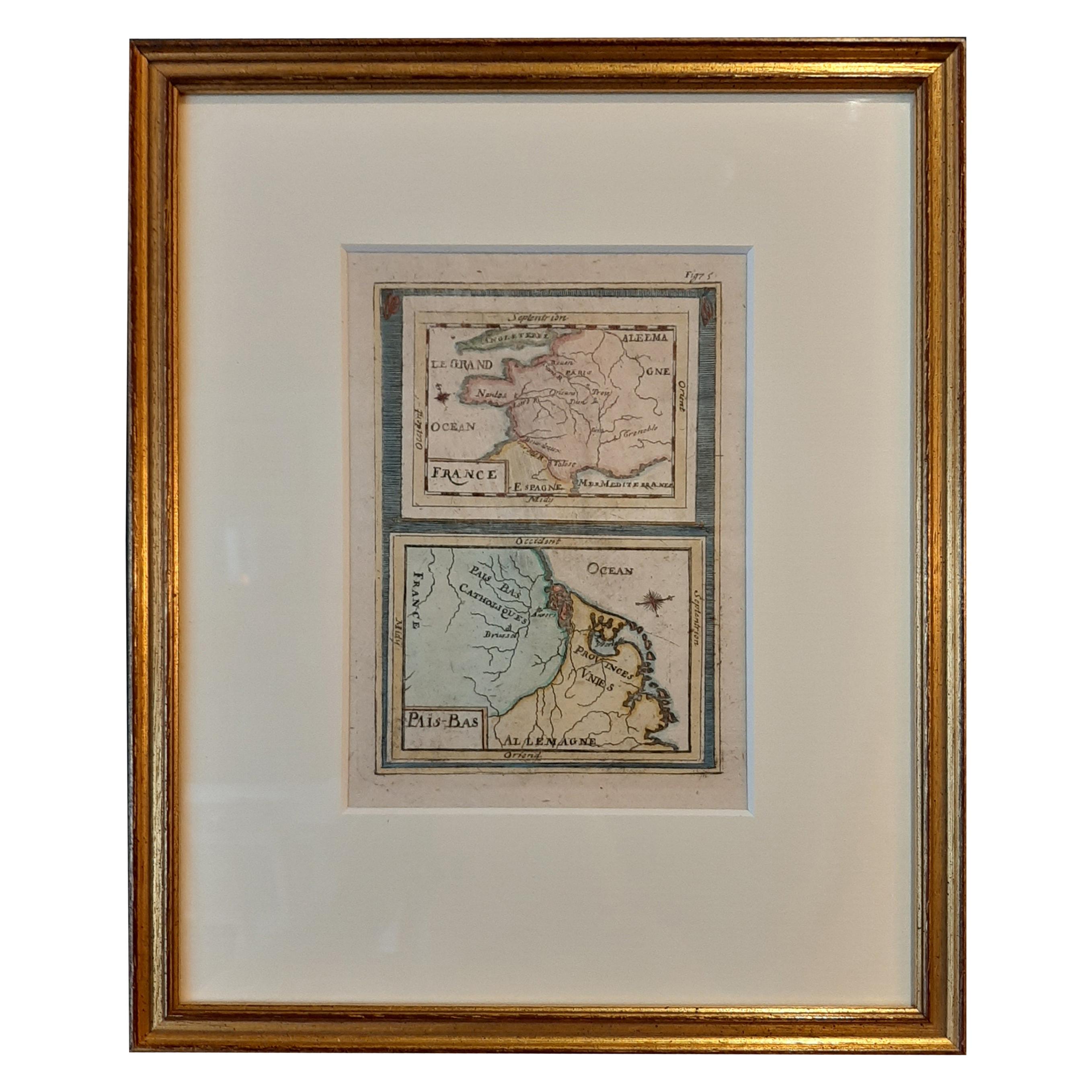
- Antique Miniature Map of France and the Low Countries by Mallet, circa 1719Located in Langweer, NLAntique map titled 'France - Païs-Bas'. Miniature Map of France and the Low Countries. Published by A.M. Mallet, circa 1719. Frame included. We carefully pack our framed items to ...Category
Antique Early 18th Century Maps
MaterialsPaper

You May Also Like
- Original Antique Map of The World by Thomas Clerk, 1817Located in St Annes, LancashireGreat map of The Eastern and Western Hemispheres On 2 sheets Copper-plate engraving Drawn and engraved by Thomas Clerk, Edinburgh. Published by Mackenzie And Dent, 1817 ...Category
Antique 1810s English Maps
MaterialsPaper
- Original Antique Map of The Netherlands, Engraved by Barlow, Dated 1807Located in St Annes, LancashireGreat map of Netherlands Copper-plate engraving by Barlow Published by Brightly & Kinnersly, Bungay, Suffolk. Dated 1807 Unframed.Category
Antique Early 1800s English Maps
MaterialsPaper
- Map of the Republic of GenoaLocated in New York, NYFramed antique hand-coloured map of the Republic of Genoa including the duchies of Mantua, Modena, and Parma. Europe, late 18th century. Dimension: 25...Category
Antique Late 18th Century European Maps
- Antique Map of Italy by Andriveau-Goujon, 1843By Andriveau-GoujonLocated in New York, NYAntique Map of Italy by Andriveau-Goujon, 1843. Map of Italy in two parts by Andriveau-Goujon for the Library of Prince Carini at Palazzo Carini i...Category
Antique 1840s French Maps
MaterialsLinen, Paper
- Antique Map of Principality of MonacoBy Antonio Vallardi EditoreLocated in Alessandria, PiemonteST/619 - "Old Geographical Atlas of Italy - Topographic map of ex-Principality of Monaco" - ediz Vallardi - Milano - A somewhat special edition ---Category
Antique Late 19th Century Italian Other Prints
MaterialsPaper
- Original Antique Map of Russia By Arrowsmith. 1820Located in St Annes, LancashireGreat map of Russia Drawn under the direction of Arrowsmith Copper-plate engraving Published by Longman, Hurst, Rees, Orme and Brown, 1820 Unframed.Category
Antique 1820s English Maps
MaterialsPaper


Recently Viewed
View AllMore Ways To Browse
Pai Pai
Pai Of
Antique Furniture Portugal
Map Of England
Original City Map
Antique Furniture Edinburgh
Maps Colored
Antique Map Of Holland
Antique Furniture Mexico
Rare Antique Level
Antique Edinburgh Scotland
Dutch 16th
Vans Authentics
Railroad Furniture
19th Century World Map
British Antique Collectables
River Map
Antique Island Map