Items Similar to Antique Map of the Brazil Railway Company, '1912'
Want more images or videos?
Request additional images or videos from the seller
1 of 5
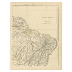
Antique Map of the Brazil Railway Company, '1912'
About the Item
Antique map titled 'Brazil Railway Company'. This folding map is attached to the booklet titled 'The Brazil Railway Company'. It is a memorandum by A. H. A. Knox-Little, who was the European Manager.
- Dimensions:Height: 22.45 in (57 cm)Width: 19.1 in (48.5 cm)Depth: 0.2 in (5 mm)
- Materials and Techniques:
- Period:
- Date of Manufacture:1912
- Condition:Some foxing and general age-related toning. Complete booklet. Please study images carefully.
- Seller Location:Langweer, NL
- Reference Number:
About the Seller
5.0
Platinum Seller
These expertly vetted sellers are 1stDibs' most experienced sellers and are rated highest by our customers.
Established in 2009
1stDibs seller since 2017
Typical response time: <1 hour
- ShippingRetrieving quote...Ships From: Langweer, Netherlands
- Return PolicyA return for this item may be initiated within 14 days of delivery.
More From This SellerView All
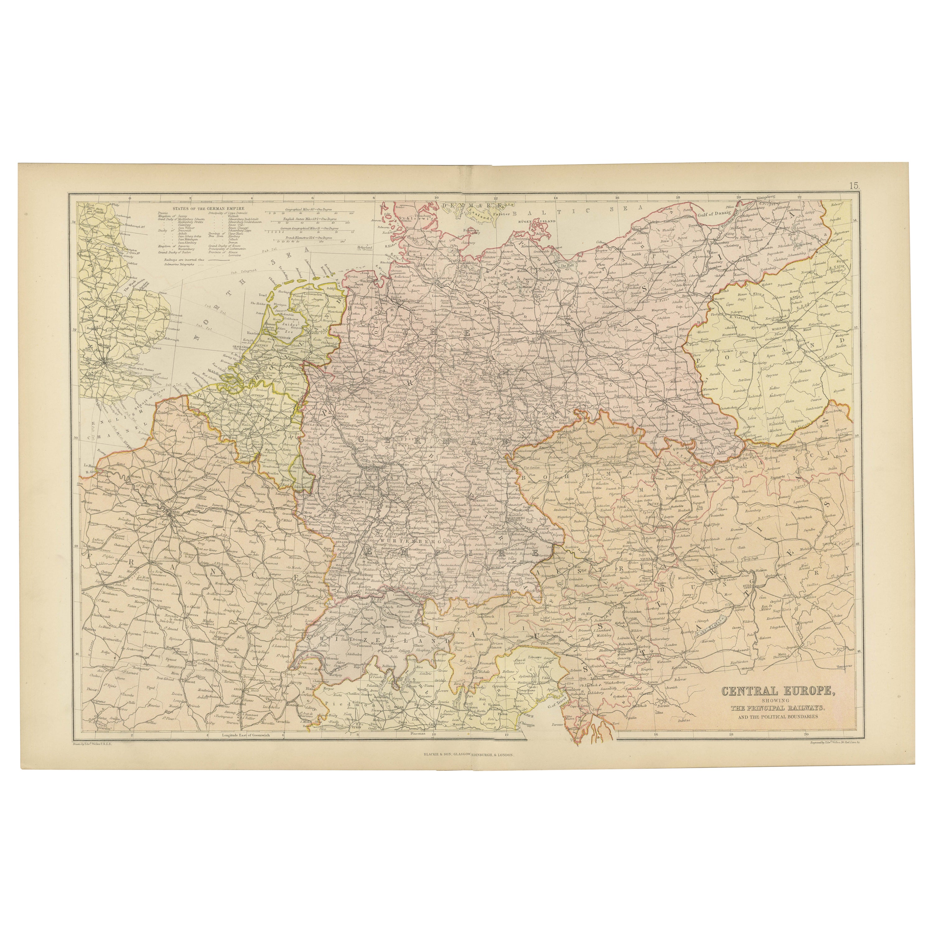
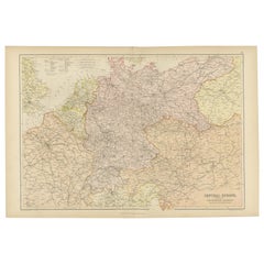
- Antique Map of Central Europe Showing The Railways and The Political BounderiesLocated in Langweer, NLExplore the Heart of Europe with the 'Central Europe' Map, Featuring Principal Railways and Political Boundaries! This map offers a captivating view of the dynamic landscapes and pol...Category
Antique 1880s Maps
MaterialsPaper
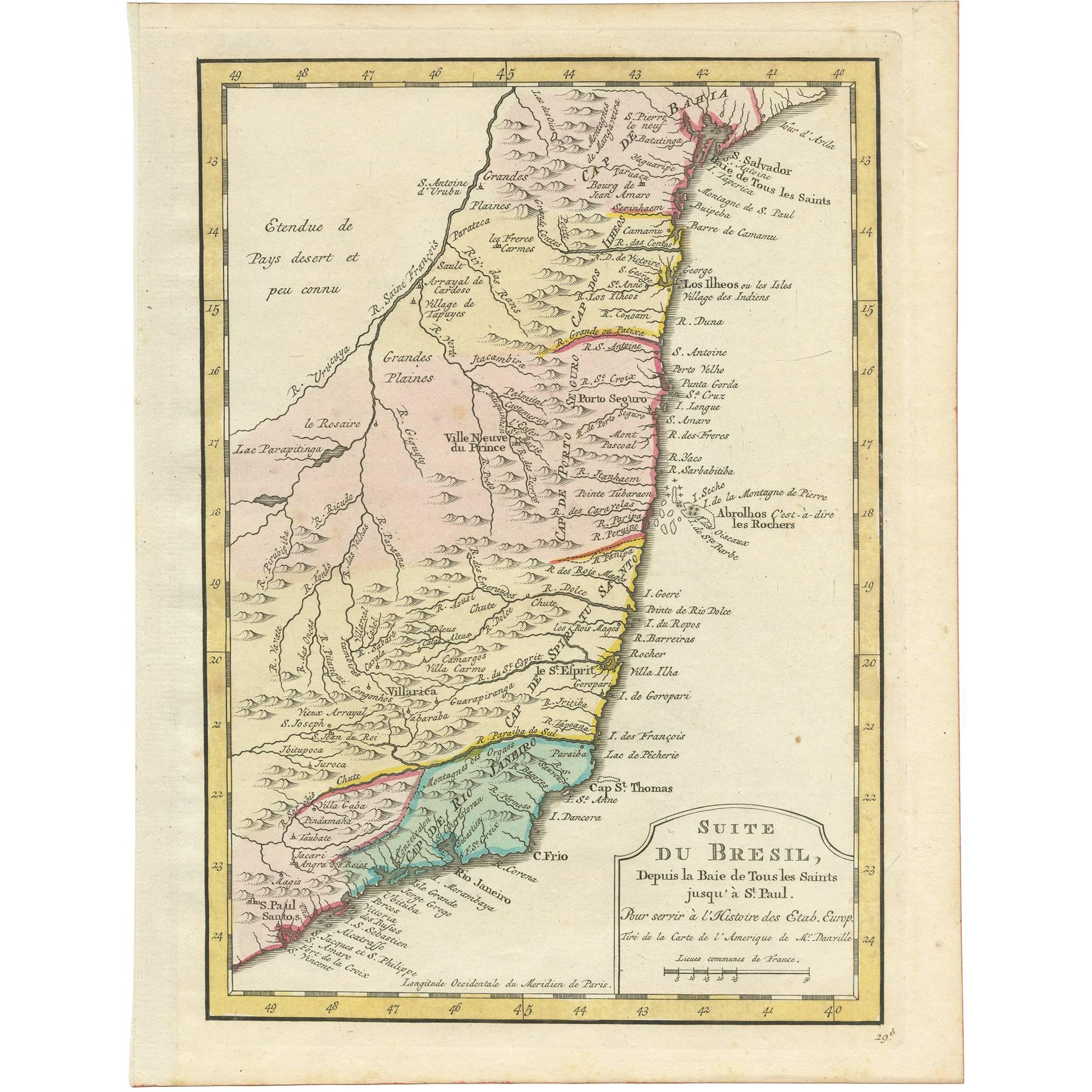
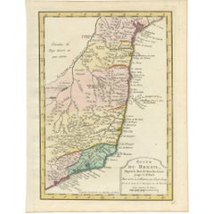
- Antique Map of the Brazilian Coast by A. Van KreveltLocated in Langweer, NLUncommon edition of this accurate map of part of Brazil, from San Salvador till Rio de Janeiro and S.Paulo. In lower right engraved "29b." Originates from 'Atlas Portatif pour servir...Category
Antique Late 18th Century Brazilian Maps
MaterialsPaper
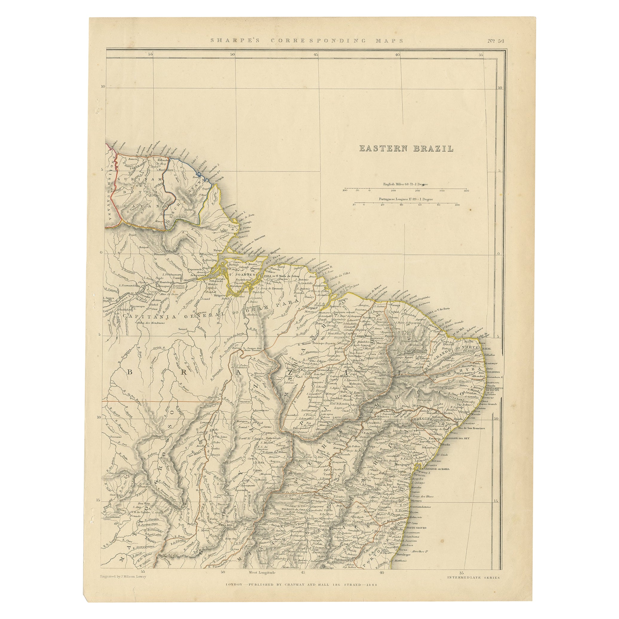
- Antique Map of Eastern Brazil, 1849Located in Langweer, NLAntique map titled 'Eastern Brazil'. Old map of Eastern Brazil. This map originates from 'Sharpe's Corresponding Atlas (..)' by J. Sharpe. Artists and Engravers: Published by Chap...Category
Antique 19th Century Maps
MaterialsPaper
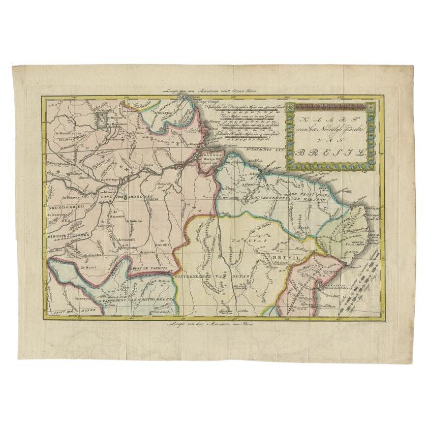
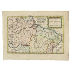
- Antique Map of the Northern Part of Brazil by Raynal, 1784Located in Langweer, NLAntique map titled 'Kaart van het Noordlijk gedeelte van Bresil'. Rare antique map of the northern part of Brazil, with the basin of the Amazon and the cities of Manaus, Recife and S...Category
Antique 18th Century Maps
MaterialsPaper
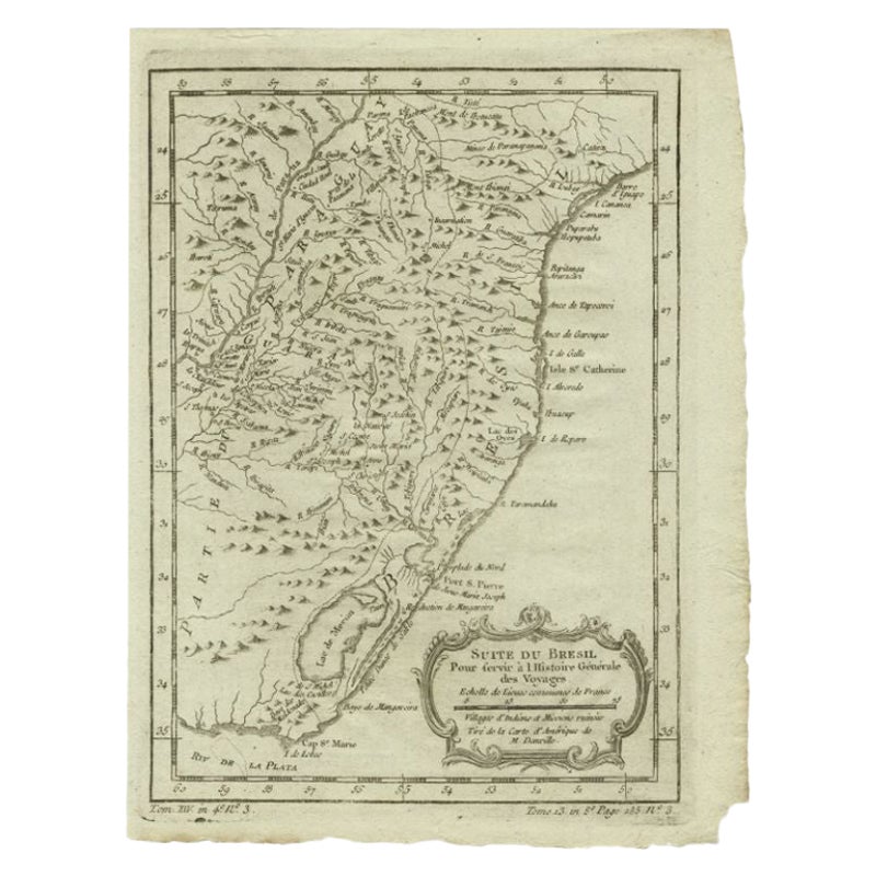
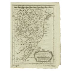
- Antique Map of the Coast of Southern Brazil by Bellin, c.1755By Jacques-Nicolas BellinLocated in Langweer, NLAntique map titled ‘Suite de Bresil’. Map of the coast of southern Brazil, with Lagoa Mirim, and Uruguay (here named as Paraguay). This print originates from 'Histoire générale des V...Category
Antique 18th Century Maps
MaterialsPaper
- Antique Map of Brazil by Wyld, '1845'Located in Langweer, NLAntique map titled 'Empire of Brazil'. Original antique map of Brazil. This map originates from 'An Atlas of the World, Comprehending Separate Ma...Category
Antique Mid-19th Century Maps
MaterialsPaper

You May Also Like
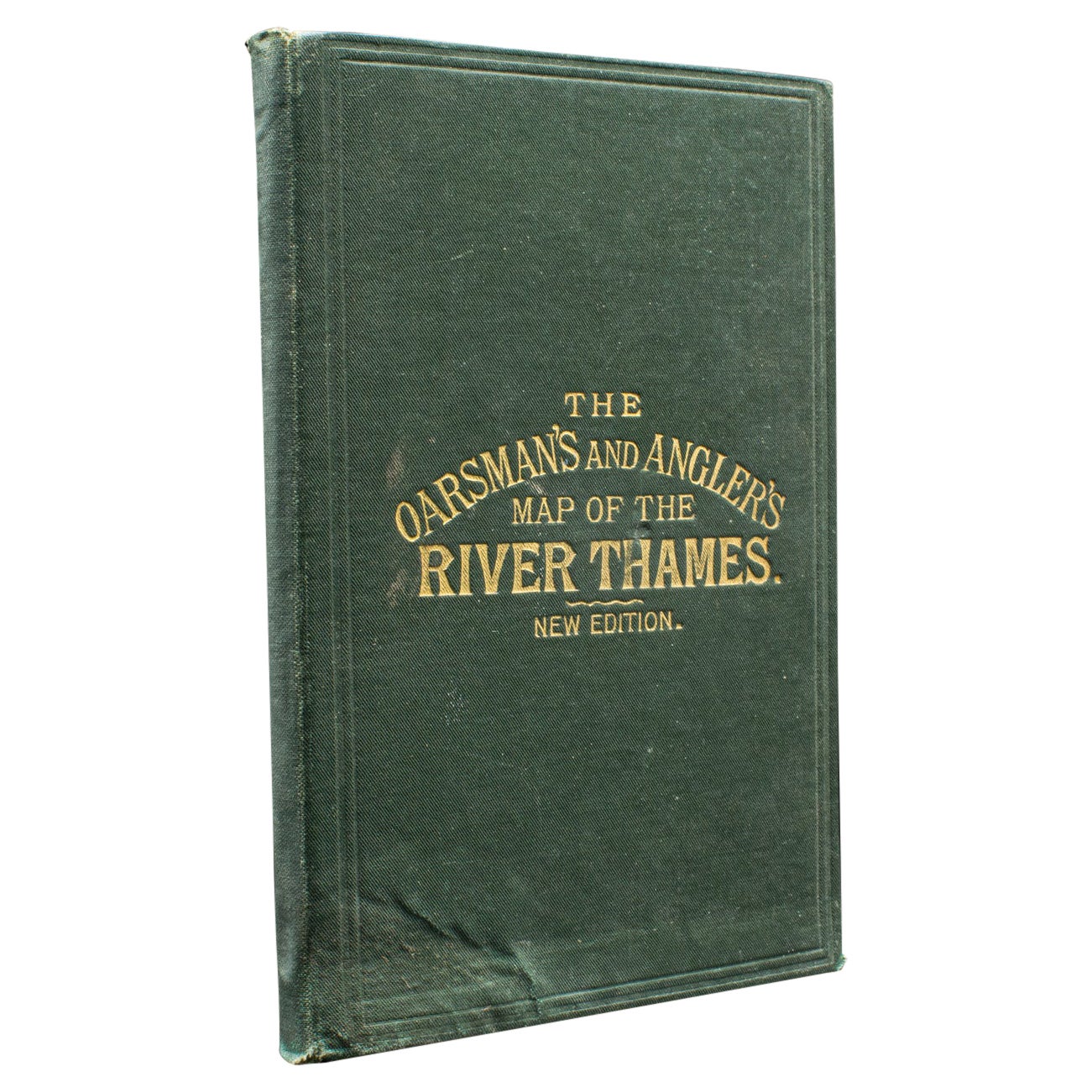
- Antique Oarsman's Map of the River Thames, English, Cartography, Published 1912Located in Hele, Devon, GBThis is an antique copy of The Oarsman's and Angler's Map of the River Thames - New Edition. An English, bound map book, published in English by Edward Stanford, London, this new edi...Category
Early 20th Century British Other Books
MaterialsPaper
- 1908 "Map of Texas" by The Kenyon CompanyLocated in Colorado Springs, COPresented is an antique map of the state of Texas, printed as a pocket map in 1908 by The Kenyon Company. The state map is brightly colored by county, with principal cities and towns listed. The congressional districts are numbered and boldly outlined in red. Rivers, roads, and railroads all appear prominently on this fantastic map...Category
Antique Early 1900s American Maps
MaterialsPaper
- "Clason's Guide Map of Montana" by The Clason Map Company, Circa 1920sLocated in Colorado Springs, COPresented is “Clason's Guide Map of Montana,” published in the early 1920s by the Clason Map Company. Issued as a folding map, this map identifies county boundaries, county seats, Na...Category
Vintage 1920s American Art Deco Maps
MaterialsPaper
- Antique 1901 National Publishing Company's Road Map of New Jersey GeologicalLocated in Dayton, OHThe National Publishing Company's road map of New Jersey, showing all county and township divisions, cities villages and post-offices, railroads, ste...Category
Antique Early 1900s Victorian Prints
MaterialsPaper
- 1861 Topographical Map of the District of Columbia, by Boschke, Antique MapLocated in Colorado Springs, COPresented is an original map of Albert Boschke's extremely sought-after "Topographical Map of the District of Columbia Surveyed in the Years 1856 ...Category
Antique 1860s American Historical Memorabilia
MaterialsPaper
- Sotheby's the Collections of Hanns and Elisabeth Weinberg & the Antique CompanyLocated in valatie, NYSotheby's the collections of Hanns and Elisabeth Weinberg & the Antique Company of New York, November 2006. 468 pages, 738 lots of important Europe...Category
Late 20th Century American Books
MaterialsPaper


Recently Viewed
View AllMore Ways To Browse
Antique Company
Antique Companies
The Antique Company
The Antique Furniture Company
Antique Paper Company
Folding Maps
Brazilian Antiques
Brazil Antique
Antique Railway
Map Of Brazil
Brazil Map
Antique Map Brazil
Antique Map Of Brazil
Antique Railway Maps
Map Of The World Antique
Rare Maps
Used World Atlas
Russian Collectable