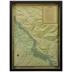
"Little Big Horn, 1876" Raised Relief Map, 1989
View Similar Items

Want more images or videos?
Request additional images or videos from the seller
1 of 5
"Little Big Horn, 1876" Raised Relief Map, 1989
About the Item
- Dimensions:Height: 31.5 in (80.01 cm)Width: 23.5 in (59.69 cm)Depth: 2.5 in (6.35 cm)
- Materials and Techniques:
- Place of Origin:
- Period:1980-1989
- Date of Manufacture:1989
- Condition:Wear consistent with age and use.
- Seller Location:Colorado Springs, CO
- Reference Number:Seller: M2711stDibs: LU909714009162
About the Seller
4.9
Platinum Seller
These expertly vetted sellers are 1stDibs' most experienced sellers and are rated highest by our customers.
Established in 2010
1stDibs seller since 2011
More From This SellerView All
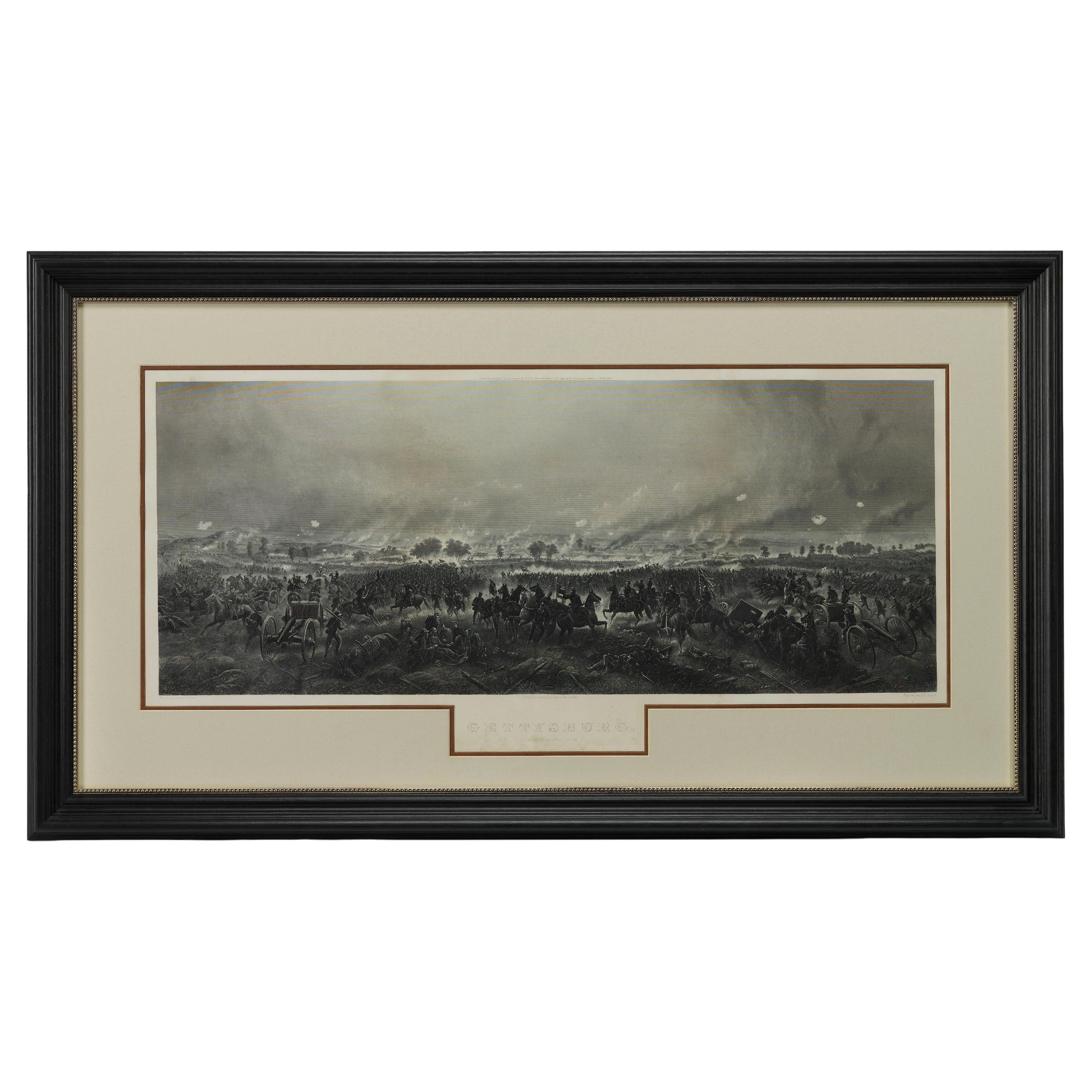
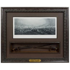
- 1876 "Gettysburg, The Repulse of Longstreet's Assault." EngravingLocated in Colorado Springs, COPresented here is an 1876 engraving of John B. Bachelder and James Walker’s Gettysburg. The Repulse of Longstreet’s Assault. The engraved scene depicts the decisive battle on the final day of the Battle of Gettysburg. Researched by the photographer and topographer John B. Bachelder and painted by James Walker, the original painting was created in 1870. This detailed engraving was done by H. B. Hall Jr. and published by James Drummond Ball. Otherwise called Pickett’s Charge, the battle occurred on July 3, 1863. Pickett’s corp commander, Lieutenant General James Longstreet was placed in charge of the attack despite his hesitations. Longstreet’s central role led to the title of the work, Repulse of Longstreet’s Assault. In an attempt to gain control of an important supply route, nine Confederate brigades charged across three-quarters of a mile of open ground against cannon fire to take Cemetery Ridge from the defending Union Army. Despite their overwhelming numbers, the Confederate forces were repelled with considerable casualties marking not only a decisive victory for the Union, but also the beginning of the slow defeat of Lee’s Army. The furthest the charging forces advanced before being repulsed would forever be known as the “High Water Mark of the Confederacy.” The Confederate army never recovered from the losses at Gettysburg and it effectively ended Lee’s campaign into Pennsylvania. The engraving gives the perspective from the Union rear, one that encompasses most of the battlefield, from Big Round Top on the left to the northern reaches of Cemetery Ridge on the right. The Confederate lines at Seminary Ridge are in the far distance, partially obscured by bursting shells. The image centers on the main Confederate assault, in the vicinity of what today are known as "The Copse" and "The Bloody Angle." The composition has elemen...Category
Antique 1870s American Prints
MaterialsPaper
- 1907 Map of Colorado, Antique Topographical Map, by Louis NellLocated in Colorado Springs, COThis highly detailed pocket map is a topographical map of the state of Colorado by Louis Nell from 1907. The map "has been complied from all availabl...Category
Antique Early 1900s American Maps
MaterialsPaper
- 1854 Map of Massachusetts, Connecticut and Rhode Island, Antique Wall MapLocated in Colorado Springs, COThis striking wall map was published in 1854 by Ensign, Bridgman & Fanning and has both full original hand-coloring and original hardware. This impression is both informative and highly decorative. The states are divided into counties, outlined in red, green, and black, and subdivided into towns. Roads, canals, and railroad lines are prominently depicted, although they are not all labeled. The mapmakers also marked lighthouses, banks, churches, and prominent buildings, with a key at right. The map is an informative and comprehensive overview of the infrastructural development of New England prior to the Civil War. Physical geographies depicted include elevation, conveyed with hachure marks, rivers and lakes. The impression features an inset map of Boston...Category
Antique 19th Century American Maps
MaterialsPaper
- 1876 "Gettysburg. Repulse of Longstreet's Assault" with Union Officer SwordsLocated in Colorado Springs, COPresented here is an 1876 engraving of John B. Bachelder and James Walker’s Gettysburg. Repulse of Longstreet’s Assault together with two ornately decorated Union Officer swords...Category
Antique 1870s American Prints
MaterialsMetal
- 1861 Topographical Map of the District of Columbia, by Boschke, Antique MapLocated in Colorado Springs, COPresented is an original map of Albert Boschke's extremely sought-after "Topographical Map of the District of Columbia Surveyed in the Years 1856 ...Category
Antique 1860s American Historical Memorabilia
MaterialsPaper
- "Clason's Guide Map of Montana" by The Clason Map Company, Circa 1920sLocated in Colorado Springs, COPresented is “Clason's Guide Map of Montana,” published in the early 1920s by the Clason Map Company. Issued as a folding map, this map identifies county boundaries, county seats, Na...Category
Vintage 1920s American Art Deco Maps
MaterialsPaper


You May Also Like
- World Relief MapLocated in Antwerp, BELarge world relief map. Measures: Width 232 cm. Height 158 cm.Category
Mid-20th Century German Mid-Century Modern Maps
MaterialsAcrylic
 $1,960
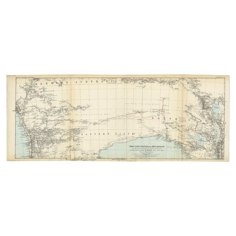
 - Antique Exploration Map of Australia from Beltana to Perth, 1876Located in Langweer, NLAntique map titled 'Thomas Elders' Expedition durch Inner-Australien von Beltana im Osten bis Perth im Western ausgefuhrt durch E. Giles (..)'. Old map of Australia from Bunbury to A...Category
Antique 19th Century Maps
MaterialsPaper
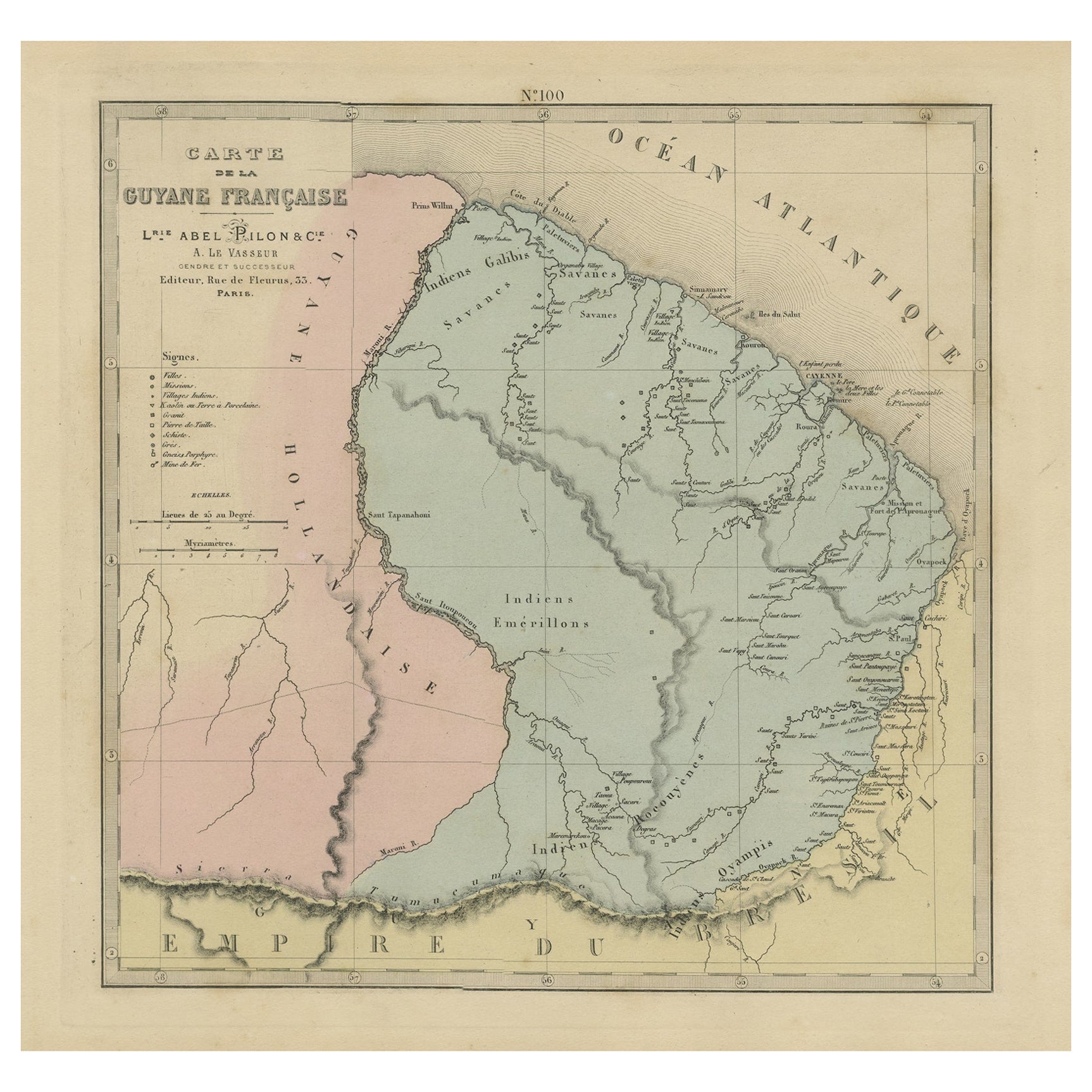
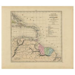
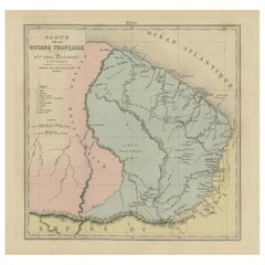
- Antique Engraved Map with Original Hand Colour of French Guiana, 1876Located in Langweer, NLThe 1876 map of French Guiana from the "Grand Atlas Départemental de la France de L'Algérie et des colonies" by H. Fisquet, published by A. Le Vasseur in Paris, is a significant piec...Category
Antique Late 19th Century Maps
MaterialsPaper
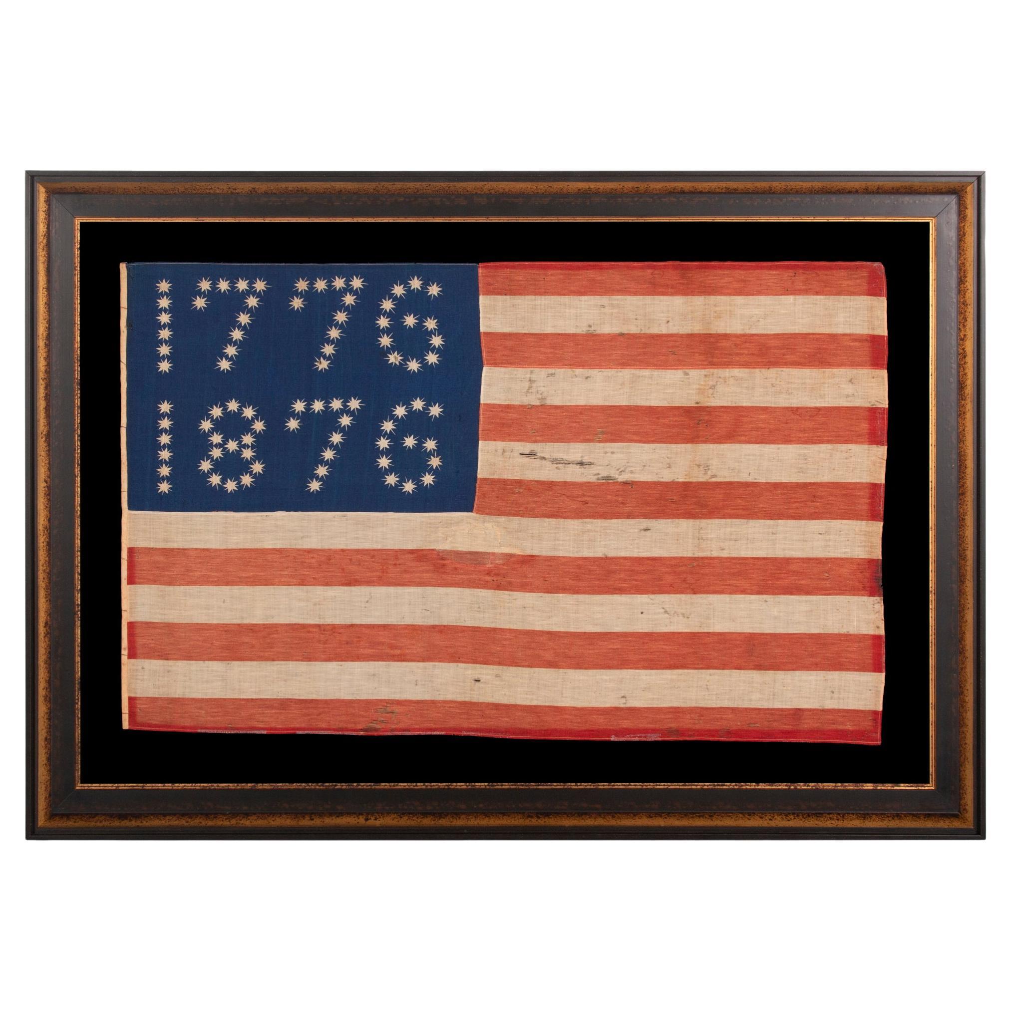
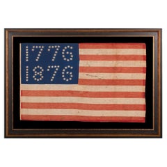
- 1776-1876 Centennial Celebration Flag, ca 1876Located in York County, PAAntique American Flag with 10-pointed stars that spell “1776 – 1876”, Made for the 100-Year Anniversary Of American Independence,one of the most graphic of all early examples. Man...Category
Antique 1870s American Political and Patriotic Memorabilia
MaterialsCotton
 Price Upon Request
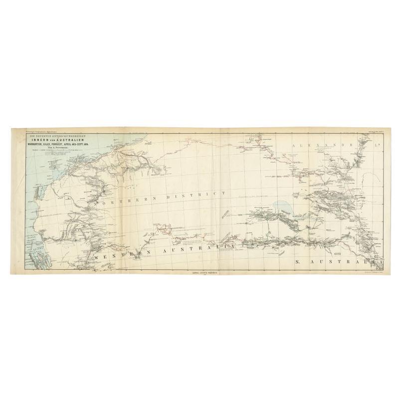
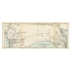
 - Antique Exploration Map of Australia from Sharks Bay to Alice Springs, 1876Located in Langweer, NLAntique map titled 'Die neuesten Entdeckungsreisen Innern von Australien von Warburton, Giles, Forrest (..)'. Old map of Australia from Sharks Bay to 90 Mile Beach over to Alice Springs...Category
Antique 19th Century Maps
MaterialsPaper
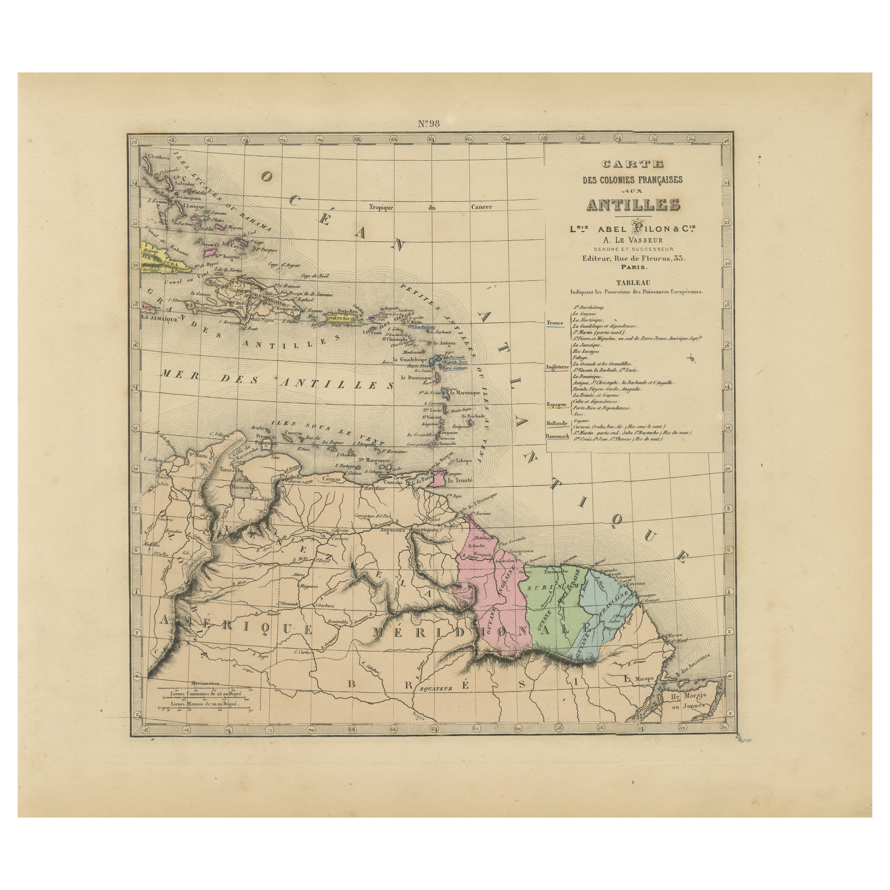
- Authentique Map by Pilon of The French Colonies in The West Indies, 1876Located in Langweer, NLThe 1876 map titled "Carte des Colonies Françaises aux Antilles" represents a significant contribution to cartography within the "Grand Atlas Départemental de la France de L'Algérie ...Category
Antique Late 19th Century Maps
MaterialsPaper
 $209 Sale Price20% Off
Recently Viewed
View AllMore Ways To Browse
Retro Maps Of The United States
Vintage Cavalry
Vintage Map Boxes
Vintage Map Box
Battle Maps
Crow Indian
Action Office 1
Vintage Wooden Shadow Boxes
Vintage Wooden Shadow Box
Relief Map
Twelve Tribes
Custom Vintage Maps
Used Furniture Cheyenne
Little Big Horn
Indian Regiment
Kill Bill
Raised Relief Map
Map Of Montana