Items Similar to Germany West of the Rhine: A Hand-colored 18th Century Map by de Wit


Want more images or videos?
Request additional images or videos from the seller
1 of 9
Germany West of the Rhine: A Hand-colored 18th Century Map by de Wit
About the Item
This original 18th century hand-colored map of the county of Moers, Germany entitled "Illustrissimo Celsissmo Principi GUILIELMO HENRICO D.G. Arausionum Principi Domino suo Clementissimo Hanc COMITATUS MEURSENSIS et Annexarum Dinastiarum" by Frederick de Wit was published in Amsterdam by Covens & Mortier in 1721. It depicts Moers, Germany on the west bank of the Rhine River. The colorful title cartouche in the lower left quadrant includes a Coat of Arms along with a Lion and an Eagle at the top and is flanked by a man on the left and a woman on the right.
This attractive mat is presented in a cream-colored mat, measuring 30" wide and 27.5" high. There is slight discoloration in the right upper and lower corners and left lower margin, as well as faint discoloration in the left map periphery. The map is otherwise in excellent condition.
Frederick de Wit (circa 1630-1706) moved to Amsterdam from Gouda in 1646. He learned cartography from the famous Dutch cartographer, Willem Blaeu. De Wit opened his own map and printing business in 1654. His success gradually expanded his business and by the 1670s he was publishing atlases.
- Creator:Frederick de Wit (Artist)
- Dimensions:Height: 27.5 in (69.85 cm)Width: 30 in (76.2 cm)Depth: 0.13 in (3.31 mm)
- Materials and Techniques:Paper,Engraved
- Place of Origin:
- Period:
- Date of Manufacture:1721
- Condition:Wear consistent with age and use.
- Seller Location:Alamo, CA
- Reference Number:
About the Seller
5.0
Vetted Seller
These experienced sellers undergo a comprehensive evaluation by our team of in-house experts.
1stDibs seller since 2020
12 sales on 1stDibs
- ShippingRetrieving quote...Ships From: Alamo, CA
- Return PolicyA return for this item may be initiated within 7 days of delivery.
More From This SellerView All
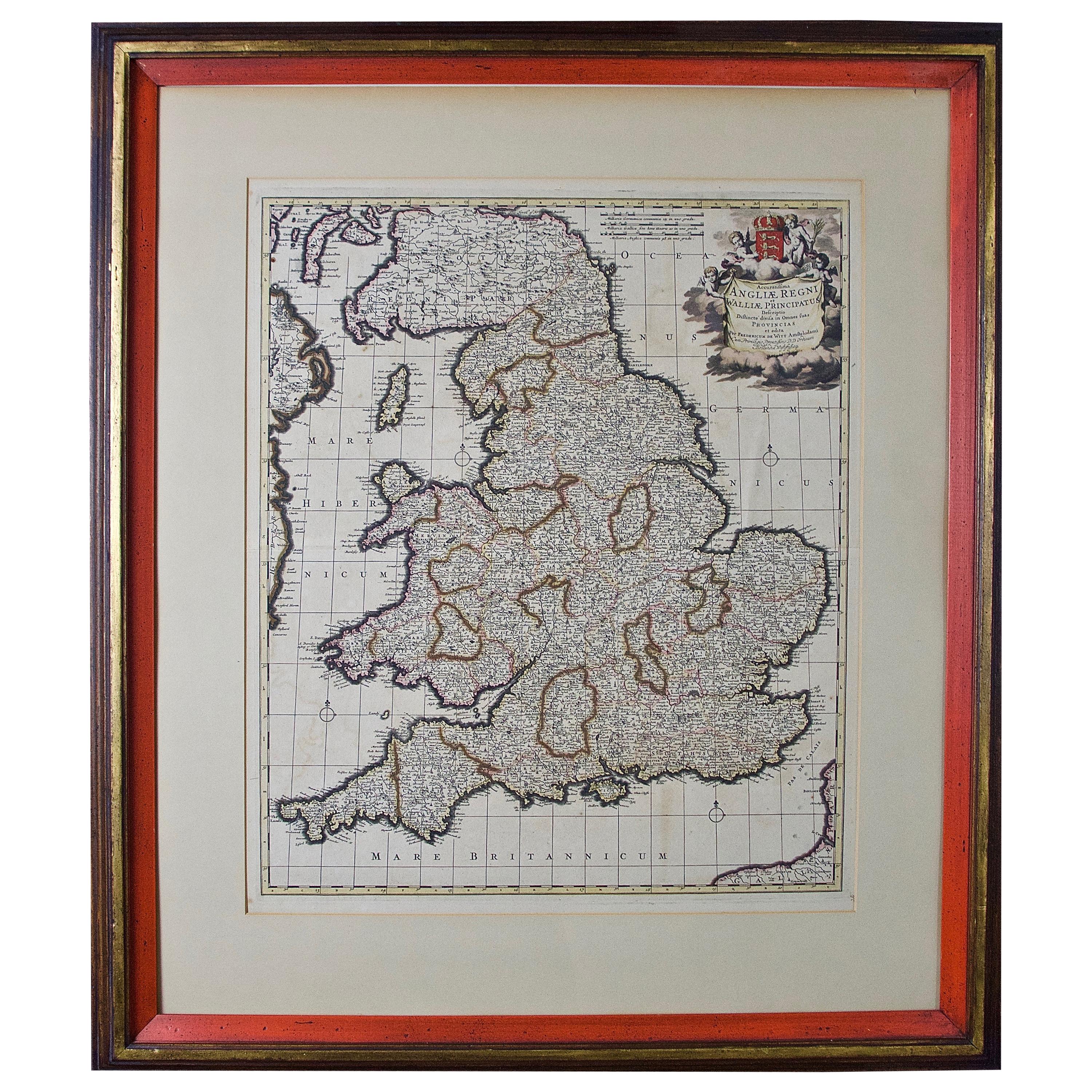
- Large 17th Century Hand Colored Map of England and the British Isles by de WitBy Frederick de WitLocated in Alamo, CAA large hand colored 17th century map of England and the British Isles by Frederick de Wit entitled "Accuratissima Angliæ Regni et Walliæ Principatus", published in Amsterdam in 1680. It is a highly detailed map of England, Scotland, the Scottish Isles...Category
Antique Late 17th Century Dutch Maps
MaterialsPaper
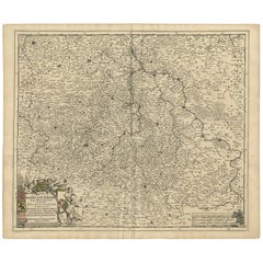
- 17th Century Hand-Colored Map of a Region in West Germany by JanssoniusBy Johannes JanssoniusLocated in Alamo, CAThis attractive highly detailed 17th century original hand-colored map is entitled "Archiepiscopatus Maghdeburgensis et Anhaltinus Ducatus cum terris adjacentibus". It was published ...Category
Antique Mid-17th Century Dutch Maps
MaterialsPaper
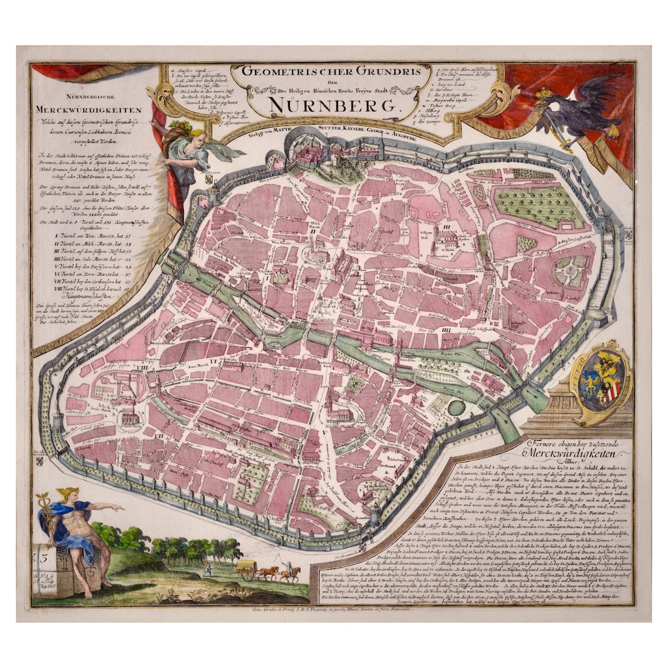
- City View of Nuremberg, Germany: An 18th Century Hand-Colored Map by M. SeutterBy Matthew SeutterLocated in Alamo, CAAn 18th century hand-colored city view of Nuremburg, Germany entitled "Geometrischer Grundris der des Heiligen Römischen Reichs Freyen Stadt Nürnberg" by Matthaus Seutter from his "A...Category
Antique Mid-18th Century German Maps
MaterialsPaper
- 18th Century Hand-Colored Homann Map of Germany, Including Frankfurt and BerlinBy Johann Baptist HomannLocated in Alamo, CAAn 18th century hand-colored map entitled "Tabula Marchionatus Brandenburgici et Ducatus Pomeraniae quae sunt Pars Septentrionalis Circuli Saxoniae Superioris" by Johann Baptist Homa...Category
Antique Early 18th Century German Maps
MaterialsPaper
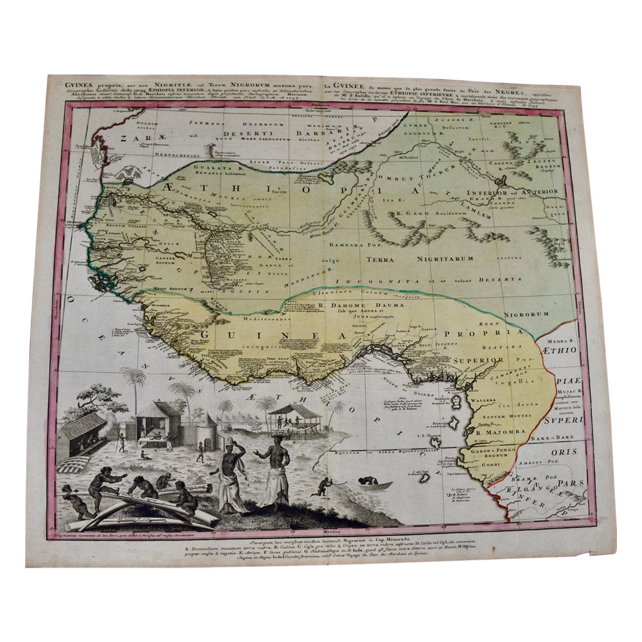
- West Africa Entitled "Guinea Propria": An 18th Century Hand Colored Homann MapBy Johann Baptist HomannLocated in Alamo, CAThis is a scarce richly hand colored copper plate engraved map of Africa entitled "Guinea Propria, nec non Nigritiae vel Terrae Nigrorum Maxima Pars" by Johann Baptist Homann (1664-1...Category
Antique Mid-18th Century German Maps
MaterialsPaper
- California, Alaska and Mexico: 18th Century Hand-Colored Map by de VaugondyBy Didier Robert de VaugondyLocated in Alamo, CAThis an 18th century hand-colored map of the western portions of North America entitled "Carte de la Californie et des Pays Nord-Ouest separés de l'Asie par le détroit d'Anian, extra...Category
Antique 1770s French Maps
MaterialsPaper


You May Also Like
- Large Antique Map of France by De Wit, c.1680By Frederick de WitLocated in Langweer, NLAntique map titled 'Accuratissima Galliae Tabula vulgo Royaume de France'. Detailed map of France. Shows provinces, cities, rivers etc. Artists and Engravers: Frederick de Wit (1...Category
Antique 17th Century Maps
MaterialsPaper
- Antique Map of the Saxony Region 'Germany' by F. de Wit, circa 1680Located in Langweer, NLA detailed map of a region in eastern Germany. Cartouches depict coat of arms surrounded by cherubs. The map is fully engraved with towns, political boundaries, rivers and forests. P...Category
Antique Late 17th Century Maps
MaterialsPaper
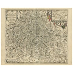
- Antique Map of Southern Germany by F. de Wit, circa 1680Located in Langweer, NLThis antique map depicts a portion of southern Germany that included the historic regions of Bavaria, the Palatinate, Prussia-Brandenburg, the Rhineland and Saxony. Regensberg, Freis...Category
Antique Late 17th Century Maps
MaterialsPaper
- Antique Map of Denmark by F. de Wit, 1680Located in Langweer, NLAntique map titled 'Dania Regnum'. Large, attractive map of Denmark, Sleschwig-Holstein and southern Sweden. Good detail throughout. Embellished with a title cartouche with the Danis...Category
Antique Late 17th Century Maps
MaterialsPaper
- Antique Map of Austria by F. de Wit, 1690Located in Langweer, NLAntique map titled 'Circuli Austriaci pars Septentrionalis in qua Archiducatus'. Decorative and detailed map of Austria by F. de Wit.Category
Antique Late 17th Century Maps
MaterialsPaper
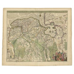
- Antique Map of The Dutch Province of Groningen by De Wit, c.1680Located in Langweer, NLAntique map titled 'Tabulae dominii Groeningae quae et complecitur maximam partem Drentiae Emendata'. Old map of the province of Groningen, the Netherlands. With an inset map of th...Category
Antique 17th Century Maps
MaterialsPaper