Items Similar to Antique Map of South America by Migeon '1880'
Want more images or videos?
Request additional images or videos from the seller
1 of 5
Antique Map of South America by Migeon '1880'
About the Item
Antique map titled 'Amérique Méridionale'. Old map of South America. With an inset map of the Galapagos Islands and decorative vignettes. This map originates from 'Géographie Universelle Atlas-Migeon' by J. Migeon.
- Creator:J. Migeon (Artist)
- Dimensions:Height: 18.71 in (47.5 cm)Width: 13.59 in (34.5 cm)Depth: 0.02 in (0.5 mm)
- Materials and Techniques:
- Place of Origin:
- Period:
- Date of Manufacture:1880
- Condition:Wear consistent with age and use. General age-related toning. Please study images carefully.
- Seller Location:Langweer, NL
- Reference Number:
About the Seller
5.0
Platinum Seller
These expertly vetted sellers are 1stDibs' most experienced sellers and are rated highest by our customers.
Established in 2009
1stDibs seller since 2017
1,909 sales on 1stDibs
Typical response time: <1 hour
- ShippingRetrieving quote...Ships From: Langweer, Netherlands
- Return PolicyA return for this item may be initiated within 14 days of delivery.
More From This SellerView All
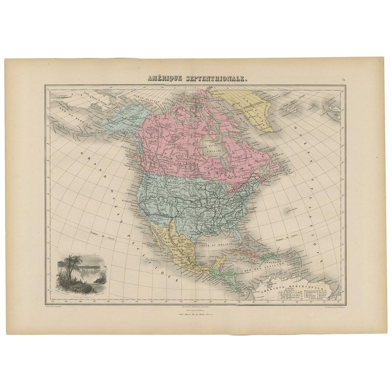
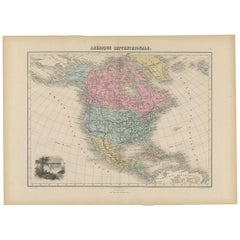
- Antique Map of North and Central America by Migeon '1880'By J. MigeonLocated in Langweer, NLAntique map titled 'Amérique Septentrionale'. Old map of North and Central America. With a decorative vignette of the Niagara Falls. This map originates from 'Géographie Universelle ...Category
Antique Late 19th Century French Maps
MaterialsPaper
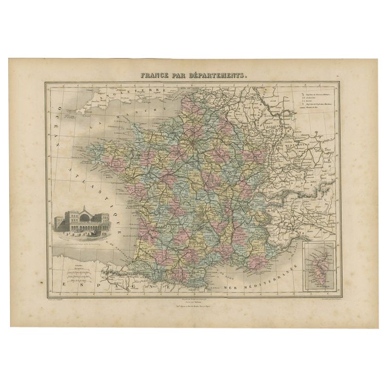
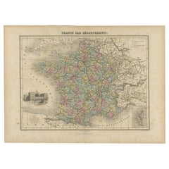
- Antique Map of the Departments of France by Migeon, 1880By J. MigeonLocated in Langweer, NLAntique map titled 'France par Départements'. Old map of France with a decorative vignette of Strasbourg and an inset map of Corsica. This map originate...Category
Antique 19th Century Maps
MaterialsPaper
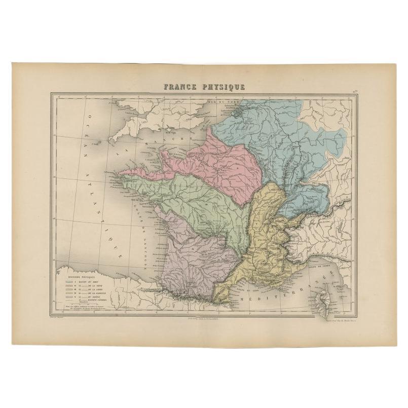
- Antique Map of France by Migeon, 1880Located in Langweer, NLAntique map titled 'France Physique'. Old map of France. This map originates from 'Géographie Universelle Atlas-Migeon' by J. Migeon. Artists and Engravers: Published by J. Migeon...Category
Antique 19th Century Maps
MaterialsPaper
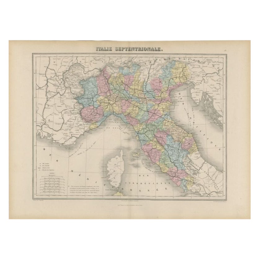
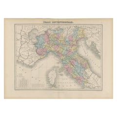
- Antique Map of Northern Italy by Migeon, 1880Located in Langweer, NLAntique map titled 'Italie Septentrionale'. Old map of the northern part of Italy. This map originates from 'Géographie Universelle Atlas-Migeon' by J. Migeon. Artists and Engravers:...Category
Antique 19th Century Maps
MaterialsPaper
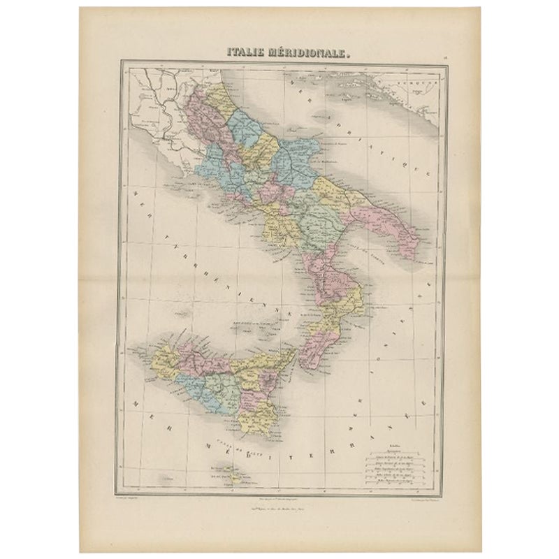
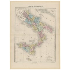
- Antique Map of Southern Italy by Migeon, 1880Located in Langweer, NL"Antique map titled 'Italie Méridionale'. Old map of southern Italy including Sicily/Sicilia. This map originates from 'Géographie Universelle Atlas-Mig...Category
Antique 19th Century Maps
MaterialsPaper
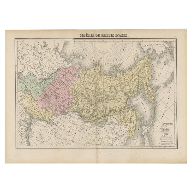
- Antique Map of Russia and Siberia by Migeon, 1880Located in Langweer, NLAntique map titled 'Sibérie ou Russie d'Asie'. Migeon's map covers the Russian empire in Asia from european Russia and the Ural Mountains to the Bering Strait and from the Arctic Cir...Category
Antique 19th Century Maps
MaterialsPaper


You May Also Like
- Original Antique Map of South America. C.1780Located in St Annes, LancashireGreat map of South America Copper-plate engraving Published C.1780 Two small worm holes to left side of map Unframed.Category
Antique Early 1800s English Georgian Maps
MaterialsPaper
- Original Antique Map of South America, circa 1830Located in St Annes, LancashireGreat map of South America Copper plate engraving Published by Butterworth, Livesey & Co., circa 1830 Unframed.Category
Antique Early 1800s English Other Maps
MaterialsPaper
- Original Antique Decorative Map of South America-West Coast, Fullarton, C.1870Located in St Annes, LancashireGreat map of Chili, Peru and part of Bolivia Wonderful figural border From the celebrated Royal Illustrated Atlas Lithograph. Original color. Published by Fullarton, Edi...Category
Antique 1870s Scottish Maps
MaterialsPaper
- Antique Lithography Map, South America, English, Framed, Cartography, VictorianLocated in Hele, Devon, GBThis is an antique lithography map of South America. An English, framed atlas engraving of cartographic interest by John Rapkin , dating to the early Victorian period and later, circ...Category
Antique Mid-19th Century British Early Victorian Maps
MaterialsWood
- Original Antique Map of Cyprus. Circa 1880Located in St Annes, LancashireGreat map of Cyprus Drawn and Engraved by R.Walker Published W.Mackenzie, London Original colour Unframed.Category
Antique 1880s English Maps
MaterialsPaper
- Original Antique Map of South Africa, Arrowsmith, 1820Located in St Annes, LancashireGreat map of South Africa. Drawn under the direction of Arrowsmith. Copper-plate engraving. Published by Longman, Hurst, Rees, Orme and Br...Category
Antique 1820s English Maps
MaterialsPaper


Recently Viewed
View AllMore Ways To Browse
South America
J Antique
Antique Map America
Antique American Maps
Antique American Map
America Antique Map
Antique Map Of America
Antique Maps Of America
Map South America
Map Of South America
French Map Of America
Map Of South Of France
Old American Maps
Antique Map South America
Antique Maps South America
South America Antique Map
Antique South America Map
Antique Map Of South America