Items Similar to 1903 Antique National Publishing Road Map of New Jersey Geological Survey


Want more images or videos?
Request additional images or videos from the seller
1 of 12
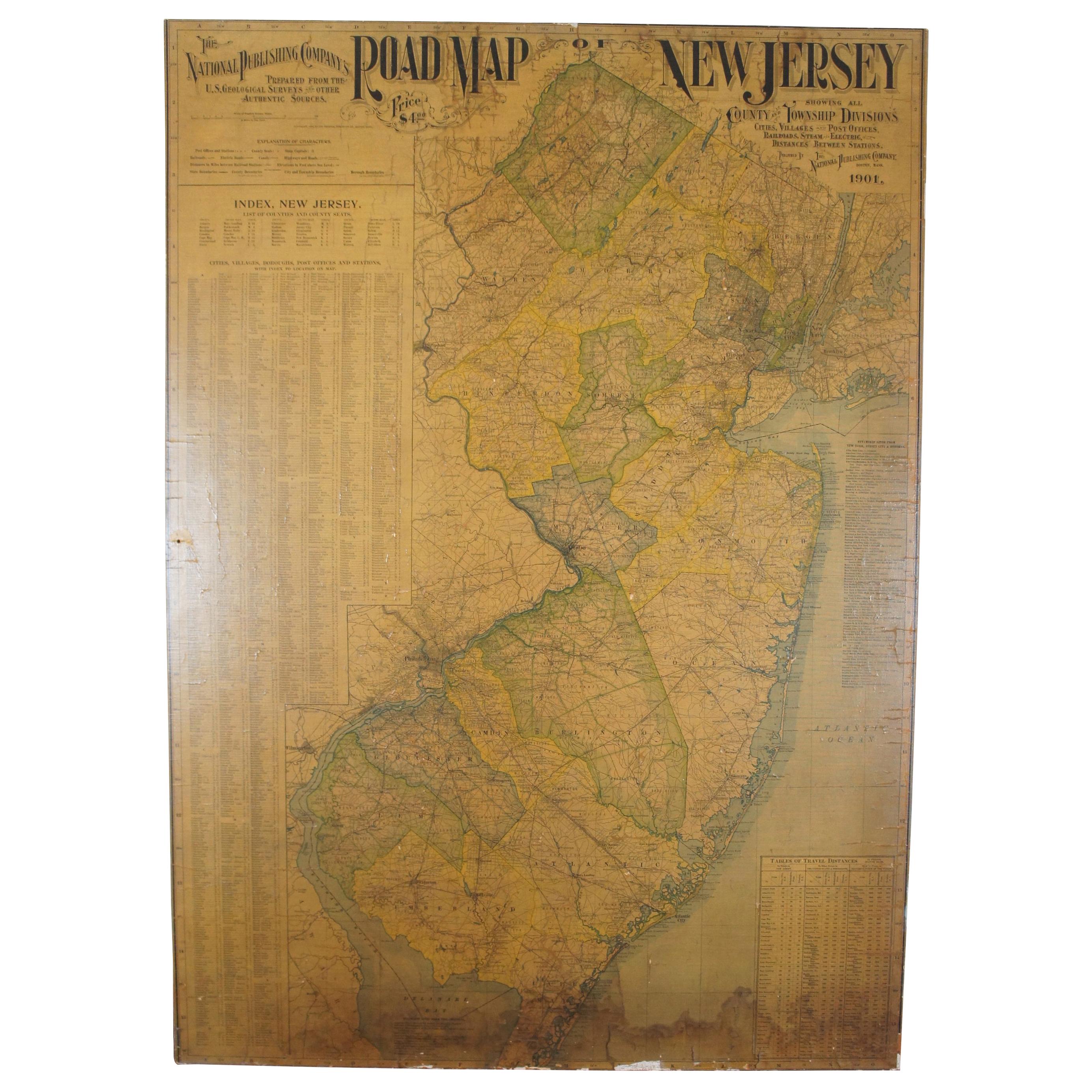
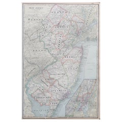
1903 Antique National Publishing Road Map of New Jersey Geological Survey
About the Item
1903 antique New Jersey road map by The National Publishing Company of Boston Massachusettes, No 384. Index for New Jersey Census 1900, Population 1,883,669. Framed in burl wood with gold accent.
Measures: map 44.5" x 32".
- Dimensions:Height: 48 in (121.92 cm)Width: 1 in (2.54 cm)Depth: 35.25 in (89.54 cm)
- Style:Victorian (Of the Period)
- Materials and Techniques:
- Period:1900-1909
- Date of Manufacture:1903
- Condition:Wear consistent with age and use. Good antique condition, map shows signs of age, some foxing, staining, creasing and tearing.
- Seller Location:Dayton, OH
- Reference Number:

About the Seller
4.9
Platinum Seller
These expertly vetted sellers are 1stDibs' most experienced sellers and are rated highest by our customers.
Established in 2010
1stDibs seller since 2020
1,109 sales on 1stDibs
Typical response time: <1 hour
- ShippingRetrieving quote...Ships From: Dayton, OH
- Return PolicyA return for this item may be initiated within 2 days of delivery.
More From This SellerView All
- Antique 1901 National Publishing Company's Road Map of New Jersey GeologicalLocated in Dayton, OHThe National Publishing Company's road map of New Jersey, showing all county and township divisions, cities villages and post-offices, railroads, ste...Category
Antique Early 1900s Victorian Prints
MaterialsPaper
- Antique Chicago Illinois National Map Commercial Rollup Classroom Census Map 47"Located in Dayton, OHAntique early to mid 20th century double sided hanging map titled the New Commercial and Census Map of Illinois, Edition 1073. Verso shows the National Map of Chicago and Suburbs - O...Category
Early 20th Century North American Maps
MaterialsPaper
- Antique 1844 J Calvin Smith JH Colton Midwest United States Survey Map 27"By J.H. ColtonLocated in Dayton, OHAntique framed black and white map of seven Midwestern American states. Guide Through Ohio, Michigan, Indiana, Illinois, Missouri, Wisco...Category
Antique 1840s Maps
MaterialsPaper
- Vintage Oversized New York City Lower Manhattan 1840s Map PrintLocated in Dayton, OHVintage late 20th century reproduction print of New York City featuring lower Manhattan in 1840.Category
Late 20th Century Victorian Maps
MaterialsPaper
- Antique 1630 Colored Belgium Map Flandria Gallica Flanders Henricus HondiusLocated in Dayton, OH"Antique hand colored map of Flanders, Belgium, circa 1630, engraved by Henricus Hondius. “Henricus Hondius II (1597 – 16 August 1651) was a Dutch eng...Category
Antique Early 17th Century Renaissance Maps
MaterialsPaper
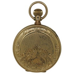
- 1888 Elgin National 14K Gold 11J Pocket Watch Brooklyn Hunt 6s 54gBy Elgin American Mfg Co.Located in Dayton, OHAntique late 1880’s pocket watch by Elgin National Watch Company. White porcelain face with black Roman numerals; second counting sub-dial with Ar...Category
Antique 1880s Victorian Collectible Jewelry
MaterialsGold


You May Also Like
- Antique Map of New JerseyLocated in Langweer, NLAntique map titled 'Colton's New Jersey'. This rare hand colored map of New Jersey is a copper plate engraving dating to 1855. Produced by the import...Category
Antique Mid-19th Century Maps
MaterialsPaper
- Antique Map of Wisconsin with Inset Geological Map of WisconsinLocated in Langweer, NLAntique map titled 'Wisconsin'. Original antique map of Wisconsin, United States. With inset geological map of Wisconsin. This print originates from '...Category
Antique Late 19th Century Maps
MaterialsPaper
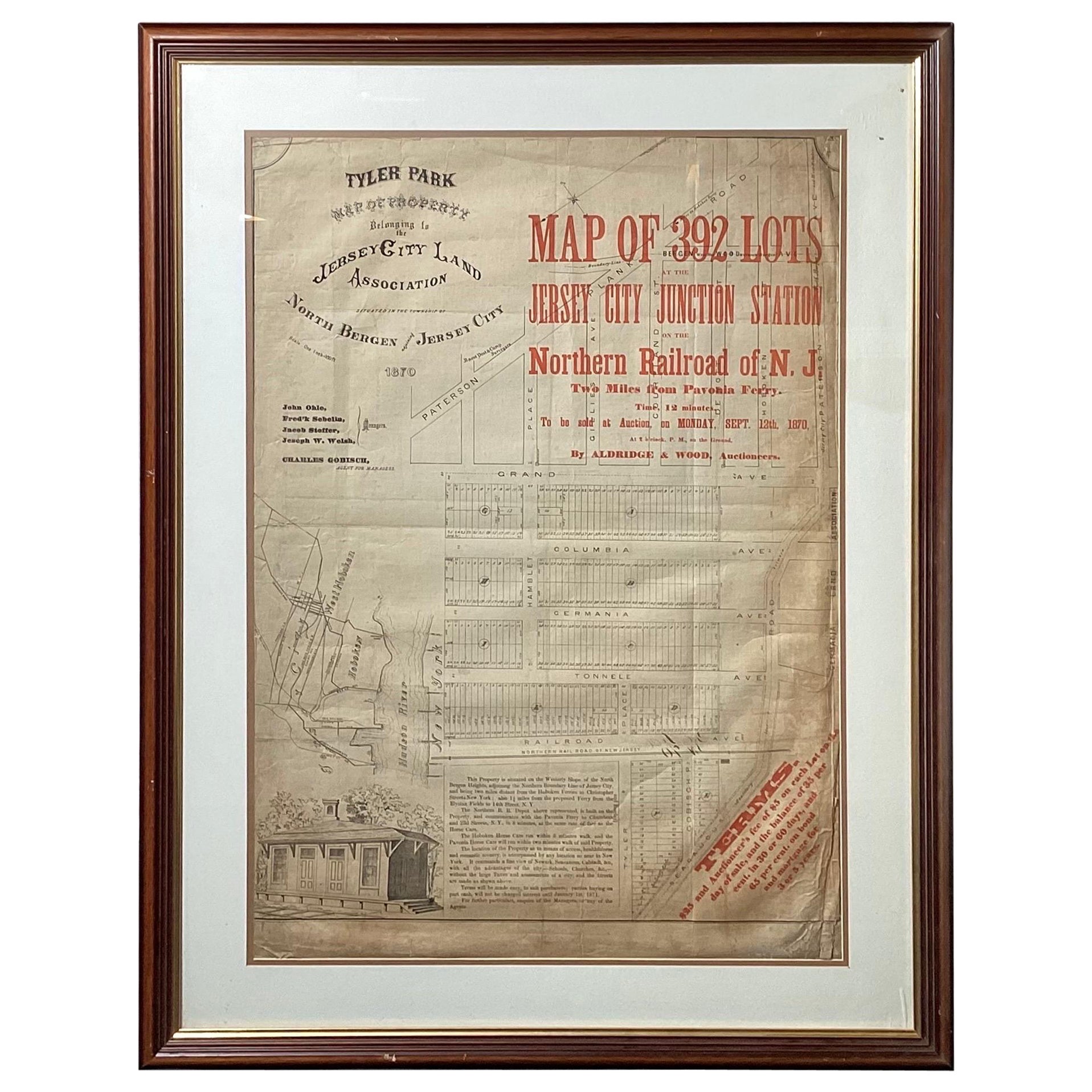
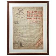
- Framed Original Land Map Survey of Tyler Park, Jersey City RailroadLocated in Lambertville, NJA framed and matted historical map of Tyler park jersey city New Jersey Railroad. The paper on canvas in later appropriate frame. Good condition with some creasing and age discolorat...Category
Antique 1870s American Posters
MaterialsCanvas, Glass, Wood
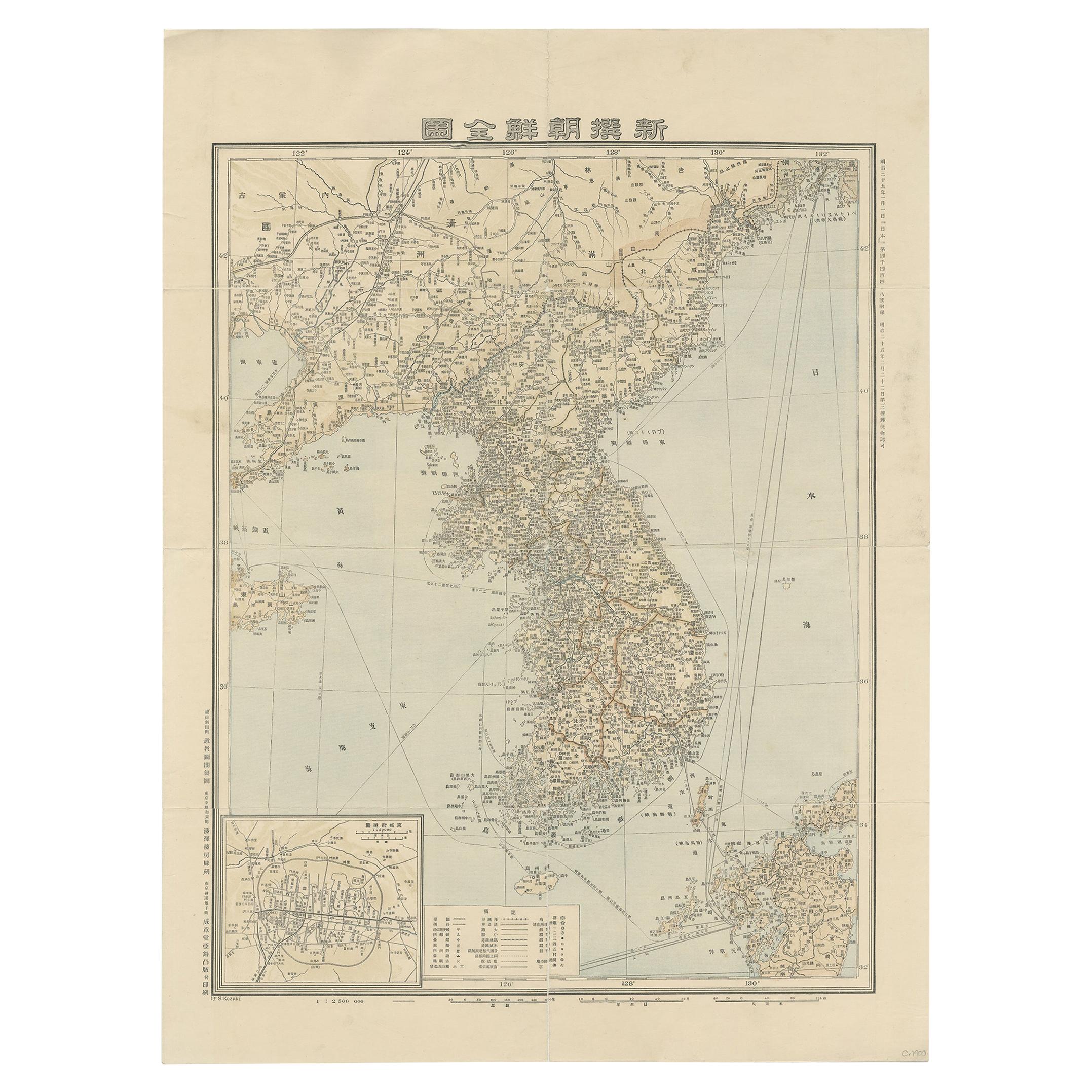
- Antique Map of Korea by Kozaki, 1903Located in Langweer, NLOld map of Korea by S. Kozaki. Restored and mounted.Category
20th Century Maps
MaterialsPaper
- Antique Geological Map of the World by Johnston '1850'Located in Langweer, NLAntique map titled 'The Geological Structure of the Globe'. Original antique geological map of the world. This map originates from 'The Physica...Category
Antique Mid-19th Century Maps
MaterialsPaper
- Large Original Antique Map of New Jersey, USA, circa 1900Located in St Annes, LancashireFabulous map of New Jersey Original color Engraved and printed by the George F. Cram Company, Indianapolis. Published, circa 1900 Unframed Repairs to minor edge tearsCategory
Antique 1890s American Maps
MaterialsPaper


Recently Viewed
View AllMore Ways To Browse
National Furniture Company
New Jersey Furniture
New Jersey Used Furniture
Antique Boston
Framed Map
Framed Maps
Gold Maps
Gold Map
Antique Map Framed
Antique Maps Framed
Antique Map Framers
Antique Framed Maps
Antique Map Framing
Framed Antique Maps
Framed Antique Map
Framing Antique Maps
Antique Map New
Antique Survey