Johannes Janssonius Maps
63
to
15
59
4
63
63
63
63
63
4
4
107
63
29
26
16
Creator: Johannes Janssonius
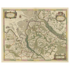
Original Antique Map of the Area of Bremen and Lower Saxony
By Johannes Janssonius
Located in Langweer, NL
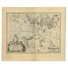
Antique map titled 'Ducatus olim Episcopatus Bremensis et ostiorum Albis et Visurgis Fluviorum novissima Descriptio'. Original old map of the area of ??Bremen and Lower Saxony. Uncom...
Category
Mid-17th Century Antique Johannes Janssonius Maps
Materials
Paper
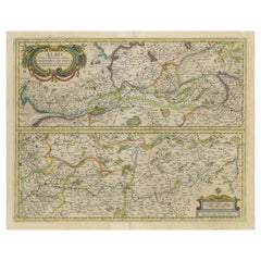
Antique Map of the of the Course of the Albis River 'or Elbe River'
By Johannes Janssonius
Located in Langweer, NL
Antique map titled 'Albis Fluvius Germaniae celebris A Fontiubus Ad Ostia, Cum Fluminibus ab utroque latere in illum fluenibus descriptus'. Detailed map of the course of the Albis Ri...
Category
Mid-17th Century Antique Johannes Janssonius Maps
Materials
Paper
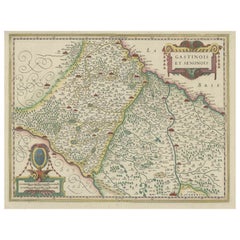
Original Antique Regional Map of France with Orleans, Auxerre and Montargis
By Johannes Janssonius
Located in Langweer, NL
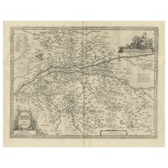
Original antique map titled 'Gastinois et Senonois'. Beautiful regional map of France. With Corbeil in the north, Pont sur Seyne in the east, Auxerre in the south, and Orleans in the...
Category
Mid-17th Century Antique Johannes Janssonius Maps
Materials
Paper
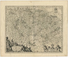
Antique Map of the Maine Region by Janssonius, 1657
By Johannes Janssonius
Located in Langweer, NL
Antique map of France titled 'Diocese du Mans vulgo le Mains'. Decorative map of the region of Maine, France. This map originates from 'Atlas Novus, Sive Theatrum Orbis Orbis Terraru...
Category
17th Century Antique Johannes Janssonius Maps
Materials
Paper
Antique Map of the Region of Sedan and Doncheri in France by Janssonius, c.1650
By Johannes Janssonius
Located in Langweer, NL
Antique map of France titled 'La Souveraineté de Sedan et de Raucourt, et la prevosté de Doncheri'. Lovely map centered on Sedan and Doncheri and the Meuze River from Charleville and...
Category
17th Century Antique Johannes Janssonius Maps
Materials
Paper
Antique Map of the Region of Touraine, France by Janssonius, 1657
By Johannes Janssonius
Located in Langweer, NL
Antique map of France titled 'Touraine - Turonensis Ducatus'. Decorative map of the Touraine region. This map originates from 'Atlas Novus, Sive Theatrum Orbis Orbis Terrarum: In quo...
Category
17th Century Antique Johannes Janssonius Maps
Materials
Paper
Antique Map of the Region of Rethel by Janssonius, 1657
By Johannes Janssonius
Located in Langweer, NL
Antique map of France titled 'Carte du Pais de Retelois'. Detailed map of the region of Rethel in the north east of France. Showing the city of Rethel, Moncornet en Tirache, Beaumont...
Category
17th Century Antique Johannes Janssonius Maps
Materials
Paper
Antique Map of the Region of Lyon by Janssonius, 1657
By Johannes Janssonius
Located in Langweer, NL
Antique map of France titled 'La Principaute de Dombes'. Detailed map of the area above Lyon. This map originates from 'Atlas Novus, Sive Theatrum Orbis Orbis Terrarum: In quo Gallia...
Category
17th Century Antique Johannes Janssonius Maps
Materials
Paper
Antique Map of the Region of Loudun and Mirebeau by Janssonius, c.1650
By Johannes Janssonius
Located in Langweer, NL
Antique map 'Loudunois Laudunum - Mirebalais'. Decorative map of the region of Loudun and Mirebeau, France. It shows the city of Moncontour, Loudun, Mirebeau and more.
Artists ...
Category
17th Century Antique Johannes Janssonius Maps
Materials
Paper
Antique Map of the Region of Perce and Blois by Janssonius, 1657
By Johannes Janssonius
Located in Langweer, NL
Antique map of France titled 'Perchensis Comitatus - Comitatus Blesensis'. Decorative map of Perce region and the region of Blois. This map originates from 'Atlas Novus, Sive Theatru...
Category
17th Century Antique Johannes Janssonius Maps
Materials
Paper
Antique Map of the Region of Guyenne by Janssonius, 1657
By Johannes Janssonius
Located in Langweer, NL
Antique map of France titled 'Description du Guienne'. Decorative map of Guyenne region. Guyenne or Guienne was an old French province which corresponded roughly to the Roman provinc...
Category
17th Century Antique Johannes Janssonius Maps
Materials
Paper
Antique Map of the Region of 'Île de France' by Janssonius, 1657
By Johannes Janssonius
Located in Langweer, NL
Antique map of France titled 'Ager Parisiensis vulgo l'Isle de France'. Old map of Paris and adjacent regions. This map originates from 'Atlas Novus, ...
Category
17th Century Antique Johannes Janssonius Maps
Materials
Paper
Antique Map of the Coast of Artois by Janssonius, 1657
By Johannes Janssonius
Located in Langweer, NL
Antique map of France titled 'Descriptio Boloniae, Pontieu'. Detailed map of the coast of Artois featuring the fortified cities of St. Valery-sur-Somme, Le Crotoy, Rue, Estaples, and...
Category
17th Century Antique Johannes Janssonius Maps
Materials
Paper
Antique Map of the Region of Périgord by Janssonius, 1657
By Johannes Janssonius
Located in Langweer, NL
Antique map of France titled 'Le Comte de Perigort'. Decorative map of the Périgord region. Périgord is a natural region and former province of France, which corresponds roughly to t...
Category
17th Century Antique Johannes Janssonius Maps
Materials
Paper
Antique Map of the Course of the Elbe River by Janssonius, c.1650
By Johannes Janssonius
Located in Langweer, NL
Antique map titled 'Nobilis Flubius Albis (..)'. Old map of the course of the Elbe river, large inset view of the city of Hamburg. Source unknown, to be determined.
Artists and En...
Category
17th Century Antique Johannes Janssonius Maps
Materials
Paper
Original Antique Map of the East Indies (Indonesia) by Janssonius, c.1644
By Johannes Janssonius
Located in Langweer, NL
Antique map titled 'India quae Orientalis dicitur, et Insulae adiacentes'. Old map of the East Indies and Southeast Asia showing the area between India in the West and parts of Japan...
Category
17th Century Antique Johannes Janssonius Maps
Materials
Paper
Antique Map of the Region of the Loire Valley by Janssonius, 1657
By Johannes Janssonius
Located in Langweer, NL
Antique map of France titled 'Aniou'. Decorative map centered on the Loire valley, France. This map originates from 'Atlas Novus, Sive Theatrum Orbis Orbis Terrarum: In quo Galliae, ...
Category
17th Century Antique Johannes Janssonius Maps
Materials
Paper
Antique Map of the City of Harlingen by Janssonius, c.1657
By Johannes Janssonius
Located in Langweer, NL
Antique map titled ‘Harlingen‘. This map depicts the city of Harlingen (Friesland, The Netherlands). Published by J. Janssonius, Amsterdam, c.1657.
Artists and Engravers: Johannes...
Category
17th Century Antique Johannes Janssonius Maps
Materials
Paper
Antique Map of the Region of Picardy by Janssonius 'c.1650'
By Johannes Janssonius
Located in Langweer, NL
Antique map of France titled 'Picardia vera et inferior'. Detailed map of the Picardy region of France. Shows the cities of Calais, Abbeville, St. Quentin, Rethel and others.
Ar...
Category
17th Century Antique Johannes Janssonius Maps
Materials
Paper
Antique Map of the Region of Saintonge by Janssonius, 1657
By Johannes Janssonius
Located in Langweer, NL
Antique map of France titled 'La Saintonge vers le Septentrion avecq le Pays d'Aulnis'. Decorative map of the Saintonge region. Includes Ile de Re, Ile d'Oleron and the cities of Nio...
Category
17th Century Antique Johannes Janssonius Maps
Materials
Paper
Antique Map of the City of Harlingen by Janssonius, c.1657
By Johannes Janssonius
Located in Langweer, NL
Antique map titled ‘Harlingen‘. This map depicts the city of Harlingen (Friesland, The Netherlands). Published by J. Janssonius, Amsterdam, c.1657.
Artists and Engravers: Johannes...
Category
17th Century Antique Johannes Janssonius Maps
Materials
Paper
Antique Map of the City of Franeker by Janssonius, 1657
By Johannes Janssonius
Located in Langweer, NL
Antique map titled ‘Franekera‘. This map depicts the city of Franeker (Friesland, The Netherlands). Published by J. Janssonius, Amsterdam, 1657.
Artists and Engravers: Johannes Jans...
Category
17th Century Antique Johannes Janssonius Maps
Materials
Paper
Antique Map of the Region of Touraine in France by Janssonius, 1657
By Johannes Janssonius
Located in Langweer, NL
Antique map titled 'Touraine - Turonensis Ducatus'.
Decorative map of the Touraine region. This map originates from 'Atlas Novus, Sive Theatrum Orbis Orbis Terrarum: In quo Galli...
Category
17th Century Antique Johannes Janssonius Maps
Materials
Paper
Antique Map of the Region of Nivernais by Janssonius, 1657
By Johannes Janssonius
Located in Langweer, NL
Antique map of France titled 'Carte du Païs et Duché de Nivernois'. Decorative map of the Nivernais region, part of Burgundy, France. This map originates from 'Atlas Novus, Sive Thea...
Category
17th Century Antique Johannes Janssonius Maps
Materials
Paper
Antique Map of the Region of Roermond by Janssonius, c.1650
By Johannes Janssonius
Located in Langweer, NL
Antique map titled 'Ducatus Gelriae'. Map of the region around Roermond, the Netherlands. This map includes the cities of Gennep, Goch, Venlo, Roermond, Maaseik, Weert, Wachtendonk a...
Category
17th Century Antique Johannes Janssonius Maps
Materials
Paper
Antique Map of the Seine-et-Marne / Champagne Region by Janssonius, 1657
By Johannes Janssonius
Located in Langweer, NL
Antique map of France titled 'Valesium Ducatus Valois'. Oriented to the north of the Picardy region with Compiegne, Senlis, Meaux, Chateau-thierry and Soissons around the perimeter. ...
Category
17th Century Antique Johannes Janssonius Maps
Materials
Paper
Antique Map of the Moluccas in Indonesia by Janssonius, C.1650
By Johannes Janssonius
Located in Langweer, NL
Antique map titled 'Insularum Moluccarum Nova Descriptio.' Old map of the Moluccas. The famous Spice Islands, the cornerstone of the Dutch trading ...
Category
17th Century Antique Johannes Janssonius Maps
Materials
Paper
Original Antique Map of the Southern Coast of France by Janssonius, 1657
By Johannes Janssonius
Located in Langweer, NL
Antique map of France titled 'Comté et Gouvernement de Provence'. Decorative map of the southern coast of France. This map originates from 'Atlas Novus,...
Category
17th Century Antique Johannes Janssonius Maps
Materials
Paper
Antique Map of the Rethelois or Rethel Region in France by Janssonius, ca.1650
By Johannes Janssonius
Located in Langweer, NL
Antique map of France titled 'Dioecese de Rheims et le Païs de Rethel'.
Detailed map, centered on the River Ayne and the River Velle and sowing Reims, Chalons, Rethel, Sedan, Cha...
Category
17th Century Antique Johannes Janssonius Maps
Materials
Paper
Antique Map of the Region of Vermandois and Cappelle, France by Janssonius, 1657
By Johannes Janssonius
Located in Langweer, NL
Antique map of France titled 'Descriptio Veromanduorum - Gouvernement de la Cappelle'. Two detailed maps of France on one sheet.
The Vermandois map is centered on the Oyse and So...
Category
17th Century Antique Johannes Janssonius Maps
Materials
Paper
Antique Map of the Region of Zutphen, Netherlands by Janssonius, c.1680
By Johannes Janssonius
Located in Langweer, NL
Antique map titled 'Ducatus Gelriae pars tertia Quae est Comitatus Zutphaniensis.'
Map of region around Zutphen in the historic Duchy Gelre in the Netherlands. Cities included in...
Category
17th Century Antique Johannes Janssonius Maps
Materials
Paper
Antique Map of the Region of Zutphen in The Netherlands by Janssonius, 1647
By Johannes Janssonius
Located in Langweer, NL
Antique map titled 'Ducatus Gelriae pars tertia Quae est Comitatus Zutphaniensis'. Antique map of the region of Zutphen, Gelderland, the Netherlands. This map originates from 'Atlas ...
Category
17th Century Antique Johannes Janssonius Maps
Materials
Paper
Antique Map of the East Indies by Janssonius, c.1644
By Johannes Janssonius
Located in Langweer, NL
Antique map titled 'India quae Orientalis dicitur, et Insulae adiacentes'. Old map of the East Indies and Southeast Asia showing the area between India in the West and parts of Japan...
Category
17th Century Antique Johannes Janssonius Maps
Materials
Paper
Antique Map of the Region of Sarlat in France by Janssonius, 1657
By Johannes Janssonius
Located in Langweer, NL
Antique map of France titled 'Le Diocese de Sarlat dioccesis Sarlatensis'. Decorative map of the Sarlat region, part of the Dordogne department. This map originates from 'Atlas Novus...
Category
17th Century Antique Johannes Janssonius Maps
Materials
Paper
North & South America: A 17th Century Hand-colored Map by Jansson & Goos
By Johannes Janssonius
Located in Alamo, CA
A 17th century hand-colored map of North & South America entitled "Americae Descriptio" by the cartographer Johannes Jansson, published in Jansson's Atlas Minor in Amsterdam in 1628....
Category
1620s Dutch Antique Johannes Janssonius Maps
Materials
Paper
Antique Map of the Region of Pays de Caux by Janssonius, 1657
By Johannes Janssonius
Located in Langweer, NL
Antique map 'Le Pais de Caux'. Decorative map of the region of Pays de Caux, France. This map originates from 'Atlas Novus, Sive Theatrum Orbis Orbis Terrarum: In quo Galliae, Helvet...
Category
Mid-17th Century Antique Johannes Janssonius Maps
Materials
Paper
"Nova Barbariae Descriptio", a 17th Century Hand-Colored Map of North Africa
By Johannes Janssonius
Located in Alamo, CA
This original attractive 17th century hand-colored map of North Africa entitled "Nova Barbariae Descriptio" by Johannes Janssonius was published in Paris in 1635. It includes the Med...
Category
Mid-17th Century Dutch Antique Johannes Janssonius Maps
Materials
Paper
Antique Map of the Region of Lake Geneva by Janssonius '1657'
By Johannes Janssonius
Located in Langweer, NL
Antique map 'Das Wiflispur Gergow'. Detailed map of Switzerland showing Waadt and the Lake of Geneva and the city of Geneva, Fribourg and partly Bern. This map originates from 'Atlas...
Category
Mid-17th Century Antique Johannes Janssonius Maps
Materials
Paper
Prussia, Poland, N. Germany, Etc: A Hand-colored 17th Century Map by Janssonius
By Johannes Janssonius
Located in Alamo, CA
This is an attractive hand-colored copperplate engraved 17th century map of Prussia entitled "Prussia Accurate Descripta a Gasparo Henneberg Erlichensi", published in Amsterdam by Joannes Janssonius in 1664. This very detailed map from the golden age of Dutch cartography includes present-day Poland, Latvia, Lithuania, Estonia and portions of Germany. This highly detailed map is embellished by three ornate pink, red, mint green and gold...
Category
Mid-17th Century Dutch Antique Johannes Janssonius Maps
Materials
Paper
Antique Map of Île de Ré and Île d'Oléron by Janssonius, 1657
By Johannes Janssonius
Located in Langweer, NL
Antique map 'Insulae Divimartini et Vliarus vulgo l'isle de Re et Oleron'. Decorative map of Île de Ré and Île d'Oléron. This map originates from 'Atlas Novu...
Category
Mid-17th Century Antique Johannes Janssonius Maps
Materials
Paper
17th Century Hand-Colored Map of a Region in West Germany by Janssonius
By Johannes Janssonius
Located in Alamo, CA
This attractive highly detailed 17th century original hand-colored map is entitled "Archiepiscopatus Maghdeburgensis et Anhaltinus Ducatus cum terris adjacentibus". It was published ...
Category
Mid-17th Century Dutch Antique Johannes Janssonius Maps
Materials
Paper
Antique Map of the Region of Vermandois and Cappelle by Janssonius, circa 1650
By Johannes Janssonius
Located in Langweer, NL
Antique map of France titled 'Descriptio Veromanduorum - Gouvernement de la Cappelle'. Two detailed maps of France on one sheet. The Vermandois map is centered on the Oyse and Somme ...
Category
Mid-17th Century Antique Johannes Janssonius Maps
Materials
Paper
Antique Map of the Region of Touraine by Janssonius 'circa 1650'
By Johannes Janssonius
Located in Langweer, NL
Antique map of France titled 'Touraine - Turonensis Ducatus'. Decorative map of the Touraine region, France. It shows the cities of Tours, Amboise and others. Published by J. Jansson...
Category
Mid-17th Century Antique Johannes Janssonius Maps
Materials
Paper
Antique Map of the Region of Bretagne by Janssonius '1657'
By Johannes Janssonius
Located in Langweer, NL
Antique map 'Duche de Bretaigne'. Detailed map of Bretagne, France. With decorative cartouches for the title, key and scale, a large armorial and several vignette galleons. This map ...
Category
Mid-17th Century Antique Johannes Janssonius Maps
Materials
Paper
Antique Map of the Region of Maine by Janssonius, circa 1650
By Johannes Janssonius
Located in Langweer, NL
Antique map of France titled 'Diocese du Mans vulgo le Mains'. Decorative map of the region of Maine, France. Published by J. Janssonius.
Category
Mid-17th Century Antique Johannes Janssonius Maps
Materials
Paper
Antique Map of the Region of 'Île de France' by Janssonius, circa 1650
By Johannes Janssonius
Located in Langweer, NL
Antique map of France titled 'Le Gouvernement de L'Isle de France'. Paris is represented by a miniature plan of the city, making it distinct from the other towns of the region which ...
Category
Mid-17th Century Antique Johannes Janssonius Maps
Materials
Paper
Antique Map of the Vermandois Region by Janssonius, circa 1650
By Johannes Janssonius
Located in Langweer, NL
Antique map titled 'Vermandois'. Old map of the Vermandois region, France. Vermandois was a French County that appeared in the Merovingian period. Its na...
Category
Mid-17th Century Antique Johannes Janssonius Maps
Materials
Paper
Antique Map of the Region of Saintonge by Janssonius, 1657
By Johannes Janssonius
Located in Langweer, NL
Antique map 'La Saintonge vers le Midy avecq le Brovageais'. Decorative map of the Saintonge region, a former province of France located on the west central Atlantic coast. This map ...
Category
Mid-17th Century Antique Johannes Janssonius Maps
Materials
Paper
Antique Map of the Hainaut and Namur Region by Janssonius, 'circa 1640'
By Johannes Janssonius
Located in Langweer, NL
Antique map titled 'Comitatuum Hannoniae et Namurci Descriptio'. Old map of the region of Hainaut and Namur, France. Published by J. Janssonius, circa 1640.
Category
Mid-17th Century Antique Johannes Janssonius Maps
Materials
Paper
Antique Map of the Region of Blois by Janssonius, 'circa 1640'
By Johannes Janssonius
Located in Langweer, NL
Antique map titled 'Description du Blaisois'. Old map of the region of Blois, France. It shows the city of Blois, Amboise, the Loire River and more. Published by J. Janssonius, circa...
Category
Mid-17th Century Antique Johannes Janssonius Maps
Materials
Paper
Antique Map of the Region of Picardy by Janssonius, 1657
By Johannes Janssonius
Located in Langweer, NL
Antique map of France titled 'Picardia vera et inferior'. Detailed map of the Picardy region of France. This map originates from 'Atlas Novus, Sive Theatrum Orbis Orbis Terrarum: In ...
Category
Mid-17th Century Antique Johannes Janssonius Maps
Materials
Paper
Antique Map of the Region of Charolais by Janssonius, 1657
By Johannes Janssonius
Located in Langweer, NL
Antique map 'Les environs de L'Estang de Longpendu, comprenant une grande partie du Comté de Charolois'. Decorative map of the Charolais region. This map originates from 'Atlas Novus...
Category
Mid-17th Century Antique Johannes Janssonius Maps
Materials
Paper
Antique Map of Beauce by Janssonius, 1657
By Johannes Janssonius
Located in Langweer, NL
Antique map 'Belsia vulgo la Beausse'. Decorative map of the region of Beauce, a natural region in northern France, located between the Seine and Loire rivers. This map originates fr...
Category
Mid-17th Century Antique Johannes Janssonius Maps
Materials
Paper
Antique Map of the Region of Lyonnais by Janssonius, '1657'
By Johannes Janssonius
Located in Langweer, NL
Antique map 'Lionnois, forest, beauviolois et masconnois'. Decorative map of the Lyonnais region, France. The Lyonnais is a historical province of France which owes its name to the c...
Category
Mid-17th Century Antique Johannes Janssonius Maps
Materials
Paper
Antique Map of the Region of Aargau by Janssonius, '1657'
By Johannes Janssonius
Located in Langweer, NL
Antique map 'Argow cum parte merid. Zurichgow'. Detailed map of Switzerland showing Aargau with the southern part of Zürich. This map originates from 'Atlas Novus, Sive Theatrum Orbi...
Category
Mid-17th Century Antique Johannes Janssonius Maps
Materials
Paper
Antique Map of Northern Switzerland by Janssonius '1657'
By Johannes Janssonius
Located in Langweer, NL
Antique map 'Zurichgow et Basiliensis provincia'. Detailed map of northern Switzerland, including Zurich and Basel. This map originates from 'Atlas Novus, Sive Theatrum Orbis Orbis T...
Category
Mid-17th Century Antique Johannes Janssonius Maps
Materials
Paper
Antique Map of the Region of Aiguillon by Janssonius, 1657
By Johannes Janssonius
Located in Langweer, NL
Antique map 'Le Duche d'Aiguillon'. Decorative map of the Aiguillon region, France. Located at the confluence of the Lot and Garonne rivers. The map is based on the cartography of Pi...
Category
Mid-17th Century Antique Johannes Janssonius Maps
Materials
Paper
Antique Map of the North-Western Part of France by Janssonius (c.1657)
By Johannes Janssonius
Located in Langweer, NL
Antique map of France titled 'Le Gouvernement de Calais'. Attractive map of the north-western part of France including the towns of Calais, Gravelines. This map originates from 'Atla...
Category
Mid-17th Century Antique Johannes Janssonius Maps
Materials
Paper
Johannes Janssonius maps for sale on 1stDibs.
Johannes Janssonius maps are available for sale on 1stDibs. These distinctive items are frequently made of paper and are designed with extraordinary care. There are many options to choose from in our collection of Johannes Janssonius maps, although beige editions of this piece are particularly popular. If you’re looking for additional options, many customers also consider maps by Johannes Nieuhof, Isaak Tirion, and Pieter Van Der Aa. Prices for Johannes Janssonius maps can differ depending upon size, time period and other attributes — on 1stDibs, these items begin at $320 and can go as high as $2,286, while a piece like these, on average, fetch $490.
