School Map
3
458
83
6
to
36
309
213
545
476
488
61
47
8
7
5
5
4
2
1
1
1
89
106
262
89
34
141
61
2
3
10
20
14
25
36
18
4
1
305
173
152
85
57
214
142
139
82
28
42
39
12
9
8
Sort By
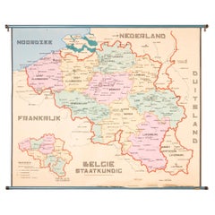
XL Old School Map of Belgium 'Printed by Procure', 1950s
Located in Oostende, BE
XL Old school map of Belgium (Printed by Procure). Presumably from around 1950-1960.
Category
Vintage 1950s Belgian Mid-Century Modern Maps
Materials
Metal
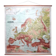
Vintage Swedish School Map of Europe, Large, Made in Sweden, 1905
Located in Los Angeles, CA
Vintage Swedish School Map of Europe - LARGE - Made in Sweden, 1905
This vintage Swedish school
Category
Antique Early 1900s Swedish Maps
Materials
Linen, Wood, Paper
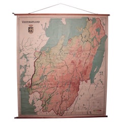
Vintage Swedish School Map of Vastergötland, Made in Sweden 1920
Located in Los Angeles, CA
Vintage Swedish School Map of Vastergötland, Made in Sweden 1920
Västergötland also known as
Category
Vintage 1920s Swedish Maps
Materials
Linen, Wood, Paper
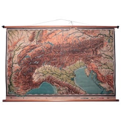
Vintage Swedish Topographic School Map of European Alps, Made in Sweden 1922
Located in Los Angeles, CA
Vintage Swedish Topographic School map of European Alps, Made in Sweden 1922
This vintage
Category
Vintage 1920s Swedish Maps
Materials
Linen, Wood, Paper
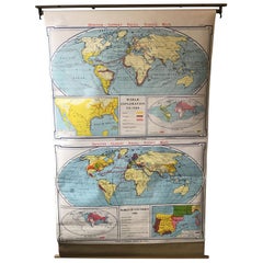
1967 World Exploration School Map
Located in Tarrytown, NY
Pull down world exploration map from 1967.
Category
Vintage 1960s Maps
Materials
Paper
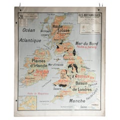
French School Map of Uk, Double-Sided
Located in Alton, GB
Map of the UK in french made for schools from the 20th century.
Category
20th Century Maps
Materials
Paper
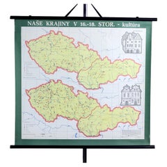
Vintage School Map of Czechoslovakia, 1960s
Located in Zohor, SK
This is a great vintage school map produced in Czechoslovakia by Skolske pomucky n.p., which was a
Category
Vintage 1960s Slovak Mid-Century Modern Posters
Materials
Paper
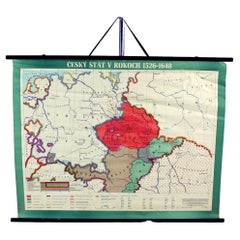
Vintage School Map Of Czech State, Czechoslovakia 1960s
Located in Zohor, SK
This is a great vintage school map of "Czech State1526-1648". The map was produced by a National
Category
Vintage 1960s Czech Mid-Century Modern Prints
Materials
Wood, Paper
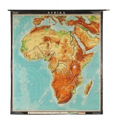
Large Africa School Map, circa 1950
Located in Meulebeke, BE
Geographical vintage school wall card Africa. The school poster is in a good vintage condition with
Category
Vintage 1950s German Mid-Century Modern Posters
Materials
Canvas, Wood, Paper
School Chart or Pull Down Map of Geography of the Netherlands, 1950s
Located in Hemiksem, VAN
A beautiful old school map of the Netherlands, painted on linen. The map shows the 3 different
Category
Vintage 1950s Belgian Mid-Century Modern Maps
Materials
Linen, Paint
Vintage Anatomical Schoolmap, Skeleton School Chart, Vintage German School Map
Located in ROTTERDAM, ZH
What an eyecatcher. This beautiful linen anatomical map is a must have for everybody who loves
Category
Vintage 1950s German Bohemian Posters
Materials
Linen
H 78.75 in W 36.62 in D 0.4 in
Antique Map of France from an Old Dutch School Atlas, 1852
Located in Langweer, NL
Antique map titled 'Frankrijk'. Map of France. This map originates from 'School-Atlas van alle
Category
Antique 19th Century Maps
Materials
Paper
Antique Map of Europe from an Old Dutch School-Atlas, 1852
Located in Langweer, NL
Antique map titled 'Europa'. Map of Europe. This map originates from 'School-Atlas van alle deelen
Category
Antique 19th Century Maps
Materials
Paper
Antique Map of Asia from a German School Atlas, c.1870
Located in Langweer, NL
Antique map titled 'Asien'. Old map of the Asian continent. This map originates from 'H. Kiepert's
Category
Antique 19th Century Maps
Materials
Paper
Antique Map of Greece from an Old French School Atlas, 1880
Located in Langweer, NL
Antique map titled 'Grèce Moderne '. Old map of Greece and surroundings. This map originates from
Category
Antique 19th Century Maps
Materials
Paper
Original Antique Map of Austria from an Old Dutch School Atlas, 1852
Located in Langweer, NL
Antique map titled 'Het Keizerrijk Oostenrijk'.
Map of the Austrian Empire. This map originates
Category
Antique 1850s Maps
Materials
Paper
Antique Map of North America from an Old Dutch School Atlas, 1852
Located in Langweer, NL
Antique map titled 'Noord-Amerika'. Map of North America. This map originates from 'School-Atlas
Category
Antique 19th Century Maps
Materials
Paper
Antique Map of the Asian Continent from a German School Atlas, 1862
Located in Langweer, NL
Antique map titled 'Asien Politische Ubersicht'. Old map of the Asian continent. Originates from
Category
Antique 19th Century Maps
Materials
Paper
Antique Map of Germany and Switzerland from an Old Dutch School Atlas, 1852
Located in Langweer, NL
Antique map titled 'Duitschland en Zwitersland'. Map of Germany and Switzerland. This map
Category
Antique 19th Century Maps
Materials
Paper
H 10.63 in W 13.59 in D 0 in
Antique Map of Germany and Switzerland from an Old Dutch School Atlas, c.1873
Located in Langweer, NL
map originates from 'School-Atlas van alle Deelen der Aarde'. Artists and Engravers: Published by O
Category
Antique 19th Century Maps
Materials
Paper
H 12.88 in W 10.32 in D 0 in
Antique Map of Saxony, Germany
Located in Langweer, NL
Original antique map titled 'Circulus Saxoniae Superioris'. Original antique map of Saxony, Germany
Category
Antique Early 18th Century Maps
Materials
Paper
Antique Map of Greece with an Inset Map of the Upper Danube Region, c.1720
Located in Langweer, NL
cities, school atlases and an Atlas of Silesia in 1750 with 20 maps.
Artist: Made by 'Homann Heirs
Category
Antique 18th Century Maps
Materials
Paper
H 21.07 in W 25.2 in D 0 in
Antique Map of Turkey and Greece, 1852
Located in Langweer, NL
Antique map titled 'Europisch Turkije en Griekenland'. Map of Turkey in Europe and Greece. This map
Category
Antique 19th Century Maps
Materials
Paper
Antique Map of Overijssel by Bachiene, 1758
Located in Langweer, NL
Geography at the 'Illustere School'. This map was engraved by Jacobus Harrewijn-Harrewyn (1660-1727) after I
Category
Antique 18th Century Maps
Materials
Paper
Antique Map of the Netherlands by Petri, 1852
Located in Langweer, NL
map originates from 'School-Atlas van alle deelen der Aarde' by Otto Petri.
Artists and Engravers
Category
Antique 19th Century Maps
Materials
Paper
1858 Colton's Map of New York, Ric.B011
Located in Norton, MA
An 1858 Colton's map of New York
Ric.b011
Colton’s New York, 1858 - A large original color
Category
Antique 19th Century Unknown Maps
Materials
Paper
Charming Scarce Small Antique Map of Asia, 1837
Located in Langweer, NL
Antique map titled ‘Asia‘. Scarce and charming little mid-19th century antique map of Asia
Category
Antique 19th Century Maps
Materials
Paper
Antique Map of South America by Petri, 1852
By Thomas Kitchin
Located in Langweer, NL
Antique map titled 'Zuid-Amerika'. Map of South America. This map originates from 'School-Atlas van
Category
Antique 19th Century Maps
Materials
Paper
Antique Map of Southern Palestine by Bachiene, 1763
Located in Langweer, NL
"Antique map of the south part of Palestine. This simplified map shows the most important cities of
Category
Antique 18th Century Maps
Materials
Paper
Antique Map of the United Kingdom and Ireland, 1852
Located in Langweer, NL
Antique map titled 'Groot-Brittanje en Ierland'. Map of the United Kingdom and Ireland. This map
Category
Antique 19th Century Maps
Materials
Paper
Antique Mercator Projection World Map by Petri, c.1873
Located in Langweer, NL
Antique world map titled 'Wereldkaart naar Mercator's Projectie'. Old map of the world. This map
Category
Antique 19th Century Maps
Materials
Paper
Antique Map of Africa with European Language Borders, 1852
Located in Langweer, NL
Antique map titled 'Afrika'. Map of Africa. This map originates from 'School-Atlas van alle deelen
Category
Antique 19th Century Maps
Materials
Paper
Antique Map of Italy with Hand-Colored Borders, 1852
Located in Langweer, NL
Antique map titled 'Italië'. Map of Italy. This map originates from 'School-Atlas van alle deelen
Category
Antique 19th Century Maps
Materials
Paper
Antique Map of the Jewish Land by Lindeman, 1761
Located in Langweer, NL
Antique map titled 'De VIde Landkaart Verbeeldende Het Joodsche Land (..).' Map of the Jewish Land
Category
Antique 18th Century Maps
Materials
Paper
Antique Map of Asia Showing Its Political Divisions, 1874
Located in Langweer, NL
company had specialized in the production of school atlases and wall maps of America. They were one of the
Category
Antique 19th Century Maps
Materials
Paper
Antique Map of South America by Petri, c.1873
By Thomas Kitchin
Located in Langweer, NL
highland of Quito. This map originates from 'School-Atlas van alle Deelen der Aarde'. Artists and Engravers
Category
Antique 19th Century Maps
Materials
Paper
Antique Map of Russia and Poland by Petri, 1852
Located in Langweer, NL
Antique map titled 'Europeesch Rusland en Polen'. Map of Russia in Europe and Poland. This map
Category
Antique 19th Century Maps
Materials
Paper
Antique Map of Northern Germany by Petri, c.1873
Located in Langweer, NL
Antique map titled 'Noord-Duitschland'. Old map depicting northern Germany. This map originates
Category
Antique 19th Century Maps
Materials
Paper
Antique Map of the Austrian Empire by Petri, 1852
Located in Langweer, NL
Antique map titled 'Het Keizerrijk Oostenrijk'. Map of the Austrian Empire. This map originates
Category
Antique 19th Century Maps
Materials
Paper
Antique Map of Spain and Portugal by Petri, 1852
Located in Langweer, NL
Antique map titled 'Spanje en Portugal'. Map of Spain and Portugal. This map originates from
Category
Antique 19th Century Maps
Materials
Paper
Antique Map of Sweden and Norway by Petri, 1852
Located in Langweer, NL
Antique map titled 'Zweden en Noorwegen'. Map of Sweden and Norway. This map originates from
Category
Antique 19th Century Maps
Materials
Paper
Antique Map of Spain and Portugal by Thomson, 1815
Located in Langweer, NL
Antique map titled 'Spain & Portugal.' Map of Spain and Portugal. From Thomson's 'New General Atlas
Category
Antique 19th Century Maps
Materials
Paper
Antique Decorative Coloured Map Egypt, Nubia, Abyssinia and more, 1882
Located in Langweer, NL
This image contains two maps, with the left one being labeled "Egypt" and the right one "Nubia
Category
Antique 1880s Maps
Materials
Paper
Free Shipping
H 14.97 in W 22.45 in D 0 in
Antique Map of Turkey and Greece by Petri, c.1873
Located in Langweer, NL
Greece. This map originates from 'School-Atlas van alle Deelen der Aarde'.
Artists and Engravers
Category
Antique 19th Century Maps
Materials
Paper
Antique Map of the United Kingdom and Ireland, c.1873
Located in Langweer, NL
, with inset maps of London and factory districts of the UK. This map originates from 'School-Atlas van
Category
Antique 19th Century Maps
Materials
Paper
FRAME DRIVING SCHOOL 70 S 20th Century
By Europa Antiques
Located in Madrid, ES
Large Globe 50S
THE GLOBE IS IN PLASTIC AND THE FOOT IN WOOD. 1950s. IT HAS LIGHT. GOOD CONDITION WITH CENTURIES OF USE. MEASUREMENTS: 110 CM IN HEIGHT AND 60 CM IN DIAMETER
good con...
Category
20th Century English Modern Maps
Materials
Plastic, Wood
Antique Map of Denmark with An Inset of Iceland, 1852
Located in Langweer, NL
Antique map titled 'Denemarken'. Map of Denmark, with a small inset map of Iceland. This map
Category
Antique 19th Century Maps
Materials
Paper
Antique Map of Vlaams-Brabant by Homann Heirs, c.1720
By Homann Heirs
Located in Langweer, NL
Antique map titled 'Ducatus Brabantiae Nova Tabula in qua (..).' Fully engraved copper plate map
Category
Antique 18th Century Maps
Materials
Paper
Antique Map of the Kingdom of Prussia by Petri, 1852
Located in Langweer, NL
Antique map titled 'Het Koningrijk Pruissen'. Map of the Kingdom of Prussia. This map originates
Category
Antique 19th Century Maps
Materials
Paper
Rare Original Double Hemisphere World Map with Allegorical Figures, 1785
Located in Langweer, NL
Antique map titled 'Nieuwe en Naukeurige Kaart der Gantsche bekende Werreld.'
A double
Category
Antique 1780s Maps
Materials
Paper
H 17.05 in W 23.23 in D 0 in
Antique Map of Ancient Persia, Assyria and surroundings, c.1760
Located in Langweer, NL
Antique map titled 'De XII de Landkaart vertoonende de Landen der Assyrische, Babylonische
Category
Antique 18th Century Maps
Materials
Paper
Antique Map of the Seventeen Provinces by Homann Heirs, 1748
By Homann Heirs
Located in Langweer, NL
cities, school atlases and an Atlas of Silesia in 1750 with 20 maps.
Condition: Good, general age
Category
Antique 18th Century Maps
Materials
Paper
Antique Map of Russia in Europe by Petri, c.1873
Located in Langweer, NL
Antique map titled 'Rusland in Europa'. Old map depicting Russia in Europe. This map originates
Category
Antique 19th Century Maps
Materials
Paper
Antique Map of Spain and Portugal by Petri, c.1873
Located in Langweer, NL
Antique map titled 'Spanje en Portugal'. Old map depicting Spain and Portugal. This map originates
Category
Antique 19th Century Maps
Materials
Paper
Antique Map of Sweden and Norway by Petri, c.1873
Located in Langweer, NL
Antique map titled 'Zweden en Noorwegen'. Old map depicting Sweden and Norway. This map originates
Category
Antique 19th Century Maps
Materials
Paper
Antique Map of the Austrian Empire by Petri, c.1873
Located in Langweer, NL
Antique map titled 'Het Keizerrijk Oostenrijk'. Old map depicting the Austrian Empire. This map
Category
Antique 19th Century Maps
Materials
Paper
Antique Map of Flanders, Belgium by Homann Heirs, c.1735
Located in Langweer, NL
Antique map titled 'Comitatus Flandriae in omnes ejusdem subjecentes Ditioes (..).' Original
Category
Antique 18th Century Maps
Materials
Paper
Antique Map of Belgium and Luxembourg by Homann Heirs, 1747
Located in Langweer, NL
Antique map titled 'Belgium Catholicum seu Decem provinciae Germaniae Inferioris cum confiniis
Category
Antique 18th Century Maps
Materials
Paper
Antique Map of Belgium and Luxembourg by Homann Heirs, 1747
Located in Langweer, NL
Antique map titled 'Belgium Catholicum seu Decem provinciae Germaniae Inferioris cum confiniis
Category
Antique 18th Century Maps
Materials
Paper
Antique Map of Northern Italy by Homann Heirs, c.1730
Located in Langweer, NL
Antique map titled 'Domini Veneti cum vicinis Parmae Mutinae, Matuae et Mirandol (..).' Detailed
Category
Antique 18th Century Maps
Materials
Paper
- 1
Get Updated with New Arrivals
Save "School Map", and we’ll notify you when there are new listings in this category.
School Map For Sale on 1stDibs
Find many varieties of an authentic school map available at 1stDibs. Each school map for sale was constructed with extraordinary care, often using paper, wood and fabric. Whether you’re looking for an older or newer school map, there are earlier versions available from the 19th Century and newer variations made as recently as the 20th Century. A school map is a generally popular piece of furniture, but those created in Mid-Century Modern, Industrial and Art Deco styles are sought with frequency. Many designers have produced at least one well-made school map over the years, but those crafted by Jung Koch Quentell, Denoyer-Geppert and Dr. Friedrich Quentell are often thought to be among the most beautiful.
How Much is a School Map?
The average selling price for a school map at 1stDibs is $498, while they’re typically $240 on the low end and $3,750 for the highest priced.
More Ways To Browse
Large Vintage Wooden Chest
Large Wooden Chest Vintage
Antique Blue Glass Table Top
8ft Table
Antique Swedish Plates
Santa Fe Antique
Southwestern Antiques
East German Light
German Putti
Antique Mexican Table
Antique Japanese Decorative Plate
West Indies Table
Small Decorative Antique Swedish
Samuel Lines
Vintage Treasure Island
Small Wooden Retro Chest
16th Century Angel
4ft Table
