Old World Maps
7
to
87
991
248
434
423
274
260
185
154
140
61
36
34
30
29
29
26
26
26
25
23
23
20
18
14
12
10
10
9
9
7
7
7
7
7
5
5
5
4
4
3
3
3
3
3
3
3
3
3
2
2
2
2
2
1
1
1
1
1
42
42
32
23
19
Sort By
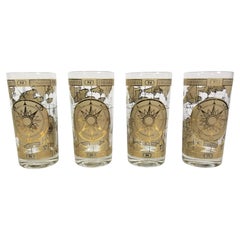
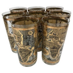
Cera Glassware Barware Old World Map Mid Century
By Cera
Located in New York, NY
Mid Century 1970s Cera Glassware Barware. Old World Map Design. Set of 4.
Category
Mid-20th Century Barware
Materials
Glass
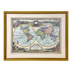
Double Hemisphere Old World Map Print, Matted & Framed
Located in Plainview, NY
A double hemisphere old world map print. The map is a reproduction of the original of the 1788 Mapa
Category
20th Century Landscape Prints
Materials
Paper
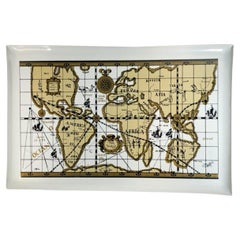
Vintage Cera "Old World Map" Pattern, Companion Serving Tray
Located in Nantucket, MA
Glassware "Old World Map" barware having an image of an antique style world map in tans and gold on a white
Category
Mid-20th Century American Mid-Century Modern Barware
Materials
Plastic
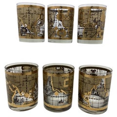
Set of 6 Cera Old World Map Double Rocks Glasses
By Cera
Located in Chapel Hill, NC
Set of 6 Cera Old World Map Double Rocks Glasses. These glasses are larger than rerocks glasses
Category
Mid-20th Century American Mid-Century Modern Barware
Materials
Glass
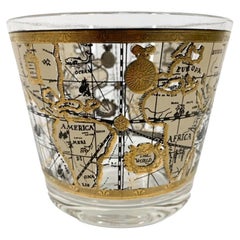
Vintage Cera Glassware Ice Bowl in the Old World Map Pattern
Located in Nantucket, MA
Mid-Century Modern ice bowl by Cera in the Old World Map pattern, with a map designed to look like
Category
Mid-20th Century American Mid-Century Modern Barware
Materials
Glass
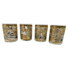
Vintage Set of 4, Cera Old World Map Pattern Double Rocks Glasses
Located in Nantucket, MA
Set of 4 mid-century modern rocks glasses by Cera in the Old World Map pattern, with a map designed
Category
Mid-20th Century American Mid-Century Modern Barware
Materials
Glass
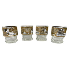
Vintage Set of 4 Cera Old World Map Stacking, Footed Rocks Glasses
Located in Nantucket, MA
Set of 4 Mid-Century Modern stacking / footed rocks glasses by Cera in the Old World Map pattern
Category
Mid-20th Century American Mid-Century Modern Barware
Materials
Glass
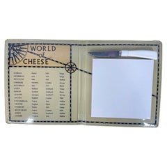
Vintage Cera Old World Map, Book Form Cheese Board, World of Cheese
Located in Nantucket, MA
to the Cera Glassware "Old World Map" pattern barware. The folding, vinyl clad book has an 'antique
Category
Mid-20th Century American Mid-Century Modern Barware
Materials
Stainless Steel
Vintage Cera Glass Highball Glasses With Old World Maps - Set of 8
By Cera
Located in Chapel Hill, NC
Set of 8 Vintage Cera Glass Highball Glasses With Old World Maps. Glasses measure 5 1/2" tall x 2 3
Category
Vintage 1970s Mid-Century Modern Barware
Materials
Glass
Set of 8 Vintage Highball Glasses by Cera in the Old World Map Pattern
Located in Nantucket, MA
Set of 8 Mid-Century Modern highball glasses by Cera in the Old World Map pattern, with a map
Category
Mid-20th Century American Mid-Century Modern Barware
Materials
Glass
Vintage Vinyl Clad Cheese Board with Old World Map Ceramic Tile Cutting Surface
Located in Nantucket, MA
mad to compliment the Cera Glassware Old World Map barware pattern, decorated with an antique style
Category
Mid-20th Century American Mid-Century Modern Barware
Materials
Ceramic, Plastic
H 2.5 in W 15 in D 10 in
Labarge Campaign Mahogany and Brass Mounted Coffee Table With Old World Map Top
By LaBarge
Located in South Bend, IN
mounted mahogany, with old world map under a glass top.
Measures: 52.25"W x 27.25"D x 16"H.
Good
Category
Mid-20th Century American Campaign Coffee and Cocktail Tables
Materials
Brass
H 16 in W 52.25 in D 27.25 in
6 Vintage Old World Map Highball Glasses with a Circular Vinyl Caddy
Located in Nantucket, MA
6 Vintage highball glasses by Cera Glassware decorated with an old world style map in tans and gold
Category
Mid-20th Century American Mid-Century Modern Barware
Materials
Glass
Vintage Cera Glassware Cocktail Pitcher in the Old World Pattern
Located in Nantucket, MA
Vintage cocktail pitcher by Cera in the Old World Map pattern, with a map designed to look like an
Category
Mid-20th Century American Mid-Century Modern Barware
Materials
Glass
Small Antique World Map in Decorative Old Hand-Colouring, circa 1840
Located in Langweer, NL
Antique map titled 'Wereld Kaart'. Small and very decorative double hemisphere world map. Source
Category
Antique 19th Century Maps
Materials
Paper
Map Silk Embroidered Western Eastern Hemisphere New Old World Asia America Afri
Located in BUNGAY, SUFFOLK
A rare, late-18th century, silk, embroidered, double hemisphere, world map, blackwork, sampler
Category
Antique 18th Century British Georgian Maps
Materials
Silk
H 0.4 in W 0.4 in D 0.4 in
Antique World Map by Johnston, 1882
Located in Langweer, NL
Antique map titled 'The World in Hemispheres'. Old double-hemisphere world map. This map originates
Category
Antique 19th Century Maps
Materials
Paper
Antique Map of the Old World Projection, Entitled Orbis Terrarum Ad Mentem, 1825
Located in Langweer, NL
Antique map titled 'Orbis Terrarum ad Mentem (..)'. Old map of the world originating from 'Atlas
Category
Antique 19th Century Maps
Materials
Paper
H 8.51 in W 9.77 in D 0 in
Antique Miniature Map of the Old World and France by Mallet, circa 1683
Located in Langweer, NL
shows a hemisphere of the Old World. The lower map shows France. This map originates from 'Description
Category
Antique Late 17th Century Maps
Materials
Paper
H 11.03 in W 8.86 in D 0.6 in
Original Old Composite of Several Maps of the Ancient World on One Sheet, 1880
Located in Langweer, NL
Theodorus Menke. The map is a detailed depiction of the ancient world. The atlas it comes from is known for
Category
Antique 1880s Maps
Materials
Paper
Free Shipping
H 15.56 in W 18.51 in D 0 in
1847 “World at One View” Antique Hand-Colored Wall Map of the World
Located in Colorado Springs, CO
This is a highly desirable hanging wall map of the "World at One View", published in 1847 by Ensign
Category
Antique 19th Century American Maps
Materials
Paper
Antique Mercator Projection World Map by Petri, c.1873
Located in Langweer, NL
Antique world map titled 'Wereldkaart naar Mercator's Projectie'. Old map of the world. This map
Category
Antique 19th Century Maps
Materials
Paper
Decorative Ancient World Map with Large Parts of the World Still Unknown, c 1731
Located in Langweer, NL
marvelous world map, based upon 2000 year old geography. From an early edition of Cellarius' Notitia Orbis
Category
Antique 1730s Maps
Materials
Paper
H 9.45 in W 14.57 in D 0 in
Antique Map of Old European Russia, 1846
Located in Langweer, NL
Antique map titled 'Russia in Europe'. Old map of European Russia. This map originates from 'A New
Category
Antique 19th Century Maps
Materials
Paper
World Map Silver Leaf Print Based on Original Willem Blaeu Wall Map 1571-1638
Located in GB
We are delighted to offer for sale this lovely Antique style pictorial plan map of the globe based
Category
20th Century English Campaign Maps
Materials
Silver Leaf
H 22.05 in W 25.6 in D 0.99 in
Old Colourful Map of Sweden and Norway, 1846
Located in Langweer, NL
Antique map titled 'Sweden & Norway'. Old map of Sweden and Norway.
This map originates from 'A
Category
Antique 1840s Maps
Materials
Paper
Old Original Antique Map of Western Canada, 1882
Located in Langweer, NL
Antique map titled 'Dominion of Canada'.
Old map of Western Canada. This map originates from
Category
Antique 1880s Maps
Materials
Paper
Old Map of Java, Indonesia by Stemler, 1875
By Stemler
Located in Langweer, NL
Antique map titled 'Hoofddriehoeken - Java en madoera.' (Main triangles measured by the
Category
Antique 19th Century Maps
Materials
Paper
Colourful Old Map of the Austrian Empire, with an Inset Map of Vienna, 1846
Located in Langweer, NL
Antique map titled 'Austrian Empire'.
Old map of the Austrian Empire, with an inset map of
Category
Antique 1840s Maps
Materials
Paper
H 13.78 in W 17.13 in D 0 in
Old Map of Southern Australia, with an Inset Map of Cape York Peninsula, 1882
Located in Langweer, NL
Antique map titled 'South Australia, New South Wales, Victoria & Queensland'.
Old map of
Category
Antique 1880s Maps
Materials
Paper
H 24.22 in W 19.53 in D 0 in
Old Colourful Decorative Map of Turkey in Europe, 1846
Located in Langweer, NL
Antique map titled 'Turkey in Europe'. Old map of Turkey in Europe.
This map originates from 'A
Category
Antique 1840s Maps
Materials
Paper
Old Antique Colourful Decorative Map of Northern Italy, 1846
Located in Langweer, NL
Description: Antique map titled 'Italy North Part'.
Old map of Northern Italy. This map
Category
Antique 1840s Maps
Materials
Paper
Old Engraved Map of Hungary with Decorative Vignettes, 1851
Located in Langweer, NL
the last series of decorative world maps ever produced. The maps were engraved by John Rapkin, a
Category
Antique 19th Century Maps
Materials
Paper
Old Map of the French Department of Loiret, France
By Victor Levasseur
Located in Langweer, NL
Antique map titled 'Dépt. du Loiret'. Map of the French department of Loiret, France. Surrounding
Category
Antique Mid-19th Century Maps
Materials
Paper
Old German Antique Map of Iran and Arabia, 1866
Located in Langweer, NL
maps to collectors, historians, educators and interior decorators all over the world. Our collection
Category
Antique 19th Century Maps
Materials
Paper
Old Map of Turkmenistan, Uzbekistan, Afghanistan, Tajikistan, Kyrgyzstan, 1757
Located in Langweer, NL
Antique map titled 'Kort over det Lille Bukarie og de naest graensende Lande. af Engelske
Category
Antique 1750s Maps
Materials
Paper
H 9.06 in W 13.78 in D 0 in
Old Map of Spain and Portugal, with an Inset Map of the Region of Madrid, 1846
Located in Langweer, NL
Antique map titled 'Kingdom of Spain and Portugal'.
Old map of Spain and Portugal, with an
Category
Antique 1840s Maps
Materials
Paper
H 13.78 in W 17.13 in D 0 in
Old Map of Southern India and Ceylon 'Sri Lanka', 1882
Located in Langweer, NL
Antique map titled 'India (Southern Sheet)'.
Old map of Southern India and Ceylon (Sri Lanka
Category
Antique 1880s Maps
Materials
Paper
Antique Map of Italy from an Old French Atlas, 1842
Located in Langweer, NL
decorators all over the world. Our collection includes a wide range of authentic antique maps from the 16th
Category
Antique 19th Century Maps
Materials
Paper
Old Map of the Bourbonnais Region of France, ca.1630
Located in Langweer, NL
Antique map titled 'Bourbonois - Borbonium Ducatus'.
Old map of the Bourbonnais region of
Category
Antique 1630s Maps
Materials
Paper
Old Map of Vaucluse, France: A Cartographic Celebration of Viticulture, 1852
Located in Langweer, NL
This original hand-colored map is from the "Atlas National Illustré," a work by Victor Levasseur, a
Category
Antique 1850s Maps
Materials
Paper
H 14.18 in W 20.99 in D 0 in
Antique Map of the Old Lands of Friesland by Halma, 1718
Located in Langweer, NL
Antique map Friesland titled 'Descriptio Agri Frisii (..)'. Old map of Friesland, the Netherlands
Category
Antique 18th Century Maps
Materials
Paper
Antique Map of the Old Lands of FriesLand by Halma, 1718
Located in Langweer, NL
Antique map Friesland titled 'Descriptio Agri Frisii (..)'. Old map of Friesland, the Netherlands
Category
Antique 18th Century Maps
Materials
Paper
Colourful Old Detailed Map of Northern Carolina, United States of America
Located in Langweer, NL
map of North Carolina. This map originates from Commercial Atlas of the World'. Published 1931.
Category
Early 20th Century Maps
Materials
Paper
H 15.56 in W 21.46 in D 0.02 in
Vintage World Map Mirror Based on the Original by Johnson 1882 Military Campaign
Located in GB
We are delighted to offer for sale this lovely Antique style pictorial plan map of the globe based
Category
20th Century English Campaign Maps
Materials
Mirror
H 18.9 in W 24.02 in D 0.79 in
Authentic Old Map of Southeast Asia with Original Border Coloring, 1745
Located in Langweer, NL
mapping and understanding the world. Their maps were known for their accuracy and detail, contributing
Category
Antique 1740s Maps
Materials
Paper
Antique Map of Greece from an Old French School Atlas, 1880
Located in Langweer, NL
Antique map titled 'Grèce Moderne '. Old map of Greece and surroundings. This map originates from
Category
Antique 19th Century Maps
Materials
Paper
Original Old Map of Eastern China, Also Depicting Taiwan 'Formosa', 1922
Located in Langweer, NL
Large map of China titled 'China - Peking'. Old map of eastern China depicting Kiangsi, Chekiang
Category
20th Century Maps
Materials
Paper
H 23.23 in W 17.92 in D 0 in
Old Map of the Western Part of Central Europe, c.1680
Located in Langweer, NL
Antique map titled 'Carta nova accurate del Passagio et strada dalli Paesi Bassi'. Old map of the
Category
Antique 17th Century Maps
Materials
Paper
Antique Map of Germany from an Old English Atlas, c.1802
Located in Langweer, NL
world. Our collection includes a wide range of authentic antique maps from the 16th to the 20th
Category
Antique 19th Century Maps
Materials
Paper
Antique Map of France from an Old Dutch School Atlas, 1852
Located in Langweer, NL
decorators all over the world. Our collection includes a wide range of authentic antique maps from the 16th
Category
Antique 19th Century Maps
Materials
Paper
Antique Map of Europe from an Old Dutch School-Atlas, 1852
Located in Langweer, NL
maps to collectors, historians, educators and interior decorators all over the world. Our collection
Category
Antique 19th Century Maps
Materials
Paper
Old Map of the Dutch City of Megen in Holland, 1916
Located in Langweer, NL
over the world. Our collection includes a wide range of authentic antique maps from the 16th to the
Category
20th Century Maps
Materials
Paper
Silver Leaf Foil Wall World Map Engraving Based on the Original Moses Pitt, 1681
Located in GB
We are delighted to offer for sale this lovely antique style pictorial silver leaf foil world map
Category
20th Century English Modern Maps
Materials
Silver Leaf
H 17.72 in W 21.66 in D 0.6 in
Very Old Antique Map of the Persian Empire by Magini, c.1597
Located in Langweer, NL
Antique map titled 'Persiae Regnum sive Sophorum Imperium'. Old map of the Persian Empire. This map
Category
Antique 16th Century Maps
Materials
Paper
Old Map of Turkey in Europe, incl Romania, Servia, Montenegro & Bulgaria, 1882
Located in Langweer, NL
Antique map titled 'Turkey in Europe'.
Old map of Turkey in Europe, also depicting part of
Category
Antique 1880s Maps
Materials
Paper
H 19.53 in W 24.14 in D 0 in
Old Antique Map of the Province of Friesland, the Netherlands, c.1580
Located in Langweer, NL
Antique map titled 'Frisia Occidentalis'. Old map of the province of Friesland, the Netherlands
Category
Antique 16th Century Maps
Materials
Paper
Old Engraving of Batavia 'Jakarta, Indonesia' with Map and Harbour View, 1750
Located in Langweer, NL
over the world. Our collection includes a wide range of authentic antique maps from the 16th to the
Category
Antique 1750s Maps
Materials
Paper
H 11.82 in W 15.75 in D 0 in
Antique Map of Russia in Asia from An Old German Atlas, 1845
By Meyer
Located in Langweer, NL
Antique map titled 'Asiatisches Russland'. This map depicts Russia in Asia and originates from
Category
Antique 19th Century Maps
Materials
Paper
Old Engraved Map of Hungary, European Balkan Countries, Greece and Crete, 1806
Located in Langweer, NL
Antique map titled 'Hongrie, Turquie Europe'.
Decorative map of Hungary, southeast European
Category
Antique 19th Century Maps
Materials
Paper
H 15.08 in W 11.34 in D 0 in
- 1
- ...
Get Updated with New Arrivals
Save "Old World Maps", and we’ll notify you when there are new listings in this category.
Old World Maps For Sale on 1stDibs
Find a variety of old world maps available on 1stDibs. Frequently made of glass, plastic and ceramic, all old world maps available were constructed with great care. There are all kinds of old world maps available, from those produced as long ago as the 18th Century to those made as recently as the 20th Century. mid-century modern old world maps are consistently popular styles. Cera produced beautiful old world maps that are worth considering.
How Much are Old World Maps?
Old world maps can differ in price owing to various characteristics — the average selling price at 1stDibs is $375, while the lowest priced sells for $186 and the highest can go for as much as $4,750.
More Ways To Browse
Kolkata Antique Furniture
Antique Map Copenhagen
Cera Maps
Cera Map
Antique Ornamental Map
East Coast Australia Charts
Antique Furniture Queensland
Montenegro Antique Map
Queensland Maps
Sampler Map
Rei K
1681 Moses Pitt
Formosa Vintage Map
Rockwell Sterling
Bullet Cocktail Shaker
Bucciarelli Coasters
Antique Wine Barrel Tap
Yachting Trophies
