Map Chart
24
to
109
559
377
372
280
252
188
159
144
112
102
79
70
58
47
42
42
40
40
36
27
24
22
19
18
17
16
15
14
13
10
10
10
8
8
7
7
7
6
6
6
5
5
5
5
4
4
4
4
4
3
3
3
3
2
2
2
2
1
1
1
30
29
24
17
12
Sort By
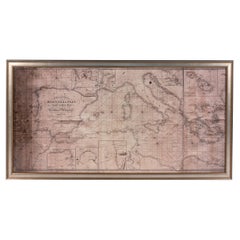
Large Framed Map of the Mediterranean
Located in New York, NY
Large map/chart chart of The Mediterranean and the Grecian Archipelago showing Italy, Sardinia
Category
20th Century French Mid-Century Modern Maps
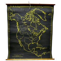
University Chart “Black Map of North America
Located in Chillerton, Isle of Wight
University Chart “Black Map of North America
W&A K Johnston’s Charts of Physical Maps By G W
Category
Early 20th Century Industrial Maps
Materials
Linen
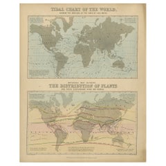
Antique Tidal Chart and Botanical Map, 1843
Located in Langweer, NL
Two antique world maps on one sheet. The upper map is a tidal chart of the world and shows the
Category
Antique 19th Century Maps
Materials
Paper
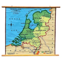
School Chart or Pull Down Map of Geography of the Netherlands, 1950s
Located in Hemiksem, VAN
A beautiful old school map of the Netherlands, painted on linen. The map shows the 3 different
Category
Vintage 1950s Belgian Mid-Century Modern Maps
Materials
Linen, Paint
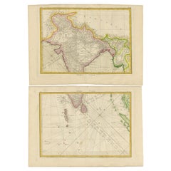
Charting the Course of Empire: Bonne's 1770 Masterpiece Maps of the Indian Ocean
Located in Langweer, NL
A voyage through history with an exquisite collection of Rigobert Bonne's 1770 maps, as featured in
Category
Antique 1770s Maps
Materials
Paper
Free Shipping
H 14.18 in W 20.28 in D 0 in
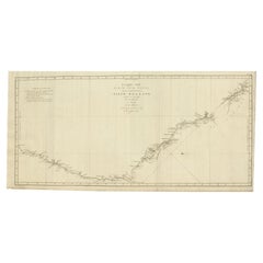
Old Map of Cook's Discovery and Charting of the East Coast of Australia, 1803
Located in Langweer, NL
Antique map titled 'Kaart van Nieuw Zuid Wales of de Oostlyke Kust van Nieuw Holland ontdekt en
Category
Antique Early 1800s Maps
Materials
Paper
H 15.36 in W 31.3 in D 0 in
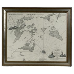
Chart of Boston's North Shore
Located in Norwell, MA
Rarely found restrike of an 1804 chart by Nathanael Bowditch of the Harbors of Salem, Marblehead
Category
Vintage 1980s North American Maps
Materials
Paper
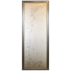
Original 1910 George Eldridge Chart
Located in Norwell, MA
Original framed 1910 George Eldridge chart "E" showing Gloucester to the Kennebec river. Showing
Category
20th Century Unknown Maps
Chart of the Harbour of Liverpool
Located in Cheshire, GB
PL Burdett A Chart of the Harbour of Liverpool hand coloured. Encased in an ebonised frame
Category
Early 20th Century British Maps
Materials
Paper
Antique Zoological Chart of the World, 1854
Located in Langweer, NL
Antique map titled 'Zoological Chart of the World'. Total of six maps and insets. Insets of the
Category
Antique 19th Century Maps
Materials
Paper
Large University Chart “Africa Physical ” by Bacon
Located in Chillerton, Isle of Wight
Large University chart “Africa Physical ” by Bacon
W&A K Johnston’s charts of physical maps by G
Category
Early 20th Century Beaux Arts Maps
Materials
Linen
Antique Chart of the Pacific Coast '1874'
Located in Langweer, NL
Antique chart titled 'Maps of the Pacific Coast exhibiting various subjects. Compiled from the
Category
Antique Late 19th Century Maps
Materials
Paper
1865 Chart of the Islands of Madeira
Located in Norwell, MA
Rare James Imray chart from 1865 titled "Chart of the Islands of Madeira, Porto Santo and Dezerea
Category
Antique 1860s European Maps
Materials
Paper
1918 George Eldridge Chart of Massachusetts Bay
Located in Norwell, MA
Rare early twentieth century chart of Cape Cod bay by George Eldridge showing Massachusetts Bay
Category
Vintage 1910s North American Maps
Materials
Paper
Antique Chart of the World by Johnston '1909'
Located in Langweer, NL
Antique map titled 'Chart of the World on Mercator's Projection Showing the directions of the
Category
Early 20th Century Maps
Materials
Paper
Antique Chart of the US Malarial Deaths, '1874'
Located in Langweer, NL
Antique chart titled 'Map showing the proportion of deaths from malarial diseases to deaths from
Category
Antique Late 19th Century Maps
Materials
Paper
Antique Chart of the US Consumption Deaths, '1874'
Located in Langweer, NL
Antique chart titled 'Map showing the proportion of deaths from consumption to deaths from all
Category
Antique Late 19th Century Maps
Materials
Paper
Large Sea Chart of the British Islands, 1918
Located in Langweer, NL
Antique map titled 'The British Islands'.
Large sea chart of the British Islands. It shows
Category
Vintage 1910s Maps
Materials
Paper
Antique Chart of the US Predominating Sex, 1874
Located in Langweer, NL
Antique chart titled 'Map of predominating sex showing the local excess of males or of females in
Category
Antique Late 19th Century Maps
Materials
Paper
Antique Print with Charts of York's Bay and Surroundings
Located in Langweer, NL
Antique map titled 'Côte depuis la Baye d'York (..)'. Charts of York's Bay, Haven of the Three
Category
Antique Late 18th Century Maps
Materials
Paper
Antique Sea Chart of the Western Coast of Africa
Located in Langweer, NL
Antique map titled 'Nieuwe Paskaert van de Kust van Genehoa (..)'. This attractive sea chart covers
Category
Antique Late 17th Century Maps
Materials
Paper
Pl. 35 Antique Chart of the US Taxation, 1874
Located in Langweer, NL
Antique chart titled 'Map showing the degree of taxation per capita imposed by state, county or
Category
Antique Late 19th Century Maps
Materials
Paper
Set of 5 Large Original Vintage Sea Charts, circa 1920
Located in St Annes, Lancashire
5 great maps or charts of the oceans
I particularly like the color of these maps
Unframed
Category
Vintage 1920s British Maps
Materials
Paper
Large Chart of the island and sea of Java, Indonesia
Located in Langweer, NL
Antique map titled 'Carte Esférica de la Isla Y Mar de Java'. Large chart of the island and sea of
Category
Antique Mid-19th Century Maps
Materials
Paper
Large Antique Chart of The White Sea, Russa 1854
Located in Langweer, NL
Antique map titled 'The White Sea Index Chart'. Large uncommon map of the White Sea with a smaller
Category
Antique 19th Century Maps
Materials
Paper
Antique Physical Chart of the Indian Ocean by Johnston '1850'
Located in Langweer, NL
Antique map titled 'Physical Chart of the Indian Ocean showing the temperature of the water
Category
Antique Mid-19th Century Maps
Materials
Paper
Antique Physical Chart of the Atlantic Ocean by Johnston '1850'
Located in Langweer, NL
Antique map titled 'Physical Chart of the Atlantic Ocean showing the form and direction of the
Category
Antique Mid-19th Century Maps
Materials
Paper
Antique Physical Chart of the Pacific Ocean by Johnston, '1850'
Located in Langweer, NL
Antique map titled 'Physical Chart of the Pacific Ocean showing the currents and temperature of the
Category
Antique Mid-19th Century Maps
Materials
Paper
Antique Tidal Chart of the British Seas by Johnston, '1850'
Located in Langweer, NL
Antique map titled 'Tidal Chart of the British Seas showing the progress of the wave of high water
Category
Antique Mid-19th Century Maps
Materials
Paper
Original Antique Chart of the Santa Cruz Islands, 1774
Located in Langweer, NL
Antique print titled 'Isles de la Reine Charlotte (..)'.
A detailed chart of the Santa Cruz
Category
Antique 1770s Maps
Materials
Paper
Antique Physical Chart of the Indian Ocean by Johnston, 1850
Located in Langweer, NL
Antique map titled 'Physical Chart of the Indian Ocean'. This map shows the temperature of the
Category
Antique 19th Century Maps
Materials
Paper
Large Chart of the Gambier Islands, Tuamotu Archipelago, French Polynesia
Located in Langweer, NL
Antique map titled 'Carte du Groupe des Iles Manga-Reva (Archipel Pomotou)'. Large chart of the
Category
Antique Mid-19th Century Maps
Materials
Paper
H 41.34 in W 28.63 in D 0.02 in
Antique Sea Chart of North America by Ottens, circa 1745
Located in Langweer, NL
Antique map titled 'Septemtrionaliora Americae a Groenlandia (..)'. Sea chart of the northern
Category
Antique Mid-18th Century Maps
Materials
Paper
Free Shipping
H 21.46 in W 25.99 in D 0.02 in
Pl. 34 Antique Chart of the US Public Indebtedness, 1874
Located in Langweer, NL
Antique chart titled 'Map showing the degree of public indebtedness per capita. Contracted by state
Category
Antique Late 19th Century Maps
Materials
Paper
Pl. 40 Antique Chart of the US Birth Rate, 1874
Located in Langweer, NL
Antique chart titled 'Map showing, in five degrees of density, the birth rate prevailing in the
Category
Antique Late 19th Century Maps
Materials
Paper
Decorative Vintage Print, Dutch Chart of Australia, 1st Edition, 1952
Located in Langweer, NL
The vintage school chart of Australia titled "Australië," created by W. Bakker & H. Rush and
Category
Mid-20th Century European Maps
Materials
Canvas
Original Hand-Coloured Nautical Chart of West-Africa, c.1680
Located in Langweer, NL
. Blanco tot C. Verde (...). Amsterdam, Johannus van Keulen, c. 1680.
Large folio coloured map in passe
Category
Antique 17th Century Maps
Materials
Paper
Antique Sea Chart of the Shetland Islands, Scotland, ca.1745
Located in Langweer, NL
Antique map of Scotland titled 'Nieuwe Paskaard van Hitland met de daar omleggende eylanden na de
Category
Antique 1740s Maps
Materials
Paper
Early Chart Identifying British Spice Trading Colony of Bencoolen, Sumatra, 1797
Located in Langweer, NL
Antique map titled 'A Chart of the West Coast of Sumatra'.
Early nautical chart identifying the
Category
Antique 1790s Maps
Materials
Paper
H 22.64 in W 27.96 in D 0 in
Antique Chart of the Voyage of Captain Cook by Benard, 1780
Located in Langweer, NL
Antique map titled 'Carte des Découvertes faites dans la Mer Pacifique sur la Vaisse au de Roi, La
Category
Antique 18th Century Maps
Materials
Paper
Charting Eastern Tartary: An 18th-Century Jesuit and English Collaboration, 1757
Located in Langweer, NL
described as "long, unpleasant, and hard." In addition to numerous maps and charts published during his
Category
Antique Mid-18th Century Maps
Materials
Paper
Free Shipping
H 9.34 in W 13.12 in D 0.02 in
Antique Sea Chart of the Coast of Sumatra, Indonesia, circa 1775
Located in Langweer, NL
Antique map titled 'Carte de la Côte Occidentale de l'Isle Sumatra'. Sea chart of the part of the
Category
Antique 18th Century Maps
Materials
Paper
Pl. 29 Antique Chart of the US Illiteracy in 1870, '1874'
Located in Langweer, NL
Antique chart titled 'Map showing the illiteracy of the aggregate population. Compiled from the
Category
Antique Late 19th Century Maps
Materials
Paper
Antique Chart of the US Adult Male Illiteracy in 1870, '1874'
Located in Langweer, NL
Antique chart titled 'Map showing the illiteracy of the adult white male population. Compiled from
Category
Antique Late 19th Century Maps
Materials
Paper
Pl. 45 Antique Chart of the US Inestinal Diseases Deaths, 1874
Located in Langweer, NL
Antique chart titled 'Map showing the proportion of deaths from intestinal diseases to deaths from
Category
Antique Late 19th Century Maps
Materials
Paper
1960s Canvas Wall School Chart with Sheep by Jung-Koch-Quentell
By Jung Koch Quentell 1
Located in Antwerp, BE
Vintage school wall chart, pull down chart with beautiful illustrated lithograph of Sheep. It shows
Category
Mid-20th Century German Mid-Century Modern Maps
Materials
Wood, Canvas, Paper
Antique Chart of the US Enteric, Cerebro-Spinal, Typhus Deaths, '1874'
Located in Langweer, NL
Antique chart titled 'Map showing the proportion of deaths from enteric, cerebro-spinal and typhus
Category
Antique Late 19th Century Maps
Materials
Paper
H 21.66 in W 16.15 in D 0.02 in
Antique Chart of the US Foreign Parentage Proportion in 1870, '1874'
Located in Langweer, NL
Antique chart titled 'Map showing the proportion to the aggregate population, of persons having one
Category
Antique Late 19th Century Maps
Materials
Paper
Antique Chart of Travelling Distances between European Cities, Ca.1792
Located in Langweer, NL
'. This unusual chart depicts the traveling distances between various European cities.
Artists and
Category
Antique 18th Century Maps
Materials
Paper
Pl. 28 Antique Chart of British American, English (..) US Population, 1874
Located in Langweer, NL
Antique chart titled 'Maps showing the distribution, within the territory of the United States
Category
Antique Late 19th Century Maps
Materials
Paper
H 21.66 in W 16.15 in D 0.02 in
Antique Chart of the Mid-Pacific Ocean by Anson, 'c.1784'
Located in Langweer, NL
Antique map titled 'Carte de la Mer du Sud ou Mer Pacifique'. Original chart of the mid-Pacific
Category
Antique Late 18th Century Maps
Materials
Paper
Antique Chart of the US Population in 1870, published in 1874
Located in Langweer, NL
Antique chart titled 'Map showing, in five degrees of density, the distribution, within the
Category
Antique Late 19th Century Maps
Materials
Paper
Antique Chart of Dundee, Aberdeen and Montrose in Scotland, C.1774
By Captain Greenvile Collins
Located in Langweer, NL
Antique map titled 'To the Honble the Magistrates of the Citty of Aberdeene'. Sea chart of Tay
Category
Antique 18th Century Maps
Materials
Paper
Antique Chart of The Spanish Coastline from Bilbao Eastwards, C.1720
Located in Langweer, NL
Antique map titled 'A Chart of the Sea Coasts Biscay and Gallicia Between Cape Machicaca and Cape
Category
Antique 18th Century Maps
Materials
Paper
Flanders, Holland & Norfolk: Hand-Colored 17th Century Sea Chart by Collins
By Captain Greenvile Collins
Located in Alamo, CA
This hand-colored chart of the seas about Flanders, Holland, Frisia, and Norfolk is from "Great
Category
Antique Late 17th Century English Maps
Materials
Paper
H 23 in W 27.75 in D 0.5 in
Pl. 36A Antique Chart of US Farms, Agriculture and Crops '1874'
Located in Langweer, NL
Antique chart titled 'Improved land in farms. Total agricultural production. Corn. Dairy products
Category
Antique Late 19th Century Maps
Materials
Paper
Antique Chart of the Storm Centres of the United States, 1874
Located in Langweer, NL
Antique chart titled 'U.S. Signal Service chart showing the frequency of storm centres. Number of
Category
Antique Late 19th Century Maps
Materials
Paper
Navigational Chart of Mexico's Coast, with Acapulco and Port Marquis, 1748
Located in Langweer, NL
Antique map titled 'The Form of cruising off Acapulca on the Coast of Mexico in the South Seas in
Category
Antique 1740s Maps
Materials
Paper
H 9.81 in W 17.52 in D 0.01 in
Antique Map of Java, Indonesia, circa 1770
By Jakob van der Schley
Located in Langweer, NL
Antique map Indonesia titled 'Nouvelle Carte de l'Isle de Java - Nieuwe kaart, van het Eiland Java
Category
Antique Mid-18th Century Maps
Materials
Paper
Antique Map of Sumatra by Bellin, 1764
Located in Langweer, NL
charts published during his lifetime, many of Bellin's maps were updated (or not) and published
Category
Antique 18th Century Maps
Materials
Paper
- 1
- ...
Get Updated with New Arrivals
Save "Map Chart", and we’ll notify you when there are new listings in this category.
Map Chart For Sale on 1stDibs
Choose from an assortment of styles, material and more in our collection of map chart on 1stDibs. Was constructed with extraordinary care, often using paper, fabric and wood. Your living room may not be complete without a piece of map chart — find older editions for sale from the 18th Century and newer versions made as recently as the 20th Century. An item from our selection of map chart is a generally popular piece of furniture, but those created in mid-century modern, folk art and Hollywood Regency styles are sought with frequency. Many designers have produced at least one well-made choice in our collection of map chart over the years, but those crafted by Captain Greenvile Collins, Jung Koch Quentell and Dr. Friedrich Quentell are often thought to be among the most beautiful.
How Much is a Map Chart?
The average selling price for a piece of map chart at 1stDibs is $488, while they’re typically $152 on the low end and $65,000 for the highest priced.
More Ways To Browse
Desert Engravings
Maritime Cabinet
North Pole Map
Dutch 17th Century Copper
Korean Furniture 18th Century
Large Antique Map Of Paris
Map Of Korea
Cuban Market
Dutch Colonial From Indonesia
Le Retour
17th Century China Cabinet
Chinese Cabinet 17th Century
Map Of South Pole
17th Century Dutch Door
Chinese Articles
Antique Map Of Northern Italy
East Bay Used Furniture
Horn Book
