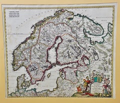
A Hand Colored 17th Century Map of Scandinavia by Frederick de Wit
View Similar Items


Want more images or videos?
Request additional images or videos from the seller
1 of 9
Frederick de WitA Hand Colored 17th Century Map of Scandinavia by Frederick de Wit 1680
1680
About the Item
- Creator:Frederick de Wit (1630 - 1706, Dutch)
- Creation Year:1680
- Dimensions:Height: 24 in (60.96 cm)Width: 26.5 in (67.31 cm)Depth: 0.13 in (3.31 mm)
- Medium:
- Movement & Style:
- Period:Late 17th Century
- Condition:
- Gallery Location:Alamo, CA
- Reference Number:Seller: # 16161stDibs: LU117325604642
About the Seller
5.0
Platinum Seller
These expertly vetted sellers are 1stDibs' most experienced sellers and are rated highest by our customers.
Established in 2011
1stDibs seller since 2019
228 sales on 1stDibs
Typical response time: 1 hour
More From This SellerView All
- L'Isle de France: A Hand-colored 17th Century Map by De WitBy Frederick de WitLocated in Alamo, CAThis colorful and detailed 17th century hand-colored copperplate map by Frederick De Wit was published in Amsterdam between 1666 and 1760. The map depicts the Île-de-France, which is one of the ancient provinces of France. Paris is located in the center of the map, with Versailles to the southwest The map extends from Rouen in the west to Reims in the east. The area around Paris, the Véxin Français, was the original domain of the king of France. Other areas were ruled by French feudal lords. For example, the Véxin Normand area was the domain of the Duke of Normandy...Category
Early 18th Century Old Masters More Prints
MaterialsEngraving
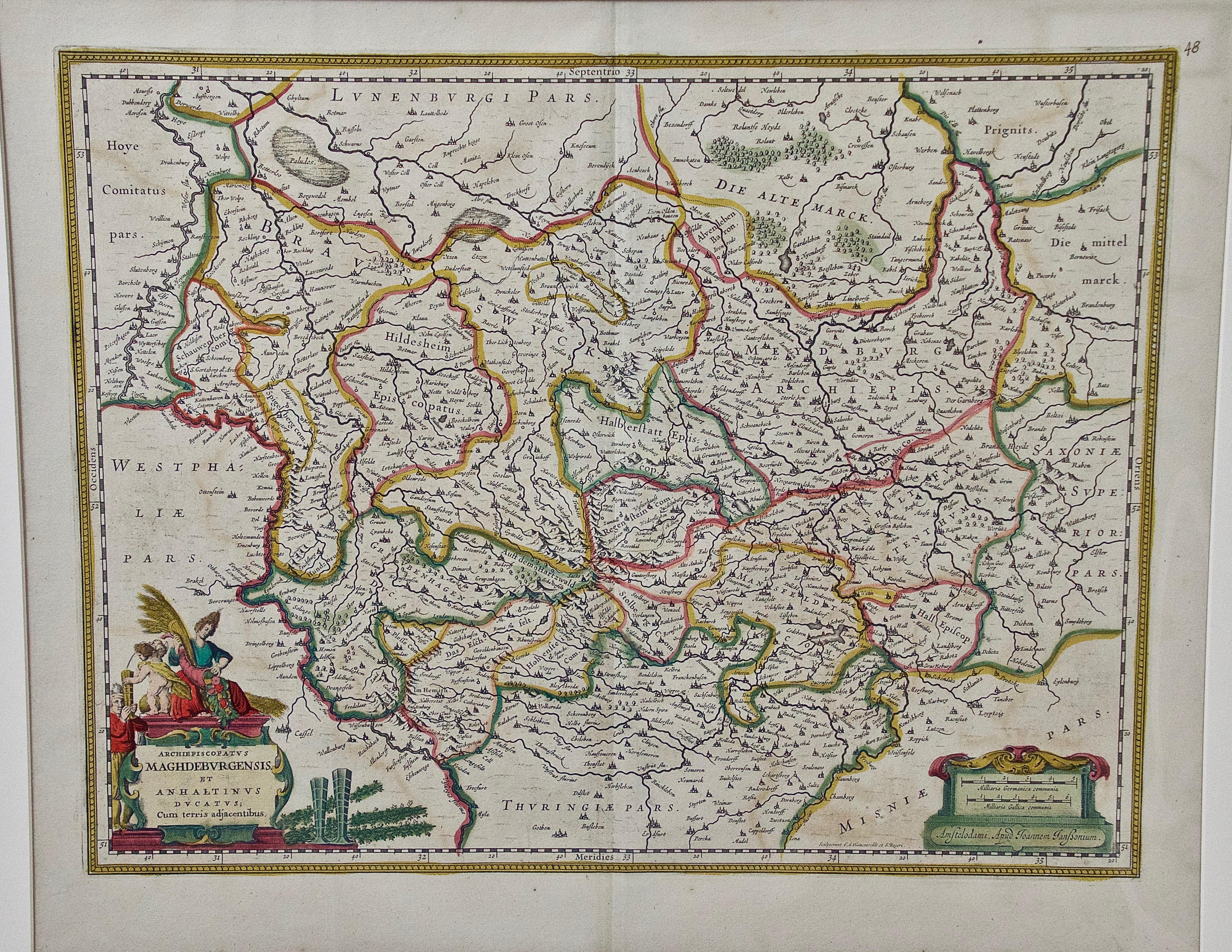
- West Germany: Original Hand Colored 17th Century Map by Johannes JanssoniusBy Johannes JanssoniusLocated in Alamo, CAAn original hand colored copperplate engraved map entitled in Latin "Archiepiscopatus Maghdeburgensis et Anhaltinus Ducatus cum terris adjacentibus", published in Amsterdam in 1640 i...Category
Mid-17th Century Old Masters More Prints
MaterialsEngraving
- "Allegory of Justice": A 17th Century Old Master Engraving by van SwanenburgBy Willem van SwanenburgLocated in Alamo, CAThis old master engraving entitled "Allegorie op de Rechtspraak" is by Willem van Swaanenburg after a painting by Joachim Wtewael, published by Ch...Category
Early 1600s Old Masters Interior Prints
MaterialsEngraving
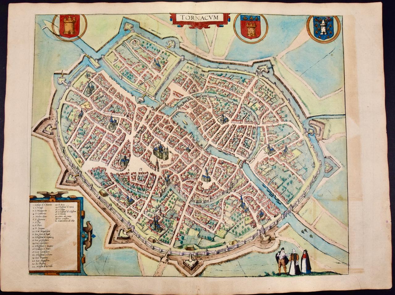
- Tournai (Tournay), Belgium: A 16th Century Hand-colored Map by Braun & HogenbergBy Franz HogenbergLocated in Alamo, CAThis is a 16th century original hand-colored copperplate engraved map of Tournai, Belgium, entitled "Tornacum" by Georg Braun & Franz Hogenberg, in volume IV of their famous city atlas "Civitates Orbis Terrarum", published in Cologne or Augsberg, Germany in 1575. The map provides a bird's-eye view of the walled city of Tournai, the second oldest city in Belgium. It lies approximately one hour by car southwest of Brussels or from Ghent. The names of thirty of its streets, prominent buildings, churches and squares are listed in a key within a strap-work cartouche in the lower left. These locations are numbered in the key corresponding to their locations on the map. This colorful map of Tournai (Tornacum or Tournay as it was called in the 16th century) includes the title in Latin in a cartouche in the upper center. Three crests are present across the upper map. A man and two woman are standing on a hill in the foreground in the lower right dressed in the style of 16th century upper class residents of the town. This is an English translation of an excerpt of Braun's description of Tornai: “Tornacum or Turnacum is a city in Gallia Belgica, situated on the Schelde in the territory of the Nervii, called Tournai by its French inhabitants, but Dorneck by the Germans. Tournai has always been a large and powerful city, with an abundance of goods and commercial activities and wonderfully resourceful craftsmen, who invent new articles every day, and although some of these go out of use they constantly conceive of other new things, both useful and delightful, so that they have at all times something that provides work and a means of livelihood for the poor." ReferencesVan der Krogt 4, 4435, State 1; Taschen, Braun and Hogenberg...Category
16th Century Old Masters Landscape Prints
MaterialsEngraving
- Canterbury: An Original 16th C. Framed Hand-colored Map by Braun & HogenbergBy Franz HogenbergLocated in Alamo, CAThis is a framed 16th century map and city view of Canterbury, England entitled "Cantuarbury" by Braun & Hogenburg, from their famous landmark atlas of city views 'Civitates Orbis Terrarum' (Atlas of the Cities of the World), which was first published in Cologne, Germany in 1572. The map of Canterbury was first published in 1588. It depicts a detailed birdseye view of the completely walled and fortified city of Canterbury, with its cathedral the most prominent feature. The coat of arms of England, Canterbury, and the Archbishop of Canterbury are included. This beautifully hand-colored map is presented in a gold-colored wood frame with a beaded inner trim and a paprika-colored mat that highlights details in the map. The frame measures 18.75" high by 22.25" wide by 0.875" deep. There is a central vertical fold, as issued. The map is in excellent condition. Braun and Hogenberg's 'The Civitates Orbis Terrarum' was the second atlas of maps ever published and the first atlas of cities and towns of the world. It is one of the most important books published in the 16th century. Most of the maps in the atlas were engraved by Franz Hogenberg and the text, with its descriptions of the history and additional factual information of the cities, was written by a team of writers and edited by Georg Braun. The work contained 546 bird-eye views and map views of cities and towns from all over the world. It gave graphic representation of the main features of the illustrated cities and towns, including the buildings and streets. Although the ordinary buildings are stylized, the principal buildings are reproduced from actual drawings created on location. The principal landmarks and streets can still be recognized today. In addition, the maps often include the heraldic arms of the city, the nature of the surrounding countryside, the important rivers, streams and harbors, even depicting stone bridges, wooden pontoons, flat-bottomed ferries, ships and working boats, wharves and jetties, as well as land-based activities, including horsemen, pedestrians, wagons, coaches, and palanquins. Small vignettes are often included which illustrate the trade, occupations and habits of the local inhabitants, such as agriculture, paper-making and textiles, as well as local forms of punishment, such as gibbets, wheels, floggings etc. Large figures dressed in their local costume are often presented out of proportion in the foreground. The aim of the authors was to give as much information as possible in a pleasing visual form. They succeeded in creating maps that were both informative and decorative works of art. The atlas is a wonderful glimpse of life in medieval Europe. Georg Braun (1541-1622) was German Catholic...Category
16th Century Old Masters Landscape Prints
MaterialsEngraving
- View of Meissen, Germany: A 16th Century Hand-colored Map by Braun & HogenbergBy Franz HogenbergLocated in Alamo, CAThis is a 16th century original hand-colored copperplate engraved map of View of View of Meissen, Germany entitled "Misena Hermun Duvorum Urbs" by Georg Braun & Franz Hogenberg, from their famous city atlas "Civitates Orbis Terrarum", published in Cologne, Germany in 1575. The map depicts a side view and bird's-eye view, looking across the Elbe River (labelled Albis Fluvius on the map; White River in Latin) from the northeast. In the foreground are three women in conversation on a hill above the city, along with a man and a woman in conversation by a road, all dressed in contemporary costumes of the upper class. A coat-of-arms is present in each upper corner. A great castle sits atop a hill in the background on the left. Meissen grew up around Albrechtsburg castle, built by Emperor Henry I around AD 929, and was granted a municipal charter at the end of the 12th century. From 1471 onwards, the castle complex was reconstructed as the residence of the Saxon electors on the northeast corner of the Domberg (Cathedral Hill). Meissen cathedral is a Gothic hall church begun c. 1270; in 1413 a bolt of lightning destroyed its west towers, which were replaced only in the 20th century. Meissen lies to the northwest of Dresden, Germany in Saxony. Meissen is famous for its Meissen porcelain and the Albrechtsburg castle The following is an English translation of an excerpt from Braun's description of the city: "This city is surrounded by very many rivers, to the east flows the Elbe, to the south the Triebisch, to the west are the mountains, to the north the Meisse, after which the city is said to be named. The city is well-situated in its surroundings, the navigable rivers, the mountains and the healthy air. Around the city there is a good land to grow grain, fertile vineyards on the hillsides and without doubt the mountains are not without ore, for one mile away, up the Elbe, is Scharfenberg, where silver and lead ore are mined.." References: Van der Krogt 4, 2684; Taschen, Braun and Hogenberg...Category
16th Century Old Masters Landscape Prints
MaterialsEngraving


You May Also Like
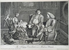
- The Happy Consultation, or Modern MatchLocated in Santa Monica, CAEIGHTEENTH CENTURY BRITISH CARICATURE THE HAPPY CONSULTATION, or MODERN MATCH, 1769 (DG 4335) ...Category
1760s Old Masters More Prints
MaterialsEngraving
 $325 Sale Price56% Off
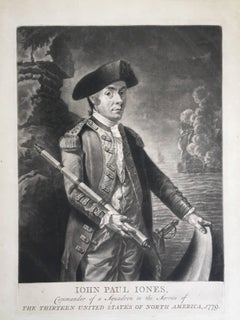
 - John Paul Jones Commander of a Squadron - 13 Colonies United States...Located in Santa Monica, CAAMERICAN REVOLUTION - (Attributed to Richard Brookshaw) JOHN PAUL JONES Commander of a Squadron in the Service of THE THIRTEEN UNITED STATES OF NORTH AMERICA, 1779 (Creswell LC1...Category
1770s Old Masters More Prints
MaterialsMezzotint
 $4,250 Sale Price32% Off
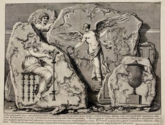
 - (Large!) UNA DELLE QUATTRO FIGURE RAPPRESENTANTI QUATTRO VITTORIEBy Giovanni Battista PiranesiLocated in Santa Monica, CAGIOVANNI BATTISTA PIRANESI (1710-1778) UNA DELLE QUATTRO FIGURE RAPPRESENTANTI QUATTTRO VITTORIE, (Focillon 330, Wilton-Ely 463) 1750-1756 Etching, Plate 48 from “Le Antichita Romane“ vol. 3. Engraved by Jean Barbault...Category
1750s Old Masters More Prints
MaterialsEtching
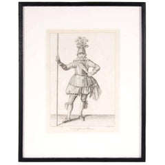
- Antique Copper Engraving of an Officer of Pikeman by Francis GroseBy Francis GroseLocated in New York, NYFrancis Grose entered the army early in life and served in the cavalry, infantry, and militia. He produced some compelling and sought after engravings on subjects including ancient a...Category
19th Century Old Masters Figurative Prints
MaterialsLithograph
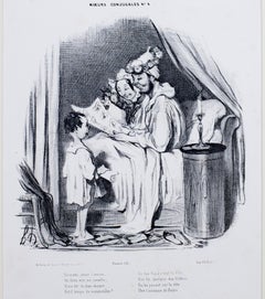
- "Ce Matin Avant l'Aurore, " Original Lithograph Genre Scene by Honore DaumierBy Honoré DaumierLocated in Milwaukee, WI"Ce Matin Avant l'Aurore" is an original lithograph by Honore Daumier, the second state of three. Original Text: Ce matin, avant l'aurore, Un Dieu vint me réveiller ; Il me dit : tu dors encore… Est-il temps de sommeiller ? De ton Papa c’est la fête, Fais lui quelque don flatteur En lui posant sur la tête Une Couronne de fleurs. Translation: This morning before dawn A God came to wake me up The curtains they were drawn And my snoring had to stop It is your daddy's birthday, A time for gifts and flowers To be placed on his head so gray Instead of his morning showers. Artwork Size: 9 1/4" x 9 1/4" Frame Size: 20 1/2" x 17 5/8" Artist Bio: Daumier was a prolific draftsman who produced over 4000 lithographs, he was perhaps best known for his caricatures of political figures and satires on the behavior of his countrymen, although posthumously the value of his painting has also been recognized. His works offer a commentary on social and political life in France in the 19th century. French caricaturist and painter, born at Marseilles. He showed in his earliest youth an irresistible inclination towards the artistic profession, which his father vainly tried to check by placing him first with a huissier, and subsequently with a bookseller. Having mastered the technique of lithography, Daumier started his artistic career by producing plates for music publishers, and illustrations for advertisements; these were followed by anonymous work for publishers, in which he followed the style of Charlet and displayed considerable enthusiasm for the Napoleonic legend. When, in the reign of Louis-Philippe, Philipon launched the comic journal, La Caricature, Daumier joined its staff, which included such powerful artists as Devéria, Raffet and Grandville, and started upon his pictorial campaign of scathing satire upon the foibles of the bourgeoisie, the corruption of the law and the incompetence of a blundering government. His caricature of the king as "Gargantua" led to Daumier's imprisonment for six months at Ste. Pélagie in 1832. The publication of La Caricature was discontinued soon after, but Philipon provided a new field for Daumier's activity when he founded the Charivari. For this journal Daumier produced his famous social caricatures, in which bourgeois society is held up to ridicule in the figure of Robert Macaire, the hero of a then popular melodrama. Another series, "L'Histoire Ancienne", was directed against the pseudoclassicism which held the art of the period in fetters. In 1848 Daumier embarked again on his political campaign, still in the service of Charivari, which he left in 1860 and rejoined in 1864. In spite of his prodigious activity in the field of caricature -- the list of Daumier's lithographed plates compiled in 1904 numbers no fewer than 3958 -- he found time for flight in the higher sphere of painting. Except for the searching truthfulness of his vision and the powerful directness of his brushwork, it would be difficult to recognize the creator of Robert Macaire, of Les Bas bleus, Les Bohémiens de Paris, and the Masques, in the paintings of "Christ and His Apostles" at the Ryks Museum in Amsterdam, or in his "Good Samaritan", "Don Quixote and Sancho Panza", "Christ Mocked...Category
1830s Old Masters Figurative Prints
MaterialsLithograph
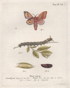
- Esper Antique 18th century Moth engraving with original hand-colouringBy LG Klinger (engraver)Located in Melbourne, VictoriaA German copper-line engraving with original hand-colouring of a moth, caterpillars and chrysalis. Printed on hand made laid paper. Engraved by JC Bock. From Eugenius Esper's "Die S...Category
Late 18th Century Naturalistic More Prints
MaterialsEngraving