Engraving Landscape Prints

52
to
169
930
271
155
209
768
515
19
911
254
88
41
15
Overall Height
to
Overall Width
to
248
224
83
80
48
10
7
4
3
2
2
2
747
355
325
220
218
135
126
90
88
84
81
75
72
62
62
61
57
56
53
48
379
277
590
95
10
23
77
50
19
17
110
136
17
25
193
40
25
23
18
17
4,178
3,017
2,456
1,294
Medium: Engraving
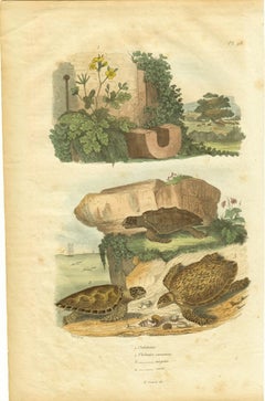
Chelidoine / Chelonee caouanne - vergete - caret; Pl. 98
Located in Mount Vernon, NY
Hand-colored engraving by P. Fitzer for Dictionnaire pittoresque d’histoire naturelle et des phénomènes de la nature, edited by French entomologist Felix Edouard Guerin-Meneville (17...
Category

19th Century Engraving Landscape Prints

Materials

Engraving

David Loggan Clare College Cambridge engraving 1690
Located in London, GB
To see our other views of Oxford and Cambridge, scroll down to "More from this Seller" and below it click on "See all from this Seller" - or send us a message if you cannot find the view you want. David Loggan (1634-1692) Clare College Cambridge...
Category

1670s Realist Engraving Landscape Prints

Materials

Engraving

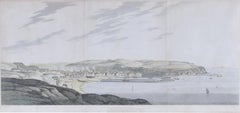
Whitehaven, Cumbria engraving by Elizabeth Byrne after Joseph Farington RA
Located in London, GB
To see more, scroll down to "More from this Seller" and below it click on "See all from this Seller." Elizabeth Byrne (1777 - 1849) after Joseph Farington RA (1747 - 1821) North View of Whitehaven, Cumbria Hand-coloured engraving 27.5 x 56.5 cm A view of the cliffs and port of Whitehaven in Cumbria. Joseph Farington RA was an 18th-century English landscape painter and diarist. He drew a north and south view of Whitehaven, which were engraved by Elizabeth Byrne in the early 19th century. Byrne was a London-born etcher and landscape painter, who was taught by her father, the etcher William Byrne...
Category

1810s Realist Engraving Landscape Prints

Materials

Engraving

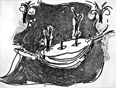
Isle of View
Located in New York, NY
George Trakas Isle of View, 2006 Aquatint and dry point etching printed on Lana Gravure paper Signed, titled and numbered X/X in pencil; bears publishers' blind stamp on the front 18...
Category

Early 2000s Contemporary Engraving Landscape Prints

Materials

Mixed Media, Drypoint, Etching

Rising Tides, by Jenny Robinson
Located in Palm Springs, CA
Medium: Intaglio on Mulberry paper Year: 2017 Edition: 15 (edition sold out, this is the last artist proof) Image Size: 20 x 20 inches Robinson has been honored as the recipient of...
Category

21st Century and Contemporary Contemporary Engraving Landscape Prints

Materials

Drypoint

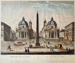
Veduta della Piazza del Popolo
Located in Middletown, NY
Ruga, Pietro (after Luigi Magozza). Veduta della Piazza del Popolo. Rome: Giacomo Antonelli, 1825. Engraving with hand coloring in watercolor on cream wove paper with a "PM" watermar...
Category

Early 19th Century Italian School Engraving Landscape Prints

Materials

Watercolor, Handmade Paper, Engraving

Europe: An Original 18th Century Hand-colored Map by E. Bowen
Located in Alamo, CA
This is an original 18th century hand-colored map entitled "A New & Accurate Map of Europe Drawn from the Best Authorities Assisted by the Most Improved Modern Charts and Maps." by E...
Category

Mid-18th Century Old Masters Engraving Landscape Prints

Materials

Engraving

Map of the East Indies: An Original 18th Century Hand-colored Map by E. Bowen
Located in Alamo, CA
This is an original 18th century hand-colored map entitled "An Accurate Map of the East Indies Exhibiting the Course of the European Trade both on the Continent and Islands" by Emanu...
Category

Mid-18th Century Old Masters Engraving Landscape Prints

Materials

Engraving

Temple of the Dea Tussis
Located in Middletown, NY
London: J. Taylor, 1820. Etching and aquatint with engraving on cream wove paper with a gilded edge, 11 1/2 x 14 3/4 inches (290 x 374 mm), full margins. Small spots of adhesive resi...
Category

Early 19th Century English School Engraving Landscape Prints

Materials

Aquatint, Handmade Paper, Engraving, Etching

Asia Declineatio: A 17th Century Hand-colored Map of Asia by Justus Danckerts
Located in Alamo, CA
This is a scarce 17th century beautifully hand-colored copperplate engraved map of Asia entitled “Exactissima Asiae Delineatio in Praecipuas Regiones Caerterasque Partes divisa et de...
Category

Late 17th Century Old Masters Engraving Landscape Prints

Materials

Engraving

Crab Boats, Southampton Water /// Impressionist British Seascape Ship Maritime
By Aileen Mary Elliot
Located in Saint Augustine, FL
Artist: Aileen Mary Elliot (English, 1896-1966) Title: "Crab Boats, Southampton Water" *Signed by Elliot in pencil lower right Circa: 1925 Medium: Original Drypoint Etching on laid p...
Category

1920s Impressionist Engraving Landscape Prints

Materials

Drypoint, Etching, Laid Paper, Intaglio

Roman Hills, Aqueducts and Roads: An Early 18th Century Map by Jan Goeree
Located in Alamo, CA
This richly engraved map of Rome and its environs entitled "Urbis Cum Vicis Seu Pagis Adiacentibus Dissertationi III De Aq et Aqueaed Veteris Promae Praemissa Authore Raph Fabretto G...
Category

Early 18th Century Old Masters Engraving Landscape Prints

Materials

Engraving

Charlotte, Lady Milnes
Located in Mount Vernon, NY
Description: Antique signed mezzotint by Henry Scott Bridgwater (1864-1950) after painting "Charlotte, Lady Milnes," c. 1788-1792, by British artist George Romney (1734-1802) who was...
Category

Late 19th Century Engraving Landscape Prints

Materials

Engraving, Mezzotint

Temple of Fortuna Virilis
Located in Middletown, NY
London: J. Taylor, 1820. Etching and aquatint with engraving on cream wove paper with a gilded edge, 11 1/2 x 14 3/4 inches (290 x 374 mm), full margins. Small spots of adhesive residue from a former mount at each edge on the recto. Light ghost impression in the area of the sky. Scattered minor areas of light brown discoloration, with a 3 3/4 inch horizontal edge loss along the lower left sheet edge, outside of the platemark. Colors remain fresh. Plate No. 3 from Wonders: Images of the Ancient World. Likely printed 1828. A view of the Temple of Hercules Victor...
Category

Early 19th Century English School Engraving Landscape Prints

Materials

Handmade Paper, Engraving, Etching, Aquatint

David Loggan Wadham College Oxford Collegium Wadhamense 1675 engraving
Located in London, GB
To see our other views of Oxford and Cambridge, scroll down to "More from this Seller" and below it click on "See all from this Seller" - or send us a message if you cannot find the view you want. David Loggan (1634-1692) Wadham College Oxford Engraving 1675 34x42cm Loggan was born to English and Scottish parents, and was baptised in Danzig in 1634. After studying engraving in Danzig with Willem Hondius (1598-1652 or 1658), he moved to London in the late 1650s, going on to produce the engraved title-page for the folio 1662 Book of Common Prayer. He married in 1663 and moved to Nuffield in Oxfordshire in 1665. Loggan was appointed Public Sculptor to the nearby University of Oxford in the late 1660s, having been commissioned to produce bird’s-eye views of all the Oxford colleges. He lived in Holywell Street as he did this. The 'Oxonia Illustrata' was published in 1675, with the help of Robert White (1645-1704). Following its completion, Loggan began work on his equivalent work for Cambridge; the 'Cantabrigia Illustrata' was finally published in 1690, when he was made engraver to Cambridge University. The 'Oxonia Illustrata' also includes an engraving of Winchester College (Winchester and New College share William of Wykeham as their founder) whilst the 'Cantabrigia Illustrata' includes one of Eton College (which shares its founder, Henry VIII, with King’s College). Bird’s-eye views from this era required a particular talent as an architectural perspectivist; it was not until 1783 that it became possible for artists to ascend via hot air balloons and view the scenes they were depicting from above. Loggan thus had to rely on his imagination in conceiving the views. Loggan’s views constitute the first accurate depictions of the two Universities, in many ways unchanged today. Whilst the Oxford engravings were produced in reasonable numbers and ran to a second edition by Henry Overton (on thicker paper and with a plate number in Roman numerals in the bottom right-hand corner), those of Cambridge were printed in much smaller numbers. The Dutchman Pieter van der Aa published some miniature versions of the engravings for James Beverell’s guidebook to the UK, 'Les Delices de la Grande Bretagne' (c. 1708). The contemporary artist Andrew Ingamells...
Category

1670s Realist Engraving Landscape Prints

Materials

Engraving

Johann Christian Reinhart (1761-1847) - 1807 Engraving, Balaam's Donkey
Located in Corsham, GB
A fine early 19th Century engraving, showing the Biblical scene of Balaam's Donkey. The artist has inscribed their name and date in plate at the lower edge, along with an inscription...
Category

Early 19th Century Engraving Landscape Prints

Materials

Engraving

Durham Cathedral, C19th English topographical engraving, by Samuel Read, 1884
By Samuel Read
Located in Melbourne, Victoria
'Durham Cathedral' Wood-engraving after Samuel Read. From 'The Illustrated London News'. Samuel Read was an English illustrator who provided many illustrations for the Illustrated...
Category

Late 19th Century Naturalistic Engraving Landscape Prints

Materials

Engraving

Grande Albero
Located in Ljubljana, SI
Grande Albero. Original aquatint and dry-point, 1992-3. Edition of 60 signed and numbered impressions on Arches paper. Safet Zec is a Bosnian painter and graphic designer, known as one of the major artists of poetic realism. At the beginning of the 90’s he became one of the most important artists...
Category

1990s Post-Modern Engraving Landscape Prints

Materials

Drypoint, Aquatint

Rooftops (the harbor and skyline of NYC from Brooklyn rooftop)
Located in New Orleans, LA
Moody, mysterious, majestic – these are some of the ways to describe the mezzotints of Frederick Mershimer. His images travel through the serenity of a Brooklyn neighborhood on a sti...
Category

Early 20th Century American Modern Engraving Landscape Prints

Materials

Mezzotint, Aquatint

Drenched (Lincoln Park, Chicago)
Located in San Francisco, CA
This artwork titled "Drenched (Lincoln Park, Chicago)" c.1960 is an original drypoint etching by noted Chicago artist James Swann, 1905-1985. It is hand s...
Category

Mid-20th Century American Realist Engraving Landscape Prints

Materials

Drypoint, Etching

Sketches from Western Summer Resorts Harper's Weekly
By Charles Graham
Located in Milwaukee, WI
"Sketches from Western Summer Resorts, Harper's Weekly" is a hand-colored wood engraving by Charles Graham. The artist engraved his signature into the piece. It depicts multiple scenes of summer leisure activities. 16 1/2" x 11 1/2" paper 23 1/4" x 18 1/4" frame An itinerant, self-taught sketch artist...
Category

1880s Victorian Engraving Landscape Prints

Materials

Engraving

Rising Tide (color version)
Located in Palm Springs, CA
Medium: Mezzotint Year: 2015 Edition: 40 Image Size: 24 x 24 inches Signed, titled and numbered in pencil by the artist Moon reflecting on ocean waves crashing on a beach. Werger's mezzotint prints are masterful at capturing a mood, and suggesting a story for the viewer to complete. His seascapes and ocean prints are from the California coastline. Signed and numbered from the edition of 40. Werger has received over 250 awards in national and international exhibitions. In 2015 he recieved the Guanlan International Printmaking Prize at the Guanlan Biennial in China, followed by the Grand Prize at the Ekaterinburg mezzotint festival in Russia. In 2012 he received the Award of the Rector at the International Print Triennial in Krakow, Poland and the Prize for Full Correspondence between technique and Imagery at the First International Mezzotint Festival in Ekaterinburg, Russia. He currently teaches printmaking at Ohio University...
Category

2010s Contemporary Engraving Landscape Prints

Materials

Mezzotint

Savièze by Fred Fay - Engraving 33x42 cm
Located in Geneva, CH
Engraving on paper without frame.
Category

1950s Modern Engraving Landscape Prints

Materials

Engraving

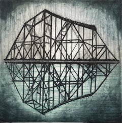
Victorian Gasometer, by Jenny Robinson
Located in Palm Springs, CA
Medium: Etching and spitbite Year: 2010 Edition: 7 (EV) Image Size: 22 x 17.5 inches Robinson has been honored as the recipient of the Mario Avati Gravure Laureate Award from the A...
Category

21st Century and Contemporary Contemporary Engraving Landscape Prints

Materials

Drypoint

Papaya and Moth Metamorphosis: 18th C. Hand-colored Engraving by Maria Merian
Located in Alamo, CA
This exquisite hand-colored 18th century folio-sized engraving of a papaya plant and moth metamorphosis is plate 64 from Maria Sibylla Merian's publication '...
Category

Early 18th Century Academic Engraving Landscape Prints

Materials

Engraving

Map of the Russian Empire: An Original 18th Century Hand-colored Map by E. Bowen
Located in Alamo, CA
This is an original 18th century hand-colored map entitled "A New & Accurate Map of The Whole Russian Empire, As Contain'd Both In Europe and Asia, Drawn from Authentic Journals, Sur...
Category

Mid-18th Century Old Masters Engraving Landscape Prints

Materials

Engraving

Piccadilly Circus, London, etching by Frederick Farrell, circa 1920
Located in Melbourne, Victoria
Signed in pencil below the image by the artist. Blind stamps of etching societies lower left just under the image. Frederick Farrell was a Scottish etcher specializing in architectu...
Category

1920s Other Art Style Engraving Landscape Prints

Materials

Drypoint, Etching

Daliean Prophesy, Salvador Dali
Located in Fairfield, CT
Title: Dalinean Prophecy Year: 1975 Medium: Engraving with pochoir on Arches paper Edition: 250 Arabic Numerals on Arches paper, 250 (I = International) Arabic Numerals on Rives paper, 75 Roman Numerals on Japon paper, 25 Roman Numeral proofs (EAs) on Japon paper, and 5 Roman Numeral proofs (HCs) on Japon paper. Size: 22.25 x 30.25 inches Condition: Excellent Inscription: Signed and numbered by the artist. Notes: Published by Merrill Chase Publishing Associates. Albert Field Catalog Reference #: 75-13. SALVADOR DALI (1904-1989) Salvador Dali's work is associated with the surrealist movement of the 20th Century. A diverse and multi-talented artist, Dali is considered one of the most collected artists today, and his works offer an incredible opportunity for enormous appreciation in value. In addition to his original works, Dali produced works on paper for reproduction using dry point, etching, woodcut, and lithography. Many of his works are held in prestigious private and public collections world...
Category

1950s Surrealist Engraving Landscape Prints

Materials

Engraving

Hounds Gentlemen Please by Tom Carr - Engraving 26x31 cm
Located in Geneva, CH
Work on paper Ed: 63/75
Category

Mid-20th Century Realist Engraving Landscape Prints

Materials

Engraving

Richard Earlom after Claude Lorrain - 1775 Mezzotint, Driving Cattle
Located in Corsham, GB
A fine and striking sepia mezzotint engraved by Richard Earlom (1743-1822) after the original drawing by Claude Lorrain (1600-1682). Earlom was an accomplished engraver and has used ...
Category

18th Century Engraving Landscape Prints

Materials

Mezzotint

421 Nights: Reach (Silos on Highway 421)
By Donald Furst
Located in New Orleans, LA
Donald Furst has created a series of 10 mezzotints based on Highway 421. U.S. Route 421 is a spur route of U.S. 21. It runs for 941 miles from Fort Fisher, North Carolina south of Wilmington to Michigan City, Indiana at U.S. 20. This image, "421 Nights: Reach", shows the reach of some storage tanks. This impression is #10 from an edition of just 30. A member of the faculty since 1985, Donald Furst is Professor of Art and former chair (2002-2009) of the UNCW Department of Art and Art History. He has received the following recognitions for teaching: University of North Carolina Board of Governors Award for Excellence in Teaching, 1999; University Distinguished Professorship, UNCW, 1996-98; Board of Trustees Teaching Excellence Award, UNCW, 1996; College of Arts and Sciences Excellence in Teaching, UNCW, 1992. Furst currently operates Ars Longa...
Category

1990s Contemporary Engraving Landscape Prints

Materials

Mezzotint

China: An Original 18th Century Hand-colored Map by E. Bowen
Located in Alamo, CA
This is an original 18th century hand-colored map entitled "A New & Accurate Map of China, Drawn from Surveys made by the Jesuit Missionaries, by order of the Emperor. The whole bein...
Category

Mid-18th Century Old Masters Engraving Landscape Prints

Materials

Engraving

Campi Phlegraei - View of a section of a part of the cone of Astruni, Italy
Located in Melbourne, Victoria
Campi Phlegraei - View of a section of a part of the cone of Astruni taken at the entrance of this volcano Copper-line engraving with gouache. 1776. ...
Category

Late 18th Century Naturalistic Engraving Landscape Prints

Materials

Engraving

Siberia as Explored by Behring: Original 18th Century Hand-colored Map by Bowen
Located in Alamo, CA
This is an original 18th century hand-colored map entitled "An Exact Chart of all the Countries through which Capt. Behring Travelled from Tobolski, Capital of Siberia to the Country...
Category

Mid-18th Century Old Masters Engraving Landscape Prints

Materials

Engraving

Castle (University College, Durham) engraving after Samuel and Nathaniel Buck
Located in London, GB
To see more, scroll down to "More from this Seller" and below it click on "See all from this Seller." after Samuel Buck (1696 - 1779) and Nathaniel Buck (active 1724 - 1759) View of Durham Castle...
Category

Late 18th Century Engraving Landscape Prints

Materials

Engraving

Cadiz Island: A Framed 17th Century Hand-colored Map from Blaeu's Atlas Major
Located in Alamo, CA
This is a 17th century hand-colored map entitled "Insula Gaditana Isla de Cadiz" from Johannes (Joan) Blaeu's Atlas Maior, published in Amsterdam in 1662. The map provides an excellent plan of Cadiz Island on the southwest coast of Spain, with its harbor, fortifications, agricultural fields and several surrounding salt processing areas. Numerous sailing ships of various sizes are included in and around the harbor and bay, including five large sailing ships, as well as twenty-four smaller ships. There is a small compass rose overlying the bay. The bridge to the mainland from the island is shown on the right. There is an extremely ornate and colorful title cartouche in the lower left, with its mythological figures reminiscent of Raphael’s Galatea fresco at the Villa Farnesina in Rome. The vibrant colors are vividly preserved. The master colorist tried to emulate a painting by using various tones to create a three-dimensional effect.
 Blaeu's name is present in the plate in the lower right. Blaeu stated in his description of Cadiz: “The main wealth of the islanders consists of salt, which they harvest, and
 the tuna fisheries.” 
 This 17th century hand-colored map is framed in an ornate, partially textured bronze-colored wood frame and glazed with UV protected conservation glass. There is a vertical center fold, as issued. There is a faint crease in the lower right and faint color offset on the left from the right side of the map, resulting from having been in an atlas for hundreds of years. Small foci of paint are present in the upper portion of the left margin and in the left corner margin. The map is otherwise in very good condition. Due in large part to their powerful trade empire, the Dutch became known for cartography in the seventeenth century. This period is considered the Golden Age of Dutch cartography. Their publishing houses produced the highest quality work in Europe, particularly those maps and charts of foreign lands, and Dutch map-making set the bar for cartographic accuracy and artistry into the early-eighteenth century. Some of the most well-known cartographers worked in Amsterdam during this period. Perhaps the most famous of these was the Blaeu family. Willem Janszoon Blaeu, set up shop in Amsterdam. His son, Johannes (Joan), succeeded him upon his death in 1638, continuing in his father’s position as Hydrographer to the Dutch East India Company and selling maps to the public. The Blaeu map presses, located near Amsterdam’s Dam Square...
Category

Mid-17th Century Old Masters Engraving Landscape Prints

Materials

Engraving

The Spire -- New York
Located in Storrs, CT
The Spire -- New York. 1985. Etching and drypoint. 14 1/2 x 11 (sheet 22 1/2 x 18). Trial proof of the second third, prior to the edition of 100. Printed on Rives cream wove paper, on the full sheet with deckle edges. A rich impression in pristine condition, housed in an archival sleeve. This etching has never been matted. Provenance: the artist's estate. Titled, annotated 'third state - trial proof' and signed in pencil. A dramatic view of the Chrysler Building. Painter and printmaker Lawrence Nelson...
Category

20th Century American Modern Engraving Landscape Prints

Materials

Drypoint, Etching

Tournai (Tournay), Belgium: A 16th Century Hand-colored Map by Braun & Hogenberg
Located in Alamo, CA
This is a 16th century original hand-colored copperplate engraved map of Tournai, Belgium, entitled "Tornacum" by Georg Braun & Franz Hogenberg, in volume IV of their famous city atlas "Civitates Orbis Terrarum", published in Cologne or Augsberg, Germany in 1575. The map provides a bird's-eye view of the walled city of Tournai, the second oldest city in Belgium. It lies approximately one hour by car southwest of Brussels or from Ghent. The names of thirty of its streets, prominent buildings, churches and squares are listed in a key within a strap-work cartouche in the lower left. These locations are numbered in the key corresponding to their locations on the map. This colorful map of Tournai (Tornacum or Tournay as it was called in the 16th century) includes the title in Latin in a cartouche in the upper center. Three crests are present across the upper map. A man and two woman are standing on a hill in the foreground in the lower right dressed in the style of 16th century upper class residents of the town. This is an English translation of an excerpt of Braun's description of Tornai: “Tornacum or Turnacum is a city in Gallia Belgica, situated on the Schelde in the territory of the Nervii, called Tournai by its French inhabitants, but Dorneck by the Germans. Tournai has always been a large and powerful city, with an abundance of goods and commercial activities and wonderfully resourceful craftsmen, who invent new articles every day, and although some of these go out of use they constantly conceive of other new things, both useful and delightful, so that they have at all times something that provides work and a means of livelihood for the poor." ReferencesVan der Krogt 4, 4435, State 1; Taschen, Braun and Hogenberg...
Category

16th Century Old Masters Engraving Landscape Prints

Materials

Engraving

Bermuda: An Early 17th Century Hand-colored Map by Henricus Hondius
By Henricus Hondius
Located in Alamo, CA
This attractive and interesting map of Bermuda by Henricus Hondius in 1633 is entitled "Mappa Aestivarum Insularum, Alias Barmudas". It is based on a ...
Category

Early 17th Century Old Masters Engraving Landscape Prints

Materials

Engraving

Cartas de Japon by Ray Smith surreal Dali esque print Japanese portfolio
Located in New York, NY
Ray Smith's aptitude for the surreal is apparent in this portfolio of six drypoint prints, presented in a portfolio case. Each image depicts an intriguing, fantastic landscape populated with chimeric nudes. Each one is carefully printed to appear as if doodled on lined notebook paper with ballpoint pen: Japanese letter paper chine-colle on Kizuki Hosho paper. Translated as "Letters from Japan," Cartas de Japon plays on tropes of an exotic, faraway land. The series of prints perhaps pictures Japan in the imagination of westerners, who for centuries speculated that those from other continents had wildly different bodies and customs. The title may be a reference to iconic Mexican director Carlos Velo's 1973 film Letters from Japan. Cartas del Japon, 1988-89 Portfolio of 6 drypoint prints printed on Japanese letter paper mounted on Kizuki Hosho paper Plate 6 x 7.8 in. Paper 18 x 23.4 in. Ed. 30 with three artist proofs. Printed by Hideharu Mishio, Norimasa Mizutani, and Marie Okada at Woodblock Workshop. Published by AC&T CORPORATION, Tokyo, 1989. Per the Broad: "Ray Smith’s paintings incorporate surrealistic and animistic tendencies informed by his Latin heritage as well as deep study of the history of modern art. Smith was born near the Texas/Mexico border...
Category

1980s Pop Art Engraving Landscape Prints

Materials

Drypoint

Pacific Ocean Currents, Handmade Cyanotype Seascape in Blue, Waves Landscape
Located in Barcelona, ES
This is an exclusive handprinted limited edition cyanotype. "Pacific Ocean Currents" is a handmade cyanotype print of rough water texture resembling Pacific Ocean swell. Details: + ...
Category

2010s Realist Engraving Landscape Prints

Materials

Emulsion, Watercolor, Photographic Paper, C Print, Engraving, Etching

Magdalene College, Cambridge engraving by David Loggan
Located in London, GB
To see our other views of Oxford and Cambridge, scroll down to "More from this Seller" and below it click on "See all from this seller" - or send us a message if you cannot find the view you want. David Loggan (1634 - 1692) Magdalene College, Cambridge (1690) Engraving 38 x 43 cm Loggan's view of Magdalene from the 'Cantabrigia Illustrata'. Loggan was born to English and Scottish parents, and was baptised in Danzig in 1634. After studying engraving in Danzig with Willem Hondius (1598-1652 or 1658), he moved to London in the late 1650s, going on to produce the engraved title-page for the folio 1662 Book of Common Prayer. He married in 1663 and moved to Nuffield in Oxfordshire in 1665. Loggan was appointed Public Sculptor to the nearby University of Oxford in the late 1660s, having been commissioned to produce bird’s-eye views of all the Oxford colleges. He lived in Holywell Street as he did this. The 'Oxonia Illustrata' was published in 1675, with the help of Robert White (1645-1704). Following its completion, Loggan began work on his equivalent work for Cambridge; the 'Cantabrigia Illustrata' was finally published in 1690, when he was made engraver to Cambridge University. The 'Oxonia Illustrata' also includes an engraving of Winchester College (Winchester and New College share William of Wykeham as their founder) whilst the 'Cantabrigia Illustrata' includes one of Eton College (which shares its founder, Henry VIII, with King’s College). Bird’s-eye views from this era required a particular talent as an architectural perspectivist; it was not until 1783 that it became possible for artists to ascend via hot air balloons and view the scenes they were depicting from above. Loggan thus had to rely on his imagination in conceiving the views. Loggan’s views constitute the first accurate depictions of the two Universities, in many ways unchanged today. Whilst the Oxford engravings were produced in reasonable numbers and ran to a second edition by Henry Overton (on thicker paper and with a plate number in Roman numerals in the bottom right-hand corner), those of Cambridge were printed in much smaller numbers. The Dutchman Pieter van der Aa published some miniature versions of the engravings for James Beverell’s guidebook to the UK, 'Les Delices de la Grande Bretagne' (circa 1708). The contemporary artist Andrew Ingamells...
Category

1670s Realist Engraving Landscape Prints

Materials

Engraving

(after) John Constable mezzotint "View on the River Stour"
Located in Henderson, NV
Medium: mezzotint (engraved by David Lucas after the John Constable painting). Printed in 1855 on cream wove paper for the "English Landscape Scenery" portfolio, published in London ...
Category

1850s Engraving Landscape Prints

Materials

Mezzotint

Le Marché aux Puces
Located in Middletown, NY
Published in Paris by Chalcographie Louvre around 1910. Drypoint etching on buff wove paper, 7 x 11 inches (175 x 278 mm) full margins. With the "Musée Louvre Chalcographie" blind st...
Category

Early 20th Century French School Engraving Landscape Prints

Materials

Handmade Paper, Drypoint, Etching

Lake Tahoe Panorama, Nautical Landscape Cyanotype in Blue, Minimal Water Art
Located in Barcelona, ES
This is an exclusive handprinted limited edition cyanotype. "Lake Tahoe Panorama" shows a sequence of abstracted ripples of the calm Tahoe waters. Details: + Title: Lake Tahoe Panor...
Category

2010s Minimalist Engraving Landscape Prints

Materials

Emulsion, Watercolor, C Print, Color, Engraving, Lithograph, Photogram

View of Seravalle, Italy: A 16th Century Hand-colored Map by Braun & Hogenberg
Located in Alamo, CA
This is an original 16th century copperplate originally hand-colored engraved map of View of Seravalle, Italy entitled "Seravallum Celeberrimum Marchiae Tarvisiniae in Agro Foro Juliensi Opp. - Seravalli, quam vides, Spectator, iconem, operi huic nostro suis sumptib. . . ." by Georg Braun & Franz Hogenberg, from their famous city atlas "Civitates Orbis Terrarum", published in Augsberg, Germany in 1575. The map depicts a view of Seravalle, now Vittorio Veneto, in San Marino, Italy, north of Venice, in a topographically accurate bird's-eye view from the south. A water-filled moat is seen to the south of the city walls and farmland to the east. Two men are depicted standing on a hill in the lower right in conversation next to grain sacks and a grazing horse, while a younger man behind them to the right herds a mule carrying presumably pigs. A very colorful and ornate title cartouche is in the upper center and coat-of-arms are in the right and left upper corners. Serravalle lies in an idyllic setting in the foothills and surrounded by orchards. St Mary's Cathedral with its tall bell tower is prominent in the center of the town. The marketplace and town hall with a bell tower in the square are depicted. Houses and shops are around the main square. Serravalle's importance as an agricultural centre is emphasized by the figures in the foreground. In 1337 Serravalle was conquered by the Republic of Venice. In 1866 the town was united with neighbouring Ceneda to form the town of Vittorio Veneto. The following is an English translation of an excerpt from the French description of the city on the back of the map: "Serravalle, a market town renowned for cloth, wine and grain, is in such a beautiful situation that the number of its inhabitants, attracted by the loveliness of the place, has grown so much at times that the wall encircling it has had to be enlarged for the third time. The city with the surrounding town once belonged to the Church in Ceneda as an imperial fief. It subsequently became the seat of the Da Camino family (a princely house that at that time was one of the five most noble in all Italy). Now the city is under the sway of the Venetians but is prudently governed by them. For they send only one city councillor with instructions to ensure that justice prevails and to collect duties. In all else, power lies in the hands of the noble families." This is a translation of the Latin in the title cartouche on the front: "The picture of the town of Serravalle, which you see, viewer, has been contributed to our work entirely at his own expense by Minutius, son of Hieronymus Minutius, a noble gentleman and one renowned for the far-reaching competence of his jurisdiction. We saw him sojourning in Cologne, where he was on business for Gregory XIII; while our good wishes accompany him, we should also like to accompany him on his way with this remembrance, even though it might be against his will, so that even those who have not seen him may learn of his excellence. However, those who do not yet know him will also see his excellence if God the Almighthy does not summon erring souls too soon back to the eternal seat of the Blessed." References: Van der Krogt 4, 4728, State 1; Taschen, Braun and Hogenberg, p.331; Fauser, #14960 This striking hand-colored city view is printed on laid, chain-linked paper with wide margins. The sheet measures 16" high by 21" wide. There is a central vertical fold as issued and French text on the verso, with Latin on the front. There is some discoloration in the upper and right margins which may represent some watercolor paint from the time of the original hand-coloring of the map. There is a small hole to the right of the upper portion of the vertical fold, which is only visible when held up to light and an area of reinforcement on the verso of the lower vertical fold. The map is otherwise in very good to excellent condition. Braun and Hogenberg's 'The Civitates Orbis Terrarum' was the second atlas of maps ever published and the first atlas of cities and towns of the world. It is one of the most important books published in the 16th century. Most of the maps in the atlas were engraved by Franz Hogenberg and the text, with its descriptions of the history and additional factual information of the cities, was written by a team of writers and edited by Georg Braun. The work contained 546 bird-eye views and map views of cities and towns from all over the world. It gave graphic representation of the main features of the illustrated cities and towns, including the buildings and streets. Although the ordinary buildings are stylized, the principal buildings are reproduced from actual drawings created on location. The principal landmarks and streets can still be recognized today. In addition, the maps often include the heraldic arms of the city, the nature of the surrounding countryside, the important rivers, streams and harbors, even depicting stone bridges, wooden pontoons, flat-bottomed ferries, ships and working boats, wharves and jetties, as well as land-based activities, including horsemen, pedestrians, wagons, coaches, and palanquins. Small vignettes are often included which illustrate the trade, occupations and habits of the local inhabitants, such as agriculture, paper-making and textiles, as well as local forms of punishment, such as gibbets, wheels, floggings etc. Large figures dressed in their local costume are often presented out of proportion in the foreground. The aim of the authors was to give as much information as possible in a pleasing visual form. They succeeded in creating maps that were both informative and decorative works of art. The atlas is a wonderful glimpse of life in medieval Europe. Georg Braun (1541-1622) was German Catholic...
Category

16th Century Old Masters Engraving Landscape Prints

Materials

Engraving

JOB SACRIFICED - And My Servant Job Shall Pray For You
Located in Santa Monica, CA
WILLIAM BLAKE (British 1757-1827) JOB'S SACRIFICE - And my Servant Job Shall Pray For You, 1825 (Bindman 1978.643; Binyon 1926.123 iii; Russell 1912.33) Engraving, First edition, one of 100 sets printed directly onto Whatman wove paper with a 1825 watermark. and the word “proof” removed. From "Illustrations of the Book of Job...
Category

1820s English School Engraving Landscape Prints

Materials

Engraving

(after) John Constable mezzotint "Summer Evening"
Located in Henderson, NV
Medium: mezzotint (engraved by David Lucas after the John Constable painting). Printed in 1855 on cream wove paper for the "English Landscape S...
Category

1850s Engraving Landscape Prints

Materials

Mezzotint

(after) John Constable mezzotint "Autumnal Sun Set"
Located in Henderson, NV
Medium: mezzotint (engraved by David Lucas after the John Constable painting). Printed in 1855 on cream wove paper for the "English Landscape S...
Category

1850s Engraving Landscape Prints

Materials

Mezzotint

(after) John Constable mezzotint "A Dell, Helmingham Park, Suffolk"
Located in Henderson, NV
Medium: mezzotint (engraved by David Lucas after the John Constable painting). Printed in 1855 on cream wove paper for the "English Landscape S...
Category

1850s Engraving Landscape Prints

Materials

Mezzotint

"Coastal Ti Tree" Gums NSW Drypoint Etching in Ink on Paper No. 30/100
Located in Soquel, CA
"Coastal Ti Tree" Drypoint Etching in Ink on Paper No. 30/100 Detailed etching attributed to Ernest Edwin Abbot (British, 1888-1973). Several trees grow along the coast at the edge of the water at Ti Tree, Australia. In the far distance, a mountain range can be seen on the opposite shore. Titled and numbered "Coastal Ti Tree 30-100" in the left corner. Signed "G. Cope" in the right corner. Presented in a new black mat with foamcore backing. Mat size: 11"H x 14"W Paper size: 5.5"H x 10.25"W According to The Centre for Australian Art: Prints + Printmaking, Abbot often produced work under the pseudonym "G. Cope" Ernest Edwin Abbott was born in 1889 and grew up in Bideford United Kingdom, With his younger siblings Violet, Reginald, Olive and his parents Charles and Sarah Abbott, His Farther worked as a upholsterer. Abbott decided in 1911 to migrate to Western Australia on the ship Tainui, Settled in Western Australia he then married his wife Florence Radcliffe Olde in 1913 whom also came to Australia in 1912 from Bideford. They had two sons, Reginald Douglas Abbott and Kenneth John Abbott. They moved to South Australia where he taught art at Stott’s for four years. Later in 1920 the family moved to the suburb of Kew in Melbourne Victoria, where he took a studio in Oxford Chambers at 475 Bourke Street. He also built a studio later at his home in Black Rock. In about 1920 or 1930 he took up dry-point etching, and gave up his city studio to concentrate on printmaking at his home. Abbott made his own engraving tools...
Category

Early 20th Century Naturalistic Engraving Landscape Prints

Materials

Paper, Ink, Drypoint

(after) John Constable mezzotint "Jacques and the Wounded Stag"
Located in Henderson, NV
Medium: mezzotint (engraved by David Lucas after the John Constable painting). Printed in 1855 on cream wove paper for the "English Landscape S...
Category

1850s Engraving Landscape Prints

Materials

Mezzotint

(after) John Constable mezzotint "Mill Stream"
Located in Henderson, NV
Medium: mezzotint (engraved by David Lucas after the John Constable painting). Printed in 1855 on cream wove paper for the "English Landscape S...
Category

1850s Engraving Landscape Prints

Materials

Mezzotint

(after) John Constable mezzotint "Stoke by Nayland, Suffolk"
Located in Henderson, NV
Medium: mezzotint (engraved by David Lucas after the John Constable painting). Printed in 1855 on cream wove paper for the "English Landscape S...
Category

1850s Engraving Landscape Prints

Materials

Mezzotint

(after) John Constable mezzotint "East Bergholt"
Located in Henderson, NV
Medium: mezzotint (engraved by David Lucas after the John Constable painting). Printed in 1855 on cream wove paper for the "English Landscape Scenery" portfolio, published in London ...
Category

1850s Engraving Landscape Prints

Materials

Mezzotint

(after) John Constable mezzotint "River Stour, Suffolk"
Located in Henderson, NV
Medium: mezzotint (engraved by David Lucas after the John Constable painting). Printed in 1855 on cream wove paper for the "English Landscape Scenery" portfolio, published in London ...
Category

1850s Engraving Landscape Prints

Materials

Mezzotint

View of Meissen, Germany: A 16th Century Hand-colored Map by Braun & Hogenberg
Located in Alamo, CA
This is a 16th century original hand-colored copperplate engraved map of View of View of Meissen, Germany entitled "Misena Hermun Duvorum Urbs" by Georg Braun & Franz Hogenberg, from their famous city atlas "Civitates Orbis Terrarum", published in Cologne, Germany in 1575. The map depicts a side view and bird's-eye view, looking across the Elbe River (labelled Albis Fluvius on the map; White River in Latin) from the northeast. In the foreground are three women in conversation on a hill above the city, along with a man and a woman in conversation by a road, all dressed in contemporary costumes of the upper class. A coat-of-arms is present in each upper corner. A great castle sits atop a hill in the background on the left. Meissen grew up around Albrechtsburg castle, built by Emperor Henry I around AD 929, and was granted a municipal charter at the end of the 12th century. From 1471 onwards, the castle complex was reconstructed as the residence of the Saxon electors on the northeast corner of the Domberg (Cathedral Hill). Meissen cathedral is a Gothic hall church begun c. 1270; in 1413 a bolt of lightning destroyed its west towers, which were replaced only in the 20th century. Meissen lies to the northwest of Dresden, Germany in Saxony. Meissen is famous for its Meissen porcelain and the Albrechtsburg castle The following is an English translation of an excerpt from Braun's description of the city:  "This city is surrounded by very many rivers, to the east flows the Elbe, to the south the Triebisch, to the west are the mountains, to the north the Meisse, after which the city is said to be named. The city is well-situated in its surroundings, the navigable rivers, the mountains and the healthy air. Around the city there is a good land to grow grain, fertile vineyards on the hillsides and without doubt the mountains are not without ore, for one mile away, up the Elbe, is Scharfenberg, where silver and lead ore are mined.." 
  References: Van der Krogt 4, 2684; Taschen, Braun and Hogenberg...
Category

16th Century Old Masters Engraving Landscape Prints

Materials

Engraving

Cartusia Bruxellensis Monastery in Brussels: A 17th C. Hand-colored Engraving
Located in Alamo, CA
This is a 17th century hand-colored copperplate engraving entitled "Cartusia Bruxellensis" by Lucas Vorsterman, the Younger, after a drawing by Jacob van Werden or Jacques van Weerden, published in 1659 in Antonius Sanderus' book 'Chorographia sacra Brabantiae sive celebrium aliquot in ea provincia ecclesiarum et coenobiorum descriptio . . . Brussel' (A sacred chorography of Brabant, or a description of several famous churches and convents in that province). It also appeared in other publications by Sanderus. In the 17th century, Brussels was within the Duchy of Brabant. This engraving depicts a bird's-eye view of the Scheut Carthusian Monastery in Brussels. Scheut is a district of Anderlecht, a municipality of Brussels, Belgium. The monastery housed monks, who took a vow of silence, in 20 rooms. There is a central courtyard with trees and shrubs. Monks are depicted strolling along its pathways. The cells for the friars are in the middle the cloister. There are people along the streets in the foreground and to the right of the large, imposing monastery. Some are on horseback, others are walking. In the lower right, what appears to be a dog pulls a small cart containing barrels, possibly of beer or wine. Districts and neighborhoods are labelled in the background, including Scheut, Anderlecht and Ransfort. A very ornate cartouche in the lower left contains Latin and the artist's attribution. Another decorative cartouche in the upper central area contains the title. This beautifully hand-colored and detailed engraving is printed on laid, chain-linked paper with wide, full margins. The sheet measures 17.25" high and 21.25" wide. It has Latin text on the verso. It has a central vertical fold, as issued, which is reinforced on the verso. Two small spots in the lower margin may actually represent drops of watercolor paint used to color the engraving. It is otherwise in very good condition. Antonius Sanderus (1586-1664) was a Flemish Catholic cleric and historian. He was born "Antoon Sanders", but Latinized his name like many writers and scholars of his time. He was the author of several books, including 'Chorographia Sacra Brabantiae', which was illustrated with this engraving. Lucas Vorsterman the Younger (1624-between 1666 & 1676) was a Flemish Baroque engraver and draughtsman. He produced engravings after the work of contemporary painters and for books by Antwerp publishers. Jacob van Werden or Jacques van Weerden (active 1643-1669), was a Flemish draughtsman, cartographer, military engineer and archer who was active in the Habsburg Netherlands. His drawings were used as designs for prints executed by various printmakers. He worked on maps, topographical views, historical scenes, portraits and book illustrations. He had a career as a military engineer and a member of the guard of the Spanish King. He advised on various military engineering projects and was an engineer of the Spanish army...
Category

Mid-17th Century Old Masters Engraving Landscape Prints

Materials

Engraving

Engraving landscape prints for sale on 1stDibs.

Find a wide variety of authentic Engraving landscape prints available on 1stDibs. While artists have worked in this medium across a range of time periods, art made with this material during the 21st Century is especially popular. If you’re looking to add landscape prints created with this material to introduce a provocative pop of color and texture to an otherwise neutral space in your home, the works available on 1stDibs include elements of blue, orange, purple, yellow and other colors. There are many well-known artists whose body of work includes ceramic sculptures. Popular artists on 1stDibs associated with pieces like this include David Loggan, Adriaen Collaert, David Lucas, and Salvador Dalí. Frequently made by artists working in the Modern, Contemporary, all of these pieces for sale are unique and many will draw the attention of guests in your home. Not every interior allows for large Engraving landscape prints, so small editions measuring 0.01 inches across are also available

Recently Viewed

View All